
| ELK HILLS-BUTTONWILLOW BUTTONWILLOW CA |
| |
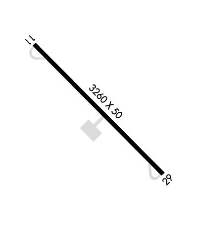
| Lat: N 3521.2 Long: W 11928.8 Elev: 326 Var: -15 Longest Runway: 3260 | ||
| CTAF: 122.9 | ||
| ||||||||||||||||||||||||||||||||
| ||||||||||||||||||||||||||||||||
| Rwy | Rwy | |||||||
| 3260x50 | 3260' | 3260x50 | 3260' | |||||
| Runway ID | Single Wheel | Double Wheel | Double Tandem Wheel | Dual Double Wheel |
| 11/29 | 10,000 | N/A | N/A | N/A |
| These numbers are Advisory and are not limits. The Airport Manager should have more accurate Weight Limits | ||||
| FltPlan does not have IFR approach charts available for KL62. |
 Airport Diagram might not be current. | |
| Facility Name: | ELK HILLS-BUTTONWILLOW |
| City Name: | BUTTONWILLOW |
| County: | KERN |
| State abbrev: | CA |
| State Name: | CALIFORNIA |
| Ownership: | PUBLICLY OWNED |
| Use: | OPEN TO THE PUBLIC |
| Owner's Name: | COUNTY OF KERN DEPT OF AIRPORTS |
| Address: | 3701 WINGS WAY, SUITE 300 |
| BAKERSFIELD, CA 93308-7026 | |
| Owner's Phone: | 661-391-1800 |
| Manager's Name: | RON BREWSTER |
| Address: | 3701 WINGS WAY, SUITE 300 |
| BAKERSFIELD, CA 93308-7026 | |
| Phone: | (661) 391-1824; 24 HRS: (661) 747-4053 FAX: (661) 391-1801 EMAIL: BREWSTERR@CO.KERN.CA.US |
| FAA Region: | WESTERN-PACIFIC |
| FAA Field Office: | LAX |
| Date | Sunrise | Sunset |
|---|---|---|
| 09/24/21 Friday | 6:47 | 18:52 |
| 09/25/21 Saturday | 6:48 | 18:51 |
| 09/26/21 Sunday | 6:49 | 18:49 |
| 09/27/21 Monday | 6:50 | 18:48 |
| 09/28/21 Tuesday | 6:50 | 18:46 |
| 09/29/21 Wednesday | 6:51 | 18:45 |
| 09/30/21 Thursday | 6:52 | 18:43 |
| 10/01/21 Friday | 6:53 | 18:42 |
| 10/02/21 Saturday | 6:53 | 18:41 |
| 10/03/21 Sunday | 6:54 | 18:39 |
| 10/04/21 Monday | 6:55 | 18:38 |
| 10/05/21 Tuesday | 6:56 | 18:36 |
| 10/06/21 Wednesday | 6:57 | 18:35 |
| 10/07/21 Thursday | 6:57 | 18:34 |
| Airport Attendance Schedule | UNATTENDED |
| Airport Status | OPERATIONAL (This Status can change at any time - please check NOTAMS) |
| Airport Lighting Schedule | |
| Airport Storage Available | Tie Downs |
| Extra Services Available | NONE |
| Wind Indicator | YES - (unlit) |
| Control Tower | NO |
| CTAF Frequency | 122.900 |
| Unicom Frequency | |
| Rotating Beacon Color | |
| Segmented Circle | YES |
| Landing Fee | NO |
| Airport Inspected | STATE - performed by STATE AERONAUTICAL PERSONNEL |
| Inspection Date | 03/05/2021 |
| Type of Fuel Available | None |
| Airframe Repair Service | NONE |
| Power Plant Repair Service | NONE |
| Latitude | N3521.2 |
| Longitude | W11928.8 (ESTIMATED) |
| Arpt Elevation | 326ft (ESTIMATED) |
| Magnetic Variation | 15E |
| 3 miles S | of BUTTONWILLOW |
| Traffic Pattern Altitude | 800 |
| Sectional Chart | LOS ANGELES |
| Operations (Reported) | Yearly | Avg. Daily |
|---|---|---|
| General Aviation Transient | 1200 | 3 |
| General Aviation Local | 0 | 0 |
| Air Taxi | 0 | 0 |
| Commerical | 0 | 0 |
| Commuter | 0 | 0 |
| Military | 0 | 0 |
| Aircraft based on Field | |
|---|---|
| General Aviation Singles | 0 |
| General Aviation Multi | 0 |
| Jet Aircraft | 0 |
| General Aviation Helicopters | 0 |
| Military Aircraft | 0 |
| Gliders | 0 |
| Ultralights | 0 |
| FSS on field | NO |
| FSS tie-in | RANCHO MURIETA |
| FSS Phone | 1-800-WX-BRIEF |
| Who issues Notams | RIU |
| Notam D service at airport | YES |
| ARTCC Name | LOS ANGELES |
| Airport Certification | |
| Aircraft Rescue & Firefighting Index | None |
| Airport of Entry | No |
| Custom Landing Rights | No |
| Joint Civil/Military | No |
| Military Landing rights | YES |
| GRANT AGREEMENTS UNDER FAAP/ADAP/AIP |
| ASSURANCES PURSUANT TO TITLE VI, CIVIL RIGHTS ACT OF 1964 |
| ARPT CLSD TO NIGHT OPNS. |
| ELK HILLS-BUTTONWILLOW ELEV 326 PAINTED ON CENTER OF RWY. |
| CROP DUSTING OPNS PROHIBITED EXCP BY PPR AMGR 661-391-1800. |
| RADIO CTLD MODEL ACFT BELOW 800 FT AGL INVOF ARPT. |
| FOR CD CTC LOS ANGELES ARTCC AT 661-575-2079. |
| Runway: 11 | Runway: 29 | ||
| Mag heading: | N/A | Mag heading: | N/A |
| Approach: | Approach: | ||
| Pattern: | Right Traffic | Pattern: | Left Traffic |
| Markings: | BASIC | Markings: | BASIC |
| Marking Condition: | GOOD | Marking Condition: | GOOD |
| Arresting Dev: | Arresting Dev: | ||
| Lat & Long: | N3521.4 W11929.0 | Lat. & Long.: | N3521.0 W11928.5 |
| Elev: | N/A | Elev: | N/A |
| TCH: | TCH: | ||
| Visual Glide Path: | Visual Glide Path: | ||
| Displaced Threshold: | No | Displaced Threshold: | No |
| Touchdown Zone: | NO | Touchdown Zone: | NO |
| Touchdown Elev.: | Touchdown Elev.: | ||
| Visual Glide Slope: | Visual Glide Slope: | ||
| RVR Equipment: | RVR Equipment: | ||
| RVV Equipment: | NO | RVV Equipment: | NO |
| Approach Lights: | Approach Lights: | ||
| REIL: | NO | REIL: | NO |
| Centerline Lights: | NO | Centerline Lights: | NO |
| Touchdown lights: | NO | Touchdown lights: | NO |
| Runway Category: | Runway with a Visual Approach | Runway Category: | Runway with a Visual Approach |
| Declared Distances: | Declared Distances: |
Thanks for using FltPlan.com
all rights reserved © 1999-2021 by Flight Plan LLC
