
| SHIVELY FIELD SARATOGA WY |
| |
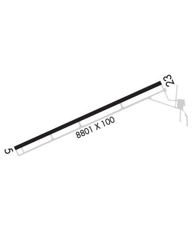
| Lat: N 4126.6 Long: W 10649.7 Elev: 7014 Var: -12 Longest Runway: 8801 | ||
| AWOS: 118.17 CTAF: 122.8 | ||
| ||||||
| ||||||
|
| Rwy | Rwy | |||||||
| 8801x100 | 8801' | 8801x100 | 8801' | |||||
| Runway ID | Single Wheel | Double Wheel | Double Tandem Wheel | Dual Double Wheel |
| 05/23 | 50,000 | N/A | N/A | N/A |
| These numbers are Advisory and are not limits. The Airport Manager should have more accurate Weight Limits | ||||
 Airport Diagram might not be current. | |
| Facility Name: | SHIVELY FLD |
| City Name: | SARATOGA |
| County: | CARBON |
| State abbrev: | WY |
| State Name: | WYOMING |
| Ownership: | PUBLICLY OWNED |
| Use: | OPEN TO THE PUBLIC |
| Owner's Name: | TOWN OF SARATOGA |
| Address: | P.O. BOX 486 |
| SARATOGA, WY 82331 | |
| Owner's Phone: | 307-326-8335 |
| Manager's Name: | BOB MADDOX |
| Address: | P.O. BOX 1015 |
| SARATOGA, WY 82331 | |
| Phone: | 307-326-8344 |
| FAA Region: | NORTHWEST MOUNTAIN |
| FAA Field Office: | DEN |
| Date | Sunrise | Sunset |
|---|---|---|
| 09/24/21 Friday | 6:57 | 19:01 |
| 09/25/21 Saturday | 6:58 | 19:00 |
| 09/26/21 Sunday | 6:59 | 18:58 |
| 09/27/21 Monday | 7:00 | 18:56 |
| 09/28/21 Tuesday | 7:01 | 18:55 |
| 09/29/21 Wednesday | 7:02 | 18:53 |
| 09/30/21 Thursday | 7:03 | 18:51 |
| 10/01/21 Friday | 7:04 | 18:49 |
| 10/02/21 Saturday | 7:05 | 18:48 |
| 10/03/21 Sunday | 7:06 | 18:46 |
| 10/04/21 Monday | 7:07 | 18:44 |
| 10/05/21 Tuesday | 7:08 | 18:43 |
| 10/06/21 Wednesday | 7:09 | 18:41 |
| 10/07/21 Thursday | 7:10 | 18:39 |
| Airport Attendance Schedule | APR-NOV 7 Days A Week 0800-1700, DEC-MAR 7 Days A Week 0800-1600 |
| Airport Status | OPERATIONAL (This Status can change at any time - please check NOTAMS) |
| Airport Lighting Schedule | ACTVT REIL RWY 5 & 23; PAPI RWY 5 & 23; MIRL RWY 05/23 - CTAF. |
| Airport Storage Available | Tie Downs, Hanger |
| Extra Services Available | NONE |
| Wind Indicator | YES - (lighted) |
| Control Tower | NO |
| CTAF Frequency | 122.800 |
| Unicom Frequency | 122.800 |
| Rotating Beacon Color | CLEAR-GREEN (Light Land Airport) |
| Segmented Circle | YES |
| Landing Fee | YES; $100 FOR TURBO JET & $75 FOR TURBO PROP ACFT. |
| Airport Inspected | STATE - performed by STATE AERONAUTICAL PERSONNEL |
| Inspection Date | 07/15/2020 |
| Type of Fuel Available | Grade 100LL, JET A (freeze point -40C); -A FULL SERVICE FUEL. FEE APPLIED JET AIRCRAFT. AFT HRS CALL 307-326-8344. |
| Airframe Repair Service | NONE |
| Power Plant Repair Service | NONE |
| Latitude | N4126.6 |
| Longitude | W10649.7 (ESTIMATED) |
| Arpt Elevation | 7014ft (SURVEYED) |
| Magnetic Variation | 12E |
| 1 miles SW | of SARATOGA |
| Traffic Pattern Altitude | |
| Sectional Chart | CHEYENNE |
| Operations (Reported) | Yearly | Avg. Daily |
|---|---|---|
| General Aviation Transient | 6500 | 18 |
| General Aviation Local | 760 | 2 |
| Air Taxi | 950 | 3 |
| Commerical | 0 | 0 |
| Commuter | 0 | 0 |
| Military | 0 | 0 |
| Aircraft based on Field | |
|---|---|
| General Aviation Singles | 13 |
| General Aviation Multi | 1 |
| Jet Aircraft | 1 |
| General Aviation Helicopters | 0 |
| Military Aircraft | 0 |
| Gliders | 0 |
| Ultralights | 0 |
| FSS on field | NO |
| FSS tie-in | CASPER |
| FSS Phone | 1-800-WX-BRIEF |
| Who issues Notams | CPR |
| Notam D service at airport | YES |
| ARTCC Name | DENVER |
| Airport Certification | |
| Aircraft Rescue & Firefighting Index | None |
| Airport of Entry | No |
| Custom Landing Rights | No |
| Joint Civil/Military | No |
| Military Landing rights | YES |
| NATIONAL PLAN OF INTEGRATED AIRPORT SYSTEMS (NPIAS) |
| GRANT AGREEMENTS UNDER FAAP/ADAP/AIP |
| CONVEYANCE UNDER SCETION 16, FEDERAL AIRPORT ACT OF 1946 OR SECTION 23, AIRPORT AND AIRWAY DEVELOPMENT ACT OF 1970 |
| ASSURANCES PURSUANT TO TITLE VI, CIVIL RIGHTS ACT OF 1964 |
| WIND SHEAR OVER HIGHWAY APCH END RWY 23. |
| ANTELOPE MAY BE ON RY. |
| FOR CD CTC DENVER ARTCC AT 303-651-4257. |
Airport Communications & Frequencies:
| |||||||||
| Runway: 05 | Runway: 23 | ||
| Mag heading: | 54° | Mag heading: | 234° |
| Rwy Slope: | -1.78% Down | Rwy Slope: | 1.78% Up |
| Approach: | Approach: | ||
| Pattern: | Left Traffic | Pattern: | Left Traffic |
| Markings: | NONPRECISION INSTRUMENT | Markings: | NONPRECISION INSTRUMENT |
| Marking Condition: | GOOD | Marking Condition: | GOOD |
| Arresting Dev: | Arresting Dev: | ||
| Lat & Long: | N4126.3 W10650.5 | Lat. & Long.: | N4126.9 W10648.8 |
| Elev: | 7014.2 ft. MSL | Elev: | 6857.2 ft. MSL |
| TCH: | 49 ft. AGL | TCH: | 47 ft. AGL |
| Visual Glide Path: | 3.00 degrees | Visual Glide Path: | 3.00 degrees |
| Displaced Threshold: | No | Displaced Threshold: | No |
| Touchdown Zone: | YES | Touchdown Zone: | YES |
| Touchdown Elev.: | 7014.2 feet | Touchdown Elev.: | 6911.2 feet |
| Visual Glide Slope: | 4-Light PAPI on LEFT side of Runway | Visual Glide Slope: | 4-Light PAPI on LEFT side of Runway |
| RVR Equipment: | RVR Equipment: | ||
| RVV Equipment: | NO | RVV Equipment: | NO |
| Approach Lights: | Approach Lights: | ||
| REIL: | YES | REIL: | YES |
| Centerline Lights: | NO | Centerline Lights: | NO |
| Touchdown lights: | NO | Touchdown lights: | NO |
| Runway Category: | Runway with a Non-precision Approach having visibility minimums greater than 3/4 mile | Runway Category: | Runway with a Visual Approach |
| Declared Distances: | Declared Distances: |
Thanks for using FltPlan.com
all rights reserved © 1999-2021 by Flight Plan LLC
