
| RUSH COUNTY LA CROSSE KS |
| |
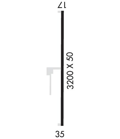
| Lat: N 3832.8 Long: W 09917.4 Elev: 2076 Var: -06 Longest Runway: 3200 | ||
| CTAF: 122.9 | ||
| ||||||||||||||||||||||||||||||||
| ||||||||||||||||||||||||||||||||
| Rwy | Rwy | |||||||
| 3200x50 | 3200' | 3200x50 | 3200' | |||||
| Runway ID | Single Wheel | Double Wheel | Double Tandem Wheel | Dual Double Wheel |
| 17/35 | 12,000 | 16,000 | N/A | N/A |
| These numbers are Advisory and are not limits. The Airport Manager should have more accurate Weight Limits | ||||
| FltPlan does not have IFR approach charts available for KK94. |
 Airport Diagram might not be current. | |
| Facility Name: | RUSH COUNTY |
| City Name: | LA CROSSE |
| County: | RUSH |
| State abbrev: | KS |
| State Name: | KANSAS |
| Ownership: | PUBLICLY OWNED |
| Use: | OPEN TO THE PUBLIC |
| Owner's Name: | CITY OF LA CROSSE-RUSH CO |
| Address: | 1119 MAIN |
| LA CROSSE, KS 67548 | |
| Owner's Phone: | 785-222-2511 |
| Manager's Name: | GENE KNIELING; AIRPORT COMMITTEE CHAIRMAN. |
| Address: | 518 SOUTH DENVER |
| RUSH CENTER, KS 67575 | |
| Phone: | 620-923-5364 |
| FAA Region: | CENTRAL |
| FAA Field Office: | NONE |
| Date | Sunrise | Sunset |
|---|---|---|
| 06/07/26 Sunday | 6:13 | 20:59 |
| 06/08/26 Monday | 6:13 | 21:00 |
| 06/09/26 Tuesday | 6:13 | 21:00 |
| 06/10/26 Wednesday | 6:12 | 21:01 |
| 06/11/26 Thursday | 6:12 | 21:01 |
| 06/12/26 Friday | 6:12 | 21:02 |
| 06/13/26 Saturday | 6:12 | 21:02 |
| 06/14/26 Sunday | 6:12 | 21:03 |
| 06/15/26 Monday | 6:12 | 21:03 |
| 06/16/26 Tuesday | 6:12 | 21:03 |
| 06/17/26 Wednesday | 6:12 | 21:04 |
| 06/18/26 Thursday | 6:13 | 21:04 |
| 06/19/26 Friday | 6:13 | 21:04 |
| 06/20/26 Saturday | 6:13 | 21:05 |
| Airport Attendance Schedule | UNATTENDED |
| Airport Status | OPERATIONAL (This Status can change at any time - please check NOTAMS) |
| Airport Lighting Schedule | FOR RWY LGTS KEY 122.7 5 TIMES IN 5 SEC. |
| Airport Storage Available | Tie Downs |
| Extra Services Available | Crop Dusting |
| Wind Indicator | YES - (lighted) |
| Control Tower | NO |
| CTAF Frequency | 122.900 |
| Unicom Frequency | |
| Rotating Beacon Color | |
| Segmented Circle | YES |
| Landing Fee | NO |
| Airport Inspected | STATE - performed by STATE AERONAUTICAL PERSONNEL |
| Inspection Date | 09/11/2023 |
| Type of Fuel Available | None |
| Airframe Repair Service | NONE |
| Power Plant Repair Service | NONE |
| Latitude | N3832.8 |
| Longitude | W09917.4 (ESTIMATED) |
| Arpt Elevation | 2076ft (SURVEYED) |
| Magnetic Variation | |
| 1 miles NE | of LA CROSSE |
| Traffic Pattern Altitude | |
| Sectional Chart | WICHITA |
| Operations (Reported) | Yearly | Avg. Daily |
|---|---|---|
| General Aviation Transient | 0 | 0 |
| General Aviation Local | 0 | 0 |
| Air Taxi | 0 | 0 |
| Commerical | 0 | 0 |
| Commuter | 0 | 0 |
| Military | 0 | 0 |
| Aircraft based on Field | |
|---|---|
| General Aviation Singles | 0 |
| General Aviation Multi | 0 |
| Jet Aircraft | 0 |
| General Aviation Helicopters | 0 |
| Military Aircraft | 0 |
| Gliders | 0 |
| Ultralights | 0 |
| FSS on field | NO |
| FSS tie-in | WICHITA |
| FSS Phone | 1-800-WX-BRIEF |
| Who issues Notams | ICT |
| Notam D service at airport | YES |
| ARTCC Name | KANSAS CITY |
| Airport Certification | |
| Aircraft Rescue & Firefighting Index | None |
| Airport of Entry | No |
| Custom Landing Rights | No |
| Joint Civil/Military | No |
| Military Landing rights | YES |
| GRANT AGREEMENTS UNDER FAAP/ADAP/AIP |
| ASSURANCES PURSUANT TO TITLE VI, CIVIL RIGHTS ACT OF 1964 |
| (E81) TWY LGTS AT EXIT ONLY. |
| FOR EMERGENCY CONTACT SHERIFFS OFFICE 785-222-2578 |
| FOR CD CTC KANSAS CITY ARTCC AT 913-254-8508. |
| Runway: 17 | Runway: 35 | ||
| Mag heading: | 179° | Mag heading: | 359° |
| Rwy Slope: | -.75% Down | Rwy Slope: | .75% Up |
| Approach: | Approach: | ||
| Pattern: | Left Traffic | Pattern: | Left Traffic |
| Markings: | BASIC | Markings: | BASIC |
| Marking Condition: | FAIR | Marking Condition: | FAIR |
| Arresting Dev: | Arresting Dev: | ||
| Lat & Long: | N3833.1 W09917.4 | Lat. & Long.: | N3832.5 W09917.4 |
| Elev: | 2076.0 ft. MSL | Elev: | 2052.0 ft. MSL |
| TCH: | TCH: | ||
| Visual Glide Path: | Visual Glide Path: | ||
| Displaced Threshold: | No | Displaced Threshold: | No |
| Touchdown Zone: | NO | Touchdown Zone: | NO |
| Touchdown Elev.: | Touchdown Elev.: | ||
| Visual Glide Slope: | Visual Glide Slope: | ||
| RVR Equipment: | RVR Equipment: | ||
| RVV Equipment: | NO | RVV Equipment: | NO |
| Approach Lights: | Approach Lights: | ||
| REIL: | NO | REIL: | NO |
| Centerline Lights: | NO | Centerline Lights: | NO |
| Touchdown lights: | NO | Touchdown lights: | NO |
| Runway Category: | Runway with a Visual Approach | Runway Category: | Runway with a Visual Approach |
| Declared Distances: | Declared Distances: | ||
| Obstructions: | Obstructions: | +50 FT SILO 200 FT LEFT OF CNTRLN AT 1500 FT. | |
| Marked: | Marked: | NOT Marked/Lighted | |
| Clearance slope: | 20:1 | Clearance slope: | 20:1 |
| Obstruction height: | Obstruction height: | ||
| Dist. from runway: | Dist. from runway: | ||
| Centerline offset: | Centerline offset: | ||
| Comments: | Comments: |
Thanks for using FltPlan.com
all rights reserved © 1999-2026 by Flight Plan LLC
