
| MID-WAY RGNL MIDLOTHIAN/WAXAHACHI TX |
| |
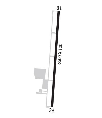
| Lat: N 3227.5 Long: W 09654.8 Elev: 727 Var: -06 Longest Runway: 6500 | ||
| AWOS: 119.57 CTAF: 122.97 | ||
| ||||||||||||||||||||||||||||||||||||||||||||
| ||||||||||||||||||||||||||||||||||||||||||||
| ||||||||||||||||||||||||||||||||||||||||||||
| Rwy | Rwy | |||||||
| 6500x100 | 6500' | 6500x100 | 6500' | |||||
| Runway ID | Single Wheel | Double Wheel | Double Tandem Wheel | Dual Double Wheel |
| 18/36 | 30,000 | 90,000 | N/A | N/A |
| These numbers are Advisory and are not limits. The Airport Manager should have more accurate Weight Limits | ||||
 Airport Diagram might not be current. | |
| Facility Name: | MID-WAY RGNL |
| City Name: | MIDLOTHIAN/WAXAHACHIE |
| County: | ELLIS |
| State abbrev: | TX |
| State Name: | TEXAS |
| Ownership: | PUBLICLY OWNED |
| Use: | OPEN TO THE PUBLIC |
| Owner's Name: | MIDLOTHIAN & WAXAHACHIE CITY |
| Address: | 408 S. ROGERS |
| WAXAHACHIE, TX 75165 | |
| Owner's Phone: | 469-309-4000; WAXAHACHIE CITY HALL. |
| Manager's Name: | SHARLETTE WRIGHT |
| Address: | 131 AIRPORT DRIVE, STE 101 |
| MIDLOTHIAN, TX 76065 | |
| Phone: | 972-923-0080 |
| FAA Region: | SOUTHWEST |
| FAA Field Office: | TEX |
| Date | Sunrise | Sunset |
|---|---|---|
| 06/08/26 Monday | 6:20 | 20:33 |
| 06/09/26 Tuesday | 6:20 | 20:34 |
| 06/10/26 Wednesday | 6:20 | 20:34 |
| 06/11/26 Thursday | 6:20 | 20:35 |
| 06/12/26 Friday | 6:20 | 20:35 |
| 06/13/26 Saturday | 6:20 | 20:36 |
| 06/14/26 Sunday | 6:20 | 20:36 |
| 06/15/26 Monday | 6:20 | 20:36 |
| 06/16/26 Tuesday | 6:20 | 20:37 |
| 06/17/26 Wednesday | 6:20 | 20:37 |
| 06/18/26 Thursday | 6:20 | 20:37 |
| 06/19/26 Friday | 6:20 | 20:38 |
| 06/20/26 Saturday | 6:21 | 20:38 |
| 06/21/26 Sunday | 6:21 | 20:38 |
| Airport Attendance Schedule | MAR-OCT MON-SAT 0800-1900, NOV-FEB MON-SAT 0800-1800, MAR-OCT SUN 0900-1900, NOV-FEB SUN 0900-1800 |
| Airport Status | OPERATIONAL (This Status can change at any time - please check NOTAMS) |
| Airport Lighting Schedule | ACTVT REIL RWY 18; MIRL RWY 18/36 - CTAF. |
| Airport Storage Available | Tie Downs |
| Extra Services Available | Avionics, Glider, Flight Instruction, Aircraft Sales, Annual Surveying, Glider Towing |
| Wind Indicator | YES - (lighted) |
| Control Tower | NO |
| CTAF Frequency | 122.975 |
| Unicom Frequency | 122.975 |
| Rotating Beacon Color | WG |
| Segmented Circle | YES |
| Landing Fee |
| Airport Inspected | STATE - performed by PRIVATE CONTRACT PERSONNEL |
| Inspection Date | 05/19/2025 |
| Type of Fuel Available | Grade 100LL, JET A (freeze point -40C); -10FOR FUEL & SVCS AFT HRS CALL 214-762-8286 OR 972-979-5723. |
| Airframe Repair Service | MAJOR |
| Power Plant Repair Service | MAJOR |
| Latitude | N3227.5 |
| Longitude | W09654.8 (ESTIMATED) |
| Arpt Elevation | 727ft (ESTIMATED) |
| Magnetic Variation | 06E |
| 5 miles SE | of MIDLOTHIAN/WAXAHACHIE |
| Traffic Pattern Altitude | |
| Sectional Chart | DALLAS-FT WORTH |
| Operations (Reported) | Yearly | Avg. Daily |
|---|---|---|
| General Aviation Transient | 0 | 0 |
| General Aviation Local | 0 | 0 |
| Air Taxi | 0 | 0 |
| Commerical | 0 | 0 |
| Commuter | 0 | 0 |
| Military | 0 | 0 |
| Aircraft based on Field | |
|---|---|
| General Aviation Singles | 0 |
| General Aviation Multi | 0 |
| Jet Aircraft | 0 |
| General Aviation Helicopters | 0 |
| Military Aircraft | 0 |
| Gliders | 0 |
| Ultralights | 0 |
| FSS on field | NO |
| FSS tie-in | FORT WORTH |
| FSS Phone | 1-800-WX-BRIEF |
| Who issues Notams | JWY |
| Notam D service at airport | YES |
| ARTCC Name | FORT WORTH |
| Airport Certification | |
| Aircraft Rescue & Firefighting Index | None |
| Airport of Entry | No |
| Custom Landing Rights | No |
| Joint Civil/Military | No |
| Military Landing rights | No |
| NATIONAL PLAN OF INTEGRATED AIRPORT SYSTEMS (NPIAS) |
| GRANT AGREEMENTS UNDER FAAP/ADAP/AIP |
| ASSURANCES PURSUANT TO TITLE VI, CIVIL RIGHTS ACT OF 1964 |
| GLIDER OPNS ON ARPT. |
| FOR CD CTC LONE STAR APCH AT 972-615-2799. |
Airport Communications & Frequencies:
| ||||||||||||||
| Runway: 18 | Runway: 36 | ||
| Mag heading: | 178° | Mag heading: | 358° |
| Rwy Slope: | -.63% Down | Rwy Slope: | .63% Up |
| Approach: | Approach: | ||
| Pattern: | Left Traffic | Pattern: | Left Traffic |
| Markings: | PRECISION INSTRUMENT | Markings: | NONPRECISION INSTRUMENT |
| Marking Condition: | FAIR | Marking Condition: | GOOD |
| Arresting Dev: | Arresting Dev: | ||
| Lat & Long: | N3228.0 W09654.7 | Lat. & Long.: | N3227.0 W09654.8 |
| Elev: | 727.0 ft. MSL | Elev: | 686.3 ft. MSL |
| TCH: | 40 ft. AGL | TCH: | 40 ft. AGL |
| Visual Glide Path: | 3.00 degrees | Visual Glide Path: | 3.00 degrees |
| Displaced Threshold: | No | Displaced Threshold: | No |
| Touchdown Zone: | YES | Touchdown Zone: | YES |
| Touchdown Elev.: | 727.0 feet | Touchdown Elev.: | 702.6 feet |
| Visual Glide Slope: | 4-Light PAPI on RIGHT side of Runway | Visual Glide Slope: | 4-Light PAPI on LEFT side of Runway |
| RVR Equipment: | RVR Equipment: | ||
| RVV Equipment: | NO | RVV Equipment: | NO |
| Approach Lights: | Approach Lights: | ||
| REIL: | YES | REIL: | NO |
| Centerline Lights: | NO | Centerline Lights: | NO |
| Touchdown lights: | NO | Touchdown lights: | NO |
| Runway Category: | D | Runway Category: | Runway with a Non-precision Approach having visibility minimums greater than 3/4 mile |
| Declared Distances: | Declared Distances: | ||
| Obstructions: | TREES | Obstructions: | PLINE |
| Marked: | NOT Marked/Lighted | Marked: | NOT Marked/Lighted |
| Clearance slope: | 40:1; CONTROLLING OBSTRUCTION EXCEEDS A 45 DEGREE SLOPE | Clearance slope: | |
| Obstruction height: | 26 feet AGL | Obstruction height: | 27 feet AGL |
| Dist. from runway: | 1254 feet | Dist. from runway: | 224 feet |
| Centerline offset: | 630 right of centerline | Centerline offset: | 503 feet left of centerline |
| Comments: | Comments: |
Thanks for using FltPlan.com
all rights reserved © 1999-2026 by Flight Plan LLC