
| WALKER COUNTY-BEVILL FIELD JASPER AL |
| |
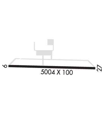
| Lat: N 3354.1 Long: W 08718.8 Elev: 483 Var: +01 Longest Runway: 5004 | ||
| Clr Del: 121.725 AWOS: 119.22 CTAF: 123.07 | ||
| ||||||||||||||||||||||||||||||||||||||||||||
| ||||||||||||||||||||||||||||||||||||||||||||
| ||||||||||||||||||||||||||||||||||||||||||||
| Rwy | Rwy | |||||||
| 5004x100 | 5004' | 5004x100 | 4814' | 108.90 - 272° | ||||
| Runway ID | Single Wheel | Double Wheel | Double Tandem Wheel | Dual Double Wheel |
| 09/27 | 50,000 | N/A | N/A | N/A |
| These numbers are Advisory and are not limits. The Airport Manager should have more accurate Weight Limits | ||||
 Airport Diagram might not be current. | |
| Facility Name: | WALKER COUNTY/BEVILL FLD |
| City Name: | JASPER |
| County: | WALKER |
| State abbrev: | AL |
| State Name: | ALABAMA |
| Ownership: | PUBLICLY OWNED |
| Use: | OPEN TO THE PUBLIC |
| Owner's Name: | WALKER COUNTY COMMISSION; STEVE MILLER, CHAIRMAN. MIKE SHORT, CO ENGR, KEITH DUNCAN, ARPT MGR. |
| Address: | 1801 3RD AVE. S., SUITE 113 |
| JASPER, AL 35501 | |
| Owner's Phone: | 205-384-7230 |
| Manager's Name: | KEITH DUNCAN |
| Address: | 198 BIDDLE DRIVE |
| JASPER, AL 35503 | |
| Phone: | 205-388-1294 |
| FAA Region: | SOUTHERN |
| FAA Field Office: | JAN |
| Date | Sunrise | Sunset |
|---|---|---|
| 07/13/26 Monday | 5:48 | 20:02 |
| 07/14/26 Tuesday | 5:49 | 20:01 |
| 07/15/26 Wednesday | 5:49 | 20:01 |
| 07/16/26 Thursday | 5:50 | 20:00 |
| 07/17/26 Friday | 5:50 | 20:00 |
| 07/18/26 Saturday | 5:51 | 20:00 |
| 07/19/26 Sunday | 5:52 | 19:59 |
| 07/20/26 Monday | 5:52 | 19:58 |
| 07/21/26 Tuesday | 5:53 | 19:58 |
| 07/22/26 Wednesday | 5:54 | 19:57 |
| 07/23/26 Thursday | 5:54 | 19:57 |
| 07/24/26 Friday | 5:55 | 19:56 |
| 07/25/26 Saturday | 5:56 | 19:55 |
| 07/26/26 Sunday | 5:56 | 19:55 |
| Airport Attendance Schedule | MON - SAT 0700-2000 |
| Airport Status | OPERATIONAL (This Status can change at any time - please check NOTAMS) |
| Airport Lighting Schedule | ACTVT REIL RWY 9 & 27; VASI RWY 9 & 27; MIRL RWY 9/27- CTAF. |
| Airport Storage Available | Tie Downs |
| Extra Services Available | Flight Instruction, Aircraft Rental |
| Wind Indicator | YES - (lighted) |
| Control Tower | NO |
| CTAF Frequency | 123.075 |
| Unicom Frequency | 123.075 |
| Rotating Beacon Color | WG |
| Segmented Circle | YES |
| Landing Fee | NO |
| Airport Inspected | STATE - performed by STATE AERONAUTICAL PERSONNEL |
| Inspection Date | 05/03/2024 |
| Type of Fuel Available | Grade 100LL, JET A (freeze point -40C), JET A-1 (freeze point -50C); -10FUEL AVBL 24/7 WITH CC. |
| Airframe Repair Service | MAJOR; NO OUTSIDE WORK EXCP EMERGS. |
| Power Plant Repair Service | MAJOR; NO OUTSIDE WORK EXCP EMERGS. |
| Latitude | N3354.1 |
| Longitude | W08718.8 (ESTIMATED) |
| Arpt Elevation | 482ft (SURVEYED) |
| Magnetic Variation | 01W |
| 5 miles NW | of JASPER |
| Traffic Pattern Altitude | |
| Sectional Chart | ATLANTA |
| Operations (Reported) | Yearly | Avg. Daily |
|---|---|---|
| General Aviation Transient | 0 | 0 |
| General Aviation Local | 0 | 0 |
| Air Taxi | 0 | 0 |
| Commerical | 0 | 0 |
| Commuter | 0 | 0 |
| Military | 0 | 0 |
| Aircraft based on Field | |
|---|---|
| General Aviation Singles | 0 |
| General Aviation Multi | 0 |
| Jet Aircraft | 0 |
| General Aviation Helicopters | 0 |
| Military Aircraft | 0 |
| Gliders | 0 |
| Ultralights | 0 |
| FSS on field | NO |
| FSS tie-in | ANNISTON |
| FSS Phone | 1-800-WX-BRIEF |
| Who issues Notams | ANB |
| Notam D service at airport | YES |
| ARTCC Name | ATLANTA |
| Airport Certification | |
| Aircraft Rescue & Firefighting Index | None |
| Airport of Entry | No |
| Custom Landing Rights | No |
| Joint Civil/Military | No |
| Military Landing rights | YES |
| NATIONAL PLAN OF INTEGRATED AIRPORT SYSTEMS (NPIAS) |
| GRANT AGREEMENTS UNDER FAAP/ADAP/AIP |
| ASSURANCES PURSUANT TO TITLE VI, CIVIL RIGHTS ACT OF 1964 |
| THIS AIRPORT HAS BEEN SURVEYED BY THE NATIONAL GEODETIC SURVEY. |
| DEER ON & INVOF RWYS. |
| GCO AVBL ON FREQ 121.725 THRU BIRMINGHAM (BHM) CLEARANCE DELIVERY. |
| FOR CD IF UNA VIA GCO CTC BIRMINGHAM APCH AT 205-769-3890. |
| HVY FLT STUDENT ACT. |
Airport Communications & Frequencies:
| ||||||||||||||||
| Runway: 09 | Runway: 27 | ||
| Mag heading: | 93° | Mag heading: | 273° |
| Rwy Slope: | -.17% Down | Rwy Slope: | .17% Up |
| Approach: | Approach: | ILS/DME | |
| Pattern: | Left Traffic | Pattern: | Left Traffic |
| Markings: | NONPRECISION INSTRUMENT | Markings: | PRECISION INSTRUMENT |
| Marking Condition: | FAIR | Marking Condition: | FAIR |
| Arresting Dev: | Arresting Dev: | ||
| Lat & Long: | N3354.1 W08719.3 | Lat. & Long.: | N3354.1 W08718.3 |
| Elev: | 482.3 ft. MSL | Elev: | 473.8 ft. MSL |
| TCH: | 39 ft. AGL | TCH: | 45 ft. AGL |
| Visual Glide Path: | 3.00 degrees | Visual Glide Path: | 3.00 degrees |
| Displaced Threshold: | No | Displaced Threshold: | 190 feet |
| Touchdown Zone: | YES | Touchdown Zone: | YES |
| Touchdown Elev.: | 482.6 feet | Touchdown Elev.: | 480.6 feet |
| Visual Glide Slope: | 4-BOX VASI ON LEFT SIDE OF RUNWAY | Visual Glide Slope: | 4-BOX VASI ON LEFT SIDE OF RUNWAY |
| RVR Equipment: | RVR Equipment: | ||
| RVV Equipment: | NO | RVV Equipment: | NO |
| Approach Lights: | Approach Lights: | ||
| REIL: | YES | REIL: | YES |
| Centerline Lights: | NO | Centerline Lights: | NO |
| Touchdown lights: | NO | Touchdown lights: | NO |
| Runway Category: | Runway with a Non-precision Approach having visibility minimums greater than 3/4 mile | Runway Category: | Precision Instrument Runway |
| Declared Distances: | TORA:5001' TODA:5001' ASDA:4800' LDA:4800' | Declared Distances: | TORA:5001' TODA:5001' ASDA:5001' LDA:4800' |
| Obstructions: | TREES | Obstructions: | TREES |
| Marked: | NOT Marked/Lighted | Marked: | NOT Marked/Lighted |
| Clearance slope: | 2:1 | Clearance slope: | 24:1 |
| Obstruction height: | 11 feet AGL | Obstruction height: | 21 feet AGL |
| Dist. from runway: | 230 feet | Dist. from runway: | 705 feet |
| Centerline offset: | 202 left of centerline | Centerline offset: | 64 feet right of centerline |
| Comments: | Comments: |
Thanks for using FltPlan.com
all rights reserved © 1999-2026 by Flight Plan LLC
