
| CAMPBELL COUNTY JACKSBORO TN |
| |
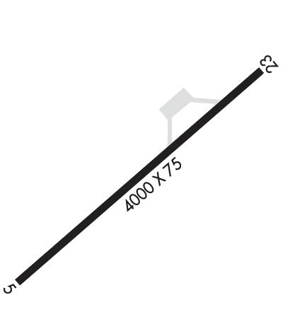
| Lat: N 3620.0 Long: W 08409.8 Elev: 1180 Var: +03 Longest Runway: 4000 | ||
| AWOS: 124.97 CTAF: 122.8 | ||
| ||||||
| ||||||
|
| Rwy | Rwy | |||||||
| 4000x75 | 4000' | 4000x75 | 4000' | |||||
| Runway ID | Single Wheel | Double Wheel | Double Tandem Wheel | Dual Double Wheel |
| 05/23 | 25,000 | N/A | N/A | N/A |
| These numbers are Advisory and are not limits. The Airport Manager should have more accurate Weight Limits | ||||
 Airport Diagram might not be current. | |
| Facility Name: | COLONEL TOMMY C STINER AIRFIELD |
| City Name: | JACKSBORO |
| County: | CAMPBELL |
| State abbrev: | TN |
| State Name: | TENNESSEE |
| Ownership: | PUBLICLY OWNED |
| Use: | OPEN TO THE PUBLIC |
| Owner's Name: | CAMPBELL COUNTY |
| Address: | COUNTY COURTHOUSE, PO BOX 435 |
| JACKSBORO, TN 37757 | |
| Owner's Phone: | 423-562-2526 |
| Manager's Name: | BERT LOUPE |
| Address: | 610 MEMORIAL LANE |
| JACKSBORO, TN 37757 | |
| Phone: | 423-562-9966 |
| FAA Region: | SOUTHERN |
| FAA Field Office: | MEM |
| Date | Sunrise | Sunset |
|---|---|---|
| 06/08/26 Monday | 6:19 | 20:53 |
| 06/09/26 Tuesday | 6:19 | 20:53 |
| 06/10/26 Wednesday | 6:18 | 20:54 |
| 06/11/26 Thursday | 6:18 | 20:54 |
| 06/12/26 Friday | 6:18 | 20:55 |
| 06/13/26 Saturday | 6:18 | 20:55 |
| 06/14/26 Sunday | 6:18 | 20:56 |
| 06/15/26 Monday | 6:18 | 20:56 |
| 06/16/26 Tuesday | 6:18 | 20:56 |
| 06/17/26 Wednesday | 6:19 | 20:57 |
| 06/18/26 Thursday | 6:19 | 20:57 |
| 06/19/26 Friday | 6:19 | 20:57 |
| 06/20/26 Saturday | 6:19 | 20:57 |
| 06/21/26 Sunday | 6:19 | 20:58 |
| Airport Attendance Schedule | MON-FRI 0900-1700, SAT 0900-1500 |
| Airport Status | OPERATIONAL (This Status can change at any time - please check NOTAMS) |
| Airport Lighting Schedule | ACTVT REIL RWY 5 & 23; MIRL RWY 5/23 - CTAF. PAPI RWY 05 & 23 ON CONSLY. |
| Airport Storage Available | Tie Downs, Hanger |
| Extra Services Available | NONE |
| Wind Indicator | YES - (lighted) |
| Control Tower | NO |
| CTAF Frequency | 122.800 |
| Unicom Frequency | 122.800 |
| Rotating Beacon Color | WG |
| Segmented Circle | YES |
| Landing Fee | NO |
| Airport Inspected | STATE - performed by STATE AERONAUTICAL PERSONNEL |
| Inspection Date | 03/19/2024 |
| Type of Fuel Available | Grade 100LL, JET A (freeze point -40C) |
| Airframe Repair Service | None |
| Power Plant Repair Service | None |
| Latitude | N3620.0 |
| Longitude | W08409.8 (ESTIMATED) |
| Arpt Elevation | 1179ft (SURVEYED) |
| Magnetic Variation | 03W |
| 1 miles E | of JACKSBORO |
| Traffic Pattern Altitude | |
| Sectional Chart | CINCINNATI |
| Operations (Reported) | Yearly | Avg. Daily |
|---|---|---|
| General Aviation Transient | 0 | 0 |
| General Aviation Local | 0 | 0 |
| Air Taxi | 0 | 0 |
| Commerical | 0 | 0 |
| Commuter | 0 | 0 |
| Military | 0 | 0 |
| Aircraft based on Field | |
|---|---|
| General Aviation Singles | 0 |
| General Aviation Multi | 0 |
| Jet Aircraft | 0 |
| General Aviation Helicopters | 0 |
| Military Aircraft | 0 |
| Gliders | 0 |
| Ultralights | 0 |
| FSS on field | NO |
| FSS tie-in | NASHVILLE |
| FSS Phone | 1-800-WX-BRIEF |
| Who issues Notams | BNA |
| Notam D service at airport | YES |
| ARTCC Name | ATLANTA |
| Airport Certification | |
| Aircraft Rescue & Firefighting Index | None |
| Airport of Entry | No |
| Custom Landing Rights | No |
| Joint Civil/Military | No |
| Military Landing rights | YES |
| NATIONAL PLAN OF INTEGRATED AIRPORT SYSTEMS (NPIAS) |
| GRANT AGREEMENT HAS EXPIRED; HOWEVER, AGREEMENT REMAINS IN EFFECT FOR THIS FACILITY AS LONG AS IT IS PUBLIC USE. |
| HIGH TRRN S-NE. |
| DEER & COYOTE ON RWY. |
| FOR CD CTC ATLANTA ARTCC AT 770-210-7692. |
Airport Communications & Frequencies:
| |||||||||
| Runway: 05 | Runway: 23 | ||
| Mag heading: | 49° | Mag heading: | 229° |
| Rwy Slope: | 1.16% Up | Rwy Slope: | -1.16% Down |
| Approach: | Approach: | ||
| Pattern: | Left Traffic | Pattern: | Left Traffic |
| Markings: | BASIC | Markings: | BASIC |
| Marking Condition: | GOOD | Marking Condition: | GOOD |
| Arresting Dev: | Arresting Dev: | ||
| Lat & Long: | N3619.8 W08410.1 | Lat. & Long.: | N3620.3 W08409.5 |
| Elev: | 1133.7 ft. MSL | Elev: | 1179.9 ft. MSL |
| TCH: | 26 ft. AGL | TCH: | 30 ft. AGL |
| Visual Glide Path: | 3.00 degrees | Visual Glide Path: | 3.00 degrees |
| Displaced Threshold: | No | Displaced Threshold: | No |
| Touchdown Zone: | YES | Touchdown Zone: | YES |
| Touchdown Elev.: | 1172.8 feet | Touchdown Elev.: | 1179.9 feet |
| Visual Glide Slope: | 2-Light PAPI on LEFT side of Runway | Visual Glide Slope: | 2-Light PAPI on LEFT side of Runway |
| RVR Equipment: | RVR Equipment: | ||
| RVV Equipment: | NO | RVV Equipment: | NO |
| Approach Lights: | Approach Lights: | ||
| REIL: | YES | REIL: | YES |
| Centerline Lights: | NO | Centerline Lights: | NO |
| Touchdown lights: | NO | Touchdown lights: | NO |
| Runway Category: | Runway with a Visual Approach | Runway Category: | Runway with a Non-precision Approach |
| Declared Distances: | Declared Distances: | ||
| Obstructions: | TREES | Obstructions: | TREES |
| Marked: | NOT Marked/Lighted | Marked: | NOT Marked/Lighted |
| Clearance slope: | 15:1 | Clearance slope: | 13:1 |
| Obstruction height: | 28 feet AGL | Obstruction height: | 9 feet AGL |
| Dist. from runway: | 630 feet | Dist. from runway: | 318 feet |
| Centerline offset: | 111 left of centerline | Centerline offset: | 81 feet left of centerline |
| Comments: | Comments: |
Thanks for using FltPlan.com
all rights reserved © 1999-2026 by Flight Plan LLC
