
| KINSTON RGNL JETPORT AT STALLI KINSTON NC |
| |
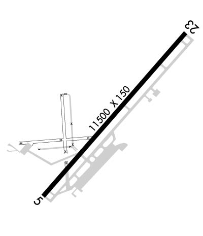
| Lat: N 3519.9 Long: W 07736.5 Elev: 93 Var: +09 Longest Runway: 11498 | ||
| AWOS: 132.75 Ground: 121.9 Tower: 120.6 | ||
| ||||||||||||||||||||||||||||||||||||||||||||
| ||||||||||||||||||||||||||||||||||||||||||||
| ||||||||||||||||||||||||||||||||||||||||||||
| Rwy | Rwy | |||||||
| 11498x150 | 10958' | 111.30 - 050° | 11498x150 | 11498' | ||||
| Runway ID | Single Wheel | Double Wheel | Double Tandem Wheel | Dual Double Wheel |
| 05/23 | 120,000 | 219,000 | 404,000 | 901,000 |
| These numbers are Advisory and are not limits. The Airport Manager should have more accurate Weight Limits | ||||
 Airport Diagram might not be current. | |
| Facility Name: | KINSTON RGNL JETPORT AT STALLINGS FLD |
| City Name: | KINSTON |
| County: | LENOIR |
| State abbrev: | NC |
| State Name: | NORTH CAROLINA |
| Ownership: | PUBLICLY OWNED |
| Use: | OPEN TO THE PUBLIC |
| Owner's Name: | NORTH CAROLINA |
| Address: | 2780 JETPORT ROAD |
| KINSTON, NC 23504 | |
| Owner's Phone: | 252-523-1351 |
| Manager's Name: | RICHARD W. BARKES; KINSTON REGIONAL JETPORT (DIRECTOR OF OPERATIONS). |
| Address: | 2780 JETPORT ROAD SUITE I |
| KINSTON, NC 28504 | |
| Phone: | (252) 523-1351 |
| FAA Region: | SOUTHERN |
| FAA Field Office: | MEM |
| Date | Sunrise | Sunset |
|---|---|---|
| 09/24/21 Friday | 7:00 | 19:05 |
| 09/25/21 Saturday | 7:00 | 19:03 |
| 09/26/21 Sunday | 7:01 | 19:02 |
| 09/27/21 Monday | 7:02 | 19:00 |
| 09/28/21 Tuesday | 7:03 | 18:59 |
| 09/29/21 Wednesday | 7:04 | 18:57 |
| 09/30/21 Thursday | 7:04 | 18:56 |
| 10/01/21 Friday | 7:05 | 18:55 |
| 10/02/21 Saturday | 7:06 | 18:53 |
| 10/03/21 Sunday | 7:07 | 18:52 |
| 10/04/21 Monday | 7:07 | 18:50 |
| 10/05/21 Tuesday | 7:08 | 18:49 |
| 10/06/21 Wednesday | 7:09 | 18:48 |
| 10/07/21 Thursday | 7:10 | 18:46 |
| Airport Attendance Schedule | 7 Days A Week 0630-2200 |
| Airport Status | OPERATIONAL (This Status can change at any time - please check NOTAMS) |
| Airport Lighting Schedule | WHEN ATCT CLSD ACTVT HIRL RY 05/23 & MALSR RY 05 & REIL RY 23 - CTAF. |
| Airport Storage Available | Tie Downs, Hanger |
| Extra Services Available | Air Freight, Air Ambulance, Cargo Handling, Charter, Flight Instruction, Aircraft Rental, Aircraft Sales |
| Wind Indicator | YES - (lighted) |
| Control Tower | YES |
| CTAF Frequency | 120.600 |
| Unicom Frequency | 122.950 |
| Rotating Beacon Color | CLEAR-GREEN (Light Land Airport) |
| Segmented Circle | YES |
| Landing Fee | NO |
| Airport Inspected | FEDERAL - performed by FAA AIRPORTS FIELD PERSONNEL |
| Inspection Date | 06/03/2021 |
| Type of Fuel Available | Grade 100LL, JET A (freeze point -40C) |
| Airframe Repair Service | MAJOR |
| Power Plant Repair Service | MAJOR |
| Latitude | N3519.9 |
| Longitude | W07736.5 (ESTIMATED) |
| Arpt Elevation | 92ft (SURVEYED) |
| Magnetic Variation | 09W |
| 3 miles NW | of KINSTON |
| Traffic Pattern Altitude | |
| Sectional Chart | CHARLOTTE |
| Operations (Reported) | Yearly | Avg. Daily |
|---|---|---|
| General Aviation Transient | 5135 | 14 |
| General Aviation Local | 4667 | 13 |
| Air Taxi | 1268 | 3 |
| Commerical | 9 | 0 |
| Commuter | 0 | 0 |
| Military | 13632 | 37 |
| Aircraft based on Field | |
|---|---|
| General Aviation Singles | 16 |
| General Aviation Multi | 0 |
| Jet Aircraft | 22 |
| General Aviation Helicopters | 2 |
| Military Aircraft | 0 |
| Gliders | 0 |
| Ultralights | 0 |
| FSS on field | NO |
| FSS tie-in | RALEIGH |
| FSS Phone | 1-800-WX-BRIEF |
| Who issues Notams | ISO |
| Notam D service at airport | YES |
| ARTCC Name | WASHINGTON |
| Airport Certification | AIRPORT RECEIVING SCHEDULED AIR CARRIER SERVICE FROM CARRIERS CERTIFICATED BY THE CIVIL AERONAUTICS BOARD; CLSD TO UNSKED ACR OPNS WITH MORE THAN 30 PSGR SEATS EXCP 24 HR PPR CALL AMGR 252-523-1351. |
| Aircraft Rescue & Firefighting Index | AIRPORT HAS A CERTIFICATE UNDER CFR PART 139 |
| Airport of Entry | No |
| Custom Landing Rights | No |
| Joint Civil/Military | No |
| Military Landing rights | YES |
| NATIONAL PLAN OF INTEGRATED AIRPORT SYSTEMS (NPIAS) |
| GRANT AGREEMENTS UNDER FAAP/ADAP/AIP |
| SURPLUS PROPERTY AGREEMENT UNDER PUBLIC LAW 289 |
| SURPLUS PROPERTY AGREEMENT UNDER REGULATION 16-WAA |
| ASSURANCES PURSUANT TO TITLE VI, CIVIL RIGHTS ACT OF 1964 |
| AGREEMENT UNDER DLAND OR DCLA HAS EXPIRED. |
| ALS UNMON WHEN ATCT IS CLSD. |
| FOR CD IF UNA TO CTC ON FSS FREQ, CTC WASHINGTON ARTCC AT 703-771-3587. |
Airport Communications & Frequencies:
| |||||||||||||||||||||||||||
| Runway: 05 | Runway: 23 | ||
| Mag heading: | 50° | Mag heading: | 230° |
| Rwy Slope: | -.04% Down | Rwy Slope: | .04% Up |
| Approach: | ILS | Approach: | |
| Pattern: | Left Traffic | Pattern: | Left Traffic |
| Markings: | PRECISION INSTRUMENT | Markings: | NONPRECISION INSTRUMENT |
| Marking Condition: | GOOD | Marking Condition: | GOOD |
| Arresting Dev: | Arresting Dev: | ||
| Lat & Long: | N3519.2 W07737.3 | Lat. & Long.: | N3520.6 W07735.8 |
| Elev: | 91.2 ft. MSL | Elev: | 86.2 ft. MSL |
| TCH: | 60 ft. AGL | TCH: | 100 ft. AGL |
| Visual Glide Path: | 3.00 degrees | Visual Glide Path: | 3.00 degrees |
| Displaced Threshold: | 540 feet | Displaced Threshold: | No |
| Touchdown Zone: | YES | Touchdown Zone: | YES |
| Touchdown Elev.: | 92.9 feet | Touchdown Elev.: | 86.5 feet |
| Visual Glide Slope: | 4-Light PAPI on LEFT side of Runway | Visual Glide Slope: | 4-Light PAPI on LEFT side of Runway |
| RVR Equipment: | TOUCHDOWN | RVR Equipment: | ROLLOUT |
| RVV Equipment: | NO | RVV Equipment: | NO |
| Approach Lights: | MALSR - 1,400 foot medium intensity approach lighting system with runway alignment indicator lights | Approach Lights: | |
| REIL: | NO | REIL: | YES |
| Centerline Lights: | NO | Centerline Lights: | NO |
| Touchdown lights: | NO | Touchdown lights: | NO |
| Runway Category: | Precision Instrument Runway | Runway Category: | Runway with a Non-precision Approach having visibility minimums greater than 3/4 mile |
| Declared Distances: | Declared Distances: | ||
| Obstructions: | Obstructions: | POLE | |
| Marked: | Marked: | NOT Marked/Lighted | |
| Clearance slope: | 50:1 | Clearance slope: | 34:1 |
| Obstruction height: | Obstruction height: | 57 feet AGL | |
| Dist. from runway: | Dist. from runway: | 2150 feet | |
| Centerline offset: | Centerline offset: | 350 feet left of centerline | |
| Comments: | Comments: |
Thanks for using FltPlan.com
all rights reserved © 1999-2021 by Flight Plan LLC
