
| ALEXANDRIA ALEXANDRIA IN |
| |
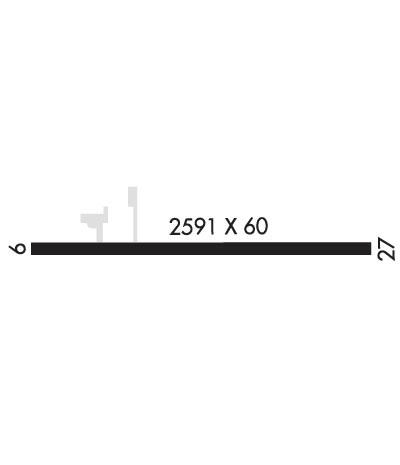
| Lat: N 4014.0 Long: W 08538.3 Elev: 900 Var: -00 Longest Runway: 2591 | ||
| CTAF: 123.05 | ||
| |||||
|
| Rwy | Rwy | |||||||
| 2591x60 | 2396' | 2591x60 | 2315' | |||||
| Runway ID | Single Wheel | Double Wheel | Double Tandem Wheel | Dual Double Wheel |
| 09/27 | N/A | N/A | N/A | N/A |
| These numbers are Advisory and are not limits. The Airport Manager should have more accurate Weight Limits | ||||
| FltPlan does not have IFR approach charts available for KI99. |
 Airport Diagram might not be current. | |
| Facility Name: | ALEXANDRIA |
| City Name: | ALEXANDRIA |
| County: | MADISON |
| State abbrev: | IN |
| State Name: | INDIANA |
| Ownership: | PRIVATELY OWNED |
| Use: | OPEN TO THE PUBLIC |
| Owner's Name: | CENTRAL INDIANA SOARING SOCIETY |
| Address: | 1577 E. 900 N. |
| ALEXANDRIA, IN 46001 | |
| Owner's Phone: | 765-744-0242 |
| Manager's Name: | DANIEL DEWITT |
| Address: | 1577 E. 900 N. |
| ALEXANDRIA, IN 46001 | |
| Phone: | (765) 744-4132 |
| FAA Region: | GREAT LAKES |
| FAA Field Office: | CHI |
| Date | Sunrise | Sunset |
|---|---|---|
| 09/24/21 Friday | 7:32 | 19:37 |
| 09/25/21 Saturday | 7:33 | 19:35 |
| 09/26/21 Sunday | 7:34 | 19:33 |
| 09/27/21 Monday | 7:35 | 19:32 |
| 09/28/21 Tuesday | 7:36 | 19:30 |
| 09/29/21 Wednesday | 7:37 | 19:28 |
| 09/30/21 Thursday | 7:38 | 19:27 |
| 10/01/21 Friday | 7:39 | 19:25 |
| 10/02/21 Saturday | 7:40 | 19:24 |
| 10/03/21 Sunday | 7:41 | 19:22 |
| 10/04/21 Monday | 7:42 | 19:20 |
| 10/05/21 Tuesday | 7:43 | 19:19 |
| 10/06/21 Wednesday | 7:44 | 19:17 |
| 10/07/21 Thursday | 7:45 | 19:15 |
| Airport Attendance Schedule | IRREGULAR |
| Airport Status | OPERATIONAL (This Status can change at any time - please check NOTAMS) |
| Airport Lighting Schedule | |
| Airport Storage Available | Tie Downs |
| Extra Services Available | Glider, Flight Instruction, Glider Towing |
| Wind Indicator | YES - (unlit) |
| Control Tower | NO |
| CTAF Frequency | 123.050 |
| Unicom Frequency | 123.050 |
| Rotating Beacon Color | |
| Segmented Circle | NO |
| Landing Fee | NO |
| Airport Inspected | STATE - performed by STATE AERONAUTICAL PERSONNEL |
| Inspection Date | 08/04/2020 |
| Type of Fuel Available | None |
| Airframe Repair Service | None |
| Power Plant Repair Service | None |
| Latitude | N4014.0 |
| Longitude | W08538.3 (ESTIMATED) |
| Arpt Elevation | 900ft (SURVEYED) |
| Magnetic Variation | 00E |
| 3 miles SE | of ALEXANDRIA |
| Traffic Pattern Altitude | |
| Sectional Chart | CHICAGO |
| Operations (Reported) | Yearly | Avg. Daily |
|---|---|---|
| General Aviation Transient | 1043 | 3 |
| General Aviation Local | 5334 | 15 |
| Air Taxi | 0 | 0 |
| Commerical | 0 | 0 |
| Commuter | 0 | 0 |
| Military | 0 | 0 |
| Aircraft based on Field | |
|---|---|
| General Aviation Singles | 2 |
| General Aviation Multi | 0 |
| Jet Aircraft | 0 |
| General Aviation Helicopters | 0 |
| Military Aircraft | 0 |
| Gliders | 16 |
| Ultralights | 0 |
| FSS on field | NO |
| FSS tie-in | TERRE HAUTE |
| FSS Phone | 1-800-WX-BRIEF |
| Who issues Notams | HUF |
| Notam D service at airport | YES |
| ARTCC Name | INDIANAPOLIS |
| Airport Certification | |
| Aircraft Rescue & Firefighting Index | None |
| Airport of Entry | No |
| Custom Landing Rights | No |
| Joint Civil/Military | No |
| Military Landing rights | No |
| THIS AIRPORT HAS BEEN SURVEYED BY THE NATIONAL GEODETIC SURVEY. |
| HEAVY GLIDER ACTIVITY ON AND INVOF ARPT. |
| FOR CD CTC INDIANAPOLIS APCH AT 317-227-5743. |
| RWY 09/2 7 GRASS GROWING THROUGH NUMEROUS CRACKS. |
Airport Communications & Frequencies:
| |||||||||||||||||
| Runway: 09 | Runway: 27 | ||
| Mag heading: | 91° | Mag heading: | 271° |
| Rwy Slope: | -.35% Down | Rwy Slope: | .35% Up |
| Approach: | Approach: | ||
| Pattern: | Left Traffic | Pattern: | Left Traffic |
| Markings: | Markings: | ||
| Marking Condition: | Marking Condition: | ||
| Arresting Dev: | Arresting Dev: | ||
| Lat & Long: | N4014.0 W08538.5 | Lat. & Long.: | N4013.9 W08538.0 |
| Elev: | 894.0 ft. MSL | Elev: | 885.0 ft. MSL |
| TCH: | TCH: | ||
| Visual Glide Path: | Visual Glide Path: | ||
| Displaced Threshold: | 195 feet | Displaced Threshold: | 276 feet |
| Touchdown Zone: | YES | Touchdown Zone: | YES |
| Touchdown Elev.: | 900.0 feet | Touchdown Elev.: | 900.0 feet |
| Visual Glide Slope: | Visual Glide Slope: | ||
| RVR Equipment: | RVR Equipment: | ||
| RVV Equipment: | NO | RVV Equipment: | NO |
| Approach Lights: | Approach Lights: | ||
| REIL: | NO | REIL: | NO |
| Centerline Lights: | NO | Centerline Lights: | NO |
| Touchdown lights: | NO | Touchdown lights: | NO |
| Runway Category: | Runway with a Visual Approach | Runway Category: | Runway with a Visual Approach |
| Declared Distances: | Declared Distances: | ||
| Obstructions: | CROPS | Obstructions: | CROPS |
| Marked: | NOT Marked/Lighted | Marked: | NOT Marked/Lighted |
| Clearance slope: | APCH SLOPE 21:1 AT DISP TH DUE TO 11 FT ROAD 235 FT FM DISP TH | Clearance slope: | APCH SLOPE 20:1 AT DISP TH DUE TO 15 FT ROAD 305 FT FM DISP TH |
| Obstruction height: | 10 feet AGL | Obstruction height: | 10 feet AGL |
| Dist. from runway: | 201 feet | Dist. from runway: | 201 feet |
| Centerline offset: | Centerline offset: | ||
| Comments: | 11 FT ROAD 45 FT FROM RWY END & CROPS 55 FT FROM RWY END | Comments: | 15 FT ROAD 30 FT FROM RWY END & CROPS 50 FT FROM RWY END |
Thanks for using FltPlan.com
all rights reserved © 1999-2021 by Flight Plan LLC
