
| MORAINE AIR PARK DAYTON OH |
| |
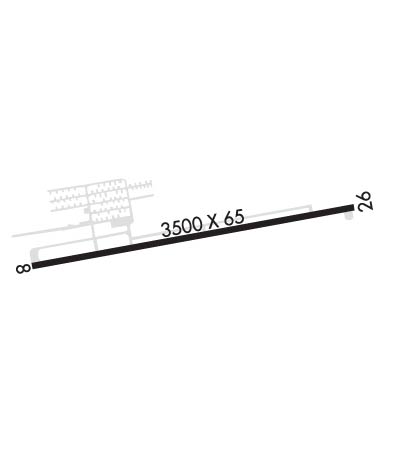
| Lat: N 3940.9 Long: W 08414.4 Elev: 720 Var: +04 Longest Runway: 3500 | ||
| CTAF: 122.7 | ||
| ||||||
|
| Rwy | Rwy | |||||||
| 3500x65 | 2942' | 3500x65 | 3364' | |||||
| Runway ID | Single Wheel | Double Wheel | Double Tandem Wheel | Dual Double Wheel |
| 08/26 | N/A | N/A | N/A | N/A |
| These numbers are Advisory and are not limits. The Airport Manager should have more accurate Weight Limits | ||||
 Airport Diagram might not be current. | |
| Facility Name: | MORAINE AIR PARK |
| City Name: | DAYTON |
| County: | MONTGOMERY |
| State abbrev: | OH |
| State Name: | OHIO |
| Ownership: | PUBLICLY OWNED |
| Use: | OPEN TO THE PUBLIC |
| Owner's Name: | MONTGOMERY COUNTY |
| Address: | 3800 CLEARVIEW AVE |
| MORAINE, OH 45439-1199 | |
| Owner's Phone: | 937-866-2489 |
| Manager's Name: | J R SNYDER |
| Address: | 3800 CLEARVIEW AVE |
| MORAINE, OH 45439-1199 | |
| Phone: | 937-866-2489 |
| FAA Region: | GREAT LAKES |
| FAA Field Office: | DET |

| Date | Sunrise | Sunset |
|---|---|---|
| 06/08/26 Monday | 6:09 | 21:03 |
| 06/09/26 Tuesday | 6:09 | 21:04 |
| 06/10/26 Wednesday | 6:09 | 21:04 |
| 06/11/26 Thursday | 6:09 | 21:05 |
| 06/12/26 Friday | 6:09 | 21:05 |
| 06/13/26 Saturday | 6:08 | 21:06 |
| 06/14/26 Sunday | 6:08 | 21:06 |
| 06/15/26 Monday | 6:08 | 21:06 |
| 06/16/26 Tuesday | 6:09 | 21:07 |
| 06/17/26 Wednesday | 6:09 | 21:07 |
| 06/18/26 Thursday | 6:09 | 21:07 |
| 06/19/26 Friday | 6:09 | 21:08 |
| 06/20/26 Saturday | 6:09 | 21:08 |
| 06/21/26 Sunday | 6:09 | 21:08 |
| Airport Attendance Schedule | 7 Days A Week DALGT |
| Airport Status | OPERATIONAL (This Status can change at any time - please check NOTAMS) |
| Airport Lighting Schedule | INCR INTST MIRL RWY 08/26 - CTAF. MIRL RWY 08/26 OPR SS-SR LOW INTST. |
| Airport Storage Available | Tie Downs |
| Extra Services Available | Flight Instruction, Aircraft Rental |
| Wind Indicator | YES - (unlit) |
| Control Tower | NO |
| CTAF Frequency | 122.700 |
| Unicom Frequency | 122.700 |
| Rotating Beacon Color | WG |
| Segmented Circle | NO |
| Landing Fee | NO |
| Airport Inspected | STATE - performed by STATE AERONAUTICAL PERSONNEL |
| Inspection Date | 10/02/2025 |
| Type of Fuel Available | Grade 100LL; -10100LL UNAVBL AFT ATNDD HRS. |
| Airframe Repair Service | NONE |
| Power Plant Repair Service | NONE |
| Latitude | N3940.9 |
| Longitude | W08414.4 (ESTIMATED) |
| Arpt Elevation | 720ft (SURVEYED) |
| Magnetic Variation | 04W |
| 4 miles SW | of DAYTON |
| Traffic Pattern Altitude | |
| Sectional Chart | CINCINNATI |
| Operations (Reported) | Yearly | Avg. Daily |
|---|---|---|
| General Aviation Transient | 0 | 0 |
| General Aviation Local | 0 | 0 |
| Air Taxi | 0 | 0 |
| Commerical | 0 | 0 |
| Commuter | 0 | 0 |
| Military | 0 | 0 |
| Aircraft based on Field | |
|---|---|
| General Aviation Singles | 0 |
| General Aviation Multi | 0 |
| Jet Aircraft | 0 |
| General Aviation Helicopters | 0 |
| Military Aircraft | 0 |
| Gliders | 0 |
| Ultralights | 0 |
| FSS on field | NO |
| FSS tie-in | DAYTON |
| FSS Phone | 1-800-WX-BRIEF |
| Who issues Notams | DAY |
| Notam D service at airport | YES |
| ARTCC Name | INDIANAPOLIS |
| Airport Certification | |
| Aircraft Rescue & Firefighting Index | None |
| Airport of Entry | No |
| Custom Landing Rights | No |
| Joint Civil/Military | No |
| Military Landing rights | No |
| 15 FT LEVEE SOUTH OF & PARL TO RWY. TREES NORTH OF RWY. |
| PAEW ADJ TWYS. |
| FOR CD CTC COLUMBUS APCH AT 614-338-8537. |
| ULTRA-LIGHT ACTVTY. |
| +75 FT TREE OVERHANGS PARL TWY BTN TRML & RWY END 26. |
| MIL JETS OVR ARPT INBD & OUBD TO/FM KFFO AFB 12 NM NE. |
| BIRDS INVOF ARPT. |
Airport Communications & Frequencies:
| ||||||||||||||||||
| Runway: 08 | Runway: 26 | ||
| Mag heading: | 84° | Mag heading: | 264° |
| Rwy Slope: | .00% | Rwy Slope: | .00% |
| Approach: | Approach: | ||
| Pattern: | Left Traffic | Pattern: | Left Traffic |
| Markings: | BASIC | Markings: | BASIC |
| Marking Condition: | FAIR | Marking Condition: | FAIR |
| Arresting Dev: | Arresting Dev: | ||
| Lat & Long: | N3940.9 W08414.8 | Lat. & Long.: | N3941.0 W08414.0 |
| Elev: | 720.0 ft. MSL | Elev: | 720.0 ft. MSL |
| TCH: | TCH: | ||
| Visual Glide Path: | Visual Glide Path: | ||
| Displaced Threshold: | 558 feet | Displaced Threshold: | 136 feet |
| Touchdown Zone: | YES | Touchdown Zone: | YES |
| Touchdown Elev.: | 720.0 feet | Touchdown Elev.: | 720.0 feet |
| Visual Glide Slope: | Visual Glide Slope: | ||
| RVR Equipment: | RVR Equipment: | ||
| RVV Equipment: | NO | RVV Equipment: | NO |
| Approach Lights: | Approach Lights: | ||
| REIL: | NO | REIL: | NO |
| Centerline Lights: | NO | Centerline Lights: | NO |
| Touchdown lights: | NO | Touchdown lights: | NO |
| Runway Category: | Runway with a Visual Approach | Runway Category: | Runway with a Visual Approach |
| Declared Distances: | Declared Distances: | ||
| Obstructions: | BERM | Obstructions: | BERM |
| Marked: | LIGHTED | Marked: | LIGHTED |
| Clearance slope: | 1:1; APCH RATIO 16:1 TO DSPLCD THLD; +15 FT DIKE 245 FT FM 150 FT R. | Clearance slope: | 1:1; APCH RATIO 12:1 TO DTHR OVR 15 FT DIKE, 180 FT DIST, 140 FT L. |
| Obstruction height: | 15 feet AGL | Obstruction height: | 6 feet AGL |
| Dist. from runway: | 201 feet | Dist. from runway: | 201 feet |
| Centerline offset: | 75 left of centerline | Centerline offset: | 60 feet right of centerline |
| Comments: | +15 FT LGTD DIKE, 0-200 FT DIST, 75 FT L TO 85 FT R. | Comments: | 6 FT LGTD DIKE, 0-200 FT DIST, 125 FT L TO 120 FT R. |
Thanks for using FltPlan.com
all rights reserved © 1999-2026 by Flight Plan LLC