
| STANTON STANTON KY |
| |
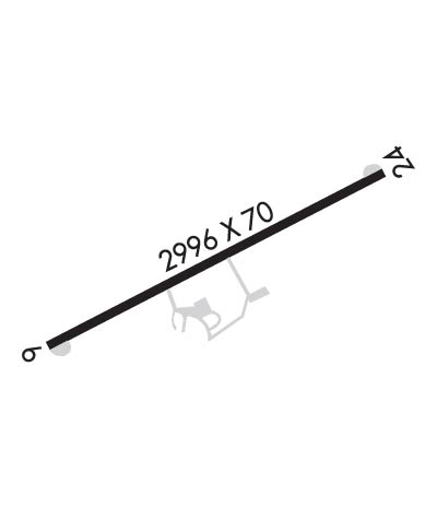
| Lat: N 3751.0 Long: W 08350.8 Elev: 651 Var: +04 Longest Runway: 2996 | ||
| CTAF: 122.8 | ||
| ||||||||||||||||||||||||||||||||||||||||||||
| ||||||||||||||||||||||||||||||||||||||||||||
| Rwy | Rwy | |||||||
| 2996x70 | 2565' | 2996x70 | 2775' | |||||
| Runway ID | Single Wheel | Double Wheel | Double Tandem Wheel | Dual Double Wheel |
| 06/24 | 8,000 | N/A | N/A | N/A |
| These numbers are Advisory and are not limits. The Airport Manager should have more accurate Weight Limits | ||||
| FltPlan does not have IFR approach charts available for KI50. |
 Airport Diagram might not be current. | |
| Facility Name: | STANTON |
| City Name: | STANTON |
| County: | POWELL |
| State abbrev: | KY |
| State Name: | KENTUCKY |
| Ownership: | PUBLICLY OWNED |
| Use: | OPEN TO THE PUBLIC |
| Owner's Name: | POWELL CO ARPT BOARD |
| Address: | 310 AIRPORT ROAD |
| STANTON, KY 40380 | |
| Owner's Phone: | 606-599-7997 |
| Manager's Name: | CHARLES DONALDSON |
| Address: | 310 AIRPORT ROAD |
| STANTON, KY 40380 | |
| Phone: | 606-569-9011 |
| FAA Region: | SOUTHERN |
| FAA Field Office: | MEM |
| Date | Sunrise | Sunset |
|---|---|---|
| 06/07/26 Sunday | 6:13 | 20:55 |
| 06/08/26 Monday | 6:13 | 20:56 |
| 06/09/26 Tuesday | 6:13 | 20:56 |
| 06/10/26 Wednesday | 6:13 | 20:57 |
| 06/11/26 Thursday | 6:13 | 20:57 |
| 06/12/26 Friday | 6:13 | 20:58 |
| 06/13/26 Saturday | 6:13 | 20:58 |
| 06/14/26 Sunday | 6:13 | 20:59 |
| 06/15/26 Monday | 6:13 | 20:59 |
| 06/16/26 Tuesday | 6:13 | 20:59 |
| 06/17/26 Wednesday | 6:13 | 21:00 |
| 06/18/26 Thursday | 6:13 | 21:00 |
| 06/19/26 Friday | 6:13 | 21:00 |
| 06/20/26 Saturday | 6:13 | 21:01 |
| Airport Attendance Schedule | UNATTENDED |
| Airport Status | OPERATIONAL (This Status can change at any time - please check NOTAMS) |
| Airport Lighting Schedule | ACTVT REIL RWY 06 & 24; PAPI RWY 06; MIRL RWY 06/24 - CTAF. |
| Airport Storage Available | Tie Downs |
| Extra Services Available | NONE |
| Wind Indicator | YES - (unlit) |
| Control Tower | NO |
| CTAF Frequency | 122.800 |
| Unicom Frequency | 122.800 |
| Rotating Beacon Color | WG |
| Segmented Circle | YES |
| Landing Fee | NO |
| Airport Inspected | STATE - performed by STATE AERONAUTICAL PERSONNEL |
| Inspection Date | 09/29/2025 |
| Type of Fuel Available | Grade 100LL; -10FUEL AVBL 24 HR WITH CREDIT CARD. |
| Airframe Repair Service | NONE |
| Power Plant Repair Service | NONE |
| Latitude | N3751.0 |
| Longitude | W08350.8 (ESTIMATED) |
| Arpt Elevation | 651ft (SURVEYED) |
| Magnetic Variation | 04W |
| 1 miles E | of STANTON |
| Traffic Pattern Altitude | |
| Sectional Chart | CINCINNATI |
| Operations (Reported) | Yearly | Avg. Daily |
|---|---|---|
| General Aviation Transient | 0 | 0 |
| General Aviation Local | 0 | 0 |
| Air Taxi | 0 | 0 |
| Commerical | 0 | 0 |
| Commuter | 0 | 0 |
| Military | 0 | 0 |
| Aircraft based on Field | |
|---|---|
| General Aviation Singles | 0 |
| General Aviation Multi | 0 |
| Jet Aircraft | 0 |
| General Aviation Helicopters | 0 |
| Military Aircraft | 0 |
| Gliders | 0 |
| Ultralights | 0 |
| FSS on field | NO |
| FSS tie-in | LOUISVILLE |
| FSS Phone | 1-800-WX-BRIEF |
| Who issues Notams | LOU |
| Notam D service at airport | YES |
| ARTCC Name | INDIANAPOLIS |
| Airport Certification | |
| Aircraft Rescue & Firefighting Index | None |
| Airport of Entry | No |
| Custom Landing Rights | No |
| Joint Civil/Military | No |
| Military Landing rights | No |
| NATIONAL PLAN OF INTEGRATED AIRPORT SYSTEMS (NPIAS) |
| TERMINAL ACCESS GATE CODE 0651 |
| FOR CD CTC LEXINGTON APCH AT 859-514-7890. |
| Runway: 06 | Runway: 24 | ||
| Mag heading: | N/A | Mag heading: | N/A |
| Rwy Slope: | .13% Up | Rwy Slope: | -.13% Down |
| Approach: | Approach: | ||
| Pattern: | Left Traffic | Pattern: | Left Traffic |
| Markings: | BASIC | Markings: | BASIC |
| Marking Condition: | GOOD | Marking Condition: | GOOD |
| Arresting Dev: | Arresting Dev: | ||
| Lat & Long: | N3750.9 W08351.0 | Lat. & Long.: | N3751.1 W08350.5 |
| Elev: | 647.3 ft. MSL | Elev: | 651.1 ft. MSL |
| TCH: | 25 ft. AGL | TCH: | |
| Visual Glide Path: | 3.50 degrees | Visual Glide Path: | |
| Displaced Threshold: | 431 feet | Displaced Threshold: | 221 feet |
| Touchdown Zone: | NO | Touchdown Zone: | NO |
| Touchdown Elev.: | Touchdown Elev.: | ||
| Visual Glide Slope: | 2-Light PAPI on LEFT side of Runway | Visual Glide Slope: | |
| RVR Equipment: | RVR Equipment: | ||
| RVV Equipment: | NO | RVV Equipment: | NO |
| Approach Lights: | Approach Lights: | ||
| REIL: | YES | REIL: | YES |
| Centerline Lights: | NO | Centerline Lights: | NO |
| Touchdown lights: | NO | Touchdown lights: | NO |
| Runway Category: | Runway with a Visual Approach | Runway Category: | Runway with a Visual Approach |
| Declared Distances: | TODA:2890' ASDA:2990' LDA:2460' | Declared Distances: | TODA:2770' ASDA:2990' LDA:2550' |
| Obstructions: | TREES | Obstructions: | ROAD |
| Marked: | NOT Marked/Lighted | Marked: | NOT Marked/Lighted |
| Clearance slope: | 2:1; APCH SLOPE 20:1 TO DSPLCD THR. | Clearance slope: | 1:1; TREES 1,193 FT BYD RWY, 179' RT, AND 113' ABOVE RESULTS IN APCH SLOPE OF 12:1 TO DSPLCD THR. |
| Obstruction height: | 31 feet AGL | Obstruction height: | 8 feet AGL |
| Dist. from runway: | 278 feet | Dist. from runway: | 201 feet |
| Centerline offset: | 123 right of centerline | Centerline offset: | |
| Comments: | Comments: |
Thanks for using FltPlan.com
all rights reserved © 1999-2026 by Flight Plan LLC
