
| FALSE RIVER RGNL NEW ROADS LA |
| |
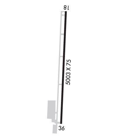
| Lat: N 3043.1 Long: W 09128.7 Elev: 39 Var: -00 Longest Runway: 5003 | ||
| AWOS: 121.25 CTAF: 122.8 | ||
| ||||||||||||||||||||||||||||||||
| ||||||||||||||||||||||||||||||||
| ||||||||||||||||||||||||||||||||
| Rwy | Rwy | |||||||
| 5003x75 | 5003' | 5003x75 | 5003' | 111.90 - 004° | ||||
| Runway ID | Single Wheel | Double Wheel | Double Tandem Wheel | Dual Double Wheel |
| 18/36 | 30,000 | N/A | N/A | N/A |
| These numbers are Advisory and are not limits. The Airport Manager should have more accurate Weight Limits | ||||
 Airport Diagram might not be current. | |
| Facility Name: | FALSE RIVER RGNL |
| City Name: | NEW ROADS |
| County: | POINTE COUPEE |
| State abbrev: | LA |
| State Name: | LOUISIANA |
| Ownership: | PUBLICLY OWNED |
| Use: | OPEN TO THE PUBLIC |
| Owner's Name: | CITY OFNEW RDS-POINTE COUPEE PARISH |
| Address: | PO BOX 97 |
| NEW ROADS, LA 70760 | |
| Owner's Phone: | 225-638-3192 |
| Manager's Name: | YVONNE CHENEVERT |
| Address: | PO BOX 97 |
| NEW ROADS, LA 70760 | |
| Phone: | 225-638-3192 |
| FAA Region: | SOUTHWEST |
| FAA Field Office: | LNM |
| Date | Sunrise | Sunset |
|---|---|---|
| 09/24/21 Friday | 6:55 | 19:00 |
| 09/25/21 Saturday | 6:56 | 18:59 |
| 09/26/21 Sunday | 6:56 | 18:58 |
| 09/27/21 Monday | 6:57 | 18:56 |
| 09/28/21 Tuesday | 6:58 | 18:55 |
| 09/29/21 Wednesday | 6:58 | 18:54 |
| 09/30/21 Thursday | 6:59 | 18:53 |
| 10/01/21 Friday | 6:59 | 18:51 |
| 10/02/21 Saturday | 7:00 | 18:50 |
| 10/03/21 Sunday | 7:01 | 18:49 |
| 10/04/21 Monday | 7:01 | 18:48 |
| 10/05/21 Tuesday | 7:02 | 18:46 |
| 10/06/21 Wednesday | 7:02 | 18:45 |
| 10/07/21 Thursday | 7:03 | 18:44 |
| Airport Attendance Schedule | MON-FRI 0800-1700; FOR ATTENDANT AFT HRS CALL 225-978-8367. |
| Airport Status | OPERATIONAL (This Status can change at any time - please check NOTAMS) |
| Airport Lighting Schedule | ACTVT REIL RWY 18 - 122.8. MIRL RWY 18/36; ODALS RWY 36 PRESET LOW INTST, TO INCR INTST - 122.8 |
| Airport Storage Available | Tie Downs |
| Extra Services Available | Crop Dusting, Flight Instruction |
| Wind Indicator | YES - (lighted) |
| Control Tower | NO |
| CTAF Frequency | 122.800 |
| Unicom Frequency | 122.800 |
| Rotating Beacon Color | CLEAR-GREEN (Light Land Airport) |
| Segmented Circle | NO |
| Landing Fee | NO |
| Airport Inspected | STATE - performed by STATE AERONAUTICAL PERSONNEL |
| Inspection Date | 09/21/2020 |
| Type of Fuel Available | Grade 100LL; -10FUEL AVBL 24 HRS SELF SERVICE WITH CREDIT CARD. |
| Airframe Repair Service | NONE |
| Power Plant Repair Service | NONE |
| Latitude | N3043.1 |
| Longitude | W09128.7 (ESTIMATED) |
| Arpt Elevation | 39ft (SURVEYED) |
| Magnetic Variation | 00E |
| 2 miles NW | of NEW ROADS |
| Traffic Pattern Altitude | 260; TPA: 260 FT AGL ULTRA-LGT, 460 FT AGL HEL, 960 FT AGL FIXED WING WI 3 NM OF ARPT. |
| Sectional Chart | HOUSTON |
| Operations (Reported) | Yearly | Avg. Daily |
|---|---|---|
| General Aviation Transient | 15750 | 43 |
| General Aviation Local | 60000 | 164 |
| Air Taxi | 0 | 0 |
| Commerical | 0 | 0 |
| Commuter | 0 | 0 |
| Military | 175 | 0 |
| Aircraft based on Field | |
|---|---|
| General Aviation Singles | 24 |
| General Aviation Multi | 0 |
| Jet Aircraft | 0 |
| General Aviation Helicopters | 0 |
| Military Aircraft | 0 |
| Gliders | 0 |
| Ultralights | 0 |
| FSS on field | NO |
| FSS tie-in | DE RIDDER |
| FSS Phone | 1-800-WX-BRIEF |
| Who issues Notams | DRI |
| Notam D service at airport | YES |
| ARTCC Name | HOUSTON |
| Airport Certification | |
| Aircraft Rescue & Firefighting Index | None |
| Airport of Entry | No |
| Custom Landing Rights | No |
| Joint Civil/Military | No |
| Military Landing rights | YES |
| NATIONAL PLAN OF INTEGRATED AIRPORT SYSTEMS (NPIAS) |
| GRANT AGREEMENTS UNDER FAAP/ADAP/AIP |
| ASSURANCES PURSUANT TO TITLE VI, CIVIL RIGHTS ACT OF 1964 |
| DUAL LIGHTING SYSTEM OPERATIONS IN EFFECT DUE TO TESTING OF LED MIRL & TWY LGTS INDEFLY. |
| FOR CD CTC HOUSTON ARTCC AT 281-230-5622. |
| RWY 18/3 6 RSCD NOT RPRTED 2100-1300 M-F AND 0500-0459 ON WKENDS, HOLS. |
Airport Communications & Frequencies:
| |||||||||||||||||
| Runway: 18 | Runway: 36 | ||
| Mag heading: | 184° | Mag heading: | 4° |
| Rwy Slope: | -.13% Down | Rwy Slope: | .13% Up |
| Approach: | Approach: | LOC/DME | |
| Pattern: | Left Traffic | Pattern: | Left Traffic |
| Markings: | NONPRECISION INSTRUMENT | Markings: | NONPRECISION INSTRUMENT |
| Marking Condition: | GOOD | Marking Condition: | GOOD |
| Arresting Dev: | Arresting Dev: | ||
| Lat & Long: | N3043.5 W09128.7 | Lat. & Long.: | N3042.7 W09128.8 |
| Elev: | 38.9 ft. MSL | Elev: | 32.4 ft. MSL |
| TCH: | 50 ft. AGL | TCH: | 50 ft. AGL |
| Visual Glide Path: | 3.00 degrees | Visual Glide Path: | 3.00 degrees |
| Displaced Threshold: | No | Displaced Threshold: | No |
| Touchdown Zone: | YES | Touchdown Zone: | YES |
| Touchdown Elev.: | 39.1 feet | Touchdown Elev.: | 36.4 feet |
| Visual Glide Slope: | 2-Light PAPI on LEFT side of Runway | Visual Glide Slope: | 2-Light PAPI on LEFT side of Runway |
| RVR Equipment: | RVR Equipment: | ||
| RVV Equipment: | NO | RVV Equipment: | NO |
| Approach Lights: | Approach Lights: | ODALS - omnidirectional approach lighting system | |
| REIL: | YES | REIL: | NO |
| Centerline Lights: | NO | Centerline Lights: | NO |
| Touchdown lights: | NO | Touchdown lights: | NO |
| Runway Category: | Runway with a Non-precision Approach having visibility minimums greater than 3/4 mile | Runway Category: | Runway with a Non-precision Approach having visibility minimums greater than 3/4 mile |
| Declared Distances: | Declared Distances: | ||
| Obstructions: | Obstructions: | Unknown | |
| Marked: | Marked: | NOT Marked/Lighted | |
| Clearance slope: | 34:1 | Clearance slope: | 29:1 |
| Obstruction height: | Obstruction height: | 78 feet AGL | |
| Dist. from runway: | Dist. from runway: | 2500 feet | |
| Centerline offset: | Centerline offset: | 451 feet right of centerline | |
| Comments: | Comments: |
Thanks for using FltPlan.com
all rights reserved © 1999-2021 by Flight Plan LLC
