
| BROOKHAVEN SHIRLEY NY |
| |
| Lat: N 4049.3 Long: W 07252.0 Elev: 81 Var: +14 Longest Runway: 4222 | ||
| Clr Del: 133.2 AWOS: 119.62 CTAF: 122.8 | ||
| ||||||||||||||||||||||||||||||||||||||||||||
| ||||||||||||||||||||||||||||||||||||||||||||
| ||||||||||||||||||||||||||||||||||||||||||||
| ||||||||||||||||||||||||||||||||||||||||||||
| Rwy | Rwy | |||||||
| 4201x100 | 4201' | 108.95 - 058° | 4201x100 | 4201' | ||||
| 4222x150 | 4222' | 4222x150 | 4222' | |||||
| Runway ID | Single Wheel | Double Wheel | Double Tandem Wheel | Dual Double Wheel |
| 06/24 | 32,000 | 56,000 | 93,000 | N/A |
| 15/33 | 52,000 | 70,000 | 120,000 | N/A |
| These numbers are Advisory and are not limits. The Airport Manager should have more accurate Weight Limits | ||||
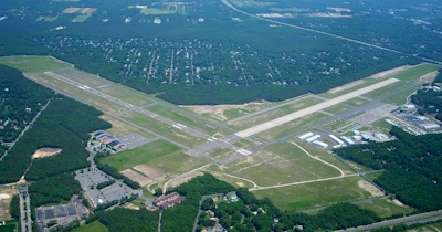
 Airport Diagram might not be current. | |
| Facility Name: | BROOKHAVEN |
| City Name: | SHIRLEY |
| County: | SUFFOLK |
| State abbrev: | NY |
| State Name: | NEW YORK |
| Ownership: | PUBLICLY OWNED |
| Use: | OPEN TO THE PUBLIC |
| Owner's Name: | TOWN OF BROOKHAVEN |
| Address: | 135 DAWN DRIVE |
| SHIRLEY, NY 11967 | |
| Owner's Phone: | 631-451-5300 |
| Manager's Name: | JAMES KEVINS |
| Address: | 135 DAWN DRIVE |
| SHIRLEY, NY 11967 | |
| Phone: | 631-451-5300; ALTN PHONE 631-451-6291 OR 631-451-6299. |
| FAA Region: | EASTERN |
| FAA Field Office: | NYC |
| Date | Sunrise | Sunset |
|---|---|---|
| 09/24/21 Friday | 6:41 | 18:46 |
| 09/25/21 Saturday | 6:42 | 18:44 |
| 09/26/21 Sunday | 6:43 | 18:42 |
| 09/27/21 Monday | 6:44 | 18:41 |
| 09/28/21 Tuesday | 6:45 | 18:39 |
| 09/29/21 Wednesday | 6:46 | 18:37 |
| 09/30/21 Thursday | 6:47 | 18:36 |
| 10/01/21 Friday | 6:48 | 18:34 |
| 10/02/21 Saturday | 6:49 | 18:32 |
| 10/03/21 Sunday | 6:50 | 18:31 |
| 10/04/21 Monday | 6:51 | 18:29 |
| 10/05/21 Tuesday | 6:52 | 18:27 |
| 10/06/21 Wednesday | 6:53 | 18:26 |
| 10/07/21 Thursday | 6:54 | 18:24 |
| Airport Attendance Schedule | 7 Days A Week 0700-1900 |
| Airport Status | OPERATIONAL (This Status can change at any time - please check NOTAMS) |
| Airport Lighting Schedule | ACTVT MALSR RWY 06; REIL RWYS 24, 15, & 33; PAPI RWYS 15 & 33; MIRL RWYS 06/24 & 15/33 - CTAF. |
| Airport Storage Available | Tie Downs, Hanger |
| Extra Services Available | Charter, Glider, Flight Instruction, Aircraft Rental, Aircraft Sales, Glider Towing |
| Wind Indicator | YES - (lighted) |
| Control Tower | NO |
| CTAF Frequency | 122.800 |
| Unicom Frequency | 122.800 |
| Rotating Beacon Color | CLEAR-GREEN (Light Land Airport) |
| Segmented Circle | YES |
| Landing Fee | YES |
| Airport Inspected | STATE - performed by STATE AERONAUTICAL PERSONNEL |
| Inspection Date | 05/26/2021 |
| Type of Fuel Available | Grade 100LL, JET A (freeze point -40C) |
| Airframe Repair Service | MAJOR |
| Power Plant Repair Service | MAJOR |
| Latitude | N4049.3 |
| Longitude | W07252.0 (ESTIMATED) |
| Arpt Elevation | 81ft (SURVEYED) |
| Magnetic Variation | 14W |
| 1 miles N | of SHIRLEY |
| Traffic Pattern Altitude | |
| Sectional Chart | NEW YORK |
| Operations (Reported) | Yearly | Avg. Daily |
|---|---|---|
| General Aviation Transient | 12539 | 34 |
| General Aviation Local | 41779 | 114 |
| Air Taxi | 0 | 0 |
| Commerical | 0 | 0 |
| Commuter | 0 | 0 |
| Military | 66 | 0 |
| Aircraft based on Field | |
|---|---|
| General Aviation Singles | 177 |
| General Aviation Multi | 6 |
| Jet Aircraft | 0 |
| General Aviation Helicopters | 1 |
| Military Aircraft | 0 |
| Gliders | 5 |
| Ultralights | 0 |
| FSS on field | NO |
| FSS tie-in | NEW YORK |
| FSS Phone | 1-800-WX-BRIEF |
| Who issues Notams | HWV |
| Notam D service at airport | YES |
| ARTCC Name | NEW YORK |
| Airport Certification | |
| Aircraft Rescue & Firefighting Index | None |
| Airport of Entry | No |
| Custom Landing Rights | No |
| Joint Civil/Military | No |
| Military Landing rights | YES |
| NATIONAL PLAN OF INTEGRATED AIRPORT SYSTEMS (NPIAS) |
| GRANT AGREEMENTS UNDER FAAP/ADAP/AIP |
| ASSURANCES PURSUANT TO TITLE VI, CIVIL RIGHTS ACT OF 1964 |
| GLIDER OPNS DALGT HOURS. |
| OVERNIGHT RAMP PARKING $5.00. |
| EXTENSIVE PARACHUTE JUMPING ACTIVITY INVOF ARPT. |
| ALL TWY LIGHTS OPR. |
| NO LANDING FEE |
| FOR CD CTC NEW YORK APCH AT 516-683-2449 OR 133.2 |
| NO TGL WKEND, HOL AND NON DALGT HRS. |
| RELOCATED THRESHOLD IS TAXIWAY Z1 |
| DINER/LUNCHEONETTE OPN 7 DAYS/WEEK 0700-1600. |
| GLIDERS USE RIGHT TRAFFIC PATTERN FOR RYS 24 & 33; GLIDERS USE LEFT TRAFFIC PATTERN FOR RYS 06 & 15 |
| UPPER AIR OBSERVATION BALLOONS LAUNCHED 3 MI NORTH OF ARPT 0600 & 1800. |
| PILOTS BE AWARE WHEN CONDUCTING PRACTICE ILS APCHS: EXTENSIVE LIGHT ACFT TRAINING ON & INVOF ARPT ALL HRS. |
| DEER ALL AREAS OF ARPT ESPECIALLY AT NIGHT. |
Airport Communications & Frequencies:
| ||||||||||||||||
| Runway: 06 | Runway: 24 | ||
| Mag heading: | 59° | Mag heading: | 239° |
| Rwy Slope: | .27% Up | Rwy Slope: | -.27% Down |
| Approach: | ILS | Approach: | |
| Pattern: | Left Traffic | Pattern: | Left Traffic |
| Markings: | PRECISION INSTRUMENT | Markings: | BASIC |
| Marking Condition: | GOOD | Marking Condition: | GOOD |
| Arresting Dev: | Arresting Dev: | ||
| Lat & Long: | N4049.3 W07252.4 | Lat. & Long.: | N4049.8 W07251.7 |
| Elev: | 70.0 ft. MSL | Elev: | 81.2 ft. MSL |
| TCH: | 47 ft. AGL | TCH: | |
| Visual Glide Path: | 3.00 degrees | Visual Glide Path: | |
| Displaced Threshold: | No | Displaced Threshold: | No |
| Touchdown Zone: | YES | Touchdown Zone: | YES |
| Touchdown Elev.: | 76.5 feet | Touchdown Elev.: | 81.3 feet |
| Visual Glide Slope: | 4-BOX VASI ON LEFT SIDE OF RUNWAY; RWY 06 VGSI & GLIDEPATH NOT COINCIDENT. | Visual Glide Slope: | |
| RVR Equipment: | RVR Equipment: | ||
| RVV Equipment: | NO | RVV Equipment: | NO |
| Approach Lights: | MALSR - 1,400 foot medium intensity approach lighting system with runway alignment indicator lights | Approach Lights: | |
| REIL: | NO | REIL: | YES |
| Centerline Lights: | NO | Centerline Lights: | NO |
| Touchdown lights: | NO | Touchdown lights: | NO |
| Runway Category: | Precision Instrument Runway | Runway Category: | Runway with a Non-precision Approach having visibility minimums greater than 3/4 mile |
| Declared Distances: | Declared Distances: | ||
| Obstructions: | TREES | Obstructions: | TREES |
| Marked: | NOT Marked/Lighted | Marked: | NOT Marked/Lighted |
| Clearance slope: | 21:1 | Clearance slope: | 1:1 |
| Obstruction height: | 77 feet AGL | Obstruction height: | 46 feet AGL |
| Dist. from runway: | 1879 feet | Dist. from runway: | 288 feet |
| Centerline offset: | 611 right of centerline | Centerline offset: | 328 feet right of centerline |
| Comments: | Comments: |
| Runway: 15 | Runway: 33 | ||
| Mag heading: | 149° | Mag heading: | 329° |
| Rwy Slope: | -.22% Down | Rwy Slope: | .22% Up |
| Approach: | Approach: | ||
| Pattern: | Left Traffic | Pattern: | Left Traffic |
| Markings: | BASIC | Markings: | BASIC |
| Marking Condition: | GOOD | Marking Condition: | GOOD |
| Arresting Dev: | Arresting Dev: | ||
| Lat & Long: | N4049.3 W07252.3 | Lat. & Long.: | N4048.8 W07251.7 |
| Elev: | 69.4 ft. MSL | Elev: | 60.3 ft. MSL |
| TCH: | 47 ft. AGL | TCH: | 46 ft. AGL |
| Visual Glide Path: | 3.00 degrees | Visual Glide Path: | 3.00 degrees |
| Displaced Threshold: | No | Displaced Threshold: | No |
| Touchdown Zone: | YES | Touchdown Zone: | YES |
| Touchdown Elev.: | 69.5 feet | Touchdown Elev.: | 67.2 feet |
| Visual Glide Slope: | 2-Light PAPI on LEFT side of Runway | Visual Glide Slope: | 2-Light PAPI on LEFT side of Runway |
| RVR Equipment: | RVR Equipment: | ||
| RVV Equipment: | NO | RVV Equipment: | NO |
| Approach Lights: | Approach Lights: | ||
| REIL: | YES | REIL: | YES |
| Centerline Lights: | NO | Centerline Lights: | NO |
| Touchdown lights: | NO | Touchdown lights: | NO |
| Runway Category: | Runway with a Non-precision Approach having visibility minimums greater than 3/4 mile | Runway Category: | Runway with a Non-precision Approach having visibility minimums greater than 3/4 mile |
| Declared Distances: | Declared Distances: | ||
| Obstructions: | TREES | Obstructions: | TREES |
| Marked: | NOT Marked/Lighted | Marked: | NOT Marked/Lighted |
| Clearance slope: | 21:1 | Clearance slope: | 13:1 |
| Obstruction height: | 55 feet AGL | Obstruction height: | 59 feet AGL |
| Dist. from runway: | 1375 feet | Dist. from runway: | 987 feet |
| Centerline offset: | 359 right of centerline | Centerline offset: | 367 feet left of centerline |
| Comments: | Comments: |
Thanks for using FltPlan.com
all rights reserved © 1999-2021 by Flight Plan LLC