
| INGALLS FIELD HOT SPRINGS VA |
| |
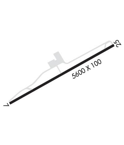
| Lat: N 3757.1 Long: W 07950.0 Elev: 3793 Var: +08 Longest Runway: 5600 | ||
| AWOS: 118.8 CTAF: 123.0 | ||
| ||||||||||||||||||||||||||||||||||||||||||||
| ||||||||||||||||||||||||||||||||||||||||||||
| ||||||||||||||||||||||||||||||||||||||||||||
| Rwy | Rwy | |||||||
| 5600x100 | 5600' | 5600x100 | 5600' | 108.70 - 246° | ||||
| Runway ID | Single Wheel | Double Wheel | Double Tandem Wheel | Dual Double Wheel |
| 07/25 | 65,000 | 160,000 | N/A | N/A |
| These numbers are Advisory and are not limits. The Airport Manager should have more accurate Weight Limits | ||||
 Airport Diagram might not be current. | |
| Facility Name: | INGALLS FLD |
| City Name: | HOT SPRINGS |
| County: | BATH |
| State abbrev: | VA |
| State Name: | VIRGINIA |
| Ownership: | PUBLICLY OWNED |
| Use: | OPEN TO THE PUBLIC |
| Owner's Name: | BATH COUNTY ARPT AUTH |
| Address: | 6240 AIRPORT ROAD |
| HOT SPRINGS, VA 24445 | |
| Owner's Phone: | 540-839-5326 |
| Manager's Name: | ERIC THOMPSON |
| Address: | 6240 AIRPORT ROAD |
| HOT SPRINGS, VA 24445 | |
| Phone: | 540-839-5326 |
| FAA Region: | EASTERN |
| FAA Field Office: | DCA |

| Date | Sunrise | Sunset |
|---|---|---|
| 09/24/21 Friday | 7:09 | 19:14 |
| 09/25/21 Saturday | 7:09 | 19:12 |
| 09/26/21 Sunday | 7:10 | 19:10 |
| 09/27/21 Monday | 7:11 | 19:09 |
| 09/28/21 Tuesday | 7:12 | 19:07 |
| 09/29/21 Wednesday | 7:13 | 19:06 |
| 09/30/21 Thursday | 7:14 | 19:04 |
| 10/01/21 Friday | 7:15 | 19:03 |
| 10/02/21 Saturday | 7:16 | 19:01 |
| 10/03/21 Sunday | 7:17 | 19:00 |
| 10/04/21 Monday | 7:17 | 18:58 |
| 10/05/21 Tuesday | 7:18 | 18:57 |
| 10/06/21 Wednesday | 7:19 | 18:55 |
| 10/07/21 Thursday | 7:20 | 18:54 |
| Airport Attendance Schedule | 7 Days A Week 0900-1700; ARNG CALL-OUT SVC DRNG BUS HRS. FEE FOR CALL-OUT SVC. |
| Airport Status | OPERATIONAL (This Status can change at any time - please check NOTAMS) |
| Airport Lighting Schedule | ACTVT HIRL RY 07/25, PAPI RYS 07 & 25, REIL RY 25, & TWY LGTS - CTAF. |
| Airport Storage Available | Tie Downs, Hanger |
| Extra Services Available | NONE |
| Wind Indicator | YES - (lighted) |
| Control Tower | NO |
| CTAF Frequency | 123.000 |
| Unicom Frequency | 123.000 |
| Rotating Beacon Color | CLEAR-GREEN (Light Land Airport) |
| Segmented Circle | YES |
| Landing Fee | YES; LDG FEE (MULTI-ENGINE ACFT) WAIVED WITH FUEL PURCHASE. |
| Airport Inspected | STATE - performed by STATE AERONAUTICAL PERSONNEL |
| Inspection Date | 06/29/2021 |
| Type of Fuel Available | Grade 100LL, JET A |
| Airframe Repair Service | NONE |
| Power Plant Repair Service | NONE |
| Latitude | N3757.1 |
| Longitude | W07950.0 (ESTIMATED) |
| Arpt Elevation | 3792ft (SURVEYED) |
| Magnetic Variation | 08W |
| 3 miles S | of HOT SPRINGS |
| Traffic Pattern Altitude | |
| Sectional Chart | CINCINNATI |
| Operations (Reported) | Yearly | Avg. Daily |
|---|---|---|
| General Aviation Transient | 8079 | 22 |
| General Aviation Local | 748 | 2 |
| Air Taxi | 0 | 0 |
| Commerical | 0 | 0 |
| Commuter | 0 | 0 |
| Military | 1152 | 3 |
| Aircraft based on Field | |
|---|---|
| General Aviation Singles | 3 |
| General Aviation Multi | 0 |
| Jet Aircraft | 0 |
| General Aviation Helicopters | 0 |
| Military Aircraft | 0 |
| Gliders | 0 |
| Ultralights | 0 |
| FSS on field | NO |
| FSS tie-in | LEESBURG |
| FSS Phone | 1-800-WX-BRIEF |
| Who issues Notams | HSP |
| Notam D service at airport | YES |
| ARTCC Name | WASHINGTON |
| Airport Certification | |
| Aircraft Rescue & Firefighting Index | None |
| Airport of Entry | No |
| Custom Landing Rights | No |
| Joint Civil/Military | No |
| Military Landing rights | YES |
| NATIONAL PLAN OF INTEGRATED AIRPORT SYSTEMS (NPIAS) |
| GRANT AGREEMENTS UNDER FAAP/ADAP/AIP |
| ASSURANCES PURSUANT TO TITLE VI, CIVIL RIGHTS ACT OF 1964 |
| THIS AIRPORT HAS BEEN SURVEYED BY THE NATIONAL GEODETIC SURVEY. |
| WILDLIFE, INCLUDING BEAR, ON & INVOF ARPT. |
| BE ADVISED LOW PASS TO CHECK/CLEAR WILDLIFE WHEN ARPT UNATNDD. |
| FOR CD CTC WASHINGTON ARTCC AT 703-771-3587. |
Airport Communications & Frequencies:
| |||||||||
| Runway: 07 | Runway: 25 | ||
| Mag heading: | 67° | Mag heading: | 247° |
| Rwy Slope: | -.49% Down | Rwy Slope: | .49% Up |
| Approach: | Approach: | ILS | |
| Pattern: | Left Traffic | Pattern: | Left Traffic |
| Markings: | PRECISION INSTRUMENT | Markings: | PRECISION INSTRUMENT |
| Marking Condition: | GOOD | Marking Condition: | GOOD |
| Arresting Dev: | Arresting Dev: | ||
| Lat & Long: | N3756.8 W07950.5 | Lat. & Long.: | N3757.3 W07949.5 |
| Elev: | 3790.4 ft. MSL | Elev: | 3763.1 ft. MSL |
| TCH: | 45 ft. AGL | TCH: | 56 ft. AGL |
| Visual Glide Path: | 3.00 degrees | Visual Glide Path: | 3.00 degrees |
| Displaced Threshold: | No | Displaced Threshold: | No |
| Touchdown Zone: | YES | Touchdown Zone: | YES |
| Touchdown Elev.: | 3792.7 feet | Touchdown Elev.: | 3772.8 feet |
| Visual Glide Slope: | 4-Light PAPI on RIGHT side of Runway | Visual Glide Slope: | 4-Light PAPI on LEFT side of Runway |
| RVR Equipment: | RVR Equipment: | ||
| RVV Equipment: | NO | RVV Equipment: | NO |
| Approach Lights: | Approach Lights: | ||
| REIL: | NO | REIL: | YES |
| Centerline Lights: | NO | Centerline Lights: | NO |
| Touchdown lights: | NO | Touchdown lights: | NO |
| Runway Category: | Runway with a Non-precision Approach having visibility minimums greater than 3/4 mile | Runway Category: | Precision Instrument Runway |
| Declared Distances: | Declared Distances: | ||
| Obstructions: | TREES | Obstructions: | |
| Marked: | NOT Marked/Lighted | Marked: | |
| Clearance slope: | 43:1 | Clearance slope: | 50:1 |
| Obstruction height: | 15 feet AGL | Obstruction height: | |
| Dist. from runway: | 851 feet | Dist. from runway: | |
| Centerline offset: | 335 right of centerline | Centerline offset: | |
| Comments: | Comments: |
Thanks for using FltPlan.com
all rights reserved © 1999-2021 by Flight Plan LLC