
| SUNDANCE AIRPARK OKLAHOMA CITY OK |
| |
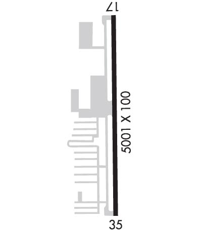
| Lat: N 3536.1 Long: W 09742.4 Elev: 1193 Var: -04 Longest Runway: 5001 | ||
| Clr Del: 123.7 AWOS: 120.97 CTAF: 122.7 | ||
| ||||||
| ||||||
|
| Rwy | Rwy | |||||||
| 5001x100 | 5001' | 109.90 - 170° | 5001x100 | 5001' | ||||
| Runway ID | Single Wheel | Double Wheel | Double Tandem Wheel | Dual Double Wheel |
| 18/36 | N/A | N/A | N/A | N/A |
| These numbers are Advisory and are not limits. The Airport Manager should have more accurate Weight Limits | ||||
 Airport Diagram might not be current. | |
| Facility Name: | SUNDANCE |
| City Name: | OKLAHOMA CITY |
| County: | CANADIAN |
| State abbrev: | OK |
| State Name: | OKLAHOMA |
| Ownership: | PRIVATELY OWNED |
| Use: | OPEN TO THE PUBLIC |
| Owner's Name: | HUNTER GROUP LLC; JERRY HUNTER |
| Address: | 13000 N. SARA RD. |
| YUKON, OK 73099 | |
| Owner's Phone: | 405-373-3886 |
| Manager's Name: | JUSTIN SKAGGS |
| Address: | 13000 N. SARA RD. |
| YUKON, OK 73099 | |
| Phone: | 405-568-1663 |
| FAA Region: | SOUTHWEST |
| FAA Field Office: | AOK |
| Date | Sunrise | Sunset |
|---|---|---|
| 09/24/21 Friday | 7:20 | 19:25 |
| 09/25/21 Saturday | 7:21 | 19:24 |
| 09/26/21 Sunday | 7:22 | 19:22 |
| 09/27/21 Monday | 7:22 | 19:21 |
| 09/28/21 Tuesday | 7:23 | 19:19 |
| 09/29/21 Wednesday | 7:24 | 19:18 |
| 09/30/21 Thursday | 7:25 | 19:16 |
| 10/01/21 Friday | 7:26 | 19:15 |
| 10/02/21 Saturday | 7:26 | 19:13 |
| 10/03/21 Sunday | 7:27 | 19:12 |
| 10/04/21 Monday | 7:28 | 19:11 |
| 10/05/21 Tuesday | 7:29 | 19:09 |
| 10/06/21 Wednesday | 7:30 | 19:08 |
| 10/07/21 Thursday | 7:30 | 19:06 |
| Airport Attendance Schedule | 7 Days A Week 0600-2000 |
| Airport Status | OPERATIONAL (This Status can change at any time - please check NOTAMS) |
| Airport Lighting Schedule | ACTVT VASI RWY 18 & 36; MIRL RWY 18/36 - CTAF. |
| Airport Storage Available | Tie Downs, Hanger |
| Extra Services Available | Flight Instruction, Aircraft Rental |
| Wind Indicator | YES - (lighted) |
| Control Tower | NO |
| CTAF Frequency | 122.700 |
| Unicom Frequency | 122.700 |
| Rotating Beacon Color | CLEAR-GREEN (Light Land Airport) |
| Segmented Circle | NO |
| Landing Fee |
| Airport Inspected | STATE - performed by STATE AERONAUTICAL PERSONNEL |
| Inspection Date | 11/04/2019 |
| Type of Fuel Available | Grade 100LL, JET A (freeze point -40C); -10100LL SELF SVC AVBL 24 HR WITH CREDIT CARD. |
| Airframe Repair Service | MAJOR |
| Power Plant Repair Service | MAJOR |
| Latitude | N3536.1 |
| Longitude | W09742.4 (ESTIMATED) |
| Arpt Elevation | 1192ft (SURVEYED) |
| Magnetic Variation | 04E |
| 12 miles NW | of OKLAHOMA CITY |
| Traffic Pattern Altitude | |
| Sectional Chart | DALLAS-FT WORTH |
| Operations (Reported) | Yearly | Avg. Daily |
|---|---|---|
| General Aviation Transient | 15896 | 44 |
| General Aviation Local | 29519 | 81 |
| Air Taxi | 0 | 0 |
| Commerical | 0 | 0 |
| Commuter | 0 | 0 |
| Military | 10 | 0 |
| Aircraft based on Field | |
|---|---|
| General Aviation Singles | 170 |
| General Aviation Multi | 31 |
| Jet Aircraft | 8 |
| General Aviation Helicopters | 1 |
| Military Aircraft | 0 |
| Gliders | 0 |
| Ultralights | 0 |
| FSS on field | NO |
| FSS tie-in | MC ALESTER |
| FSS Phone | 1-800-WX-BRIEF |
| Who issues Notams | HSD |
| Notam D service at airport | YES |
| ARTCC Name | FORT WORTH |
| Airport Certification | |
| Aircraft Rescue & Firefighting Index | None |
| Airport of Entry | No |
| Custom Landing Rights | No |
| Joint Civil/Military | No |
| Military Landing rights | No |
| THIS AIRPORT HAS BEEN SURVEYED BY THE NATIONAL GEODETIC SURVEY. |
| FOR CD CTC OKE CITY APCH AT 405-681-5683. |
Airport Communications & Frequencies:
| ||||||||||||||||
| Runway: 18 | Runway: 36 | ||
| Mag heading: | 174° | Mag heading: | 354° |
| Rwy Slope: | .80% Up | Rwy Slope: | -.80% Down |
| Approach: | LOCALIZER | Approach: | |
| Pattern: | Right Traffic | Pattern: | Left Traffic |
| Markings: | NONPRECISION INSTRUMENT | Markings: | NONPRECISION INSTRUMENT |
| Marking Condition: | GOOD | Marking Condition: | GOOD |
| Arresting Dev: | Arresting Dev: | ||
| Lat & Long: | N3536.5 W09742.4 | Lat. & Long.: | N3535.7 W09742.4 |
| Elev: | 1152.9 ft. MSL | Elev: | 1192.9 ft. MSL |
| TCH: | 30 ft. AGL | TCH: | 21 ft. AGL |
| Visual Glide Path: | 3.00 degrees | Visual Glide Path: | 3.00 degrees |
| Displaced Threshold: | No | Displaced Threshold: | No |
| Touchdown Zone: | YES | Touchdown Zone: | YES |
| Touchdown Elev.: | 1176.9 feet | Touchdown Elev.: | 1192.9 feet |
| Visual Glide Slope: | 2-Box VASI on LEFT side of Runway; VASI UNUSBL BYD 7 DEGS RIGHT & LEFT OF CNTRLN. | Visual Glide Slope: | 2-Box VASI on LEFT side of Runway; VASI UNUSBL BYD 7 DEGS LEFT OF CNTLRN. |
| RVR Equipment: | RVR Equipment: | ||
| RVV Equipment: | NO | RVV Equipment: | NO |
| Approach Lights: | Approach Lights: | ||
| REIL: | NO | REIL: | NO |
| Centerline Lights: | NO | Centerline Lights: | NO |
| Touchdown lights: | NO | Touchdown lights: | NO |
| Runway Category: | Runway with a Non-precision Approach having visibility minimums greater than 3/4 mile | Runway Category: | Runway with a Non-precision Approach having visibility minimums greater than 3/4 mile |
| Declared Distances: | Declared Distances: | ||
| Obstructions: | Obstructions: | TREES | |
| Marked: | Marked: | NOT Marked/Lighted | |
| Clearance slope: | 34:1 | Clearance slope: | 9:1 |
| Obstruction height: | Obstruction height: | 19 feet AGL | |
| Dist. from runway: | Dist. from runway: | 382 feet | |
| Centerline offset: | Centerline offset: | 135 feet right of centerline | |
| Comments: | Comments: | 10 FT RD 103 FT FM RWY END; 3 FT FENCE 65 FT FM RWY END; 17 FT TREES 120 FT FM THR 150 FT R. |
Thanks for using FltPlan.com
all rights reserved © 1999-2021 by Flight Plan LLC
