
| HOMINY MUNICIPAL HOMINY OK |
| |
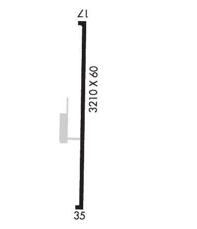
| Lat: N 3626.6 Long: W 09623.2 Elev: 825 Var: -06 Longest Runway: 3210 | ||
| CTAF: 122.9 | ||
| ||||||||||||||||||||||||||||||||||||||||||||
| ||||||||||||||||||||||||||||||||||||||||||||
| Rwy | Rwy | |||||||
| 3210x60 | 3030' | 3210x60 | 3030' | |||||
| Runway ID | Single Wheel | Double Wheel | Double Tandem Wheel | Dual Double Wheel |
| 17/35 | 8,000 | N/A | N/A | N/A |
| These numbers are Advisory and are not limits. The Airport Manager should have more accurate Weight Limits | ||||
| FltPlan does not have IFR approach charts available for KH92. |
 Airport Diagram might not be current. | |
| Facility Name: | HOMINY MUNI |
| City Name: | HOMINY |
| County: | OSAGE |
| State abbrev: | OK |
| State Name: | OKLAHOMA |
| Ownership: | PUBLICLY OWNED |
| Use: | OPEN TO THE PUBLIC |
| Owner's Name: | CITY OF HOMINY |
| Address: | 219 W. 1ST ST., PO BOX 219 |
| HOMINY, OK 74035 | |
| Owner's Phone: | 918-885-2164 |
| Manager's Name: | JUSTIN KEHLER; CITY MGR. |
| Address: | 219 W. 1ST ST., PO BOX 219 |
| HOMINY, OK 74035 | |
| Phone: | 918-232-3347 |
| FAA Region: | SOUTHWEST |
| FAA Field Office: | AOK |
| Date | Sunrise | Sunset |
|---|---|---|
| 06/08/26 Monday | 6:07 | 20:42 |
| 06/09/26 Tuesday | 6:07 | 20:43 |
| 06/10/26 Wednesday | 6:07 | 20:43 |
| 06/11/26 Thursday | 6:07 | 20:43 |
| 06/12/26 Friday | 6:07 | 20:44 |
| 06/13/26 Saturday | 6:07 | 20:44 |
| 06/14/26 Sunday | 6:07 | 20:45 |
| 06/15/26 Monday | 6:07 | 20:45 |
| 06/16/26 Tuesday | 6:07 | 20:45 |
| 06/17/26 Wednesday | 6:07 | 20:46 |
| 06/18/26 Thursday | 6:07 | 20:46 |
| 06/19/26 Friday | 6:07 | 20:46 |
| 06/20/26 Saturday | 6:08 | 20:47 |
| 06/21/26 Sunday | 6:08 | 20:47 |
| Airport Attendance Schedule | UNATTENDED |
| Airport Status | OPERATIONAL (This Status can change at any time - please check NOTAMS) |
| Airport Lighting Schedule | ACTVT MIRL RY 17/35 - CTAF. |
| Airport Storage Available | Tie Downs |
| Extra Services Available | Flight Instruction |
| Wind Indicator | YES - (lighted) |
| Control Tower | NO |
| CTAF Frequency | 122.900 |
| Unicom Frequency | |
| Rotating Beacon Color | WG |
| Segmented Circle | YES |
| Landing Fee | NO |
| Airport Inspected | STATE - performed by STATE AERONAUTICAL PERSONNEL |
| Inspection Date | 01/16/2026 |
| Type of Fuel Available | Grade 100LL; -10FUEL AVBL 24 HRS SELF SERVICE WITH CREDIT CARD. |
| Airframe Repair Service | NONE |
| Power Plant Repair Service | NONE |
| Latitude | N3626.6 |
| Longitude | W09623.2 (ESTIMATED) |
| Arpt Elevation | 825ft (ESTIMATED) |
| Magnetic Variation | 06E |
| 2 miles N | of HOMINY |
| Traffic Pattern Altitude | |
| Sectional Chart | KANSAS CITY |
| Operations (Reported) | Yearly | Avg. Daily |
|---|---|---|
| General Aviation Transient | 0 | 0 |
| General Aviation Local | 0 | 0 |
| Air Taxi | 0 | 0 |
| Commerical | 0 | 0 |
| Commuter | 0 | 0 |
| Military | 0 | 0 |
| Aircraft based on Field | |
|---|---|
| General Aviation Singles | 0 |
| General Aviation Multi | 0 |
| Jet Aircraft | 0 |
| General Aviation Helicopters | 0 |
| Military Aircraft | 0 |
| Gliders | 0 |
| Ultralights | 0 |
| FSS on field | NO |
| FSS tie-in | MC ALESTER |
| FSS Phone | 1-800-WX-BRIEF |
| Who issues Notams | MLC |
| Notam D service at airport | YES |
| ARTCC Name | KANSAS CITY |
| Airport Certification | |
| Aircraft Rescue & Firefighting Index | None |
| Airport of Entry | No |
| Custom Landing Rights | No |
| Joint Civil/Military | No |
| Military Landing rights | YES |
| NATIONAL PLAN OF INTEGRATED AIRPORT SYSTEMS (NPIAS) |
| GRANT AGREEMENTS UNDER FAAP/ADAP/AIP |
| ASSURANCES PURSUANT TO TITLE VI, CIVIL RIGHTS ACT OF 1964 |
| ULTRALIGHT ACTIVITY ON & INVOF ARPT. |
| FOR CD CTC KANSAS CITY ARTCC AT 913-254-8508. |
| Runway: 17 | Runway: 35 | ||
| Mag heading: | 174° | Mag heading: | 354° |
| Rwy Slope: | .03% Up | Rwy Slope: | -.03% Down |
| Approach: | Approach: | ||
| Pattern: | Left Traffic | Pattern: | Left Traffic |
| Markings: | BASIC | Markings: | BASIC |
| Marking Condition: | GOOD | Marking Condition: | GOOD |
| Arresting Dev: | Arresting Dev: | ||
| Lat & Long: | N3626.8 W09623.2 | Lat. & Long.: | N3626.3 W09623.2 |
| Elev: | 819.0 ft. MSL | Elev: | 820.0 ft. MSL |
| TCH: | TCH: | ||
| Visual Glide Path: | Visual Glide Path: | ||
| Displaced Threshold: | 180 feet | Displaced Threshold: | 180 feet |
| Touchdown Zone: | NO | Touchdown Zone: | NO |
| Touchdown Elev.: | Touchdown Elev.: | ||
| Visual Glide Slope: | 4-Light PAPI on LEFT side of Runway | Visual Glide Slope: | 4-Light PAPI on LEFT side of Runway |
| RVR Equipment: | RVR Equipment: | ||
| RVV Equipment: | NO | RVV Equipment: | NO |
| Approach Lights: | Approach Lights: | ||
| REIL: | NO | REIL: | NO |
| Centerline Lights: | NO | Centerline Lights: | NO |
| Touchdown lights: | NO | Touchdown lights: | NO |
| Runway Category: | Runway with a Visual Approach | Runway Category: | Runway with a Visual Approach |
| Declared Distances: | Declared Distances: |
Thanks for using FltPlan.com
all rights reserved © 1999-2026 by Flight Plan LLC
