| GOODING MUNI GOODING ID |
| |
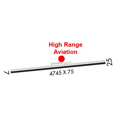
| Lat: N 4255.0 Long: W 11446.0 Elev: 3732 Var: -13 Longest Runway: 5371 | ||
| CTAF: 122.8 | ||
| ||||||||||||||||||||||||||||||||||||||||||||||||||||||||||||||||||||
| ||||||||||||||||||||||||||||||||||||||||||||||||||||||||||||||||||||
| Rwy | Rwy | |||||||
| 5371x75 | 5371' | 5371x75 | 5371' | |||||
| Runway ID | Single Wheel | Double Wheel | Double Tandem Wheel | Dual Double Wheel |
| 07/25 | 30,000 | N/A | N/A | N/A |
| These numbers are Advisory and are not limits. The Airport Manager should have more accurate Weight Limits | ||||
 Airport Diagram might not be current. | |
| Facility Name: | GOODING MUNI |
| City Name: | GOODING |
| County: | GOODING |
| State abbrev: | ID |
| State Name: | IDAHO |
| Ownership: | PUBLICLY OWNED |
| Use: | OPEN TO THE PUBLIC |
| Owner's Name: | CITY OF GOODING |
| Address: | 308 5TH AVE WEST, - CITY SUPERINTENDENT |
| GOODING, ID 83330 | |
| Owner's Phone: | (208) 961-0376 |
| Manager's Name: | DALE THOMAS |
| Address: | 1920 AIRPORT ROAD |
| GOODING, ID 83330 | |
| Phone: | (208) 539-5934 |
| FAA Region: | NORTHWEST MOUNTAIN |
| FAA Field Office: | HLN |
| Date | Sunrise | Sunset |
|---|---|---|
| 09/24/21 Friday | 7:28 | 19:33 |
| 09/25/21 Saturday | 7:29 | 19:31 |
| 09/26/21 Sunday | 7:31 | 19:29 |
| 09/27/21 Monday | 7:32 | 19:28 |
| 09/28/21 Tuesday | 7:33 | 19:26 |
| 09/29/21 Wednesday | 7:34 | 19:24 |
| 09/30/21 Thursday | 7:35 | 19:22 |
| 10/01/21 Friday | 7:36 | 19:21 |
| 10/02/21 Saturday | 7:37 | 19:19 |
| 10/03/21 Sunday | 7:38 | 19:17 |
| 10/04/21 Monday | 7:40 | 19:15 |
| 10/05/21 Tuesday | 7:41 | 19:14 |
| 10/06/21 Wednesday | 7:42 | 19:12 |
| 10/07/21 Thursday | 7:43 | 19:10 |
| Airport Attendance Schedule | 7 Days A Week 0800-1700; FOR ARPT ATTENDANT AFT HRS CALL 208-539-5934 OR 208-934-8298. |
| Airport Status | OPERATIONAL (This Status can change at any time - please check NOTAMS) |
| Airport Lighting Schedule | ACTVT REIL RWY 07; MIRL RWY 07/25 - CTAF; 3 CLICKS MED INTST - 5 CLICKS HI INTST. |
| Airport Storage Available | Tie Downs, Hanger |
| Extra Services Available | Crop Dusting, Flight Instruction |
| Wind Indicator | YES - (lighted) |
| Control Tower | NO |
| CTAF Frequency | 122.800 |
| Unicom Frequency | 122.800 |
| Rotating Beacon Color | CLEAR-GREEN (Light Land Airport) |
| Segmented Circle | YES |
| Landing Fee | NO |
| Airport Inspected | STATE - performed by STATE AERONAUTICAL PERSONNEL |
| Inspection Date | 04/30/2021 |
| Type of Fuel Available | Grade 100LL, JET A (freeze point -40C) |
| Airframe Repair Service | MAJOR |
| Power Plant Repair Service | MAJOR |
| Latitude | N4255.0 |
| Longitude | W11446.0 (ESTIMATED) |
| Arpt Elevation | 3732ft (SURVEYED) |
| Magnetic Variation | 13E |
| 3 miles SW | of GOODING |
| Traffic Pattern Altitude | |
| Sectional Chart | SALT LAKE CITY |
| Operations (Reported) | Yearly | Avg. Daily |
|---|---|---|
| General Aviation Transient | 14000 | 38 |
| General Aviation Local | 12650 | 35 |
| Air Taxi | 100 | 0 |
| Commerical | 0 | 0 |
| Commuter | 0 | 0 |
| Military | 50 | 0 |
| Aircraft based on Field | |
|---|---|
| General Aviation Singles | 55 |
| General Aviation Multi | 2 |
| Jet Aircraft | 0 |
| General Aviation Helicopters | 4 |
| Military Aircraft | 0 |
| Gliders | 0 |
| Ultralights | 0 |
| FSS on field | NO |
| FSS tie-in | BOISE |
| FSS Phone | 1-800-WX-BRIEF |
| Who issues Notams | BOI |
| Notam D service at airport | YES |
| ARTCC Name | SALT LAKE CITY |
| Airport Certification | |
| Aircraft Rescue & Firefighting Index | None |
| Airport of Entry | No |
| Custom Landing Rights | No |
| Joint Civil/Military | No |
| Military Landing rights | YES |
| NATIONAL PLAN OF INTEGRATED AIRPORT SYSTEMS (NPIAS) |
| GRANT AGREEMENTS UNDER FAAP/ADAP/AIP |
| ASSURANCES PURSUANT TO TITLE VI, CIVIL RIGHTS ACT OF 1964 |
| AGREEMENT UNDER DLAND OR DCLA HAS EXPIRED. |
| CSDRBL HEL & CROP DUSTING OPS. |
Airport Communications & Frequencies:
| |||||||||
| Runway: 07 | Runway: 25 | ||
| Mag heading: | 71° | Mag heading: | 251° |
| Rwy Slope: | 1.41% Up | Rwy Slope: | -1.41% Down |
| Approach: | Approach: | ||
| Pattern: | Left Traffic | Pattern: | Left Traffic |
| Markings: | NONPRECISION INSTRUMENT | Markings: | NONPRECISION INSTRUMENT |
| Marking Condition: | GOOD | Marking Condition: | GOOD |
| Arresting Dev: | Arresting Dev: | ||
| Lat & Long: | N4255.0 W11446.6 | Lat. & Long.: | N4255.1 W11445.4 |
| Elev: | 3656.7 ft. MSL | Elev: | 3732.2 ft. MSL |
| TCH: | TCH: | ||
| Visual Glide Path: | Visual Glide Path: | ||
| Displaced Threshold: | No | Displaced Threshold: | No |
| Touchdown Zone: | YES | Touchdown Zone: | YES |
| Touchdown Elev.: | 3701.7 feet | Touchdown Elev.: | 3732.2 feet |
| Visual Glide Slope: | Visual Glide Slope: | ||
| RVR Equipment: | RVR Equipment: | ||
| RVV Equipment: | NO | RVV Equipment: | NO |
| Approach Lights: | Approach Lights: | ||
| REIL: | YES | REIL: | NO |
| Centerline Lights: | NO | Centerline Lights: | NO |
| Touchdown lights: | NO | Touchdown lights: | NO |
| Runway Category: | Runway with a Non-precision Approach | Runway Category: | Runway with a Non-precision Approach |
| Declared Distances: | Declared Distances: | ||
| Comments: | Comments: | RY 25 +9 FT FENCE AND BERM, 0 FT FM RY END, 250 FT L. |
Thanks for using FltPlan.com
all rights reserved © 1999-2021 by Flight Plan LLC