
| FORREST CITY MUNI FORREST CITY AR |
| |
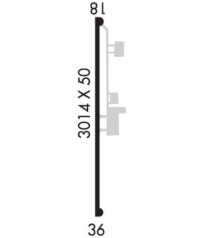
| Lat: N 3456.5 Long: W 09046.5 Elev: 249 Var: -01 Longest Runway: 3014 | ||
| CTAF: 122.8 | ||
| ||||||
|
| Rwy | Rwy | |||||||
| 3014x50 | 3014' | 3014x50 | 3014' | |||||
| Runway ID | Single Wheel | Double Wheel | Double Tandem Wheel | Dual Double Wheel |
| 18/36 | 20,000 | N/A | N/A | N/A |
| These numbers are Advisory and are not limits. The Airport Manager should have more accurate Weight Limits | ||||
| FltPlan does not have IFR approach charts available for KFCY. |
 Airport Diagram might not be current. | |
| Facility Name: | HUTFLY-FCY |
| City Name: | FORREST CITY |
| County: | ST FRANCIS |
| State abbrev: | AR |
| State Name: | ARKANSAS |
| Ownership: | PRIVATELY OWNED |
| Use: | OPEN TO THE PUBLIC |
| Owner's Name: | HUTFLY, LLC |
| Address: | PO BOX 1074 |
| FORREST CITY, AR 72335 | |
| Owner's Phone: | 870-633-1315 |
| Manager's Name: | GIL GILBREATH |
| Address: | BOX 1296 HWY 980 |
| FORREST CITY, AR 72335 | |
| Phone: | 870-633-4511 |
| FAA Region: | SOUTHWEST |
| FAA Field Office: | AOK |
| Date | Sunrise | Sunset |
|---|---|---|
| 09/24/21 Friday | 6:52 | 18:57 |
| 09/25/21 Saturday | 6:53 | 18:56 |
| 09/26/21 Sunday | 6:54 | 18:54 |
| 09/27/21 Monday | 6:55 | 18:53 |
| 09/28/21 Tuesday | 6:55 | 18:52 |
| 09/29/21 Wednesday | 6:56 | 18:50 |
| 09/30/21 Thursday | 6:57 | 18:49 |
| 10/01/21 Friday | 6:58 | 18:47 |
| 10/02/21 Saturday | 6:58 | 18:46 |
| 10/03/21 Sunday | 6:59 | 18:45 |
| 10/04/21 Monday | 7:00 | 18:43 |
| 10/05/21 Tuesday | 7:01 | 18:42 |
| 10/06/21 Wednesday | 7:02 | 18:40 |
| 10/07/21 Thursday | 7:02 | 18:39 |
| Airport Attendance Schedule | MON-FRI 0800-1700 |
| Airport Status | OPERATIONAL (This Status can change at any time - please check NOTAMS) |
| Airport Lighting Schedule | DUSK-DAWN. ACTVT MIRL RY 18/36 & PAPI RYS 18 & 36 - CTAF. |
| Airport Storage Available | Tie Downs, Hanger |
| Extra Services Available | Crop Dusting |
| Wind Indicator | YES - (lighted) |
| Control Tower | NO |
| CTAF Frequency | 122.800 |
| Unicom Frequency | 122.800 |
| Rotating Beacon Color | CLEAR-GREEN (Light Land Airport); ROTG BCN OTS INDEFLY. |
| Segmented Circle | YES |
| Landing Fee | NO |
| Airport Inspected | STATE - performed by STATE AERONAUTICAL PERSONNEL |
| Inspection Date | 09/08/2016 |
| Type of Fuel Available | Grade 100LL, JET A (freeze point -40C); -10100LL AVBL 24 HRS SELF-SERVICE WITH CREDIT CARD; JET A AVBL DURG ATTENDED HRS ONLY. |
| Airframe Repair Service | MAJOR |
| Power Plant Repair Service | MAJOR |
| Latitude | N3456.5 |
| Longitude | W09046.5 (ESTIMATED) |
| Arpt Elevation | 249ft (SURVEYED) |
| Magnetic Variation | 01E |
| 4 miles S | of FORREST CITY |
| Traffic Pattern Altitude | |
| Sectional Chart | MEMPHIS |
| Operations (Reported) | Yearly | Avg. Daily |
|---|---|---|
| General Aviation Transient | 1000 | 3 |
| General Aviation Local | 30000 | 82 |
| Air Taxi | 0 | 0 |
| Commerical | 0 | 0 |
| Commuter | 0 | 0 |
| Military | 300 | 1 |
| Aircraft based on Field | |
|---|---|
| General Aviation Singles | 3 |
| General Aviation Multi | 0 |
| Jet Aircraft | 0 |
| General Aviation Helicopters | 0 |
| Military Aircraft | 0 |
| Gliders | 0 |
| Ultralights | 0 |
| FSS on field | NO |
| FSS tie-in | JONESBORO |
| FSS Phone | 1-800-WX-BRIEF |
| Who issues Notams | JBR |
| Notam D service at airport | YES |
| ARTCC Name | MEMPHIS |
| Airport Certification | |
| Aircraft Rescue & Firefighting Index | None |
| Airport of Entry | No |
| Custom Landing Rights | No |
| Joint Civil/Military | No |
| Military Landing rights | YES |
| GRANT AGREEMENT HAS EXPIRED; HOWEVER, AGREEMENT REMAINS IN EFFECT FOR THIS FACILITY AS LONG AS IT IS PUBLIC USE. |
| THIS AIRPORT HAS BEEN SURVEYED BY THE NATIONAL GEODETIC SURVEY. |
| 494 FT LGTD TWR 3 MILES NORTH ON CNTRLN. |
| RY 36 DITCH 201 FT FROM SOUTH END OF RY. |
| FOR CD CTC MEMPHIS APCH AT 901-842-8457. |
Airport Communications & Frequencies:
| |||||||||
| Runway: 18 | Runway: 36 | ||
| Mag heading: | 180° | Mag heading: | 0° |
| Rwy Slope: | -.22% Down | Rwy Slope: | .22% Up |
| Approach: | Approach: | ||
| Pattern: | Left Traffic | Pattern: | Left Traffic |
| Markings: | BASIC | Markings: | NONPRECISION INSTRUMENT |
| Marking Condition: | FAIR | Marking Condition: | FAIR |
| Arresting Dev: | Arresting Dev: | ||
| Lat & Long: | N3456.8 W09046.5 | Lat. & Long.: | N3456.3 W09046.5 |
| Elev: | 249.0 ft. MSL | Elev: | 242.5 ft. MSL |
| TCH: | 36 ft. AGL | TCH: | 36 ft. AGL |
| Visual Glide Path: | 4.00 degrees | Visual Glide Path: | 4.00 degrees |
| Displaced Threshold: | No | Displaced Threshold: | No |
| Touchdown Zone: | YES | Touchdown Zone: | YES |
| Touchdown Elev.: | 249.2 feet | Touchdown Elev.: | 249.2 feet |
| Visual Glide Slope: | 2-Light PAPI on LEFT side of Runway; PAPI RWY 18/36 OTS INDEFLY. | Visual Glide Slope: | 2-Light PAPI on RIGHT side of Runway |
| RVR Equipment: | RVR Equipment: | ||
| RVV Equipment: | NO | RVV Equipment: | NO |
| Approach Lights: | Approach Lights: | ||
| REIL: | YES; REIL RWY 18/36 OTS INDEFLY. | REIL: | YES |
| Centerline Lights: | NO | Centerline Lights: | NO |
| Touchdown lights: | NO | Touchdown lights: | NO |
| Runway Category: | Runway with a Visual Approach | Runway Category: | Runway with a Non-precision Approach |
| Declared Distances: | Declared Distances: | ||
| Obstructions: | Obstructions: | TREES | |
| Marked: | Marked: | NOT Marked/Lighted | |
| Clearance slope: | 50:1 | Clearance slope: | 33:1 |
| Obstruction height: | Obstruction height: | 30 feet AGL | |
| Dist. from runway: | Dist. from runway: | 1200 feet | |
| Centerline offset: | Centerline offset: | 225 feet right of centerline | |
| Comments: | Comments: |
Thanks for using FltPlan.com
all rights reserved © 1999-2021 by Flight Plan LLC
