
| WINNSBORO MUNI WINNSBORO LA |
| |
| Lat: N 3209.2 Long: W 09141.9 Elev: 78 Var: -04 Longest Runway: 3001 | ||
| CTAF: 122.8 | ||
| ||||||||||||||||||||||||||||||||||||||||||||
| ||||||||||||||||||||||||||||||||||||||||||||
| Rwy | Rwy | |||||||
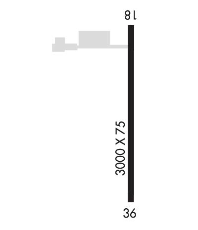
| 3001x75 | 3001' | 3001x75 | 3001' | |||||
| Runway ID | Single Wheel | Double Wheel | Double Tandem Wheel | Dual Double Wheel |
| 18/36 | 11,000 | N/A | N/A | N/A |
| These numbers are Advisory and are not limits. The Airport Manager should have more accurate Weight Limits | ||||
| FltPlan does not have IFR approach charts available for KF89. |
 Airport Diagram might not be current. | |
| Facility Name: | WINNSBORO MUNI |
| City Name: | WINNSBORO |
| County: | FRANKLIN |
| State abbrev: | LA |
| State Name: | LOUISIANA |
| Ownership: | PUBLICLY OWNED |
| Use: | OPEN TO THE PUBLIC |
| Owner's Name: | CITY OF WINNSBORO |
| Address: | PO BOX 250 |
| WINNSBORO, LA 71295 | |
| Owner's Phone: | 318-435-9087 |
| Manager's Name: | TERRY SHIRLEY |
| Address: | PO BOX 250 |
| WINNSBORO, LA 71295 | |
| Phone: | (318) 439-3676 |
| FAA Region: | SOUTHWEST |
| FAA Field Office: | LNM |
| Date | Sunrise | Sunset |
|---|---|---|
| 06/08/26 Monday | 6:00 | 20:12 |
| 06/09/26 Tuesday | 6:00 | 20:12 |
| 06/10/26 Wednesday | 6:00 | 20:13 |
| 06/11/26 Thursday | 6:00 | 20:13 |
| 06/12/26 Friday | 6:00 | 20:14 |
| 06/13/26 Saturday | 6:00 | 20:14 |
| 06/14/26 Sunday | 6:00 | 20:14 |
| 06/15/26 Monday | 6:00 | 20:15 |
| 06/16/26 Tuesday | 6:00 | 20:15 |
| 06/17/26 Wednesday | 6:00 | 20:15 |
| 06/18/26 Thursday | 6:00 | 20:16 |
| 06/19/26 Friday | 6:00 | 20:16 |
| 06/20/26 Saturday | 6:01 | 20:16 |
| 06/21/26 Sunday | 6:01 | 20:16 |
| Airport Attendance Schedule | 7 Days A Week ON CALL; 318-282-4524 |
| Airport Status | OPERATIONAL (This Status can change at any time - please check NOTAMS) |
| Airport Lighting Schedule | MIRL RWY 18/36 PRESET LOW INTS DUSK TO DAWN, TO INCR INTS ACTVT-CTAF. |
| Airport Storage Available | Tie Downs |
| Extra Services Available | Crop Dusting |
| Wind Indicator | YES - (lighted) |
| Control Tower | NO |
| CTAF Frequency | 122.800 |
| Unicom Frequency | 122.800 |
| Rotating Beacon Color | WG |
| Segmented Circle | YES |
| Landing Fee | NO |
| Airport Inspected | STATE - performed by STATE AERONAUTICAL PERSONNEL |
| Inspection Date | 09/29/2025 |
| Type of Fuel Available | Grade 100LL; -10FUEL AVBL 24 HRS SELF SERVE WITH CC. |
| Airframe Repair Service | MINOR |
| Power Plant Repair Service | MINOR |
| Latitude | N3209.2 |
| Longitude | W09141.9 (ESTIMATED) |
| Arpt Elevation | 78ft (SURVEYED) |
| Magnetic Variation | 04E |
| 1 miles E | of WINNSBORO |
| Traffic Pattern Altitude | |
| Sectional Chart | MEMPHIS |
| Operations (Reported) | Yearly | Avg. Daily |
|---|---|---|
| General Aviation Transient | 0 | 0 |
| General Aviation Local | 0 | 0 |
| Air Taxi | 0 | 0 |
| Commerical | 0 | 0 |
| Commuter | 0 | 0 |
| Military | 0 | 0 |
| Aircraft based on Field | |
|---|---|
| General Aviation Singles | 0 |
| General Aviation Multi | 0 |
| Jet Aircraft | 0 |
| General Aviation Helicopters | 0 |
| Military Aircraft | 0 |
| Gliders | 0 |
| Ultralights | 0 |
| FSS on field | NO |
| FSS tie-in | DE RIDDER |
| FSS Phone | 1-800-WX-BRIEF |
| Who issues Notams | DRI |
| Notam D service at airport | YES |
| ARTCC Name | HOUSTON |
| Airport Certification | |
| Aircraft Rescue & Firefighting Index | None |
| Airport of Entry | No |
| Custom Landing Rights | No |
| Joint Civil/Military | No |
| Military Landing rights | No |
| NATIONAL PLAN OF INTEGRATED AIRPORT SYSTEMS (NPIAS) |
| RWY 18/36 TREES WEST OF RWY OBST VIEW OF OPERATING ACFT. |
| FOR CD CTC MONROE APCH AT 318-327-5641, IF UNAVBL, CTC FORT WORTH ARTCC AT 817-858-7584. |
| CTC APRT MGR FOR DSGND RAMP SPACE FOR PUB USE. |
| Runway: 18 | Runway: 36 | ||
| Mag heading: | 176° | Mag heading: | 356° |
| Rwy Slope: | .09% Up | Rwy Slope: | -.09% Down |
| Approach: | Approach: | ||
| Pattern: | Left Traffic | Pattern: | Left Traffic |
| Markings: | BASIC | Markings: | BASIC |
| Marking Condition: | FAIR | Marking Condition: | FAIR |
| Arresting Dev: | Arresting Dev: | ||
| Lat & Long: | N3209.4 W09141.9 | Lat. & Long.: | N3208.9 W09141.9 |
| Elev: | 75.5 ft. MSL | Elev: | 78.1 ft. MSL |
| TCH: | 63 ft. AGL | TCH: | 52 ft. AGL |
| Visual Glide Path: | 3.75 degrees | Visual Glide Path: | 3.10 degrees |
| Displaced Threshold: | No | Displaced Threshold: | No |
| Touchdown Zone: | YES | Touchdown Zone: | YES |
| Touchdown Elev.: | 78.3 feet | Touchdown Elev.: | 78.3 feet |
| Visual Glide Slope: | 2-Light PAPI on LEFT side of Runway | Visual Glide Slope: | 2-Light PAPI on LEFT side of Runway |
| RVR Equipment: | RVR Equipment: | ||
| RVV Equipment: | NO | RVV Equipment: | NO |
| Approach Lights: | Approach Lights: | ||
| REIL: | NO | REIL: | YES |
| Centerline Lights: | NO | Centerline Lights: | NO |
| Touchdown lights: | NO | Touchdown lights: | NO |
| Runway Category: | Runway with a Visual Approach | Runway Category: | Runway with a Visual Approach |
| Declared Distances: | Declared Distances: | ||
| Obstructions: | TREE | Obstructions: | TREES |
| Marked: | NOT Marked/Lighted | Marked: | NOT Marked/Lighted |
| Clearance slope: | 13:1 | Clearance slope: | 14:1 |
| Obstruction height: | 81 feet AGL | Obstruction height: | 45 feet AGL |
| Dist. from runway: | 1313 feet | Dist. from runway: | 839 feet |
| Centerline offset: | 230 left of centerline | Centerline offset: | 158 feet right of centerline |
| Comments: | Comments: |
Thanks for using FltPlan.com
all rights reserved © 1999-2026 by Flight Plan LLC
