
| ABERNATHY MUNI (CLOSED) ABERNATHY TX |
| |
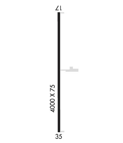
| Lat: N 3350.8 Long: W 10145.8 Elev: 3327 Var: -09 Longest Runway: 4000 | ||
| CTAF: 122.8 | ||
| ||||||||||||||||||||||||||||||||
| ||||||||||||||||||||||||||||||||
| Rwy | Rwy | |||||||
| 4000x75 | 4000' | 4000x75 | 4000' | |||||
| Runway ID | Single Wheel | Double Wheel | Double Tandem Wheel | Dual Double Wheel |
| 17/35 | N/A | N/A | N/A | N/A |
| These numbers are Advisory and are not limits. The Airport Manager should have more accurate Weight Limits | ||||
| FltPlan does not have IFR approach charts available for KF83. |
 Airport Diagram might not be current. | |
| Facility Name: | ABERNATHY MUNI |
| City Name: | ABERNATHY |
| County: | HALE |
| State abbrev: | TX |
| State Name: | TEXAS |
| Ownership: | PUBLICLY OWNED |
| Use: | OPEN TO THE PUBLIC |
| Owner's Name: | CITY OF ABERNATHY |
| Address: | PO BOX 310 |
| ABERNATHY, TX 79311 | |
| Owner's Phone: | 806-298-2546 |
| Manager's Name: | JOE HINES; CITY/AIRPORT MGR. |
| Address: | PO BOX 310 |
| ABERNATHY, TX 79311 | |
| Phone: | 806-298-2546; EMERGENCY 806-298-2545. |
| FAA Region: | SOUTHWEST |
| FAA Field Office: | TEX |
| Date | Sunrise | Sunset |
|---|---|---|
| 07/13/22 Wednesday | 6:46 | 20:59 |
| 07/14/22 Thursday | 6:46 | 20:59 |
| 07/15/22 Friday | 6:47 | 20:59 |
| 07/16/22 Saturday | 6:48 | 20:58 |
| 07/17/22 Sunday | 6:48 | 20:58 |
| 07/18/22 Monday | 6:49 | 20:57 |
| 07/19/22 Tuesday | 6:50 | 20:57 |
| 07/20/22 Wednesday | 6:50 | 20:56 |
| 07/21/22 Thursday | 6:51 | 20:56 |
| 07/22/22 Friday | 6:52 | 20:55 |
| 07/23/22 Saturday | 6:52 | 20:54 |
| 07/24/22 Sunday | 6:53 | 20:54 |
| 07/25/22 Monday | 6:54 | 20:53 |
| 07/26/22 Tuesday | 6:54 | 20:52 |
| Airport Attendance Schedule | UNATTENDED |
| Airport Status | CLOSED INDEFINITELY (This Status can change at any time - please check NOTAMS) |
| Airport Lighting Schedule | MIRL RY 17/35 PRESET LOW INTST; TO INCR INTST ACTVT - 122.8.; NO AIRFIELD BEACON |
| Airport Storage Available | NONE |
| Extra Services Available | NONE |
| Wind Indicator | NONE |
| Control Tower | NO |
| CTAF Frequency | 122.800 |
| Unicom Frequency | 122.800; UNICOM UNMONITORED. |
| Rotating Beacon Color | CLEAR-GREEN (Light Land Airport) |
| Segmented Circle | NO |
| Landing Fee | NO |
| Airport Inspected | STATE - performed by PRIVATE CONTRACT PERSONNEL |
| Inspection Date | 05/16/2020 |
| Type of Fuel Available | None |
| Airframe Repair Service | NONE |
| Power Plant Repair Service | NONE |
| Latitude | N3350.8 |
| Longitude | W10145.8 (ESTIMATED) |
| Arpt Elevation | 3327ft (SURVEYED) |
| Magnetic Variation | 09E |
| 4 miles E | of ABERNATHY |
| Traffic Pattern Altitude | |
| Sectional Chart | DALLAS-FT WORTH |
| Operations (Reported) | Yearly | Avg. Daily |
|---|---|---|
| General Aviation Transient | 0 | 0 |
| General Aviation Local | 0 | 0 |
| Air Taxi | 0 | 0 |
| Commerical | 0 | 0 |
| Commuter | 0 | 0 |
| Military | 0 | 0 |
| Aircraft based on Field | |
|---|---|
| General Aviation Singles | 0 |
| General Aviation Multi | 0 |
| Jet Aircraft | 0 |
| General Aviation Helicopters | 0 |
| Military Aircraft | 0 |
| Gliders | 0 |
| Ultralights | 0 |
| FSS on field | NO |
| FSS tie-in | FORT WORTH |
| FSS Phone | 1-800-WX-BRIEF |
| Who issues Notams | FTW |
| Notam D service at airport | YES |
| ARTCC Name | FORT WORTH |
| Airport Certification | |
| Aircraft Rescue & Firefighting Index | None |
| Airport of Entry | No |
| Custom Landing Rights | No |
| Joint Civil/Military | No |
| Military Landing rights | YES |
| SURPLUS PROPERTY AGREEMENT UNDER PUBLIC LAW 289 |
| AP CLSD INDEFLY. ALL AIRFIELD LGTG OTS. UNICOM OTS. |
| FOR CD CTC FORT WORTH ARTCC AT 817-858-7584. |
| (ARPT STATUS) ARPT CLSD INDEFLY. |
| RWY 17/3 5 RUNWAY SURFACE FAILED/UNUSABLE |
| RWY 17/3 5 NO AIRFIELD LIGHTING |
| Runway: 17 | Runway: 35 | ||
| Mag heading: | N/A | Mag heading: | N/A |
| Approach: | Approach: | ||
| Pattern: | Left Traffic | Pattern: | Right Traffic |
| Markings: | NONE | Markings: | NONE |
| Marking Condition: | POOR | Marking Condition: | POOR |
| Arresting Dev: | Arresting Dev: | ||
| Lat & Long: | Lat. & Long.: | ||
| Elev: | N/A | Elev: | N/A |
| TCH: | TCH: | ||
| Visual Glide Path: | Visual Glide Path: | ||
| Displaced Threshold: | No | Displaced Threshold: | No |
| Touchdown Zone: | NO | Touchdown Zone: | NO |
| Touchdown Elev.: | Touchdown Elev.: | ||
| Visual Glide Slope: | Visual Glide Slope: | ||
| RVR Equipment: | RVR Equipment: | ||
| RVV Equipment: | NO | RVV Equipment: | NO |
| Approach Lights: | Approach Lights: | ||
| REIL: | NO | REIL: | NO |
| Centerline Lights: | NO | Centerline Lights: | NO |
| Touchdown lights: | NO | Touchdown lights: | NO |
| Runway Category: | Runway with a Visual Approach | Runway Category: | Runway with a Visual Approach |
| Declared Distances: | Declared Distances: | ||
| Obstructions: | ROAD | Obstructions: | ROAD |
| Marked: | NOT Marked/Lighted | Marked: | NOT Marked/Lighted |
| Clearance slope: | 39:1 | Clearance slope: | 24:1 |
| Obstruction height: | 15 feet AGL | Obstruction height: | 12 feet AGL |
| Dist. from runway: | 786 feet | Dist. from runway: | 491 feet |
| Centerline offset: | Centerline offset: | ||
| Comments: | Comments: |
Thanks for using FltPlan.com
all rights reserved © 1999-2022 by Flight Plan LLC
