
| CALDWELL INDUSTRIAL CALDWELL ID |
| |
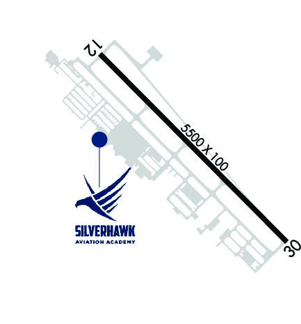
| Lat: N 4338.5 Long: W 11638.1 Elev: 2431 Var: -16 Longest Runway: 5500 | ||
| AWOS: 135.07 CTAF: 122.7 | ||
| ||||||||||||||||||||||||||||||||||||||||||||||||||||||||||||||
| ||||||||||||||||||||||||||||||||||||||||||||||||||||||||||||||
| ||||||||||||||||||||||||||||||||||||||||||||||||||||||||||||||
| Rwy | Rwy | |||||||
| 5500x100 | 5500' | 5500x100 | 5500' | |||||
| Runway ID | Single Wheel | Double Wheel | Double Tandem Wheel | Dual Double Wheel |
| 12/30 | 72,000 | 86,000 | N/A | N/A |
| These numbers are Advisory and are not limits. The Airport Manager should have more accurate Weight Limits | ||||
 Airport Diagram might not be current. | |
| Facility Name: | CALDWELL INDUSTRIAL |
| City Name: | CALDWELL |
| County: | CANYON |
| State abbrev: | ID |
| State Name: | IDAHO |
| Ownership: | PUBLICLY OWNED |
| Use: | OPEN TO THE PUBLIC |
| Owner's Name: | CITY OF CALDWELL |
| Address: | PO BOX 1179 |
| CALDWELL, ID 83606 | |
| Owner's Phone: | 208-455-3000 |
| Manager's Name: | ROB OATES |
| Address: | 4814 E. LINDEN STREET |
| CALDWELL, ID 83605 | |
| Phone: | 208-459-9779 |
| FAA Region: | NORTHWEST MOUNTAIN |
| FAA Field Office: | HLN |
| Date | Sunrise | Sunset |
|---|---|---|
| 09/24/21 Friday | 7:36 | 19:41 |
| 09/25/21 Saturday | 7:37 | 19:39 |
| 09/26/21 Sunday | 7:38 | 19:37 |
| 09/27/21 Monday | 7:39 | 19:35 |
| 09/28/21 Tuesday | 7:40 | 19:33 |
| 09/29/21 Wednesday | 7:42 | 19:31 |
| 09/30/21 Thursday | 7:43 | 19:30 |
| 10/01/21 Friday | 7:44 | 19:28 |
| 10/02/21 Saturday | 7:45 | 19:26 |
| 10/03/21 Sunday | 7:46 | 19:24 |
| 10/04/21 Monday | 7:47 | 19:22 |
| 10/05/21 Tuesday | 7:49 | 19:21 |
| 10/06/21 Wednesday | 7:50 | 19:19 |
| 10/07/21 Thursday | 7:51 | 19:17 |
| Airport Attendance Schedule | MAR-OCT 7 Days A Week 0800-1900, NOV-FEB 7 Days A Week 0800-1700 |
| Airport Status | OPERATIONAL (This Status can change at any time - please check NOTAMS) |
| Airport Lighting Schedule | ACTVT MIRL RY 12/30 - CTAF. PAPI RYS 12 & 30 OPER CONTINUOUSLY. |
| Airport Storage Available | Tie Downs |
| Extra Services Available | Flight Instruction, Parachute Jumping, Aircraft Rental, Aircraft Sales, Annual Surveying |
| Wind Indicator | YES - (lighted) |
| Control Tower | NO |
| CTAF Frequency | 122.700 |
| Unicom Frequency | 122.700 |
| Rotating Beacon Color | CLEAR-GREEN (Light Land Airport) |
| Segmented Circle | YES |
| Landing Fee | NO |
| Airport Inspected | STATE - performed by STATE AERONAUTICAL PERSONNEL |
| Inspection Date | 03/18/2021 |
| Type of Fuel Available | Grade 100LL, JET A (freeze point -40C) |
| Airframe Repair Service | MAJOR |
| Power Plant Repair Service | MAJOR |
| Latitude | N4338.5 |
| Longitude | W11638.1 (ESTIMATED) |
| Arpt Elevation | 2431ft (SURVEYED) |
| Magnetic Variation | 16E |
| 3 miles SE | of CALDWELL |
| Traffic Pattern Altitude | |
| Sectional Chart | SALT LAKE CITY |
| Operations (Reported) | Yearly | Avg. Daily |
|---|---|---|
| General Aviation Transient | 35000 | 96 |
| General Aviation Local | 110000 | 301 |
| Air Taxi | 2000 | 5 |
| Commerical | 0 | 0 |
| Commuter | 0 | 0 |
| Military | 325 | 1 |
| Aircraft based on Field | |
|---|---|
| General Aviation Singles | 374 |
| General Aviation Multi | 23 |
| Jet Aircraft | 4 |
| General Aviation Helicopters | 20 |
| Military Aircraft | 0 |
| Gliders | 2 |
| Ultralights | 1 |
| FSS on field | NO |
| FSS tie-in | BOISE |
| FSS Phone | 1-800-WX-BRIEF |
| Who issues Notams | EUL |
| Notam D service at airport | YES |
| ARTCC Name | SALT LAKE CITY |
| Airport Certification | |
| Aircraft Rescue & Firefighting Index | None |
| Airport of Entry | No |
| Custom Landing Rights | No |
| Joint Civil/Military | No |
| Military Landing rights | YES |
| NATIONAL PLAN OF INTEGRATED AIRPORT SYSTEMS (NPIAS) |
| GRANT AGREEMENTS UNDER FAAP/ADAP/AIP |
| ASSURANCES PURSUANT TO TITLE VI, CIVIL RIGHTS ACT OF 1964 |
| +363 FT RADIO TWR LCTD 1.4 MILES NORTH OF ARPT. |
| FUEL AVBL 24 HRS BY CREDIT CARD. JET A FROM TRUCK MON-SAT 1500-2300Z++. CALL 208-453-8577 FOR JET A AND AFTER HOURS CALLOUT. |
| RWY 12 CALM WIND RWY. |
| PREFERRED PARKING FOR JET AND LARGE TURBOPROP ACFT AVBL ON TERMINAL APRON ON NORTH SIDE OF RWY. |
| COURTESY CAR AVBL FOR TRAN AIRCREWS. CALL 208-459-9779 TO REQ COURTESY CAR. |
| TRANSIENT RAMP PREFERRED FOR USE BY TRAINING HELICOPTERS FOR LAUNCH AND RECOVERY. |
| PREFERRED HELICOPTER PAT SW OF RWY. |
| FOR CD CTC BIG SKY APCH AT 208-364-5860/5861. |
Airport Communications & Frequencies:
| ||||||||||||||
| Runway: 12 | Runway: 30 | ||
| Mag heading: | 119° | Mag heading: | 299° |
| Rwy Slope: | .10% Up | Rwy Slope: | -.10% Down |
| Approach: | Approach: | ||
| Pattern: | Left Traffic | Pattern: | Right Traffic |
| Markings: | NONPRECISION INSTRUMENT | Markings: | NONPRECISION INSTRUMENT |
| Marking Condition: | GOOD | Marking Condition: | GOOD |
| Arresting Dev: | Arresting Dev: | ||
| Lat & Long: | N4338.8 W11638.6 | Lat. & Long.: | N4338.2 W11637.7 |
| Elev: | 2425.9 ft. MSL | Elev: | 2431.4 ft. MSL |
| TCH: | 42 ft. AGL | TCH: | 45 ft. AGL |
| Visual Glide Path: | 3.00 degrees | Visual Glide Path: | 3.00 degrees |
| Displaced Threshold: | No | Displaced Threshold: | No |
| Touchdown Zone: | YES | Touchdown Zone: | YES |
| Touchdown Elev.: | 2431.0 feet | Touchdown Elev.: | 2431.4 feet |
| Visual Glide Slope: | 4-Light PAPI on LEFT side of Runway | Visual Glide Slope: | 4-Light PAPI on LEFT side of Runway |
| RVR Equipment: | RVR Equipment: | ||
| RVV Equipment: | NO | RVV Equipment: | NO |
| Approach Lights: | Approach Lights: | ||
| REIL: | NO | REIL: | NO |
| Centerline Lights: | NO | Centerline Lights: | NO |
| Touchdown lights: | NO | Touchdown lights: | NO |
| Runway Category: | Runway with a Non-precision Approach having visibility minimums greater than 3/4 mile | Runway Category: | Runway with a Non-precision Approach having visibility minimums greater than 3/4 mile |
| Declared Distances: | Declared Distances: | ||
| Obstructions: | ROAD | Obstructions: | |
| Marked: | NOT Marked/Lighted | Marked: | |
| Clearance slope: | 10:1 | Clearance slope: | 50:1 |
| Obstruction height: | 12 feet AGL | Obstruction height: | |
| Dist. from runway: | 330 feet | Dist. from runway: | |
| Centerline offset: | 260 left of centerline | Centerline offset: | |
| Comments: | Comments: |
Thanks for using FltPlan.com
all rights reserved © 1999-2021 by Flight Plan LLC


