
| NEOSHO HUGH ROBINSON NEOSHO MO |
| |
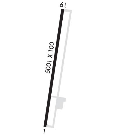
| Lat: N 3648.6 Long: W 09423.5 Elev: 1255 Var: -02 Longest Runway: 5001 | ||
| CTAF: 122.8 | ||
| ||||||||||||||||||||||||||||||||
| ||||||||||||||||||||||||||||||||
| Rwy | Rwy | |||||||
| 5001x100 | 5001' | 5001x100 | 5001' | |||||
| Runway ID | Single Wheel | Double Wheel | Double Tandem Wheel | Dual Double Wheel |
| 01/19 | 30,000 | 43,000 | N/A | N/A |
| These numbers are Advisory and are not limits. The Airport Manager should have more accurate Weight Limits | ||||
 Airport Diagram might not be current. | |
| Facility Name: | NEOSHO HUGH ROBINSON |
| City Name: | NEOSHO |
| County: | NEWTON |
| State abbrev: | MO |
| State Name: | MISSOURI |
| Ownership: | PUBLICLY OWNED |
| Use: | OPEN TO THE PUBLIC |
| Owner's Name: | CITY OF NEOSHO |
| Address: | 203 E MAIN ST |
| NEOSHO, MO 64850 | |
| Owner's Phone: | 417-451-8050 |
| Manager's Name: | CHUCK GRAVES |
| Address: | 1400 TERRY JOHNSON DR. |
| NEOSHO, MO 64850 | |
| Phone: | 417-451-8098 |
| FAA Region: | CENTRAL |
| FAA Field Office: | NONE |

| Date | Sunrise | Sunset |
|---|---|---|
| 06/08/26 Monday | 5:58 | 20:35 |
| 06/09/26 Tuesday | 5:58 | 20:36 |
| 06/10/26 Wednesday | 5:58 | 20:36 |
| 06/11/26 Thursday | 5:58 | 20:37 |
| 06/12/26 Friday | 5:58 | 20:37 |
| 06/13/26 Saturday | 5:58 | 20:37 |
| 06/14/26 Sunday | 5:58 | 20:38 |
| 06/15/26 Monday | 5:58 | 20:38 |
| 06/16/26 Tuesday | 5:58 | 20:39 |
| 06/17/26 Wednesday | 5:58 | 20:39 |
| 06/18/26 Thursday | 5:58 | 20:39 |
| 06/19/26 Friday | 5:58 | 20:39 |
| 06/20/26 Saturday | 5:58 | 20:40 |
| 06/21/26 Sunday | 5:59 | 20:40 |
| Airport Attendance Schedule | MON-FRI 0700-1530, SAT 0700-1530, SUN CLOSED; FOR SVC AFT HRS CALL (417) 439-7887. |
| Airport Status | OPERATIONAL (This Status can change at any time - please check NOTAMS) |
| Airport Lighting Schedule | ACTVT REIL RWYS 01 & 19; PAPI RWYS 01 & 19; MIRL RWYS 01/19 - CTAF |
| Airport Storage Available | Tie Downs, Hanger |
| Extra Services Available | Crop Dusting, Flight Instruction, Annual Surveying |
| Wind Indicator | YES - (lighted) |
| Control Tower | NO |
| CTAF Frequency | 122.800 |
| Unicom Frequency | 122.800; AUTOMATED UNICOM; 3 CLICKS WX, 4 CLICKS RADIO CHECK. |
| Rotating Beacon Color | WG |
| Segmented Circle | YES |
| Landing Fee | NO |
| Airport Inspected | STATE - performed by STATE AERONAUTICAL PERSONNEL |
| Inspection Date | 07/27/2023 |
| Type of Fuel Available | Grade 100LL, JET A-1 (icing inhibitor, freeze point -50C); -1024 HR SELF SERVICE 100LL FUEL PUMP. |
| Airframe Repair Service | NONE |
| Power Plant Repair Service | NONE |
| Latitude | N3648.6 |
| Longitude | W09423.5 (ESTIMATED) |
| Arpt Elevation | 1254ft (SURVEYED) |
| Magnetic Variation | 02E |
| 3 miles S | of NEOSHO |
| Traffic Pattern Altitude | |
| Sectional Chart | KANSAS CITY |
| Operations (Reported) | Yearly | Avg. Daily |
|---|---|---|
| General Aviation Transient | 0 | 0 |
| General Aviation Local | 0 | 0 |
| Air Taxi | 0 | 0 |
| Commerical | 0 | 0 |
| Commuter | 0 | 0 |
| Military | 0 | 0 |
| Aircraft based on Field | |
|---|---|
| General Aviation Singles | 0 |
| General Aviation Multi | 0 |
| Jet Aircraft | 0 |
| General Aviation Helicopters | 0 |
| Military Aircraft | 0 |
| Gliders | 0 |
| Ultralights | 0 |
| FSS on field | NO |
| FSS tie-in | COLUMBIA |
| FSS Phone | 1-800-WX-BRIEF |
| Who issues Notams | COU |
| Notam D service at airport | YES |
| ARTCC Name | KANSAS CITY |
| Airport Certification | |
| Aircraft Rescue & Firefighting Index | None |
| Airport of Entry | No |
| Custom Landing Rights | No |
| Joint Civil/Military | No |
| Military Landing rights | YES |
| NATIONAL PLAN OF INTEGRATED AIRPORT SYSTEMS (NPIAS) |
| GRANT AGREEMENTS UNDER FAAP/ADAP/AIP |
| SURPLUS PROPERTY AGREEMENT UNDER PUBLIC LAW 289 |
| ASSURANCES PURSUANT TO TITLE VI, CIVIL RIGHTS ACT OF 1964 |
| WILDLIFE ON & INVOF ARPT. |
| GND HAZ CAMP CROWDER FIRING RANGE ACTV - STAY ABV PAT ALT TIL BASE LEG WKDAYS & WKENDS INDEFLY. |
| RY 01/19 LINE OF SIGHT OBSTRUCTED BY GRADE CHANGE ON NORTH END. |
Airport Communications & Frequencies:
| |||||||||
| Runway: 01 | Runway: 19 | ||
| Mag heading: | 10° | Mag heading: | 190° |
| Rwy Slope: | -.72% Down | Rwy Slope: | .72% Up |
| Approach: | Approach: | ||
| Pattern: | Left Traffic | Pattern: | Left Traffic |
| Markings: | NONPRECISION INSTRUMENT | Markings: | NONPRECISION INSTRUMENT |
| Marking Condition: | GOOD | Marking Condition: | GOOD |
| Arresting Dev: | Arresting Dev: | ||
| Lat & Long: | N3648.2 W09423.6 | Lat. & Long.: | N3649.1 W09423.4 |
| Elev: | 1254.6 ft. MSL | Elev: | 1218.7 ft. MSL |
| TCH: | 43 ft. AGL | TCH: | 42 ft. AGL |
| Visual Glide Path: | 3.00 degrees | Visual Glide Path: | 3.00 degrees |
| Displaced Threshold: | No | Displaced Threshold: | No |
| Touchdown Zone: | YES | Touchdown Zone: | YES |
| Touchdown Elev.: | 1254.6 feet | Touchdown Elev.: | 1245.3 feet |
| Visual Glide Slope: | 4-Light PAPI on LEFT side of Runway | Visual Glide Slope: | 4-Light PAPI on LEFT side of Runway |
| RVR Equipment: | RVR Equipment: | ||
| RVV Equipment: | NO | RVV Equipment: | NO |
| Approach Lights: | Approach Lights: | ||
| REIL: | YES | REIL: | YES |
| Centerline Lights: | NO | Centerline Lights: | NO |
| Touchdown lights: | NO | Touchdown lights: | NO |
| Runway Category: | Runway with a Non-precision Approach having visibility minimums greater than 3/4 mile | Runway Category: | Runway with a Non-precision Approach having visibility minimums greater than 3/4 mile |
| Declared Distances: | Declared Distances: | ||
| Obstructions: | Obstructions: | TREES | |
| Marked: | Marked: | NOT Marked/Lighted | |
| Clearance slope: | 34:1 | Clearance slope: | 30:1 |
| Obstruction height: | Obstruction height: | 26 feet AGL | |
| Dist. from runway: | Dist. from runway: | 1005 feet | |
| Centerline offset: | Centerline offset: | 370 feet right of centerline | |
| Comments: | Comments: |
Thanks for using FltPlan.com
all rights reserved © 1999-2026 by Flight Plan LLC