
| PIKE COUNTY WAVERLY OH |
| |
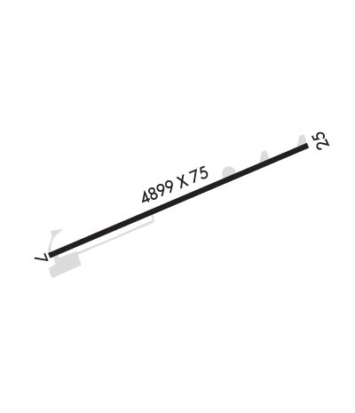
| Lat: N 3910.0 Long: W 08255.7 Elev: 661 Var: +06 Longest Runway: 4899 | ||
| AWOS: 118.4 CTAF: 123.0 | ||
| ||||||||||||||||||||||||||||||||||||||||||||
| ||||||||||||||||||||||||||||||||||||||||||||
| ||||||||||||||||||||||||||||||||||||||||||||
| Rwy | Rwy | |||||||
| 4899x75 | 4899' | 4899x75 | 4899' | |||||
| Runway ID | Single Wheel | Double Wheel | Double Tandem Wheel | Dual Double Wheel |
| 07/25 | 58,000 | N/A | N/A | N/A |
| These numbers are Advisory and are not limits. The Airport Manager should have more accurate Weight Limits | ||||
 Airport Diagram might not be current. | |
| Facility Name: | PIKE COUNTY |
| City Name: | WAVERLY |
| County: | PIKE |
| State abbrev: | OH |
| State Name: | OHIO |
| Ownership: | PUBLICLY OWNED |
| Use: | OPEN TO THE PUBLIC |
| Owner's Name: | PIKE COUNTY COMMISSIONERS |
| Address: | 230 WAVERLY PLZ STE 100 |
| WAVERLY, OH 45690-1288 | |
| Owner's Phone: | 740-947-4817 |
| Manager's Name: | SARA JUNK; OR TIM DICKERSON 740-708-3941. |
| Address: | 2577 ALMA OMEGA RD |
| WAVERLY, OH 45690-9316 | |
| Phone: | 740-947-4952; CELL 740-577-2644. |
| FAA Region: | GREAT LAKES |
| FAA Field Office: | DET |
| Date | Sunrise | Sunset |
|---|---|---|
| 06/08/26 Monday | 6:05 | 20:56 |
| 06/09/26 Tuesday | 6:05 | 20:57 |
| 06/10/26 Wednesday | 6:05 | 20:57 |
| 06/11/26 Thursday | 6:05 | 20:58 |
| 06/12/26 Friday | 6:05 | 20:58 |
| 06/13/26 Saturday | 6:05 | 20:59 |
| 06/14/26 Sunday | 6:05 | 20:59 |
| 06/15/26 Monday | 6:05 | 20:59 |
| 06/16/26 Tuesday | 6:05 | 21:00 |
| 06/17/26 Wednesday | 6:05 | 21:00 |
| 06/18/26 Thursday | 6:05 | 21:01 |
| 06/19/26 Friday | 6:05 | 21:01 |
| 06/20/26 Saturday | 6:05 | 21:01 |
| 06/21/26 Sunday | 6:06 | 21:01 |
| Airport Attendance Schedule | MON-FRI 0830-1630; EXCLDG MAJOR HOLS. |
| Airport Status | OPERATIONAL (This Status can change at any time - please check NOTAMS) |
| Airport Lighting Schedule | ACTVT REIL RWY 07 & 25; MIRL RWY 07/25 - CTAF. PAPI RWY 07 & 25 OPR CONSLY. |
| Airport Storage Available | Tie Downs |
| Extra Services Available | NONE |
| Wind Indicator | YES - (lighted) |
| Control Tower | NO |
| CTAF Frequency | 123.000 |
| Unicom Frequency | 123.000 |
| Rotating Beacon Color | WG |
| Segmented Circle | NO |
| Landing Fee | NO |
| Airport Inspected | STATE - performed by STATE AERONAUTICAL PERSONNEL |
| Inspection Date | 08/31/2023 |
| Type of Fuel Available | Grade 100LL, JET A-1 (icing inhibitor, freeze point -50C); -10FUEL AVBL H24 SELF SVC VIA CREDIT CARD. |
| Airframe Repair Service | MAJOR |
| Power Plant Repair Service | MAJOR |
| Latitude | N3910.0 |
| Longitude | W08255.7 (ESTIMATED) |
| Arpt Elevation | 661ft (SURVEYED) |
| Magnetic Variation | 06W |
| 3 miles NE | of WAVERLY |
| Traffic Pattern Altitude | |
| Sectional Chart | CINCINNATI |
| Operations (Reported) | Yearly | Avg. Daily |
|---|---|---|
| General Aviation Transient | 0 | 0 |
| General Aviation Local | 0 | 0 |
| Air Taxi | 0 | 0 |
| Commerical | 0 | 0 |
| Commuter | 0 | 0 |
| Military | 0 | 0 |
| Aircraft based on Field | |
|---|---|
| General Aviation Singles | 0 |
| General Aviation Multi | 0 |
| Jet Aircraft | 0 |
| General Aviation Helicopters | 0 |
| Military Aircraft | 0 |
| Gliders | 0 |
| Ultralights | 0 |
| FSS on field | NO |
| FSS tie-in | DAYTON |
| FSS Phone | 1-800-WX-BRIEF |
| Who issues Notams | EOP |
| Notam D service at airport | YES |
| ARTCC Name | INDIANAPOLIS |
| Airport Certification | |
| Aircraft Rescue & Firefighting Index | None |
| Airport of Entry | No |
| Custom Landing Rights | No |
| Joint Civil/Military | No |
| Military Landing rights | No |
| NATIONAL PLAN OF INTEGRATED AIRPORT SYSTEMS (NPIAS) |
| BIRDS & OTR WILDLIFE ON & INVOF ARPT. |
| FOR CD CTC INDIANAPOLIS ARTCC AT 317-247-2411. |
Airport Communications & Frequencies:
| |||||||||
| Runway: 07 | Runway: 25 | ||
| Mag heading: | 68° | Mag heading: | 248° |
| Rwy Slope: | .04% Up | Rwy Slope: | -.04% Down |
| Approach: | Approach: | ||
| Pattern: | Left Traffic | Pattern: | Left Traffic |
| Markings: | NONPRECISION INSTRUMENT | Markings: | NONPRECISION INSTRUMENT |
| Marking Condition: | FAIR | Marking Condition: | FAIR |
| Arresting Dev: | Arresting Dev: | ||
| Lat & Long: | N3909.8 W08256.2 | Lat. & Long.: | N3910.2 W08255.2 |
| Elev: | 658.6 ft. MSL | Elev: | 660.7 ft. MSL |
| TCH: | 37 ft. AGL | TCH: | 25 ft. AGL |
| Visual Glide Path: | 4.00 degrees | Visual Glide Path: | 3.00 degrees |
| Displaced Threshold: | No | Displaced Threshold: | No |
| Touchdown Zone: | YES | Touchdown Zone: | YES |
| Touchdown Elev.: | 661.1 feet | Touchdown Elev.: | 661.1 feet |
| Visual Glide Slope: | 4-Light PAPI on LEFT side of Runway | Visual Glide Slope: | 4-Light PAPI on LEFT side of Runway |
| RVR Equipment: | RVR Equipment: | ||
| RVV Equipment: | NO | RVV Equipment: | NO |
| Approach Lights: | Approach Lights: | ||
| REIL: | YES | REIL: | YES |
| Centerline Lights: | NO | Centerline Lights: | NO |
| Touchdown lights: | NO | Touchdown lights: | NO |
| Runway Category: | Runway with a Non-precision Approach | Runway Category: | Runway with a Non-precision Approach |
| Declared Distances: | Declared Distances: | ||
| Obstructions: | ROAD | Obstructions: | TREE |
| Marked: | NOT Marked/Lighted | Marked: | NOT Marked/Lighted |
| Clearance slope: | CTLG OBSTN EXCEEDS A 45 DEG SLP. | Clearance slope: | 10:1 |
| Obstruction height: | 10 feet AGL | Obstruction height: | 46 feet AGL |
| Dist. from runway: | 201 feet | Dist. from runway: | 664 feet |
| Centerline offset: | 205 left of centerline | Centerline offset: | 315 feet left of centerline |
| Comments: | +10 FT ROAD, 0-200 FT DIST, 205 FT L; +8 FT FENCE, 110-200 FT DIST, 180-190 FT L. | Comments: |
Thanks for using FltPlan.com
all rights reserved © 1999-2026 by Flight Plan LLC
