
| ELK CITY RGNL BUSINESS ELK CITY OK |
| |
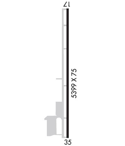
| Lat: N 3525.8 Long: W 09923.7 Elev: 2013 Var: -06 Longest Runway: 5399 | ||
| AWOS: 118.22 CTAF: 122.8 | ||
| ||||||||||||||||||||||||||||||||||||||||||||
| ||||||||||||||||||||||||||||||||||||||||||||
| ||||||||||||||||||||||||||||||||||||||||||||
| Rwy | Rwy | |||||||
| 5399x75 | 5399' | 5399x75 | 5399' | |||||
| Runway ID | Single Wheel | Double Wheel | Double Tandem Wheel | Dual Double Wheel |
| 17/35 | 30,000 | N/A | N/A | N/A |
| These numbers are Advisory and are not limits. The Airport Manager should have more accurate Weight Limits | ||||
 Airport Diagram might not be current. | |
| Facility Name: | ELK CITY RGNL BUSINESS |
| City Name: | ELK CITY |
| County: | BECKHAM |
| State abbrev: | OK |
| State Name: | OKLAHOMA |
| Ownership: | PUBLICLY OWNED |
| Use: | OPEN TO THE PUBLIC |
| Owner's Name: | CITY OF ELK CITY |
| Address: | BOX 1100 |
| ELK CITY, OK 73644 | |
| Owner's Phone: | 580-225-3230 |
| Manager's Name: | JEFF WHITTEN |
| Address: | 101 NORMAN MARTIN BLVD. |
| ELK CITY, OK 73648 | |
| Phone: | 580-225-7700 |
| FAA Region: | SOUTHWEST |
| FAA Field Office: | AOK |
| Date | Sunrise | Sunset |
|---|---|---|
| 09/24/21 Friday | 7:27 | 19:32 |
| 09/25/21 Saturday | 7:28 | 19:30 |
| 09/26/21 Sunday | 7:28 | 19:29 |
| 09/27/21 Monday | 7:29 | 19:27 |
| 09/28/21 Tuesday | 7:30 | 19:26 |
| 09/29/21 Wednesday | 7:31 | 19:25 |
| 09/30/21 Thursday | 7:31 | 19:23 |
| 10/01/21 Friday | 7:32 | 19:22 |
| 10/02/21 Saturday | 7:33 | 19:20 |
| 10/03/21 Sunday | 7:34 | 19:19 |
| 10/04/21 Monday | 7:35 | 19:17 |
| 10/05/21 Tuesday | 7:35 | 19:16 |
| 10/06/21 Wednesday | 7:36 | 19:15 |
| 10/07/21 Thursday | 7:37 | 19:13 |
| Airport Attendance Schedule | MON-SAT 0800-1700; FOR AFTER HOURS SERVICE CALL 580-225-7700 |
| Airport Status | OPERATIONAL (This Status can change at any time - please check NOTAMS) |
| Airport Lighting Schedule | ACTVT ODALS RWY 17, REIL RWY 17 & 35, MIRL RWY 17/35 - CTAF. PAPI RWYS 17 & 35 OPER CONTINUOUSLY. |
| Airport Storage Available | Tie Downs, Hanger |
| Extra Services Available | Air Ambulance, Flight Instruction, Aircraft Rental, Aircraft Sales |
| Wind Indicator | YES - (lighted) |
| Control Tower | NO |
| CTAF Frequency | 122.800 |
| Unicom Frequency | 122.800 |
| Rotating Beacon Color | CLEAR-GREEN (Light Land Airport) |
| Segmented Circle | YES |
| Landing Fee | NO |
| Airport Inspected | STATE - performed by STATE AERONAUTICAL PERSONNEL |
| Inspection Date | 08/26/2020 |
| Type of Fuel Available | Grade 100LL, JET A (freeze point -40C); -10100LL FUEL AVAILABLE 24 HRS WITH AUTOMATED CREDIT CARD SYSTEM. |
| Airframe Repair Service | MAJOR |
| Power Plant Repair Service | MAJOR |
| Latitude | N3525.8 |
| Longitude | W09923.7 (ESTIMATED) |
| Arpt Elevation | 2012ft (SURVEYED) |
| Magnetic Variation | 06E |
| 1 miles NE | of ELK CITY |
| Traffic Pattern Altitude | |
| Sectional Chart | DALLAS-FT WORTH |
| Operations (Reported) | Yearly | Avg. Daily |
|---|---|---|
| General Aviation Transient | 2400 | 7 |
| General Aviation Local | 5600 | 15 |
| Air Taxi | 40 | 0 |
| Commerical | 0 | 0 |
| Commuter | 0 | 0 |
| Military | 0 | 0 |
| Aircraft based on Field | |
|---|---|
| General Aviation Singles | 28 |
| General Aviation Multi | 2 |
| Jet Aircraft | 0 |
| General Aviation Helicopters | 1 |
| Military Aircraft | 0 |
| Gliders | 0 |
| Ultralights | 0 |
| FSS on field | NO |
| FSS tie-in | MC ALESTER |
| FSS Phone | 1-800-WX-BRIEF |
| Who issues Notams | MLC |
| Notam D service at airport | YES |
| ARTCC Name | FORT WORTH |
| Airport Certification | |
| Aircraft Rescue & Firefighting Index | None |
| Airport of Entry | No |
| Custom Landing Rights | No |
| Joint Civil/Military | No |
| Military Landing rights | YES |
| NATIONAL PLAN OF INTEGRATED AIRPORT SYSTEMS (NPIAS) |
| GRANT AGREEMENTS UNDER FAAP/ADAP/AIP |
| ASSURANCES PURSUANT TO TITLE VI, CIVIL RIGHTS ACT OF 1964 |
| DITCH LCTD OFF THE NW SIDE OF PARALLEL TWY. |
| FOR CD CTC FORT WORTH ARTCC AT 817-858-7584. |
Airport Communications & Frequencies:
| |||||||||
| Runway: 17 | Runway: 35 | ||
| Mag heading: | 174° | Mag heading: | 354° |
| Rwy Slope: | -.71% Down | Rwy Slope: | .71% Up |
| Approach: | Approach: | ||
| Pattern: | Left Traffic | Pattern: | Left Traffic |
| Markings: | NONPRECISION INSTRUMENT | Markings: | NONPRECISION INSTRUMENT |
| Marking Condition: | GOOD | Marking Condition: | GOOD |
| Arresting Dev: | Arresting Dev: | ||
| Lat & Long: | N3526.3 W09923.7 | Lat. & Long.: | N3525.4 W09923.7 |
| Elev: | 2012.8 ft. MSL | Elev: | 1974.4 ft. MSL |
| TCH: | 52 ft. AGL | TCH: | 61 ft. AGL |
| Visual Glide Path: | 3.00 degrees | Visual Glide Path: | 3.50 degrees |
| Displaced Threshold: | No | Displaced Threshold: | No |
| Touchdown Zone: | YES | Touchdown Zone: | YES |
| Touchdown Elev.: | 2012.8 feet | Touchdown Elev.: | 1983.5 feet |
| Visual Glide Slope: | 2-Light PAPI on LEFT side of Runway | Visual Glide Slope: | 2-Light PAPI on LEFT side of Runway |
| RVR Equipment: | RVR Equipment: | ||
| RVV Equipment: | NO | RVV Equipment: | NO |
| Approach Lights: | ODALS - omnidirectional approach lighting system | Approach Lights: | |
| REIL: | YES | REIL: | YES |
| Centerline Lights: | NO | Centerline Lights: | NO |
| Touchdown lights: | NO | Touchdown lights: | NO |
| Runway Category: | Runway with a Non-precision Approach having visibility minimums greater than 3/4 mile | Runway Category: | Runway with a Non-precision Approach having visibility minimums greater than 3/4 mile |
| Declared Distances: | Declared Distances: | ||
| Obstructions: | Obstructions: | POLE | |
| Marked: | Marked: | NOT Marked/Lighted | |
| Clearance slope: | 34:1 | Clearance slope: | 30:1 |
| Obstruction height: | Obstruction height: | 26 feet AGL | |
| Dist. from runway: | Dist. from runway: | 990 feet | |
| Centerline offset: | Centerline offset: | 270 feet left of centerline | |
| Comments: | Comments: |
Thanks for using FltPlan.com
all rights reserved © 1999-2021 by Flight Plan LLC
