
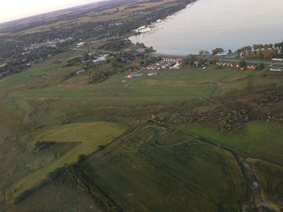
| STARBUCK MUNI STARBUCK MN |
| |
| Lat: N 4535.9 Long: W 09532.2 Elev: 1140 Var: -05 Longest Runway: 2512 | ||
| CTAF: 122.9 | ||
| ||||||||||||||||||||||||||||||||
| ||||||||||||||||||||||||||||||||
| Rwy | Rwy | |||||||
| 2512x198 | 2512' | 2512x198 | 2512' | |||||
| Runway ID | Single Wheel | Double Wheel | Double Tandem Wheel | Dual Double Wheel |
| 15/33 | N/A | N/A | N/A | N/A |
| These numbers are Advisory and are not limits. The Airport Manager should have more accurate Weight Limits | ||||
| FltPlan does not have IFR approach charts available for KD32. |
| Facility Name: | STARBUCK MUNI |
| City Name: | STARBUCK |
| County: | POPE |
| State abbrev: | MN |
| State Name: | MINNESOTA |
| Ownership: | PUBLICLY OWNED |
| Use: | OPEN TO THE PUBLIC |
| Owner's Name: | CITY OF STARBUCK |
| Address: | 307 5TH STREET, PO BOX 606, PO BOX 606 |
| STARBUCK, MN 56381 | |
| Owner's Phone: | 320-239-2525 |
| Manager's Name: | TOM BEUCKENS |
| Address: | 307 5TH STREET, PO BOX 606, PO BOX 606 |
| STARBUCK, MN 56381 | |
| Phone: | 320-239-2525 |
| FAA Region: | GREAT LAKES |
| FAA Field Office: | DMA |
| Date | Sunrise | Sunset |
|---|---|---|
| 06/08/26 Monday | 5:33 | 21:09 |
| 06/09/26 Tuesday | 5:33 | 21:10 |
| 06/10/26 Wednesday | 5:33 | 21:10 |
| 06/11/26 Thursday | 5:33 | 21:11 |
| 06/12/26 Friday | 5:33 | 21:12 |
| 06/13/26 Saturday | 5:32 | 21:12 |
| 06/14/26 Sunday | 5:32 | 21:13 |
| 06/15/26 Monday | 5:32 | 21:13 |
| 06/16/26 Tuesday | 5:32 | 21:13 |
| 06/17/26 Wednesday | 5:32 | 21:14 |
| 06/18/26 Thursday | 5:32 | 21:14 |
| 06/19/26 Friday | 5:33 | 21:14 |
| 06/20/26 Saturday | 5:33 | 21:15 |
| 06/21/26 Sunday | 5:33 | 21:15 |
| Airport Attendance Schedule | UNATTENDED |
| Airport Status | OPERATIONAL (This Status can change at any time - please check NOTAMS) |
| Airport Lighting Schedule | ACTVT NSTD LIRL RWY 15/33 - CTAF. |
| Airport Storage Available | Tie Downs |
| Extra Services Available | NONE |
| Wind Indicator | YES - (lighted) |
| Control Tower | NO |
| CTAF Frequency | 122.900 |
| Unicom Frequency | |
| Rotating Beacon Color | WG |
| Segmented Circle | NO |
| Landing Fee | NO |
| Airport Inspected | STATE - performed by STATE AERONAUTICAL PERSONNEL |
| Inspection Date | 09/16/2025 |
| Type of Fuel Available | None |
| Airframe Repair Service | NONE |
| Power Plant Repair Service | NONE |
| Latitude | N4535.9 |
| Longitude | W09532.2 (ESTIMATED) |
| Arpt Elevation | 1140ft (ESTIMATED) |
| Magnetic Variation | 05E |
| 1 miles S | of STARBUCK |
| Traffic Pattern Altitude | |
| Sectional Chart | TWIN CITIES |
| Operations (Reported) | Yearly | Avg. Daily |
|---|---|---|
| General Aviation Transient | 0 | 0 |
| General Aviation Local | 0 | 0 |
| Air Taxi | 0 | 0 |
| Commerical | 0 | 0 |
| Commuter | 0 | 0 |
| Military | 0 | 0 |
| Aircraft based on Field | |
|---|---|
| General Aviation Singles | 0 |
| General Aviation Multi | 0 |
| Jet Aircraft | 0 |
| General Aviation Helicopters | 0 |
| Military Aircraft | 0 |
| Gliders | 0 |
| Ultralights | 0 |
| FSS on field | NO |
| FSS tie-in | PRINCETON |
| FSS Phone | 1-800-WX-BRIEF |
| Who issues Notams | PNM |
| Notam D service at airport | YES |
| ARTCC Name | MINNEAPOLIS |
| Airport Certification | |
| Aircraft Rescue & Firefighting Index | None |
| Airport of Entry | No |
| Custom Landing Rights | No |
| Joint Civil/Military | No |
| Military Landing rights | No |
| FOR CD CTC MINNEAPOLIS ARTCC AT 651-463-5588. |
| RWY 15 & 33 REIL & RWY 15 THR LGTS OBSC BY BRUSH. |
| RWY 15/3 3 NSTD LIRL DUE TO SPACING. |
| Runway: 15 | Runway: 33 | ||
| Mag heading: | 151° | Mag heading: | 331° |
| Rwy Slope: | .08% Up | Rwy Slope: | -.08% Down |
| Approach: | Approach: | ||
| Pattern: | Left Traffic | Pattern: | Left Traffic |
| Markings: | Markings: | ||
| Marking Condition: | YELLOW CONES. | Marking Condition: | YELLOW CONES. |
| Arresting Dev: | Arresting Dev: | ||
| Lat & Long: | N4536.1 W09532.3 | Lat. & Long.: | N4535.8 W09532.0 |
| Elev: | 1138.4 ft. MSL | Elev: | 1140.3 ft. MSL |
| TCH: | TCH: | ||
| Visual Glide Path: | Visual Glide Path: | ||
| Displaced Threshold: | No | Displaced Threshold: | No |
| Touchdown Zone: | YES | Touchdown Zone: | YES |
| Touchdown Elev.: | 1140.3 feet | Touchdown Elev.: | 1140.3 feet |
| Visual Glide Slope: | Visual Glide Slope: | ||
| RVR Equipment: | RVR Equipment: | ||
| RVV Equipment: | NO | RVV Equipment: | NO |
| Approach Lights: | Approach Lights: | ||
| REIL: | YES | REIL: | YES |
| Centerline Lights: | NO | Centerline Lights: | NO |
| Touchdown lights: | NO | Touchdown lights: | NO |
| Runway Category: | Runway with a Visual Approach | Runway Category: | Runway with a Visual Approach |
| Declared Distances: | Declared Distances: | ||
| Obstructions: | BRUSH | Obstructions: | BRUSH |
| Marked: | NOT Marked/Lighted | Marked: | NOT Marked/Lighted |
| Clearance slope: | Clearance slope: | 1:1 | |
| Obstruction height: | 4 feet AGL | Obstruction height: | 4 feet AGL |
| Dist. from runway: | 4 feet | Dist. from runway: | 4 feet |
| Centerline offset: | 69 right of centerline | Centerline offset: | 5 feet right of centerline |
| Comments: | Comments: |
Thanks for using FltPlan.com
all rights reserved © 1999-2026 by Flight Plan LLC