
| KICKAPOO DOWNTOWN WICHITA FALLS TX |
| |
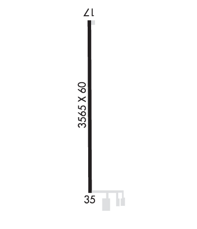
| Lat: N 3351.6 Long: W 09829.4 Elev: 1003 Var: -04 Longest Runway: 4450 | ||
| Clr Del: 121.2 AWOS: 119.62 CTAF: 122.7 | ||
| ||||||
| ||||||
|
| Rwy | Rwy | |||||||
| 4450x75 | 4300' | 4450x75 | 4200' | |||||
| Runway ID | Single Wheel | Double Wheel | Double Tandem Wheel | Dual Double Wheel |
| 17/35 | 30,000 | N/A | N/A | N/A |
| These numbers are Advisory and are not limits. The Airport Manager should have more accurate Weight Limits | ||||
 Airport Diagram might not be current. | |
| Facility Name: | KICKAPOO DOWNTOWN |
| City Name: | WICHITA FALLS |
| County: | WICHITA |
| State abbrev: | TX |
| State Name: | TEXAS |
| Ownership: | PUBLICLY OWNED |
| Use: | OPEN TO THE PUBLIC |
| Owner's Name: | CITY OF WICHITA FALLS |
| Address: | 4515 JACKSBORO HWY |
| WICHITA FALLS, TX 76302 | |
| Owner's Phone: | 940-766-1735 |
| Manager's Name: | JON WALTJEN |
| Address: | 4515 JACKSBORO HWY |
| WICHITA FALLS, TX 76302 | |
| Phone: | 940-766-1735 |
| FAA Region: | SOUTHWEST |
| FAA Field Office: | TEX |

| Date | Sunrise | Sunset |
|---|---|---|
| 09/24/21 Friday | 7:23 | 19:28 |
| 09/25/21 Saturday | 7:24 | 19:27 |
| 09/26/21 Sunday | 7:25 | 19:25 |
| 09/27/21 Monday | 7:25 | 19:24 |
| 09/28/21 Tuesday | 7:26 | 19:23 |
| 09/29/21 Wednesday | 7:27 | 19:21 |
| 09/30/21 Thursday | 7:28 | 19:20 |
| 10/01/21 Friday | 7:28 | 19:19 |
| 10/02/21 Saturday | 7:29 | 19:17 |
| 10/03/21 Sunday | 7:30 | 19:16 |
| 10/04/21 Monday | 7:30 | 19:14 |
| 10/05/21 Tuesday | 7:31 | 19:13 |
| 10/06/21 Wednesday | 7:32 | 19:12 |
| 10/07/21 Thursday | 7:33 | 19:10 |
| Airport Attendance Schedule | 7 Days A Week 0600-2000 |
| Airport Status | OPERATIONAL (This Status can change at any time - please check NOTAMS) |
| Airport Lighting Schedule | ACTVT MIRL RY 17/35, REIL RYS 17 & 35 - CTAF. PAPI RYS 17 & 35 OPERATES CONTINUOUSLY. |
| Airport Storage Available | Tie Downs, Hanger |
| Extra Services Available | Flight Instruction, Aircraft Rental |
| Wind Indicator | YES - (lighted) |
| Control Tower | NO |
| CTAF Frequency | 122.700 |
| Unicom Frequency | 122.700 |
| Rotating Beacon Color | CLEAR-GREEN (Light Land Airport) |
| Segmented Circle | NO |
| Landing Fee | NO |
| Airport Inspected | STATE - performed by STATE AERONAUTICAL PERSONNEL |
| Inspection Date | 12/07/2017 |
| Type of Fuel Available | Grade 100LL, JET A (freeze point -40C); -10SELF SERVE 100 LL AND JET A |
| Airframe Repair Service | MAJOR |
| Power Plant Repair Service | MAJOR |
| Latitude | N3351.6 |
| Longitude | W09829.4 (ESTIMATED) |
| Arpt Elevation | 1003ft (SURVEYED) |
| Magnetic Variation | 04E |
| 3 miles S | of WICHITA FALLS |
| Traffic Pattern Altitude | |
| Sectional Chart | DALLAS-FT WORTH |
| Operations (Reported) | Yearly | Avg. Daily |
|---|---|---|
| General Aviation Transient | 8400 | 23 |
| General Aviation Local | 25200 | 69 |
| Air Taxi | 20 | 0 |
| Commerical | 0 | 0 |
| Commuter | 0 | 0 |
| Military | 150 | 0 |
| Aircraft based on Field | |
|---|---|
| General Aviation Singles | 57 |
| General Aviation Multi | 15 |
| Jet Aircraft | 3 |
| General Aviation Helicopters | 0 |
| Military Aircraft | 0 |
| Gliders | 0 |
| Ultralights | 0 |
| FSS on field | NO |
| FSS tie-in | FORT WORTH |
| FSS Phone | 1-800-WX-BRIEF |
| Who issues Notams | FTW |
| Notam D service at airport | YES |
| ARTCC Name | FORT WORTH |
| Airport Certification | |
| Aircraft Rescue & Firefighting Index | None |
| Airport of Entry | No |
| Custom Landing Rights | No |
| Joint Civil/Military | No |
| Military Landing rights | No |
| NATIONAL PLAN OF INTEGRATED AIRPORT SYSTEMS (NPIAS) |
| ASSURANCES PURSUANT TO TITLE VI, CIVIL RIGHTS ACT OF 1964 |
| DO NOT MISTAKE KICKAPOO DOWNTOWN FOR SHEPPARD AFB/WICHITA FALLS MUNI ARPT 7 MILES NORTH. |
| INTENSIVE JET TRAINER TFC 2300-3000 FT MSL WITHIN ALERT AREA A-636. REMAIN BLO 1800 FT MSL UNTIL IN RADAR CTC WITH APCH CTL FOR TFC ADVISORIES. |
| (A89) LD TO FSS 855-5574. |
| ANTENNAS 2051 FT & 2047 FT MSL 3-5 MILES NW OF ARPT. |
| FOR CD CTC FORT WORTH ARTCC AT 817-858-7584. |
Airport Communications & Frequencies:
| |||||||||||||||||||
| Runway: 17 | Runway: 35 | ||
| Mag heading: | 176° | Mag heading: | 356° |
| Rwy Slope: | .54% Up | Rwy Slope: | -.54% Down |
| Approach: | Approach: | ||
| Pattern: | Left Traffic | Pattern: | Left Traffic |
| Markings: | NONPRECISION INSTRUMENT | Markings: | NONPRECISION INSTRUMENT |
| Marking Condition: | GOOD | Marking Condition: | GOOD |
| Arresting Dev: | Arresting Dev: | ||
| Lat & Long: | N3352.0 W09829.4 | Lat. & Long.: | N3351.3 W09829.4 |
| Elev: | 979.0 ft. MSL | Elev: | 1003.0 ft. MSL |
| TCH: | 37 ft. AGL | TCH: | 41 ft. AGL |
| Visual Glide Path: | 3.00 degrees | Visual Glide Path: | 3.00 degrees |
| Displaced Threshold: | 150 feet | Displaced Threshold: | 250 feet |
| Touchdown Zone: | YES | Touchdown Zone: | YES |
| Touchdown Elev.: | 992.3 feet | Touchdown Elev.: | 1000.3 feet |
| Visual Glide Slope: | 4-Light PAPI on LEFT side of Runway | Visual Glide Slope: | 4-Light PAPI on LEFT side of Runway |
| RVR Equipment: | RVR Equipment: | ||
| RVV Equipment: | NO | RVV Equipment: | NO |
| Approach Lights: | Approach Lights: | ||
| REIL: | YES | REIL: | YES |
| Centerline Lights: | NO | Centerline Lights: | NO |
| Touchdown lights: | NO | Touchdown lights: | NO |
| Runway Category: | Runway with a Visual Approach | Runway Category: | Runway with a Non-precision Approach |
| Declared Distances: | Declared Distances: | ||
| Obstructions: | ROAD | Obstructions: | ROAD |
| Marked: | NOT Marked/Lighted | Marked: | NOT Marked/Lighted |
| Clearance slope: | 10:1; APCH RATIO 71:1 AT DSPLCD THLD DUE TO AN 6 FT FENCE 430 FT FROM DSPLCD THLD, ON CENTERLINE. | Clearance slope: | 7:1; APCH RATIO AT DSPLCD THLD 37:1 BASED ON 15 FT. ROAD, 564 FT FROM DSPLCD THLD ACROSS APCH . |
| Obstruction height: | 12 feet AGL | Obstruction height: | 15 feet AGL |
| Dist. from runway: | 320 feet | Dist. from runway: | 314 feet |
| Centerline offset: | Centerline offset: | ||
| Comments: | Comments: |
Thanks for using FltPlan.com
all rights reserved © 1999-2021 by Flight Plan LLC