
| CLINTON-SHERMAN BURNS FLAT OK |
| |
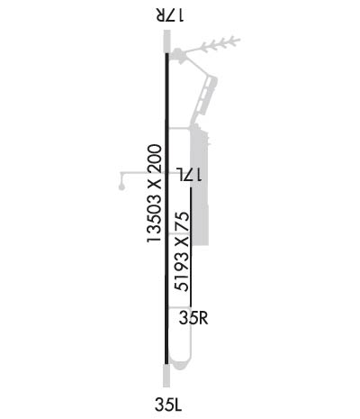
| Lat: N 3520.4 Long: W 09912.0 Elev: 1922 Var: -05 Longest Runway: 13503 | ||
| AWOS: 135.22 Ground: 121.7 Tower: 119.6 | ||
| ||||||||||||||||||||||||||||||||||||||||||||
| ||||||||||||||||||||||||||||||||||||||||||||
| ||||||||||||||||||||||||||||||||||||||||||||
| Rwy | Rwy | |||||||
| 5193x75 | 5193' | 5193x75 | 5193' | |||||
| 13503x200 | 13503' | 109.50 - 175° | 13503x200 | 13503' | ||||
| Runway ID | Single Wheel | Double Wheel | Double Tandem Wheel | Dual Double Wheel |
| 17L/35R | 50,000 | 200,000 | 390,000 | N/A |
| 17R/35L | 50,000 | 200,000 | 390,000 | N/A |
| These numbers are Advisory and are not limits. The Airport Manager should have more accurate Weight Limits | ||||
 Airport Diagram might not be current. | |
| Facility Name: | CLINTON-SHERMAN |
| City Name: | BURNS FLAT |
| County: | WASHITA |
| State abbrev: | OK |
| State Name: | OKLAHOMA |
| Ownership: | PUBLICLY OWNED |
| Use: | OPEN TO THE PUBLIC |
| Owner's Name: | OSIDA/STATE OF OKLAHOMA |
| Address: | BOX 689 |
| BURNS FLAT, OK 73624 | |
| Owner's Phone: | 580-562-3500 |
| Manager's Name: | CRAIG J. SMITH |
| Address: | 121 1ST STREET |
| BURNS FLAT, OK 73624 | |
| Phone: | 580-309-3223 |
| FAA Region: | SOUTHWEST |
| FAA Field Office: | AOK |
| Date | Sunrise | Sunset |
|---|---|---|
| 09/24/21 Friday | 7:26 | 19:31 |
| 09/25/21 Saturday | 7:27 | 19:30 |
| 09/26/21 Sunday | 7:28 | 19:28 |
| 09/27/21 Monday | 7:28 | 19:27 |
| 09/28/21 Tuesday | 7:29 | 19:25 |
| 09/29/21 Wednesday | 7:30 | 19:24 |
| 09/30/21 Thursday | 7:31 | 19:22 |
| 10/01/21 Friday | 7:31 | 19:21 |
| 10/02/21 Saturday | 7:32 | 19:19 |
| 10/03/21 Sunday | 7:33 | 19:18 |
| 10/04/21 Monday | 7:34 | 19:17 |
| 10/05/21 Tuesday | 7:35 | 19:15 |
| 10/06/21 Wednesday | 7:35 | 19:14 |
| 10/07/21 Thursday | 7:36 | 19:13 |
| Airport Attendance Schedule | MON-FRI 0900-0100; ATCT CLSD FED HOL. |
| Airport Status | OPERATIONAL (This Status can change at any time - please check NOTAMS) |
| Airport Lighting Schedule | ACTVT REIL RWY 17R & 35L; HIRL RWY 17R/35L; TWY LGT; WDI LGT - CTAF. PAPI RWY 17R & 35L ON CONSLY. |
| Airport Storage Available | Tie Downs, Hanger |
| Extra Services Available | NONE |
| Wind Indicator | YES - (lighted) |
| Control Tower | YES |
| CTAF Frequency | 119.600 |
| Unicom Frequency | 122.950 |
| Rotating Beacon Color | CLEAR-GREEN (Light Land Airport) |
| Segmented Circle | NO |
| Landing Fee | NO |
| Airport Inspected | STATE - performed by STATE AERONAUTICAL PERSONNEL |
| Inspection Date | 06/24/2020 |
| Type of Fuel Available | Grade 100LL, JET A (freeze point -40C) |
| Airframe Repair Service | MAJOR |
| Power Plant Repair Service | MAJOR; AEM AVBL FOR RPR ON SINGLE & MULTI ENG PISTON ACFT; NO TURBINE OR HEL RPR AVBL. |
| Latitude | N3520.4 |
| Longitude | W09912.0 (ESTIMATED) |
| Arpt Elevation | 1922ft (SURVEYED) |
| Magnetic Variation | 05E |
| 2 miles SW | of BURNS FLAT |
| Traffic Pattern Altitude | |
| Sectional Chart | DALLAS-FT WORTH |
| Operations (Reported) | Yearly | Avg. Daily |
|---|---|---|
| General Aviation Transient | 4453 | 12 |
| General Aviation Local | 0 | 0 |
| Air Taxi | 0 | 0 |
| Commerical | 0 | 0 |
| Commuter | 0 | 0 |
| Military | 32284 | 88 |
| Aircraft based on Field | |
|---|---|
| General Aviation Singles | 0 |
| General Aviation Multi | 0 |
| Jet Aircraft | 0 |
| General Aviation Helicopters | 0 |
| Military Aircraft | 0 |
| Gliders | 0 |
| Ultralights | 0 |
| FSS on field | NO |
| FSS tie-in | MC ALESTER |
| FSS Phone | 1-800-WX-BRIEF |
| Who issues Notams | CSM |
| Notam D service at airport | YES |
| ARTCC Name | FORT WORTH |
| Airport Certification | |
| Aircraft Rescue & Firefighting Index | None |
| Airport of Entry | No |
| Custom Landing Rights | No |
| Joint Civil/Military | No |
| Military Landing rights | YES |
| NATIONAL PLAN OF INTEGRATED AIRPORT SYSTEMS (NPIAS) |
| SURPLUS PROPERTY AGREEMENT UNDER PUBLIC LAW 289 |
| ASSURANCES PURSUANT TO TITLE VI, CIVIL RIGHTS ACT OF 1964 |
| THIS AIRPORT HAS BEEN SURVEYED BY THE NATIONAL GEODETIC SURVEY. |
| MIL JET TRNG: HVY JETS SFC TO 5000 FT WI 25 NMR. EXTSV STUDENT PILOT TRNG FM SFC TO 5000 FT WI 10 NMR BTN 0900-1200. |
| RWY 17L/35R LAID OUT & MRKD ON RWY 17L/35R PARL TWY. |
| MIL JET NGT VISION TRNG: CTC ATCT 10 MINS PRIOR TO LDG AFT SS TO ADJUST ARPT LGTS. |
| VFR ACFT ADZD TO CTC ATC 15 NM OUT FOR SEQG. |
| 24 HR JET-A & 100LL FUEL & OTR SVC AVBL - CTC 405-267-4010. |
| RWY 17L/ 35RDALGT VFR ONLY. |
| RWY 17R/ 35LNSTD; 75 FT FM RWY EDGE. |
Airport Communications & Frequencies:
| |||||||||||||||||||||
| Runway: 17L | Runway: 35R | ||
| Mag heading: | 175° | Mag heading: | 355° |
| Rwy Slope: | .01% Up | Rwy Slope: | -.01% Down |
| Approach: | Approach: | ||
| Pattern: | Left Traffic | Pattern: | Right Traffic |
| Markings: | BASIC | Markings: | BASIC |
| Marking Condition: | FAIR | Marking Condition: | FAIR |
| Arresting Dev: | Arresting Dev: | ||
| Lat & Long: | N3520.6 W09911.9 | Lat. & Long.: | N3519.8 W09911.9 |
| Elev: | 1906.2 ft. MSL | Elev: | 1906.8 ft. MSL |
| TCH: | TCH: | ||
| Visual Glide Path: | Visual Glide Path: | ||
| Displaced Threshold: | No | Displaced Threshold: | No |
| Touchdown Zone: | YES | Touchdown Zone: | YES |
| Touchdown Elev.: | 1906.3 feet | Touchdown Elev.: | 1906.8 feet |
| Visual Glide Slope: | Visual Glide Slope: | ||
| RVR Equipment: | RVR Equipment: | ||
| RVV Equipment: | NO | RVV Equipment: | NO |
| Approach Lights: | Approach Lights: | ||
| REIL: | NO | REIL: | NO |
| Centerline Lights: | NO | Centerline Lights: | NO |
| Touchdown lights: | NO | Touchdown lights: | NO |
| Runway Category: | Runway with a Visual Approach | Runway Category: | Runway with a Visual Approach |
| Declared Distances: | Declared Distances: |
| Runway: 17R | Runway: 35L | ||
| Mag heading: | 175° | Mag heading: | 355° |
| Rwy Slope: | -.08% Down | Rwy Slope: | .08% Up |
| Approach: | ILS | Approach: | |
| Pattern: | Right Traffic | Pattern: | Left Traffic |
| Markings: | PRECISION INSTRUMENT | Markings: | PRECISION INSTRUMENT |
| Marking Condition: | GOOD | Marking Condition: | GOOD |
| Arresting Dev: | Arresting Dev: | ||
| Lat & Long: | N3521.6 W09912.1 | Lat. & Long.: | N3519.4 W09912.1 |
| Elev: | 1922.1 ft. MSL | Elev: | 1911.8 ft. MSL |
| TCH: | 54 ft. AGL | TCH: | 50 ft. AGL |
| Visual Glide Path: | 3.00 degrees | Visual Glide Path: | 3.00 degrees |
| Displaced Threshold: | No | Displaced Threshold: | No |
| Touchdown Zone: | YES | Touchdown Zone: | YES |
| Touchdown Elev.: | 1922.1 feet | Touchdown Elev.: | 1913.0 feet |
| Visual Glide Slope: | 4-Light PAPI on LEFT side of Runway | Visual Glide Slope: | 4-Light PAPI on LEFT side of Runway |
| RVR Equipment: | RVR Equipment: | ||
| RVV Equipment: | NO | RVV Equipment: | NO |
| Approach Lights: | Approach Lights: | ||
| REIL: | YES | REIL: | YES |
| Centerline Lights: | NO | Centerline Lights: | NO |
| Touchdown lights: | NO | Touchdown lights: | NO |
| Runway Category: | Precision Instrument Runway | Runway Category: | D |
| Declared Distances: | Declared Distances: |
Thanks for using FltPlan.com
all rights reserved © 1999-2021 by Flight Plan LLC
