
| MC CLELLAN-PALOMAR CARLSBAD CA |
| |
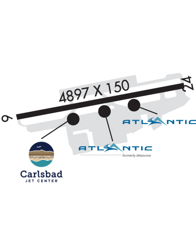
| Lat: N 3307.7 Long: W 11716.8 Elev: 331 Var: -14 Longest Runway: 4897 | ||
| Clr Del: 134.85 Dept. ATIS: 120.15 Arr. ATIS: 120.15 Ground: 121.8 Tower: 118.6 | ||
| |||||||||||||||||||||||||||||||||||||||||||||||||||||||||||||||||||||
| |||||||||||||||||||||||||||||||||||||||||||||||||||||||||||||||||||||
| |||||||||||||||||||||||||||||||||||||||||||||||||||||||||||||||||||||
| |||||||||||||||||||||||||||||||||||||||||||||||||||||||||||||||||||||
| |||||||||||||||||||||||||||||||||||||||||||||||||||||||||||||||||||||
| |||||||||||||||||||||||||||||||||||||||||||||||||||||||||||||||||||||
| Rwy | Rwy | |||||||
| 4897x150 | 4600' | 4897x150 | 4897' | 108.70 - 245° | ||||
| Runway ID | Single Wheel | Double Wheel | Double Tandem Wheel | Dual Double Wheel |
| 06/24 | 110,000 | 168,000 | 248,000 | 692,000 |
| H1 | N/A | N/A | N/A | N/A |
| These numbers are Advisory and are not limits. The Airport Manager should have more accurate Weight Limits | ||||
 Airport Diagram might not be current. | |
| Facility Name: | MC CLELLAN-PALOMAR |
| City Name: | CARLSBAD |
| County: | SAN DIEGO |
| State abbrev: | CA |
| State Name: | CALIFORNIA |
| Ownership: | PUBLICLY OWNED |
| Use: | OPEN TO THE PUBLIC |
| Owner's Name: | COUNTY OF SAN DIEGO |
| Address: | 1960 JOE CROSSON DRIVE |
| EL CAJON, CA 92020-1235 | |
| Owner's Phone: | 619-956-4800 |
| Manager's Name: | JOHN OTTO |
| Address: | 2192 PALOMAR AIRPORT ROAD |
| CARLSBAD, CA 92011-4409 | |
| Phone: | 760-431-4646 |
| FAA Region: | WESTERN-PACIFIC |
| FAA Field Office: | LAX |

| Date | Sunrise | Sunset |
|---|---|---|
| 06/08/26 Monday | 5:40 | 19:57 |
| 06/09/26 Tuesday | 5:40 | 19:57 |
| 06/10/26 Wednesday | 5:40 | 19:58 |
| 06/11/26 Thursday | 5:40 | 19:58 |
| 06/12/26 Friday | 5:40 | 19:58 |
| 06/13/26 Saturday | 5:40 | 19:59 |
| 06/14/26 Sunday | 5:40 | 19:59 |
| 06/15/26 Monday | 5:40 | 20:00 |
| 06/16/26 Tuesday | 5:40 | 20:00 |
| 06/17/26 Wednesday | 5:40 | 20:00 |
| 06/18/26 Thursday | 5:40 | 20:00 |
| 06/19/26 Friday | 5:40 | 20:01 |
| 06/20/26 Saturday | 5:40 | 20:01 |
| 06/21/26 Sunday | 5:41 | 20:01 |
| Airport Attendance Schedule | 7 Days A Week 0700-2200 |
| Airport Status | OPERATIONAL (This Status can change at any time - please check NOTAMS) |
| Airport Lighting Schedule | WHEN ATCT CLSD ACTVT HIRL RWY 06/24, PAPI RWYS 06 & 24, MALSR RWY 24 - CTAF. |
| Airport Storage Available | Tie Downs |
| Extra Services Available | Air Freight, Air Ambulance, Avionics, Charter, Flight Instruction, Aircraft Rental, Aircraft Sales |
| Wind Indicator | NONE |
| Control Tower | YES |
| CTAF Frequency | 118.600 |
| Unicom Frequency | |
| Rotating Beacon Color | WG |
| Segmented Circle | YES |
| Landing Fee | YES |
| Airport Inspected | FEDERAL - performed by FAA AIRPORTS FIELD PERSONNEL |
| Inspection Date | 09/05/2024 |
| Type of Fuel Available | Grade 100LL, JET A (freeze point -40C) |
| Airframe Repair Service | MAJOR |
| Power Plant Repair Service | MAJOR |
| Latitude | N3307.7 |
| Longitude | W11716.8 (ESTIMATED) |
| Arpt Elevation | 330ft (SURVEYED) |
| Magnetic Variation | 14E |
| 3 miles SE | of CARLSBAD |
| Traffic Pattern Altitude | TPA 672 AGL HELICOPTERS; 1172 AGL SMALL ACFT; 1672 AGL LARGE ACFT. |
| Sectional Chart | LOS ANGELES |
| Operations (Reported) | Yearly | Avg. Daily |
|---|---|---|
| General Aviation Transient | 0 | 0 |
| General Aviation Local | 0 | 0 |
| Air Taxi | 0 | 0 |
| Commerical | 0 | 0 |
| Commuter | 0 | 0 |
| Military | 0 | 0 |
| Aircraft based on Field | |
|---|---|
| General Aviation Singles | 0 |
| General Aviation Multi | 0 |
| Jet Aircraft | 0 |
| General Aviation Helicopters | 0 |
| Military Aircraft | 0 |
| Gliders | 0 |
| Ultralights | 0 |
| FSS on field | NO |
| FSS tie-in | SAN DIEGO |
| FSS Phone | 1-800-WX-BRIEF |
| Who issues Notams | CRQ |
| Notam D service at airport | YES |
| ARTCC Name | LOS ANGELES |
| Airport Certification | AIRPORT RECEIVING SCHEDULED AIR CARRIER SERVICE FROM CARRIERS CERTIFICATED BY THE CIVIL AERONAUTICS BOARD; CLOSED TO AIR CARRIER OPNS WITH MORE THAN 9 PASSENGER SEATS FM 2230 TO 0600 EXCEPT BY PPR CALL AMGR 760-431-4646. |
| Aircraft Rescue & Firefighting Index | AIRPORT HAS A CERTIFICATE UNDER CFR PART 139 |
| Airport of Entry | No |
| Custom Landing Rights | No; US CUSTOMS USER FEE ARPT. |
| Joint Civil/Military | No |
| Military Landing rights | YES; PPR ONLY - NO MIL TRNG - CONTRACT MILITARY ONLY. |
| NATIONAL PLAN OF INTEGRATED AIRPORT SYSTEMS (NPIAS) |
| GRANT AGREEMENTS UNDER FAAP/ADAP/AIP |
| ASSURANCES PURSUANT TO TITLE VI, CIVIL RIGHTS ACT OF 1964 |
| THIS AIRPORT HAS BEEN SURVEYED BY THE NATIONAL GEODETIC SURVEY. |
| ARPT HAS NOISE ABATEMENT PROCEDURES CONTACT AMGR 760-431-4646. |
| VOLUNTARY CURFEW: JETS 2200-0700 LCL, PROPS 0000-0600 LCL, EMERG, LIFEGUARD, AND LAW ENFORCEMENT EXCEPTED. |
| REQUEST JETS FLY THE ILS APPROACH. |
| LTD TRANSIENT TIE DOWN SPACE ON PUBLIC RAMP. |
| PPR FOR ALL MILITARY ACFT CALL AMGR (760) 431-4646. |
| RWY 24 HARD TO SEE 2 HRS PRIOR TO SS; DO NOT MISTAKE TWY A AS THE RWY. |
| NORTH SIDE RAMP LIMITED TO 12,500 LBS . |
| ALL ACFT MULT PRACTICE APCHS AND LNDGS DISCOURAGED 2200-0700 LCL. |
| RY 6/24 SOUTH VFR TFC PATTERN CLSD 2200-0700 LCL. |
| WHEN TWR CLSD ACFT MUST SELF-ANNOUNCE ON CTAF PRIOR TO LDG OR TKOF. |
| MULTIPLE APCHS BY LARGE ACFT (INCLUDING LARGE HEL) NOT AUTHORIZED. |
| TSNT PRKG LTD TO SML SNGL AND TWIN ENG ACFT WITH WINGSPANS UNDER 38 FT. |
| USE CAUTION REG THERMAL PLUMES IN THE VCNTY OF POWER PLANT APRXLY 2.7 NM WNW OF ARPT. |
| NO JET ACFT PRKG ALLOWED IN TSNT PRKG. |
| FOR CD WHEN ATCT CLSD CTC SOCAL APCH AT 800-448-3724. |
| NO JET ACFT TRNG DUE TO NOISE ABATEMENT AND TFC CONGESTION. |
| EXTENSIVE BIRD ACTIVITY IN VICINITY ESPECIALLY IN SPRING. |
| RWY 24 IS CALM WIND RWY. |
| POWER LINES 2 MILES W & SW. |
| RWY 06/2 4 PCR VALUE: 454/F/C/X/T |
Airport Communications & Frequencies:
| |||||||||||||||||||||||||||||
| Runway: 06 | Runway: 24 | ||
| Mag heading: | 65° | Mag heading: | 245° |
| Rwy Slope: | -.08% Down | Rwy Slope: | .08% Up |
| Approach: | Approach: | ILS/DME | |
| Pattern: | Left Traffic | Pattern: | Right Traffic |
| Markings: | NONPRECISION INSTRUMENT | Markings: | PRECISION INSTRUMENT |
| Marking Condition: | GOOD | Marking Condition: | GOOD |
| Arresting Dev: | Arresting Dev: | ||
| Lat & Long: | N3307.6 W11717.3 | Lat. & Long.: | N3307.8 W11716.3 |
| Elev: | 330.0 ft. MSL | Elev: | 326.3 ft. MSL |
| TCH: | 35 ft. AGL | TCH: | 54 ft. AGL |
| Visual Glide Path: | 3.00 degrees | Visual Glide Path: | 3.20 degrees |
| Displaced Threshold: | 297 feet | Displaced Threshold: | No |
| Touchdown Zone: | YES | Touchdown Zone: | YES |
| Touchdown Elev.: | 330.5 feet | Touchdown Elev.: | 326.3 feet |
| Visual Glide Slope: | 4-Light PAPI on LEFT side of Runway | Visual Glide Slope: | 4-Light PAPI on LEFT side of Runway |
| RVR Equipment: | ROLLOUT | RVR Equipment: | TOUCHDOWN |
| RVV Equipment: | NO | RVV Equipment: | NO |
| Approach Lights: | Approach Lights: | MALSR - 1,400 foot medium intensity approach lighting system with runway alignment indicator lights | |
| REIL: | NO | REIL: | NO |
| Centerline Lights: | NO | Centerline Lights: | NO |
| Touchdown lights: | NO | Touchdown lights: | NO |
| Runway Category: | Runway with a Non-precision Approach having visibility minimums greater than 3/4 mile | Runway Category: | Precision Instrument Runway |
| Declared Distances: | TORA:4897' TODA:4897' ASDA:4897' LDA:4600' | Declared Distances: | TORA:4897' TODA:4897' ASDA:4897' LDA:4897' |
Thanks for using FltPlan.com
all rights reserved © 1999-2026 by Flight Plan LLC


