
| YELLOWSTONE RGNL CODY WY |
| |
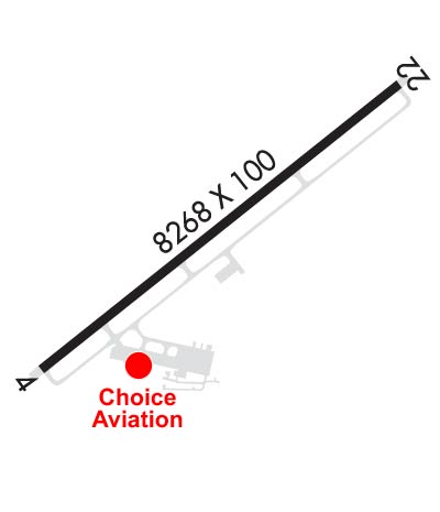
| Lat: N 4431.2 Long: W 10901.4 Elev: 5102 Var: -11 Longest Runway: 8268 | ||
| AWOS: 135.07 CTAF: 122.8 | ||
| ||||||||||||||||||||||||||||||||||||||||||||
| ||||||||||||||||||||||||||||||||||||||||||||
| ||||||||||||||||||||||||||||||||||||||||||||
| ||||||||||||||||||||||||||||||||||||||||||||
| Rwy | Rwy | |||||||
| 8268x100 | 7578' | 8268x100 | 7868' | |||||
| Runway ID | Single Wheel | Double Wheel | Double Tandem Wheel | Dual Double Wheel |
| 04/22 | 95,000 | 124,000 | 193,000 | N/A |
| These numbers are Advisory and are not limits. The Airport Manager should have more accurate Weight Limits | ||||
 Airport Diagram might not be current. | |
| Facility Name: | YELLOWSTONE RGNL |
| City Name: | CODY |
| County: | PARK |
| State abbrev: | WY |
| State Name: | WYOMING |
| Ownership: | PUBLICLY OWNED |
| Use: | OPEN TO THE PUBLIC |
| Owner's Name: | CITY OF CODY |
| Address: | 1338 RUMSEY AVE |
| CODY, WY 82414 | |
| Owner's Phone: | 307-527-7511 |
| Manager's Name: | AARON BUCK |
| Address: | 2101 ROGER SEDAM DRIVE, SUITE 1 |
| CODY, WY 82414 | |
| Phone: | 307-587-5096 |
| FAA Region: | NORTHWEST MOUNTAIN |
| FAA Field Office: | DEN |
| Date | Sunrise | Sunset |
|---|---|---|
| 06/12/26 Friday | 5:31 | 21:01 |
| 06/13/26 Saturday | 5:31 | 21:02 |
| 06/14/26 Sunday | 5:31 | 21:02 |
| 06/15/26 Monday | 5:31 | 21:03 |
| 06/16/26 Tuesday | 5:31 | 21:03 |
| 06/17/26 Wednesday | 5:31 | 21:03 |
| 06/18/26 Thursday | 5:31 | 21:04 |
| 06/19/26 Friday | 5:31 | 21:04 |
| 06/20/26 Saturday | 5:31 | 21:04 |
| 06/21/26 Sunday | 5:31 | 21:05 |
| 06/22/26 Monday | 5:31 | 21:05 |
| 06/23/26 Tuesday | 5:32 | 21:05 |
| 06/24/26 Wednesday | 5:32 | 21:05 |
| 06/25/26 Thursday | 5:32 | 21:05 |
| Airport Attendance Schedule | 7 Days A Week 0500-2200 |
| Airport Status | OPERATIONAL (This Status can change at any time - please check NOTAMS) |
| Airport Lighting Schedule | ACTVT MALSF RWY 04; MALSR RWY 22; REIL 22; PAPI RWY 04 & 22; HIRL RWY 04/22 - CTAF. |
| Airport Storage Available | Tie Downs, Hanger |
| Extra Services Available | Air Freight, Crop Dusting, Charter, Flight Instruction, Aircraft Rental, Aircraft Sales |
| Wind Indicator | YES - (lighted) |
| Control Tower | NO |
| CTAF Frequency | 122.800 |
| Unicom Frequency | 122.800 |
| Rotating Beacon Color | WG |
| Segmented Circle | YES |
| Landing Fee | YES; LANDING FEE FOR ACFT OVER 9000 LBS |
| Airport Inspected | FEDERAL - performed by FAA AIRPORTS FIELD PERSONNEL |
| Inspection Date | 07/25/2025 |
| Type of Fuel Available | Grade 100, Grade 100LL, JET A (freeze point -40C), JET A |
| Airframe Repair Service | MAJOR |
| Power Plant Repair Service | MAJOR |
| Latitude | N4431.2 |
| Longitude | W10901.4 (ESTIMATED) |
| Arpt Elevation | 5102ft (SURVEYED) |
| Magnetic Variation | 11E |
| 2 miles SE | of CODY |
| Traffic Pattern Altitude | |
| Sectional Chart | GREAT FALLS |
| Operations (Reported) | Yearly | Avg. Daily |
|---|---|---|
| General Aviation Transient | 0 | 0 |
| General Aviation Local | 0 | 0 |
| Air Taxi | 0 | 0 |
| Commerical | 0 | 0 |
| Commuter | 0 | 0 |
| Military | 0 | 0 |
| Aircraft based on Field | |
|---|---|
| General Aviation Singles | 0 |
| General Aviation Multi | 0 |
| Jet Aircraft | 0 |
| General Aviation Helicopters | 0 |
| Military Aircraft | 0 |
| Gliders | 0 |
| Ultralights | 0 |
| FSS on field | NO |
| FSS tie-in | CASPER |
| FSS Phone | 1-800-WX-BRIEF |
| Who issues Notams | COD |
| Notam D service at airport | YES |
| ARTCC Name | SALT LAKE CITY |
| Airport Certification | AIRPORT RECEIVING SCHEDULED AIR CARRIER SERVICE FROM CARRIERS CERTIFICATED BY THE CIVIL AERONAUTICS BOARD; CLSD TO UNSKED ACR OPNS WITH MORE THAN 30 PSGR SEATS EXCP PPR CALL ARPT OPS 307-899-5096. |
| Aircraft Rescue & Firefighting Index | AIRPORT HAS A CERTIFICATE UNDER CFR PART 139 |
| Airport of Entry | No |
| Custom Landing Rights | No |
| Joint Civil/Military | No |
| Military Landing rights | YES |
| NATIONAL PLAN OF INTEGRATED AIRPORT SYSTEMS (NPIAS) |
| GRANT AGREEMENTS UNDER FAAP/ADAP/AIP |
| ASSURANCES PURSUANT TO TITLE VI, CIVIL RIGHTS ACT OF 1964 |
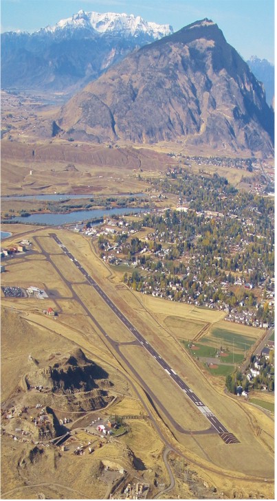
| LOW LEVEL WATERFOWL ON LAKE 1/4 MILE 'SE' OF RY 4 THLD. |
| CALL OUT AFTER HRS SVC FM CHOICE AVIATION IS 307-587-9262. |
| AIRFIELD SFC CONDS ARE NOT MNTND BTWN HRS OF 2300 - 0500. |
| COLD TEMPERATURE AIRPORT. ALTITUDE CORRECTION REQUIRED AT OR BELOW -9C. |
| FOR CD IF UNA TO CTC ON FSS FREQ, CTC SALT LAKE ARTCC AT 801-320-2568. |
| RWY 04/2 2 PCR VALUE: 300/F/D/X/T |
Airport Communications & Frequencies:
| |||||||||
| Runway: 04 | Runway: 22 | ||
| Mag heading: | 41° | Mag heading: | 221° |
| Rwy Slope: | -.33% Down | Rwy Slope: | .33% Up |
| Approach: | Approach: | ||
| Pattern: | Left Traffic | Pattern: | Left Traffic |
| Markings: | PRECISION INSTRUMENT | Markings: | PRECISION INSTRUMENT |
| Marking Condition: | GOOD | Marking Condition: | GOOD |
| Arresting Dev: | Arresting Dev: | ||
| Lat & Long: | N4430.8 W10902.2 | Lat. & Long.: | N4431.6 W10900.7 |
| Elev: | 5102.3 ft. MSL | Elev: | 5075.1 ft. MSL |
| TCH: | 73 ft. AGL | TCH: | 77 ft. AGL |
| Visual Glide Path: | 3.50 degrees | Visual Glide Path: | 3.00 degrees |
| Displaced Threshold: | 690 feet | Displaced Threshold: | 400 feet |
| Touchdown Zone: | YES | Touchdown Zone: | YES |
| Touchdown Elev.: | 5096.7 feet | Touchdown Elev.: | 5075.8 feet |
| Visual Glide Slope: | 4-Light PAPI on LEFT side of Runway; PAPI UNUSBL BYD 4.0 NM DUE TO RPDLY RSG TRRN N OF FINAL TO RWY 04 | Visual Glide Slope: | 4-Light PAPI on LEFT side of Runway |
| RVR Equipment: | RVR Equipment: | ||
| RVV Equipment: | NO | RVV Equipment: | NO |
| Approach Lights: | MALSF - 1,400 foot medium intensity approach lighting system with sequenced flashers | Approach Lights: | MALSR - 1,400 foot medium intensity approach lighting system with runway alignment indicator lights |
| REIL: | YES | REIL: | YES |
| Centerline Lights: | NO | Centerline Lights: | NO |
| Touchdown lights: | NO | Touchdown lights: | NO |
| Runway Category: | Runway with a Non-precision Approach having visibility minimums greater than 3/4 mile | Runway Category: | Runway with a Non-precision Approach having visibility minimums greater than 3/4 mile |
| Declared Distances: | TORA:8268' TODA:8268' ASDA:7868' LDA:7178' | Declared Distances: | TORA:8268' TODA:8268' ASDA:7578' LDA:7178' |
| Obstructions: | POLE | Obstructions: | GND |
| Marked: | NOT Marked/Lighted | Marked: | NOT Marked/Lighted |
| Clearance slope: | 35:1 | Clearance slope: | 34:1 |
| Obstruction height: | 15 feet AGL | Obstruction height: | 55 feet AGL |
| Dist. from runway: | 731 feet; +345 FT POLES ON HILL ON CNTRLN EXTDD. | Dist. from runway: | 2087 feet; +84 FT POLES ON HILL ON CNTRLN EXTDD. |
| Centerline offset: | 240 left of centerline | Centerline offset: | 404 feet left of centerline |
| Comments: | Comments: |
Thanks for using FltPlan.com
all rights reserved © 1999-2026 by Flight Plan LLC