
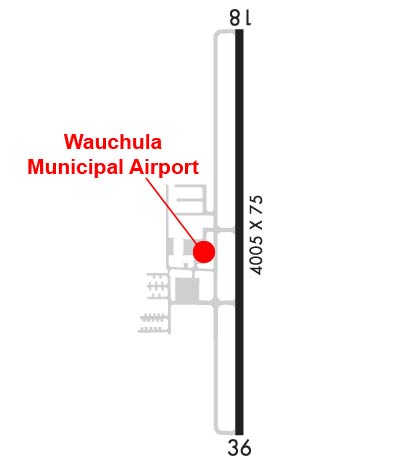
| WAUCHULA MUNI WAUCHULA FL |
| |
| Lat: N 2730.9 Long: W 08152.8 Elev: 108 Var: +04 Longest Runway: 4005 | ||
| CTAF: 122.9 | ||
| ||||||||||||||||||||||||||||||||||||||||||||||||||||||||||||||||||||
| ||||||||||||||||||||||||||||||||||||||||||||||||||||||||||||||||||||
| Rwy | Rwy | |||||||
| 4005x75 | 4005' | 4005x75 | 4005' | |||||
| Runway ID | Single Wheel | Double Wheel | Double Tandem Wheel | Dual Double Wheel |
| 18/36 | 24,000 | 39,000 | N/A | N/A |
| These numbers are Advisory and are not limits. The Airport Manager should have more accurate Weight Limits | ||||
 Airport Diagram might not be current. | |
| Facility Name: | WAUCHULA MUNI |
| City Name: | WAUCHULA |
| County: | HARDEE |
| State abbrev: | FL |
| State Name: | FLORIDA |
| Ownership: | PUBLICLY OWNED |
| Use: | OPEN TO THE PUBLIC |
| Owner's Name: | CITY OF WAUCHULA; CTC PERSON: OLIVIA MINSHEW |
| Address: | 126 S 7TH AVE. |
| WAUCHULA, FL 33873 | |
| Owner's Phone: | 863-773-3131 |
| Manager's Name: | WARD GRIMES; AIRPORT PHYSICAL ADDRESS: 1202 MAURICE SONNY CLAVEL ROAD. |
| Address: | 1202 MAURICE SONNY CLAVEL RD. |
| WAUCHULA, FL 33873 | |
| Phone: | 863-773-3115 |
| FAA Region: | SOUTHERN |
| FAA Field Office: | ORL |
| Date | Sunrise | Sunset |
|---|---|---|
| 06/08/26 Monday | 6:32 | 20:22 |
| 06/09/26 Tuesday | 6:32 | 20:22 |
| 06/10/26 Wednesday | 6:32 | 20:22 |
| 06/11/26 Thursday | 6:32 | 20:23 |
| 06/12/26 Friday | 6:32 | 20:23 |
| 06/13/26 Saturday | 6:32 | 20:23 |
| 06/14/26 Sunday | 6:32 | 20:24 |
| 06/15/26 Monday | 6:32 | 20:24 |
| 06/16/26 Tuesday | 6:32 | 20:24 |
| 06/17/26 Wednesday | 6:32 | 20:25 |
| 06/18/26 Thursday | 6:32 | 20:25 |
| 06/19/26 Friday | 6:32 | 20:25 |
| 06/20/26 Saturday | 6:33 | 20:26 |
| 06/21/26 Sunday | 6:33 | 20:26 |
| Airport Attendance Schedule | UNATTND |
| Airport Status | OPERATIONAL (This Status can change at any time - please check NOTAMS) |
| Airport Lighting Schedule | ACTVT REIL RWY 18 & 36; MIRL RWY 18/36 - CTAF. |
| Airport Storage Available | Tie Downs |
| Extra Services Available | Crop Dusting, Parachute Jumping |
| Wind Indicator | YES - (lighted) |
| Control Tower | NO |
| CTAF Frequency | 122.900 |
| Unicom Frequency | |
| Rotating Beacon Color | WG |
| Segmented Circle | Y-L |
| Landing Fee | NO |
| Airport Inspected | STATE - performed by STATE AERONAUTICAL PERSONNEL |
| Inspection Date | 07/16/2025 |
| Type of Fuel Available | Grade 100LL; -10FUEL 24 HR CREDIT CARD SVC AVBL. |
| Airframe Repair Service | MINOR |
| Power Plant Repair Service | MINOR |
| Latitude | N2730.9 |
| Longitude | W08152.8 (ESTIMATED) |
| Arpt Elevation | 107ft (SURVEYED) |
| Magnetic Variation | 04W |
| 5 miles SW | of WAUCHULA |
| Traffic Pattern Altitude | |
| Sectional Chart | MIAMI |
| Operations (Reported) | Yearly | Avg. Daily |
|---|---|---|
| General Aviation Transient | 0 | 0 |
| General Aviation Local | 0 | 0 |
| Air Taxi | 0 | 0 |
| Commerical | 0 | 0 |
| Commuter | 0 | 0 |
| Military | 0 | 0 |
| Aircraft based on Field | |
|---|---|
| General Aviation Singles | 0 |
| General Aviation Multi | 0 |
| Jet Aircraft | 0 |
| General Aviation Helicopters | 0 |
| Military Aircraft | 0 |
| Gliders | 0 |
| Ultralights | 0 |
| FSS on field | NO |
| FSS tie-in | SAINT PETERSBURG |
| FSS Phone | 1-800-WX-BRIEF |
| Who issues Notams | PIE |
| Notam D service at airport | YES |
| ARTCC Name | MIAMI |
| Airport Certification | |
| Aircraft Rescue & Firefighting Index | None |
| Airport of Entry | No |
| Custom Landing Rights | No |
| Joint Civil/Military | No |
| Military Landing rights | No |
| NATIONAL PLAN OF INTEGRATED AIRPORT SYSTEMS (NPIAS) |
| GRANT AGREEMENTS UNDER FAAP/ADAP/AIP |
| ASSURANCES PURSUANT TO TITLE VI, CIVIL RIGHTS ACT OF 1964 |
| FOR CD CTC MIAMI ARTCC AT 305-716-1731. |
Airport Communications & Frequencies:
| |||||||
| Runway: 18 | Runway: 36 | ||
| Mag heading: | 184° | Mag heading: | 4° |
| Rwy Slope: | .10% Up | Rwy Slope: | -.10% Down |
| Approach: | Approach: | ||
| Pattern: | Left Traffic | Pattern: | Left Traffic |
| Markings: | NONPRECISION INSTRUMENT | Markings: | NONPRECISION INSTRUMENT |
| Marking Condition: | FAIR | Marking Condition: | FAIR |
| Arresting Dev: | Arresting Dev: | ||
| Lat & Long: | N2731.2 W08152.8 | Lat. & Long.: | N2730.6 W08152.8 |
| Elev: | 99.3 ft. MSL | Elev: | 103.3 ft. MSL |
| TCH: | 47 ft. AGL | TCH: | 48 ft. AGL |
| Visual Glide Path: | 4.00 degrees | Visual Glide Path: | 3.00 degrees |
| Displaced Threshold: | No | Displaced Threshold: | No |
| Touchdown Zone: | YES | Touchdown Zone: | YES |
| Touchdown Elev.: | 107.8 feet | Touchdown Elev.: | 107.8 feet |
| Visual Glide Slope: | 4-Light PAPI on LEFT side of Runway | Visual Glide Slope: | 4-Light PAPI on LEFT side of Runway |
| RVR Equipment: | RVR Equipment: | ||
| RVV Equipment: | NO | RVV Equipment: | NO |
| Approach Lights: | Approach Lights: | ||
| REIL: | YES | REIL: | YES |
| Centerline Lights: | NO | Centerline Lights: | NO |
| Touchdown lights: | NO | Touchdown lights: | NO |
| Runway Category: | Runway with a Non-precision Approach | Runway Category: | Runway with a Non-precision Approach |
| Declared Distances: | Declared Distances: | ||
| Obstructions: | TREES | Obstructions: | BRUSH |
| Marked: | NOT Marked/Lighted | Marked: | NOT Marked/Lighted |
| Clearance slope: | 16:1 | Clearance slope: | 1:1 |
| Obstruction height: | 24 feet AGL | Obstruction height: | 5 feet AGL |
| Dist. from runway: | 600 feet | Dist. from runway: | 205 feet |
| Centerline offset: | 125 left of centerline | Centerline offset: | 225 feet right of centerline |
| Comments: | Comments: |
Thanks for using FltPlan.com
all rights reserved © 1999-2026 by Flight Plan LLC


