| CORTEZ MUNI CORTEZ CO |
| |
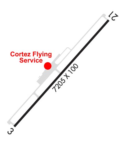
| Lat: N 3718.2 Long: W 10837.7 Elev: 5918 Var: -12 Longest Runway: 7205 | ||
| AWOS: 135.62 CTAF: 122.8 | ||
| |||||||||||||||||||||||||||||||||||||||||||||||||||||||||||||
| |||||||||||||||||||||||||||||||||||||||||||||||||||||||||||||
| |||||||||||||||||||||||||||||||||||||||||||||||||||||||||||||
| Rwy | Rwy | |||||||
| 7205x100 | 7205' | 7205x100 | 7205' | |||||
| Runway ID | Single Wheel | Double Wheel | Double Tandem Wheel | Dual Double Wheel |
| 03/21 | 40,000 | 56,000 | N/A | N/A |
| These numbers are Advisory and are not limits. The Airport Manager should have more accurate Weight Limits | ||||
 Airport Diagram might not be current. | |
| Facility Name: | CORTEZ MUNI |
| City Name: | CORTEZ |
| County: | MONTEZUMA |
| State abbrev: | CO |
| State Name: | COLORADO |
| Ownership: | PUBLICLY OWNED |
| Use: | OPEN TO THE PUBLIC |
| Owner's Name: | CITY OF CORTEZ |
| Address: | 123 ROGER SMITH AVE. |
| CORTEZ, CO 81321 | |
| Owner's Phone: | (970) 565-7458 |
| Manager's Name: | JEREMY PATTON |
| Address: | 123 ROGER SMITH AVE. |
| CORTEZ, CO 81321 | |
| Phone: | 970-565-7458 |
| FAA Region: | NORTHWEST MOUNTAIN |
| FAA Field Office: | DEN |
| Date | Sunrise | Sunset |
|---|---|---|
| 04/18/24 Thursday | 6:35 | 19:53 |
| 04/19/24 Friday | 6:33 | 19:54 |
| 04/20/24 Saturday | 6:32 | 19:55 |
| 04/21/24 Sunday | 6:31 | 19:56 |
| 04/22/24 Monday | 6:30 | 19:57 |
| 04/23/24 Tuesday | 6:28 | 19:58 |
| 04/24/24 Wednesday | 6:27 | 19:59 |
| 04/25/24 Thursday | 6:26 | 19:59 |
| 04/26/24 Friday | 6:25 | 20:00 |
| 04/27/24 Saturday | 6:23 | 20:01 |
| 04/28/24 Sunday | 6:22 | 20:02 |
| 04/29/24 Monday | 6:21 | 20:03 |
| 04/30/24 Tuesday | 6:20 | 20:04 |
| 05/01/24 Wednesday | 6:19 | 20:05 |
| Airport Attendance Schedule | 7 Days A Week DAWN-DUSK |
| Airport Status | OPERATIONAL (This Status can change at any time - please check NOTAMS) |
| Airport Lighting Schedule | ACTVT REIL RWY 03 & 21; MIRL RWY 03/21 - CTAF. PAPI RWY 03 & VASI RWY 21 ON CONSLY. |
| Airport Storage Available | Tie Downs, Hanger |
| Extra Services Available | Charter, Flight Instruction, Aircraft Rental, Aircraft Sales |
| Wind Indicator | YES - (lighted) |
| Control Tower | NO |
| CTAF Frequency | 122.800 |
| Unicom Frequency | 122.800 |
| Rotating Beacon Color | WG |
| Segmented Circle | YES |
| Landing Fee | YES |
| Airport Inspected | FEDERAL - performed by STATE AERONAUTICAL PERSONNEL |
| Inspection Date | 06/21/2021 |
| Type of Fuel Available | Grade 100LL, JET A (freeze point -40C) |
| Airframe Repair Service | MAJOR |
| Power Plant Repair Service | MAJOR |
| Latitude | N3718.2 |
| Longitude | W10837.7 (ESTIMATED) |
| Arpt Elevation | 5917ft (SURVEYED) |
| Magnetic Variation | 12E |
| 3 miles SW | of CORTEZ |
| Traffic Pattern Altitude | |
| Sectional Chart | DENVER |
| Operations (Reported) | Yearly | Avg. Daily |
|---|---|---|
| General Aviation Transient | 5500 | 15 |
| General Aviation Local | 3000 | 8 |
| Air Taxi | 1304 | 4 |
| Commerical | 0 | 0 |
| Commuter | 0 | 0 |
| Military | 30 | 0 |
| Aircraft based on Field | |
|---|---|
| General Aviation Singles | 38 |
| General Aviation Multi | 1 |
| Jet Aircraft | 1 |
| General Aviation Helicopters | 3 |
| Military Aircraft | 0 |
| Gliders | 0 |
| Ultralights | 0 |
| FSS on field | NO |
| FSS tie-in | DENVER |
| FSS Phone | 1-800-WX-BRIEF |
| Who issues Notams | CEZ |
| Notam D service at airport | YES |
| ARTCC Name | DENVER |
| Airport Certification | PPR FOR UNSKED ACR OPS WITH MORE THAN 30 PAX SEATS - AMGR. |
| Aircraft Rescue & Firefighting Index | None |
| Airport of Entry | No |
| Custom Landing Rights | No |
| Joint Civil/Military | No |
| Military Landing rights | YES |
| NATIONAL PLAN OF INTEGRATED AIRPORT SYSTEMS (NPIAS) |
| GRANT AGREEMENTS UNDER FAAP/ADAP/AIP |
| ASSURANCES PURSUANT TO TITLE VI, CIVIL RIGHTS ACT OF 1964 |
| ACFT GTR THAN 20000 LBS DUAL WHEEL RSTRD TO TWY CONNECTOR A2; BACK TAXI ON RWY TO & FM TWY CONNECTOR A2 TO APRON. |
| FOR CD CTC DENVER ARTCC ON FREQ. IF UNA, CTC FSS ON FREQ VIA RCO. IF UNA, CTC DENVER ARTCC AT 303-651-4257. |
Airport Communications & Frequencies:
| |||||||||
| Runway: 03 | Runway: 21 | ||
| Mag heading: | 30° | Mag heading: | 210° |
| Rwy Slope: | -.06% Down | Rwy Slope: | .06% Up |
| Approach: | Approach: | ||
| Pattern: | Left Traffic | Pattern: | Left Traffic |
| Markings: | NONPRECISION INSTRUMENT | Markings: | NONPRECISION INSTRUMENT |
| Marking Condition: | GOOD | Marking Condition: | GOOD |
| Arresting Dev: | Arresting Dev: | ||
| Lat & Long: | N3717.7 W10838.2 | Lat. & Long.: | N3718.6 W10837.2 |
| Elev: | 5913.2 ft. MSL | Elev: | 5909.2 ft. MSL |
| TCH: | 47 ft. AGL | TCH: | 50 ft. AGL |
| Visual Glide Path: | 3.00 degrees | Visual Glide Path: | 3.00 degrees |
| Displaced Threshold: | No | Displaced Threshold: | No |
| Touchdown Zone: | YES | Touchdown Zone: | YES |
| Touchdown Elev.: | 5917.6 feet | Touchdown Elev.: | 5912.8 feet |
| Visual Glide Slope: | 4-Light PAPI on LEFT side of Runway | Visual Glide Slope: | 4-BOX VASI ON LEFT SIDE OF RUNWAY |
| RVR Equipment: | RVR Equipment: | ||
| RVV Equipment: | NO | RVV Equipment: | NO |
| Approach Lights: | Approach Lights: | ||
| REIL: | YES | REIL: | YES |
| Centerline Lights: | NO | Centerline Lights: | NO |
| Touchdown lights: | NO | Touchdown lights: | NO |
| Runway Category: | Runway with a Non-precision Approach having visibility minimums greater than 3/4 mile | Runway Category: | Runway with a Non-precision Approach having visibility minimums greater than 3/4 mile |
| Declared Distances: | TORA:7205' TODA:7205' ASDA:7205' LDA:7205' | Declared Distances: | TORA:7205' TODA:7205' ASDA:7205' LDA:7205' |
| Obstructions: | TREES | Obstructions: | ROAD |
| Marked: | NOT Marked/Lighted | Marked: | NOT Marked/Lighted |
| Clearance slope: | 30:1 | Clearance slope: | 30:1 |
| Obstruction height: | 59 feet AGL | Obstruction height: | 16 feet AGL |
| Dist. from runway: | 2000 feet; 133 FT POLE ON CNTRLN. | Dist. from runway: | 680 feet |
| Centerline offset: | 350 right of centerline | Centerline offset: | 300 feet right of centerline |
| Comments: | Comments: |
Thanks for using FltPlan.com
all rights reserved © 1999-2024 by Flight Plan LLC