
| LOWELL LOWELL IN |
| |
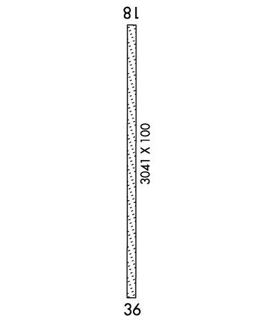
| Lat: N 4113.8 Long: W 08730.5 Elev: 672 Var: +01 Longest Runway: 3041 | ||
| CTAF: 122.9 | ||
| ||||||||||||||||||||||||||||||||||||||||||||
| ||||||||||||||||||||||||||||||||||||||||||||
| Rwy | Rwy | |||||||
| 3041x100 | 2266' | 3041x100 | 3041' | |||||
| Runway ID | Single Wheel | Double Wheel | Double Tandem Wheel | Dual Double Wheel |
| 18/36 | N/A | N/A | N/A | N/A |
| These numbers are Advisory and are not limits. The Airport Manager should have more accurate Weight Limits | ||||
| FltPlan does not have IFR approach charts available for KC97. |
 Airport Diagram might not be current. | |
| Facility Name: | LOWELL |
| City Name: | LOWELL |
| County: | LAKE |
| State abbrev: | IN |
| State Name: | INDIANA |
| Ownership: | PRIVATELY OWNED |
| Use: | OPEN TO THE PUBLIC |
| Owner's Name: | DONALD E. BAILEY |
| Address: | 14705 BELSHAW RD. |
| LOWELL, IN 46356 | |
| Owner's Phone: | (219) 614-6633 |
| Manager's Name: | KEVIN BAILEY |
| Address: | 14705 BELSHAW RD |
| LOWELL, IN 46356 | |
| Phone: | (219) 614-6633 |
| FAA Region: | GREAT LAKES |
| FAA Field Office: | CHI |
| Date | Sunrise | Sunset |
|---|---|---|
| 06/08/26 Monday | 5:17 | 20:21 |
| 06/09/26 Tuesday | 5:17 | 20:22 |
| 06/10/26 Wednesday | 5:17 | 20:22 |
| 06/11/26 Thursday | 5:17 | 20:23 |
| 06/12/26 Friday | 5:17 | 20:23 |
| 06/13/26 Saturday | 5:16 | 20:24 |
| 06/14/26 Sunday | 5:16 | 20:24 |
| 06/15/26 Monday | 5:16 | 20:25 |
| 06/16/26 Tuesday | 5:16 | 20:25 |
| 06/17/26 Wednesday | 5:17 | 20:25 |
| 06/18/26 Thursday | 5:17 | 20:26 |
| 06/19/26 Friday | 5:17 | 20:26 |
| 06/20/26 Saturday | 5:17 | 20:26 |
| 06/21/26 Sunday | 5:17 | 20:26 |
| Airport Attendance Schedule | IRREGULAR |
| Airport Status | OPERATIONAL (This Status can change at any time - please check NOTAMS) |
| Airport Lighting Schedule | |
| Airport Storage Available | Tie Downs, Hanger |
| Extra Services Available | Flight Instruction, Aircraft Rental |
| Wind Indicator | YES - (unlit) |
| Control Tower | NO |
| CTAF Frequency | 122.900 |
| Unicom Frequency | |
| Rotating Beacon Color | |
| Segmented Circle | YES |
| Landing Fee | YES |
| Airport Inspected | STATE - performed by STATE AERONAUTICAL PERSONNEL |
| Inspection Date | 05/27/2021 |
| Type of Fuel Available | Grade 100LL |
| Airframe Repair Service | MAJOR |
| Power Plant Repair Service | MAJOR |
| Latitude | N4113.8 |
| Longitude | W08730.5 (ESTIMATED) |
| Arpt Elevation | 671ft (ESTIMATED) |
| Magnetic Variation | 01W |
| 5 miles SW | of LOWELL |
| Traffic Pattern Altitude | |
| Sectional Chart | CHICAGO |
| Operations (Reported) | Yearly | Avg. Daily |
|---|---|---|
| General Aviation Transient | 0 | 0 |
| General Aviation Local | 0 | 0 |
| Air Taxi | 0 | 0 |
| Commerical | 0 | 0 |
| Commuter | 0 | 0 |
| Military | 0 | 0 |
| Aircraft based on Field | |
|---|---|
| General Aviation Singles | 0 |
| General Aviation Multi | 0 |
| Jet Aircraft | 0 |
| General Aviation Helicopters | 0 |
| Military Aircraft | 0 |
| Gliders | 0 |
| Ultralights | 0 |
| FSS on field | NO |
| FSS tie-in | TERRE HAUTE |
| FSS Phone | 1-800-WX-BRIEF |
| Who issues Notams | HUF |
| Notam D service at airport | YES |
| ARTCC Name | CHICAGO |
| Airport Certification | |
| Aircraft Rescue & Firefighting Index | None |
| Airport of Entry | No |
| Custom Landing Rights | No |
| Joint Civil/Military | No |
| Military Landing rights | No |
| SNOW REMOVAL & MOWING WITH LARGE TRACTOR . |
| DEER ON & INVOF ARPT. |
| CALL FOR FUEL OR SVC BFR ARR - 219-613-4588. |
| FOR CD CTC CHICAGO ARTCC AT 630-906-8921. |
| RWY 18/3 6 CROPS 75 FT E & 87 FT W OF CNTRLN. |
Airport Communications & Frequencies:
| |||||||
| Runway: 18 | Runway: 36 | ||
| Mag heading: | 181° | Mag heading: | 1° |
| Rwy Slope: | -.72% Down | Rwy Slope: | .72% Up |
| Approach: | Approach: | ||
| Pattern: | Right Traffic | Pattern: | Left Traffic |
| Markings: | NONSTANDARD | Markings: | NONSTANDARD |
| Marking Condition: | FAIR; WHITE BARREL HALVES & LGT FIXTURES. | Marking Condition: | FAIR; WHITE BARREL HALVES & LGT FIXTURES. |
| Arresting Dev: | Arresting Dev: | ||
| Lat & Long: | N4114.1 W08730.5 | Lat. & Long.: | N4113.6 W08730.5 |
| Elev: | 671.8 ft. MSL | Elev: | 650.0 ft. MSL |
| TCH: | TCH: | ||
| Visual Glide Path: | Visual Glide Path: | ||
| Displaced Threshold: | 775 feet | Displaced Threshold: | No |
| Touchdown Zone: | YES | Touchdown Zone: | YES |
| Touchdown Elev.: | 671.8 feet | Touchdown Elev.: | 671.8 feet |
| Visual Glide Slope: | Visual Glide Slope: | ||
| RVR Equipment: | RVR Equipment: | ||
| RVV Equipment: | NO | RVV Equipment: | NO |
| Approach Lights: | Approach Lights: | ||
| REIL: | NO | REIL: | NO |
| Centerline Lights: | NO | Centerline Lights: | NO |
| Touchdown lights: | NO | Touchdown lights: | NO |
| Runway Category: | Runway with a Visual Approach | Runway Category: | Runway with a Visual Approach |
| Declared Distances: | Declared Distances: | ||
| Obstructions: | CROPS | Obstructions: | CROPS |
| Marked: | NOT Marked/Lighted | Marked: | NOT Marked/Lighted |
| Clearance slope: | APCH SLOPE 15:1 FM DSPLCD THR; 65 FT TREE 985 FT & 110 FT R. | Clearance slope: | |
| Obstruction height: | 10 feet AGL | Obstruction height: | 10 feet AGL |
| Dist. from runway: | 0 feet | Dist. from runway: | 0 feet |
| Centerline offset: | Centerline offset: | ||
| Comments: | Comments: |
Thanks for using FltPlan.com
all rights reserved © 1999-2026 by Flight Plan LLC
