
| BULT FIELD MONEE IL |
| |
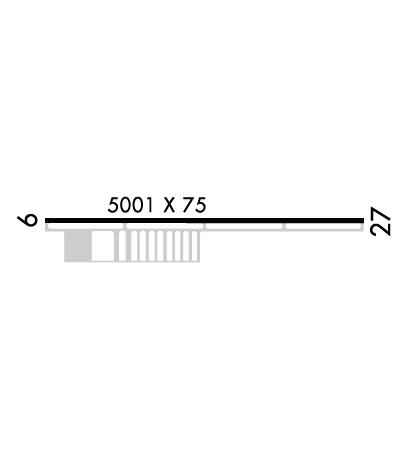
| Lat: N 4122.6 Long: W 08740.8 Elev: 790 Var: +03 Longest Runway: 5001 | ||
| CTAF: 123.0 | ||
| ||||||||||||||||||||||||||||||||||||||||||||
| ||||||||||||||||||||||||||||||||||||||||||||
| Rwy | Rwy | |||||||
| 5001x75 | 5001' | 5001x75 | 4850' | |||||
| Runway ID | Single Wheel | Double Wheel | Double Tandem Wheel | Dual Double Wheel |
| 09/27 | 60,000 | N/A | N/A | N/A |
| These numbers are Advisory and are not limits. The Airport Manager should have more accurate Weight Limits | ||||
 Airport Diagram might not be current. | |
| Facility Name: | BULT FLD |
| City Name: | MONEE |
| County: | WILL |
| State abbrev: | IL |
| State Name: | ILLINOIS |
| Ownership: | PUBLICLY OWNED |
| Use: | OPEN TO THE PUBLIC |
| Owner's Name: | IL DEPT OF TRANSPORTATION |
| Address: | 5710 NW EAGLE LAKE RD |
| PEOTONE, IL 60468 | |
| Owner's Phone: | 708-534-8282 |
| Manager's Name: | KEN MARTIN |
| Address: | 28261 SOUTH KEDZIE AVE; EMAIL ADDRESS: MTHOMPSON@BULTFIELD.COM (ALL LOWER CASE) |
| MONEE, IL 60449 | |
| Phone: | (708) 534-8282 |
| FAA Region: | GREAT LAKES |
| FAA Field Office: | CHI |
| Date | Sunrise | Sunset |
|---|---|---|
| 09/24/21 Friday | 6:40 | 18:45 |
| 09/25/21 Saturday | 6:41 | 18:43 |
| 09/26/21 Sunday | 6:42 | 18:41 |
| 09/27/21 Monday | 6:43 | 18:40 |
| 09/28/21 Tuesday | 6:44 | 18:38 |
| 09/29/21 Wednesday | 6:45 | 18:36 |
| 09/30/21 Thursday | 6:46 | 18:35 |
| 10/01/21 Friday | 6:47 | 18:33 |
| 10/02/21 Saturday | 6:48 | 18:31 |
| 10/03/21 Sunday | 6:49 | 18:30 |
| 10/04/21 Monday | 6:50 | 18:28 |
| 10/05/21 Tuesday | 6:51 | 18:26 |
| 10/06/21 Wednesday | 6:52 | 18:25 |
| 10/07/21 Thursday | 6:54 | 18:23 |
| Airport Attendance Schedule | 7 Days A Week 0800-1700; 708-534-8282 |
| Airport Status | OPERATIONAL (This Status can change at any time - please check NOTAMS) |
| Airport Lighting Schedule | SS-SR |
| Airport Storage Available | Tie Downs, Hanger |
| Extra Services Available | NONE |
| Wind Indicator | YES - (unlit) |
| Control Tower | NO |
| CTAF Frequency | 123.000 |
| Unicom Frequency | 123.000 |
| Rotating Beacon Color | |
| Segmented Circle | NO |
| Landing Fee | NO |
| Airport Inspected | STATE - performed by STATE AERONAUTICAL PERSONNEL |
| Inspection Date | 08/31/2018 |
| Type of Fuel Available | Grade 100LL, JET A (freeze point -40C); -10100LL FUEL AVBL H24 W/CREDIT CARD.; -A JET A AVBL AFT HR WITH PRIOR ARRANGEMENT |
| Airframe Repair Service | None |
| Power Plant Repair Service | None |
| Latitude | N4122.6 |
| Longitude | W08740.8 (ESTIMATED) |
| Arpt Elevation | 790ft (SURVEYED) |
| Magnetic Variation | 03W |
| 3 miles SE | of MONEE |
| Traffic Pattern Altitude | |
| Sectional Chart | CHICAGO |
| Operations (Reported) | Yearly | Avg. Daily |
|---|---|---|
| General Aviation Transient | 9900 | 27 |
| General Aviation Local | 3300 | 9 |
| Air Taxi | 100 | 0 |
| Commerical | 0 | 0 |
| Commuter | 0 | 0 |
| Military | 0 | 0 |
| Aircraft based on Field | |
|---|---|
| General Aviation Singles | 59 |
| General Aviation Multi | 3 |
| Jet Aircraft | 1 |
| General Aviation Helicopters | 1 |
| Military Aircraft | 0 |
| Gliders | 2 |
| Ultralights | 0 |
| FSS on field | NO |
| FSS tie-in | KANKAKEE |
| FSS Phone | 1-800-WX-BRIEF |
| Who issues Notams | IKK |
| Notam D service at airport | YES |
| ARTCC Name | CHICAGO |
| Airport Certification | |
| Aircraft Rescue & Firefighting Index | None |
| Airport of Entry | No |
| Custom Landing Rights | No |
| Joint Civil/Military | No |
| Military Landing rights | No |
| NATIONAL PLAN OF INTEGRATED AIRPORT SYSTEMS (NPIAS) |
| BIRDS AND ANIMALS ON AND INVOF OF ARPT. |
| FOR CD CTC CHICAGO ARTCC AT 630-906-8921. |
| RWY 27 CALM WND RWY. |
Airport Communications & Frequencies:
| |||||||||
| Runway: 09 | Runway: 27 | ||
| Mag heading: | 92° | Mag heading: | 272° |
| Rwy Slope: | -.35% Down | Rwy Slope: | .35% Up |
| Approach: | Approach: | ||
| Pattern: | Left Traffic | Pattern: | Left Traffic |
| Markings: | NONPRECISION INSTRUMENT | Markings: | NONPRECISION INSTRUMENT |
| Marking Condition: | GOOD | Marking Condition: | GOOD |
| Arresting Dev: | Arresting Dev: | ||
| Lat & Long: | N4122.6 W08741.3 | Lat. & Long.: | N4122.6 W08740.2 |
| Elev: | 790.0 ft. MSL | Elev: | 772.4 ft. MSL |
| TCH: | TCH: | ||
| Visual Glide Path: | Visual Glide Path: | ||
| Displaced Threshold: | No | Displaced Threshold: | 151 feet |
| Touchdown Zone: | YES | Touchdown Zone: | YES |
| Touchdown Elev.: | 790.2 feet | Touchdown Elev.: | 778.1 feet |
| Visual Glide Slope: | Visual Glide Slope: | ||
| RVR Equipment: | RVR Equipment: | ||
| RVV Equipment: | NO | RVV Equipment: | NO |
| Approach Lights: | Approach Lights: | ||
| REIL: | NO | REIL: | NO |
| Centerline Lights: | NO | Centerline Lights: | NO |
| Touchdown lights: | NO | Touchdown lights: | NO |
| Runway Category: | Runway with a Non-precision Approach having visibility minimums greater than 3/4 mile | Runway Category: | Runway with a Non-precision Approach having visibility minimums greater than 3/4 mile |
| Declared Distances: | Declared Distances: | ||
| Obstructions: | TREE | Obstructions: | |
| Marked: | NOT Marked/Lighted | Marked: | |
| Clearance slope: | 20:1 | Clearance slope: | 34:1 |
| Obstruction height: | 21 feet AGL | Obstruction height: | |
| Dist. from runway: | 615 feet | Dist. from runway: | |
| Centerline offset: | 287 right of centerline | Centerline offset: | |
| Comments: | 8 FT ROAD 156 FT FM RWY END ON CL. | Comments: | 12 FT ROAD 141 FT FM RWY END ON CL. EFFECTIVE HEIGHT 141 FT FM THE RY END ON CL. |
Thanks for using FltPlan.com
all rights reserved © 1999-2021 by Flight Plan LLC
