
| PEKIN MUNI PEKIN IL |
| |
| Lat: N 4029.3 Long: W 08940.6 Elev: 530 Var: +02 Longest Runway: 5000 | ||
| CTAF: 122.8 | ||
| |||||||||||||||||||||||||||||||||||||||||||||||||||||||||||||
| |||||||||||||||||||||||||||||||||||||||||||||||||||||||||||||
| Rwy | Rwy | |||||||
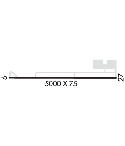
| 5000x75 | 5000' | 5000x75 | 5000' | |||||
| Runway ID | Single Wheel | Double Wheel | Double Tandem Wheel | Dual Double Wheel |
| 09/27 | 25,000 | N/A | N/A | N/A |
| These numbers are Advisory and are not limits. The Airport Manager should have more accurate Weight Limits | ||||
 Airport Diagram might not be current. | |
| Facility Name: | PEKIN MUNI |
| City Name: | PEKIN |
| County: | TAZEWELL |
| State abbrev: | IL |
| State Name: | ILLINOIS |
| Ownership: | PUBLICLY OWNED |
| Use: | OPEN TO THE PUBLIC |
| Owner's Name: | CITY OF PEKIN |
| Address: | CITY HALL 111 S. CAPITOL |
| PEKIN, IL 61554 | |
| Owner's Phone: | 309-477-2300 |
| Manager's Name: | TODD DUGAN |
| Address: | 13906 AIRPORT LANE, DIRKSEN PARKWAY |
| PEKIN, IL 61554 | |
| Phone: | 309-348-3692; CELL NUMBER 309-287-2496 |
| FAA Region: | GREAT LAKES |
| FAA Field Office: | CHI |
| Date | Sunrise | Sunset |
|---|---|---|
| 09/24/21 Friday | 6:48 | 18:53 |
| 09/25/21 Saturday | 6:49 | 18:51 |
| 09/26/21 Sunday | 6:50 | 18:50 |
| 09/27/21 Monday | 6:51 | 18:48 |
| 09/28/21 Tuesday | 6:52 | 18:46 |
| 09/29/21 Wednesday | 6:53 | 18:45 |
| 09/30/21 Thursday | 6:54 | 18:43 |
| 10/01/21 Friday | 6:55 | 18:41 |
| 10/02/21 Saturday | 6:56 | 18:40 |
| 10/03/21 Sunday | 6:57 | 18:38 |
| 10/04/21 Monday | 6:58 | 18:36 |
| 10/05/21 Tuesday | 6:59 | 18:35 |
| 10/06/21 Wednesday | 7:00 | 18:33 |
| 10/07/21 Thursday | 7:01 | 18:31 |
| Airport Attendance Schedule | MON-FRI 0800-1700 |
| Airport Status | OPERATIONAL (This Status can change at any time - please check NOTAMS) |
| Airport Lighting Schedule | ACTVT REIL RWY 09 & 27; PAPI RWY 09 & 27; MIRL RWY 09/27 PRESET ON LOW, TO INCR INTST & ACTVT - CTAF |
| Airport Storage Available | Tie Downs, Hanger |
| Extra Services Available | Crop Dusting, Air Ambulance, Aircraft Sales, Annual Surveying |
| Wind Indicator | YES - (lighted) |
| Control Tower | NO |
| CTAF Frequency | 122.800 |
| Unicom Frequency | 122.800 |
| Rotating Beacon Color | CLEAR-GREEN (Light Land Airport) |
| Segmented Circle | NO |
| Landing Fee | NO |
| Airport Inspected | STATE - performed by STATE AERONAUTICAL PERSONNEL |
| Inspection Date | 06/11/2021 |
| Type of Fuel Available | Grade 100LL, JET A (freeze point -40C) |
| Airframe Repair Service | MAJOR |
| Power Plant Repair Service | MAJOR |
| Latitude | N4029.3 |
| Longitude | W08940.6 (ESTIMATED) |
| Arpt Elevation | 530ft (SURVEYED) |
| Magnetic Variation | 02W |
| 4 miles S | of PEKIN |
| Traffic Pattern Altitude | |
| Sectional Chart | CHICAGO |
| Operations (Reported) | Yearly | Avg. Daily |
|---|---|---|
| General Aviation Transient | 4000 | 11 |
| General Aviation Local | 3000 | 8 |
| Air Taxi | 2000 | 5 |
| Commerical | 0 | 0 |
| Commuter | 0 | 0 |
| Military | 0 | 0 |
| Aircraft based on Field | |
|---|---|
| General Aviation Singles | 42 |
| General Aviation Multi | 2 |
| Jet Aircraft | 0 |
| General Aviation Helicopters | 1 |
| Military Aircraft | 0 |
| Gliders | 0 |
| Ultralights | 0 |
| FSS on field | NO |
| FSS tie-in | KANKAKEE |
| FSS Phone | 1-800-WX-BRIEF |
| Who issues Notams | IKK |
| Notam D service at airport | YES |
| ARTCC Name | CHICAGO |
| Airport Certification | |
| Aircraft Rescue & Firefighting Index | None |
| Airport of Entry | No |
| Custom Landing Rights | No |
| Joint Civil/Military | No |
| Military Landing rights | YES |
| NATIONAL PLAN OF INTEGRATED AIRPORT SYSTEMS (NPIAS) |
| GRANT AGREEMENTS UNDER FAAP/ADAP/AIP |
| ASSURANCES PURSUANT TO TITLE VI, CIVIL RIGHTS ACT OF 1964 |
| WILDLIFE INVOF ARPT. |
| ADMIN BLDG CAN BE ACCESSED BY CIPHER LOCK WHICH HAS APPLICABLE INSTRUCTIONS. |
| FOR CD CTC PEORIA APCH AT 309-697-0752, EXT 210. |
Airport Communications & Frequencies:
| ||||||||||||||
| Runway: 09 | Runway: 27 | ||
| Mag heading: | 91° | Mag heading: | 271° |
| Rwy Slope: | -.09% Down | Rwy Slope: | .09% Up |
| Approach: | Approach: | ||
| Pattern: | Left Traffic | Pattern: | Left Traffic |
| Markings: | NONPRECISION INSTRUMENT | Markings: | NONPRECISION INSTRUMENT |
| Marking Condition: | GOOD | Marking Condition: | GOOD |
| Arresting Dev: | Arresting Dev: | ||
| Lat & Long: | N4029.3 W08941.1 | Lat. & Long.: | N4029.3 W08940.0 |
| Elev: | 530.0 ft. MSL | Elev: | 525.3 ft. MSL |
| TCH: | 20 ft. AGL | TCH: | 27 ft. AGL |
| Visual Glide Path: | 3.00 degrees | Visual Glide Path: | 3.00 degrees |
| Displaced Threshold: | No | Displaced Threshold: | No |
| Touchdown Zone: | YES | Touchdown Zone: | YES |
| Touchdown Elev.: | 530.0 feet | Touchdown Elev.: | 525.4 feet |
| Visual Glide Slope: | 2-Light PAPI on LEFT side of Runway | Visual Glide Slope: | 4-Light PAPI on LEFT side of Runway |
| RVR Equipment: | RVR Equipment: | ||
| RVV Equipment: | NO | RVV Equipment: | NO |
| Approach Lights: | Approach Lights: | ||
| REIL: | YES | REIL: | YES |
| Centerline Lights: | NO | Centerline Lights: | NO |
| Touchdown lights: | NO | Touchdown lights: | NO |
| Runway Category: | Runway with a Non-precision Approach | Runway Category: | Runway with a Non-precision Approach |
| Declared Distances: | Declared Distances: |
Thanks for using FltPlan.com
all rights reserved © 1999-2021 by Flight Plan LLC

