| BARTLESVILLE MUNI BARTLESVILLE OK |
| |
| Lat: N 3645.8 Long: W 09600.7 Elev: 717 Var: -03 Longest Runway: 6850 | ||
| AWOS: 132.67 CTAF: 122.82 | ||
| ||||||||||||||||||||||||||||||||||||||||||||||||||||||||||||||||||||
| ||||||||||||||||||||||||||||||||||||||||||||||||||||||||||||||||||||
| ||||||||||||||||||||||||||||||||||||||||||||||||||||||||||||||||||||
| ||||||||||||||||||||||||||||||||||||||||||||||||||||||||||||||||||||
| Rwy | Rwy | |||||||
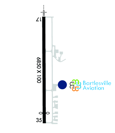
| 6850x100 | 6850' | 111.30 - 175° | 6850x100 | 6201' | ||||
| Runway ID | Single Wheel | Double Wheel | Double Tandem Wheel | Dual Double Wheel |
| 17/35 | 50,000 | 100,000 | 170,000 | N/A |
| These numbers are Advisory and are not limits. The Airport Manager should have more accurate Weight Limits | ||||
 Airport Diagram might not be current. | |
| Facility Name: | BARTLESVILLE MUNI |
| City Name: | BARTLESVILLE |
| County: | OSAGE |
| State abbrev: | OK |
| State Name: | OKLAHOMA |
| Ownership: | PUBLICLY OWNED |
| Use: | OPEN TO THE PUBLIC |
| Owner's Name: | CITY OF BARTLESVILLE |
| Address: | CITY HALL, 401 S. JOHNSTONE |
| BARTLESVILLE, OK 74003 | |
| Owner's Phone: | 918-338-4282 |
| Manager's Name: | MIKE RICHARDSON |
| Address: | 401 NW WILEY POST RD. |
| BARTLESVILLE, OK 74003 | |
| Phone: | (918) 661-3500; FOR EMERG ONLY 918-350-0076. |
| FAA Region: | SOUTHWEST |
| FAA Field Office: | AOK |
| Date | Sunrise | Sunset |
|---|---|---|
| 09/24/21 Friday | 7:13 | 19:18 |
| 09/25/21 Saturday | 7:14 | 19:17 |
| 09/26/21 Sunday | 7:15 | 19:15 |
| 09/27/21 Monday | 7:16 | 19:14 |
| 09/28/21 Tuesday | 7:17 | 19:12 |
| 09/29/21 Wednesday | 7:17 | 19:11 |
| 09/30/21 Thursday | 7:18 | 19:09 |
| 10/01/21 Friday | 7:19 | 19:08 |
| 10/02/21 Saturday | 7:20 | 19:06 |
| 10/03/21 Sunday | 7:21 | 19:05 |
| 10/04/21 Monday | 7:22 | 19:03 |
| 10/05/21 Tuesday | 7:23 | 19:02 |
| 10/06/21 Wednesday | 7:23 | 19:00 |
| 10/07/21 Thursday | 7:24 | 18:59 |
| Airport Attendance Schedule | MON-THU 0700-1900, FRI 0700-1800, SAT-SUN 0800-1600 |
| Airport Status | OPERATIONAL (This Status can change at any time - please check NOTAMS) |
| Airport Lighting Schedule | ACTVT MALSR RWY 17; REIL RWY 35; PAPI RWY 17 & 35 - CTAF. MIRL RWY 17/35 OPER SS TO SR & PRESET LOW INTST, INCR INTST - CTAF. |
| Airport Storage Available | Tie Downs, Hanger |
| Extra Services Available | Crop Dusting, Flight Instruction |
| Wind Indicator | YES - (lighted) |
| Control Tower | NO |
| CTAF Frequency | 122.825; ADZY FREQ 122.825 MNT M-F DURG BUS HRS. |
| Unicom Frequency | |
| Rotating Beacon Color | CLEAR-GREEN (Light Land Airport) |
| Segmented Circle | YES |
| Landing Fee | NO |
| Airport Inspected | STATE - performed by STATE AERONAUTICAL PERSONNEL |
| Inspection Date | 11/20/2020 |
| Type of Fuel Available | Grade 100LL, JET A (freeze point -40C) |
| Airframe Repair Service | MAJOR |
| Power Plant Repair Service | MAJOR |
| Latitude | N3645.8 |
| Longitude | W09600.7 (ESTIMATED) |
| Arpt Elevation | 716ft (SURVEYED) |
| Magnetic Variation | 03E |
| 2 miles NW | of BARTLESVILLE |
| Traffic Pattern Altitude | |
| Sectional Chart | KANSAS CITY |
| Operations (Reported) | Yearly | Avg. Daily |
|---|---|---|
| General Aviation Transient | 9272 | 25 |
| General Aviation Local | 3090 | 8 |
| Air Taxi | 750 | 2 |
| Commerical | 0 | 0 |
| Commuter | 0 | 0 |
| Military | 0 | 0 |
| Aircraft based on Field | |
|---|---|
| General Aviation Singles | 34 |
| General Aviation Multi | 4 |
| Jet Aircraft | 2 |
| General Aviation Helicopters | 0 |
| Military Aircraft | 0 |
| Gliders | 0 |
| Ultralights | 0 |
| FSS on field | NO |
| FSS tie-in | MC ALESTER |
| FSS Phone | 1-800-WX-BRIEF |
| Who issues Notams | BVO |
| Notam D service at airport | YES |
| ARTCC Name | KANSAS CITY |
| Airport Certification | |
| Aircraft Rescue & Firefighting Index | None |
| Airport of Entry | No |
| Custom Landing Rights | No |
| Joint Civil/Military | No |
| Military Landing rights | YES |
| NATIONAL PLAN OF INTEGRATED AIRPORT SYSTEMS (NPIAS) |
| GRANT AGREEMENTS UNDER FAAP/ADAP/AIP |
| ASSURANCES PURSUANT TO TITLE VI, CIVIL RIGHTS ACT OF 1964 |
| LARGE CABIN ACFT PROHIBITED ON FBO RAMP. |
| FOR CD IF UNA TO CTC ON FSS FREQ, CTC KANSAS CITY ARTCC AT 913-254-8508. |
Airport Communications & Frequencies:
| |||||||
| Runway: 17 | Runway: 35 | ||
| Mag heading: | 176° | Mag heading: | 356° |
| Rwy Slope: | .46% Up | Rwy Slope: | -.46% Down |
| Approach: | LOCALIZER | Approach: | |
| Pattern: | Right Traffic | Pattern: | Left Traffic |
| Markings: | PRECISION INSTRUMENT | Markings: | PRECISION INSTRUMENT |
| Marking Condition: | GOOD | Marking Condition: | GOOD |
| Arresting Dev: | Arresting Dev: | ||
| Lat & Long: | N3646.4 W09600.7 | Lat. & Long.: | N3645.2 W09600.7 |
| Elev: | 685.5 ft. MSL | Elev: | 716.9 ft. MSL |
| TCH: | 53 ft. AGL | TCH: | 45 ft. AGL |
| Visual Glide Path: | 3.00 degrees | Visual Glide Path: | 3.00 degrees |
| Displaced Threshold: | No | Displaced Threshold: | 649 feet |
| Touchdown Zone: | YES | Touchdown Zone: | YES |
| Touchdown Elev.: | 693.8 feet | Touchdown Elev.: | 711.9 feet |
| Visual Glide Slope: | 4-Light PAPI on LEFT side of Runway | Visual Glide Slope: | 4-Light PAPI on LEFT side of Runway |
| RVR Equipment: | RVR Equipment: | ||
| RVV Equipment: | NO | RVV Equipment: | NO |
| Approach Lights: | MALSR - 1,400 foot medium intensity approach lighting system with runway alignment indicator lights | Approach Lights: | |
| REIL: | NO | REIL: | YES |
| Centerline Lights: | NO | Centerline Lights: | NO |
| Touchdown lights: | NO | Touchdown lights: | NO |
| Runway Category: | D | Runway Category: | Runway with a Non-precision Approach having visibility minimums greater than 3/4 mile |
| Declared Distances: | TORA:6201' TODA:6201' ASDA:6201' LDA:6201' | Declared Distances: | TORA:6850' TODA:6850' ASDA:6850' LDA:6201' |
| Obstructions: | Obstructions: | ROAD | |
| Marked: | Marked: | NOT Marked/Lighted | |
| Clearance slope: | 34:1 | Clearance slope: | 21:1 |
| Obstruction height: | Obstruction height: | 13 feet AGL | |
| Dist. from runway: | Dist. from runway: | 484 feet | |
| Centerline offset: | Centerline offset: | ||
| Comments: | Comments: |
Thanks for using FltPlan.com
all rights reserved © 1999-2021 by Flight Plan LLC