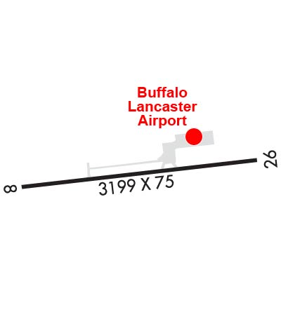
| BUFFALO-LANCASTER RGNL BUFFALO NY |
| |
| Lat: N 4255.3 Long: W 07836.7 Elev: 752 Var: +10 Longest Runway: 3199 | ||
| CTAF: 123.05 | ||
| |||||||||||||||||||||||||||||||||||||||||||||||||||||||||||||
| |||||||||||||||||||||||||||||||||||||||||||||||||||||||||||||
| Rwy | Rwy | |||||||
| 3199x75 | 3199' | 3199x75 | 3199' | |||||
| Runway ID | Single Wheel | Double Wheel | Double Tandem Wheel | Dual Double Wheel |
| 09/27 | N/A | N/A | N/A | N/A |
| These numbers are Advisory and are not limits. The Airport Manager should have more accurate Weight Limits | ||||
 Airport Diagram might not be current. | |
| Facility Name: | BUFFALO-LANCASTER RGNL |
| City Name: | BUFFALO |
| County: | ERIE |
| State abbrev: | NY |
| State Name: | NEW YORK |
| Ownership: | PRIVATELY OWNED |
| Use: | OPEN TO THE PUBLIC |
| Owner's Name: | LANCASTER APT INC (THOMAS GELES) |
| Address: | 4343 WALDEN AVE |
| LANCASTER, NY 14086 | |
| Owner's Phone: | 585-591-0366 |
| Manager's Name: | GEORGE EZZO; ALTN CTC: ERIC WOBSCHALL 716-208-5460 ERIC@BUFFALOLANCASTER.COM. |
| Address: | |
| DARIEN CENTER, NY 14040-1922 | |
| Phone: | 716-860-6044 |
| FAA Region: | EASTERN |
| FAA Field Office: | NYC |
| Date | Sunrise | Sunset |
|---|---|---|
| 06/12/26 Friday | 5:35 | 20:54 |
| 06/13/26 Saturday | 5:35 | 20:54 |
| 06/14/26 Sunday | 5:35 | 20:55 |
| 06/15/26 Monday | 5:35 | 20:55 |
| 06/16/26 Tuesday | 5:35 | 20:55 |
| 06/17/26 Wednesday | 5:35 | 20:56 |
| 06/18/26 Thursday | 5:35 | 20:56 |
| 06/19/26 Friday | 5:35 | 20:56 |
| 06/20/26 Saturday | 5:35 | 20:57 |
| 06/21/26 Sunday | 5:36 | 20:57 |
| 06/22/26 Monday | 5:36 | 20:57 |
| 06/23/26 Tuesday | 5:36 | 20:57 |
| 06/24/26 Wednesday | 5:36 | 20:57 |
| 06/25/26 Thursday | 5:37 | 20:57 |
| Airport Attendance Schedule | ON CALL; 716-860-6044. |
| Airport Status | OPERATIONAL (This Status can change at any time - please check NOTAMS) |
| Airport Lighting Schedule | ACTVT REILS RWY 09 & 27; PAPIS RWY 09 & 27; MIRLS RWY 9/27 - CTAF. |
| Airport Storage Available | Tie Downs, Hanger |
| Extra Services Available | Air Freight, Flight Instruction, Aircraft Rental |
| Wind Indicator | YES - (lighted) |
| Control Tower | NO |
| CTAF Frequency | 123.050 |
| Unicom Frequency | 123.050; AUTOMATED UNICOM. ADZY ALSO AVBL BY CALLING 617-262-3825. |
| Rotating Beacon Color | WG |
| Segmented Circle | NO |
| Landing Fee | NO |
| Airport Inspected | STATE - performed by PRIVATE CONTRACT PERSONNEL |
| Inspection Date | 07/12/2024 |
| Type of Fuel Available | Grade 100LL |
| Airframe Repair Service | MAJOR |
| Power Plant Repair Service | MAJOR |
| Latitude | N4255.3 |
| Longitude | W07836.7 (ESTIMATED) |
| Arpt Elevation | 751ft (SURVEYED) |
| Magnetic Variation | 10W |
| 12 miles E | of BUFFALO |
| Traffic Pattern Altitude | 800 |
| Sectional Chart | DETROIT |
| Operations (Reported) | Yearly | Avg. Daily |
|---|---|---|
| General Aviation Transient | 0 | 0 |
| General Aviation Local | 0 | 0 |
| Air Taxi | 0 | 0 |
| Commerical | 0 | 0 |
| Commuter | 0 | 0 |
| Military | 0 | 0 |
| Aircraft based on Field | |
|---|---|
| General Aviation Singles | 0 |
| General Aviation Multi | 0 |
| Jet Aircraft | 0 |
| General Aviation Helicopters | 0 |
| Military Aircraft | 0 |
| Gliders | 0 |
| Ultralights | 0 |
| FSS on field | NO |
| FSS tie-in | BUFFALO |
| FSS Phone | 1-800-WX-BRIEF |
| Who issues Notams | BUF |
| Notam D service at airport | YES |
| ARTCC Name | CLEVELAND |
| Airport Certification | |
| Aircraft Rescue & Firefighting Index | None |
| Airport of Entry | No |
| Custom Landing Rights | No |
| Joint Civil/Military | No |
| Military Landing rights | No |
| NATIONAL PLAN OF INTEGRATED AIRPORT SYSTEMS (NPIAS) |
| 25 FT RLRD; 215 FT S & PARL TO RWY. |
| FOR CD CTC CLEVELAND ARTCC AT 440-774-0490. |
Airport Communications & Frequencies:
| ||||||||||||||
| Runway: 09 | Runway: 27 | ||
| Mag heading: | N/A | Mag heading: | N/A |
| Rwy Slope: | -.03% Down | Rwy Slope: | .03% Up |
| Approach: | Approach: | ||
| Pattern: | Left Traffic | Pattern: | Left Traffic |
| Markings: | NONPRECISION INSTRUMENT | Markings: | NONPRECISION INSTRUMENT |
| Marking Condition: | FAIR | Marking Condition: | FAIR |
| Arresting Dev: | Arresting Dev: | ||
| Lat & Long: | N4255.3 W07837.1 | Lat. & Long.: | N4255.4 W07836.4 |
| Elev: | 751.6 ft. MSL | Elev: | 750.5 ft. MSL |
| TCH: | 40 ft. AGL | TCH: | 40 ft. AGL |
| Visual Glide Path: | 3.00 degrees | Visual Glide Path: | 3.00 degrees |
| Displaced Threshold: | No | Displaced Threshold: | No |
| Touchdown Zone: | YES | Touchdown Zone: | YES |
| Touchdown Elev.: | 751.7 feet | Touchdown Elev.: | 751.6 feet |
| Visual Glide Slope: | 2-Light PAPI on RIGHT side of Runway; RWY 09 PAPI UNUSBL BYD 3 DEG RT OF RCL. | Visual Glide Slope: | 2-Light PAPI on LEFT side of Runway; RWY 27 PAPI UNUSBL BYD 5 DEG LEFT OF RCL. |
| RVR Equipment: | RVR Equipment: | ||
| RVV Equipment: | NO | RVV Equipment: | NO |
| Approach Lights: | Approach Lights: | ||
| REIL: | YES | REIL: | YES |
| Centerline Lights: | NO | Centerline Lights: | NO |
| Touchdown lights: | NO | Touchdown lights: | NO |
| Runway Category: | Runway with a Non-precision Approach | Runway Category: | Runway with a Non-precision Approach |
| Declared Distances: | Declared Distances: | ||
| Obstructions: | RR | Obstructions: | RR |
| Marked: | MARKED and LIGHTED | Marked: | NOT Marked/Lighted |
| Clearance slope: | 9 FT FENCE, 15 FT TREES. | Clearance slope: | |
| Obstruction height: | 23 feet AGL | Obstruction height: | 25 feet AGL |
| Dist. from runway: | 201 feet | Dist. from runway: | 201 feet |
| Centerline offset: | 215 right of centerline | Centerline offset: | 215 feet left of centerline |
| Comments: | 9 FT FENCE, 15 FT TREE, 23 FT RR. | Comments: | 9 FT FENCE, 25 FT RR. |
Thanks for using FltPlan.com
all rights reserved © 1999-2026 by Flight Plan LLC