| Rwy | Length | Land Dist Avail** | Approach* | | Rwy | Length | Land Dist Avail** | Approach* | | 13 | 5700x75 | 5700' | | | 31 | 5700x75 | 5700' | | | * only ILS, LOC, LDA, and SDF approaches to a specific runway are shown** For any Declared Landing Distance Available, please see A/FD or Approach plates |
| Runway Weight Capability (lbs.) more info on Runway Weight Capability | | Runway ID | Single Wheel | Double Wheel | Double Tandem Wheel | Dual Double Wheel | | 13/31 | 25,000 | 40,000 | N/A | N/A | These numbers are Advisory and are not limits. The Airport Manager should have more accurate Weight Limits
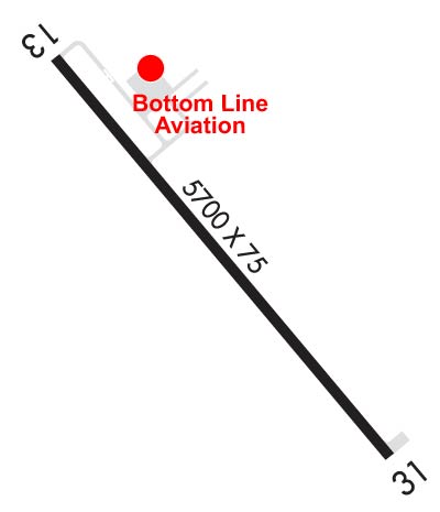
Please email Support@FltPlan.com for further information. |
| Customs Information ( Send updates to Support@FltPlan.com ) |
| A/FD |
| Database effective date: 01/05/2017 |
Airport Diagram might not be current.
| | Facility Name: | BOWMAN RGNL | | City Name: | BOWMAN | | County: | BOWMAN | | State abbrev: | ND | | State Name: | NORTH DAKOTA | | | | | Ownership: | PUBLICLY OWNED | | Use: | OPEN TO THE PUBLIC | | Owner's Name: | BOWMAN COUNTY ARPT AUTH | | Address: | PO BOX 331 | | | BOWMAN, ND 58623 | | Owner's Phone: | 701-523-7484; APT AUTH MEMBER BOB MORLAND. | | | | | Manager's Name: | BRENT KLINE | | Address: | PO BOX 331 | | | BOWMAN, ND 58623 | | Phone: | 701-523-7484; MGR CELL PHONE 701-440-7449. | | | | | FAA Region: | GREAT LAKES | | FAA Field Office: | DMA |
| 

Click here for full scale & interactive Sectional view of KBWW
|
| Sunrise / Sunset times for: BOWMAN RGNL | | Date: | Sunrise | Sunset | | 02/26/17 Sunday | 6:38 | 17:35 | | 02/27/17 Monday | 6:36 | 17:37 | | 02/28/17 Tuesday | 6:34 | 17:38 | | 03/01/17 Wednesday | 6:33 | 17:39 | | 03/02/17 Thursday | 6:31 | 17:41 | | 03/03/17 Friday | 6:29 | 17:42 | | 03/04/17 Saturday | 6:27 | 17:44 |
| : | | Date: | Sunrise | Sunset | | 03/05/17 Sunday | 6:25 | 17:45 | | 03/06/17 Monday | 6:23 | 17:46 | | 03/07/17 Tuesday | 6:22 | 17:48 | | 03/08/17 Wednesday | 6:20 | 17:49 | | 03/09/17 Thursday | 6:18 | 17:51 | | 03/10/17 Friday | 6:16 | 17:52 | | 03/11/17 Saturday | 6:14 | 17:53 |
|
|
| Airport Facilities | Airport Attendance Schedule: MON-FRI 0800-1700; FOR ATTENDANT & FUEL OTHER HRS CALL 701-275-6352 OR 701-440-0098.
Airport Status: OPERATIONAL (This Status can change at any time - please check NOTAMS)
Airport Lighting Schedule: RWY APT PAPI RWYS 13/31 OPER DUSK-1800. MIRL RWY 13/31 PRESET ON LOW INTST DUSK-1800; TO INCR INTST - CTAF. AFT 1800 ACTVT REIL (3 STEP) RY 13/31; PAPI RY 13/31; MIRL RY 13/31 - CTAF.
Airport Storage Available: Tie Downs, Hanger
Extra Services Available: Crop Dusting, Flight Instruction
Wind Indicator: YES - (lighted)Control Tower: NO
CTAF Frequency: 122.800
Unicom Frequency: 122.800 | Rotating Beacon Color: CLEAR-GREEN (Light Land Airport)
Segmented Circle: YES | | Landing Fee: | |
|
| Airport Services | Type of Fuel Available: Grade 100LL, JET A (freeze point -40C); FUEL SELF SERVICE 24 HR CREDIT CARD ACCESS.
Airframe Repair Service: MAJOR
Power Plant Repair Service: MAJOR |
|
| Geographic Data | | Latitude: N4609.9 Longitude: W10318.0 (ESTIMATED) | | Arpt Elevation: 2965ft (SURVEYED) | | | Magnetic Variation: 08E | | 4 miles E of BOWMAN | | Traffic Pattern Altitude: | | Sectional Chart: BILLINGS |
|
| Aircraft Data | | Operations (reported) | Yearly | Avg. Daily | | General Aviation transient: | 2085 | 6 | | General Aviation Local: | 2400 | 7 | | Air Taxi: | 600 | 2 | | Commerical: | 0 | 0 | | Commuter: | 0 | 0 | | Military: | 20 | 0 |
| | Aircraft based on Field | | General Aviation Singles: | 17 | | General Aviation Multi: | 2 | | Jet Aircraft: | 0 | | General Aviation Helicopters: | 0 | | Military Aircraft: | 0 | | Gliders: | 0 | | Ultralights: | 0 |
|
|
| FAA Services | FSS on field: NO
FSS tie-in:GRAND FORKS
FSS Phone: 1-800-WX-BRIEFWho issues Notams: GFK
Notam D service at airport: YES
ARTCC Name: SALT LAKE CITY | |
|
|
| Federal Status | Airport Certification:
Aircraft Rescue & Firefighting Index: NoneAirport of Entry: No
Custom Landing Rights: No | Joint Civil/Military: No
Military Landing rights: No | |
|
|
Runway Identification: 13/31Length: 5700 ft
Width: 75 ft
Surface: CONCRETE
Edge lights: Medium Intensity
Treatment: GROOVED
|
| |
| | Mag heading: | N/A | Mag heading: | N/A | | Rwy Slope: | .34% Up | Rwy Slope: | -.34% Down | | Approach: | | Approach: | | | Pattern: | Left Traffic | Pattern: | Left Traffic | | Markings: | NONPRECISION INSTRUMENT | Markings: | NONPRECISION INSTRUMENT | | Marking Condition: | GOOD | Marking Condition: | GOOD | | Arresting Dev: | | Arresting Dev: | | | Lat & Long: | N4610.3 W10318.5 | Lat. & Long.: | N4609.6 W10317.6 | | Elev: | 2946.0 ft. MSL | Elev: | 2965.4 ft. MSL | | TCH: | 39 ft. AGL | TCH: | 38 ft. AGL | | Visual Glide Path: | 3.00 degrees | Visual Glide Path: | 3.00 degrees | | Displaced Threshold: | No | Displaced Threshold: | No | | Touchdown Zone: | YES | Touchdown Zone: | YES | | Touchdown Elev.: | 2947.8 feet | Touchdown Elev.: | 2965.4 feet | | Visual Glide Slope: | 4-Light PAPI on LEFT side of Runway | Visual Glide Slope: | 4-Light PAPI on LEFT side of Runway | | RVR Equipment: | | RVR Equipment: | | | RVV Equipment: | NO | RVV Equipment: | NO | | Approach Lights: | | Approach Lights: | | | REIL: | YES | REIL: | YES | | Centerline Lights: | NO | Centerline Lights: | NO | | Touchdown lights: | NO | Touchdown lights: | NO | | Runway Category: | Runway with a Non-precision Approach having visibility minimums greater than 3/4 mile | Runway Category: | Runway with a Non-precision Approach having visibility minimums greater than 3/4 mile | | Declared Distances: | | Declared Distances: | | | Obstructions: | PLINE | Obstructions: | GND | | Marked: | NOT Marked/Lighted | Marked: | NOT Marked/Lighted | | Clearance slope: | 36:1 | Clearance slope: | 34:1 | | Obstruction height: | 32 feet AGL | Obstruction height: | 0 feet AGL | | Dist. from runway: | 2400 feet | Dist. from runway: | 300 feet | | Centerline offset: | 380 left of centerline | Centerline offset: | 250 feet right of centerline | | Comments: | | Comments: | |
|
| Remarks | | BIRDS ON & INVOF ARPT.CONFIRM SNOW REMOVAL WITH MGR AFT MAJOR STORM.RWY ENDS & SIDE GRASS SPARSE AND GROUND SOFT WHEN WET.RWY 13 UP SE. |
|
| Federal Agreements | | NATIONAL PLAN OF INTEGRATED AIRPORT SYSTEMS (NPIAS)GRANT AGREEMENTS UNDER FAAP/ADAP/AIPASSURANCES PURSUANT TO TITLE VI, CIVIL RIGHTS ACT OF 1964 |
|
| Airport Inspection Data | Airport Inspected: No Inspection Data Available performed by STATE AERONAUTICAL PERSONNEL
Inspection Date: 02/17/2015 |
|
Airport Communications & Frequencies:
| Unicom Frequency: | | 122.800 |
| Remarks | | APCH/DEP SVC PRVVD BY SALT LAKE (ZLC) ARTCC ON 132. 425/317.45 (MILES CITY RCAG). |
|
|
1/1/
Thanks for using FltPlan.com
all rights reserved © copyright 1999-2017 by Flight Plan LLC |
|
|