| BOISE AIR TERMINAL/GOWEN FLD BOISE ID |
| |
| Lat: N 4333.9 Long: W 11613.4 Elev: 2872 Var: -13 Longest Runway: 10000 | ||
| Clr Del: 125.9 Dept. ATIS: 123.9 Arr. ATIS: 123.9 Ground: 121.7 Tower: 118.1/119.0 | ||
| |||||||||||||||||||||||||||||||||||||||||||||||||||||||||||||||||||
| |||||||||||||||||||||||||||||||||||||||||||||||||||||||||||||||||||
| |||||||||||||||||||||||||||||||||||||||||||||||||||||||||||||||||||
| |||||||||||||||||||||||||||||||||||||||||||||||||||||||||||||||||||
| |||||||||||||||||||||||||||||||||||||||||||||||||||||||||||||||||||
| Rwy | Rwy | |||||||
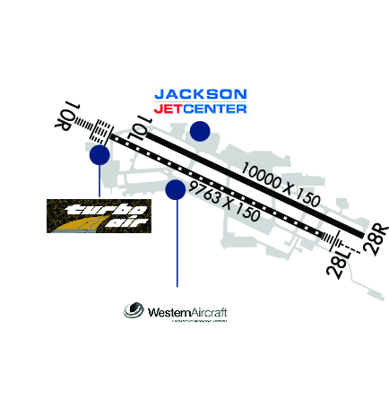
| 10000x150 | 10000' | 10000x150 | 10000' | 110.15 - 282° | ||||
| 9763x150 | 9763' | 111.10 - 102° | 9763x150 | 9763' | ||||
| Runway ID | Single Wheel | Double Wheel | Double Tandem Wheel | Dual Double Wheel |
| 10L/28R | 100,000 | 210,000 | 446,000 | 947,000 |
| 10R/28L | 100,000 | 210,000 | 430,000 | 994,000 |
| These numbers are Advisory and are not limits. The Airport Manager should have more accurate Weight Limits | ||||
 Airport Diagram might not be current. | |
| Facility Name: | BOISE AIR TRML/GOWEN FLD |
| City Name: | BOISE |
| County: | ADA |
| State abbrev: | ID |
| State Name: | IDAHO |
| Ownership: | PUBLICLY OWNED |
| Use: | OPEN TO THE PUBLIC |
| Owner's Name: | CITY OF BOISE |
| Address: | PO BOX 500 |
| BOISE, ID 83701 | |
| Owner's Phone: | 208-383-3110 |
| Manager's Name: | REBECCA HUPP |
| Address: | 3201 AIRPORT WAY SUITE 1000 |
| BOISE, ID 83705 | |
| Phone: | (208) 972-8420 |
| FAA Region: | NORTHWEST MOUNTAIN |
| FAA Field Office: | HLN |
| Date | Sunrise | Sunset |
|---|---|---|
| 09/24/21 Friday | 7:34 | 19:39 |
| 09/25/21 Saturday | 7:35 | 19:37 |
| 09/26/21 Sunday | 7:36 | 19:35 |
| 09/27/21 Monday | 7:38 | 19:33 |
| 09/28/21 Tuesday | 7:39 | 19:32 |
| 09/29/21 Wednesday | 7:40 | 19:30 |
| 09/30/21 Thursday | 7:41 | 19:28 |
| 10/01/21 Friday | 7:42 | 19:26 |
| 10/02/21 Saturday | 7:43 | 19:24 |
| 10/03/21 Sunday | 7:45 | 19:23 |
| 10/04/21 Monday | 7:46 | 19:21 |
| 10/05/21 Tuesday | 7:47 | 19:19 |
| 10/06/21 Wednesday | 7:48 | 19:17 |
| 10/07/21 Thursday | 7:49 | 19:16 |
| Airport Attendance Schedule | CONTINUOUS |
| Airport Status | OPERATIONAL (This Status can change at any time - please check NOTAMS) |
| Airport Lighting Schedule | SS-SR |
| Airport Storage Available | Tie Downs, Hanger |
| Extra Services Available | Air Ambulance, Avionics, Cargo Handling, Charter, Flight Instruction, Aircraft Rental, Aircraft Sales |
| Wind Indicator | YES - (lighted) |
| Control Tower | YES |
| CTAF Frequency | |
| Unicom Frequency | 122.950 |
| Rotating Beacon Color | CLEAR-GREEN (Light Land Airport) |
| Segmented Circle | NO |
| Landing Fee | NO |
| Airport Inspected | FEDERAL - performed by FAA AIRPORTS FIELD PERSONNEL |
| Inspection Date | 05/02/2019 |
| Type of Fuel Available | Grade 100LL, JET A |
| Airframe Repair Service | MAJOR |
| Power Plant Repair Service | MAJOR |
| Latitude | N4333.9 |
| Longitude | W11613.4 (ESTIMATED) |
| Arpt Elevation | 2871ft (SURVEYED) |
| Magnetic Variation | 13E |
| 3 miles S | of BOISE |
| Traffic Pattern Altitude | |
| Sectional Chart | SALT LAKE CITY |
| Operations (Reported) | Yearly | Avg. Daily |
|---|---|---|
| General Aviation Transient | 45065 | 123 |
| General Aviation Local | 21971 | 60 |
| Air Taxi | 10180 | 28 |
| Commerical | 49867 | 137 |
| Commuter | 0 | 0 |
| Military | 10376 | 28 |
| Aircraft based on Field | |
|---|---|
| General Aviation Singles | 147 |
| General Aviation Multi | 22 |
| Jet Aircraft | 37 |
| General Aviation Helicopters | 17 |
| Military Aircraft | 46 |
| Gliders | 0 |
| Ultralights | 0 |
| FSS on field | NO |
| FSS tie-in | BOISE |
| FSS Phone | 1-800-WX-BRIEF |
| Who issues Notams | BOI |
| Notam D service at airport | YES |
| ARTCC Name | SALT LAKE CITY |
| Airport Certification | AIRPORT RECEIVING SCHEDULED AIR CARRIER SERVICE FROM CARRIERS CERTIFICATED BY THE CIVIL AERONAUTICS BOARD |
| Aircraft Rescue & Firefighting Index | AIRPORT HAS A CERTIFICATE UNDER CFR PART 139 |
| Airport of Entry | YES |
| Custom Landing Rights | No; FLIGHT NOTIFICATION SERVICE (ADCUS) AVBL MON-FRI 0800-1700; WEEKENDS IF NOTIFIED BY 1700 THURS. |
| Joint Civil/Military | No |
| Military Landing rights | YES |
| NATIONAL PLAN OF INTEGRATED AIRPORT SYSTEMS (NPIAS) |
| GRANT AGREEMENTS UNDER FAAP/ADAP/AIP |
| COMPLIANCE WITH ACCESSIBILITY TO THE HANDICAPPED |
| ASSURANCES PURSUANT TO TITLE VI, CIVIL RIGHTS ACT OF 1964 |
| SURPLUS PROPERTY AGREEMENT UNDER PUBLIC LAW 289 |
| AGREEMENT UNDER DLAND OR DCLA HAS EXPIRED. |
| EXTSV HEL OPNS SFC TO 3500' WITHIN 1 NM EAST & WEST & 5 NM S OF RWY 10R/28L. |
| CSTMS/AG/IMG: 1400-0130Z++ MON-FRI, PHONE 24 HRS PRIOR TO ARRIVAL C208-334-9062. |
| ANG: OPR 1400-2330Z++ CLSD WKND, HOL AND DOWN MON. TRAN SVC UNAVBL OUTSIDE OF ANG OPR HR. FOR FBO SVC AND PRK CTC FBO. TRAN SVC AND GND EQPT VERY LTD OTHER THAN A10 ACFT. TRAN MUST BE ABLE TO FUEL/SVC OWN ACFT. |
| MISC: BASE SECURITY DSN 422-5366 (H24)COMD POST BUS HR ONLY DSN: 422-5333, BASE OPS BUS HR ONLY DSN 422-5348. |
| - ARNG DSN 422-3976 C208-272-3976, 1330-0600Z++ MON-FRI. ALL ARNG RAMP ACFT OPS USE ADVISORY FREQ 266.2. C-12 OPS DSN 422-3588. |
| ANG: AFLD MGR DOES NOT ISSUE OR STORE COMSEC FOR TRANS CREWS. |
| CAUTION: ALL MIL ACFT OPR: BASH PHASE II PERIOD (1 OCT-31 MAR), BIRD WATCH COND SEVERE (TKOF, LDG AND LOW APCH PROH UNLESS GREATER EMERG AND/OR IMMED OPR NEC EXISTS, LCL AND TACTICAL TRNG PROH), MODERATE (MULTIPLE APCH PROH, DEP AND FULL STOP ALLOWED IF RTE AVOIDS BIRD ACT.) |
| ALL TWYS CLSD TO ACFT WITH WINGSPAN OVR 147 FT 1 IN, EXCP WITH 1 HR PPR 208-972-8420. |
| TWY B EAST OF TWY C CLSD TO ACFT WITH WINGSPAN OVER 118 FT WHEN EAST ARM/DEARM PAD IS IN USE. TWY J NORTH OF TWY F CLSD TO ACFT WITH WINGSPAN OVER 94 FT WHEN WEST ARM/DEARM PAD IS IN USE. |
| TWY S CLSD TO ACFT WITH WINGSPAN OVER 95 FT. |
| SCTY RQRS PPR WITH FBO DUE TO LOCKED GATES & FENCING BTN HRS 2200-0700 FOR INGRESS/EGRESS TO ARPT. |
| THE ARPT REQ FLT CREWS PRKG ON THE COML RAMP CTC GND CTL ON 121.7 MHZ PRIOR TO PUSHBACK. |
| ANG: NTSD MRK ON WEST PRK RAMP FOR WHITE WINGTIP CLNC LINE BEHIND PRK SPOTS, AND WHITE PRK SPOT DESIGNATED NR. PERM WAIVER FOR GUARD RAILS THAT ENCROACH ON WINGTIP CLNC LINE, FADED AND OBSCR NTSD MRK ON EAST PRK RAMP. |
| TWY A5 CLSD TO ACFT WITH WINGSPAN OVR 55 FT, EXC WITH 24 HR PPR (208 972 8420). |
| (A89) LOCAL CALL TO FSS 343-2525. |
| (E94) WSFO |
| MODERATE MIGRATORY BIRD ACTIVITY WITHIN 5 NM OF THE AIRPORT OCTOBER THROUGH MARCH. |
| AERODROME OFFL BUS ONLY FOR ALL MIL ACFT. MANDATORY PPR RQR FOR ALL MIL ACFT ARR AT KBOI-REGARDLESS OF WHERE ACFT IS PRKG-PRIOR TO ARR, NO LATER THAN 72 HR IF PRK ON ANG RAMP AT HTTP://WWW.124THFIGHTERWING.ANG.AF.MIL/. STRICTLY ENFORCED. PPR VALID +/- 30 MIN. TRAN ACFT RSTD TO STR-IN FULL STOP ONLY. IN EVENT OF GO-AROUND OR MISSED-APCH EXP RT TFC." |
| PORTIONS OF TWY K & THE SOUTHWEST RAMP NOT VSBL TO ATCT. |
Airport Communications & Frequencies:
| |||||||||||||||||||||||||||||||||||||||||||||||||||
| Runway: 10L | Runway: 28R | ||
| Mag heading: | 102° | Mag heading: | 282° |
| Rwy Slope: | .41% Up | Rwy Slope: | -.41% Down |
| Approach: | Approach: | ILS/DME | |
| Pattern: | Left Traffic | Pattern: | Right Traffic |
| Markings: | NONPRECISION INSTRUMENT | Markings: | PRECISION INSTRUMENT |
| Marking Condition: | GOOD | Marking Condition: | GOOD |
| Arresting Dev: | Arresting Dev: | ||
| Lat & Long: | N4334.2 W11614.2 | Lat. & Long.: | N4333.5 W11612.2 |
| Elev: | 2830.6 ft. MSL | Elev: | 2871.7 ft. MSL |
| TCH: | 53 ft. AGL | TCH: | 70 ft. AGL |
| Visual Glide Path: | 3.00 degrees | Visual Glide Path: | 3.00 degrees |
| Displaced Threshold: | No | Displaced Threshold: | No |
| Touchdown Zone: | YES | Touchdown Zone: | YES |
| Touchdown Elev.: | 2844.3 feet | Touchdown Elev.: | 2871.7 feet |
| Visual Glide Slope: | 4-Light PAPI on RIGHT side of Runway | Visual Glide Slope: | 4-Light PAPI on LEFT side of Runway |
| RVR Equipment: | RVR Equipment: | ||
| RVV Equipment: | NO | RVV Equipment: | NO |
| Approach Lights: | Approach Lights: | ||
| REIL: | YES | REIL: | NO |
| Centerline Lights: | NO | Centerline Lights: | NO |
| Touchdown lights: | NO | Touchdown lights: | NO |
| Runway Category: | D | Runway Category: | Precision Instrument Runway |
| Declared Distances: | TORA:10000' TODA:10000' ASDA:10000' LDA:10000' | Declared Distances: | TORA:10000' TODA:10000' ASDA:10000' LDA:10000' |
| Obstructions: | ANT | Obstructions: | |
| Marked: | LIGHTED | Marked: | |
| Clearance slope: | 50:1 | Clearance slope: | 50:1 |
| Obstruction height: | 16 feet AGL | Obstruction height: | |
| Dist. from runway: | 600 feet | Dist. from runway: | 52 feet |
| Centerline offset: | 300 right of centerline | Centerline offset: | |
| Comments: | Comments: |
| Runway: 10R | Runway: 28L | ||
| Mag heading: | 102° | Mag heading: | 282° |
| Rwy Slope: | .35% Up | Rwy Slope: | -.35% Down |
| Approach: | ILS/DME | Approach: | MLS |
| Pattern: | Right Traffic | Pattern: | Left Traffic |
| Markings: | PRECISION INSTRUMENT | Markings: | PRECISION INSTRUMENT |
| Marking Condition: | GOOD | Marking Condition: | GOOD |
| Arresting Dev: | BAK-14 | Arresting Dev: | BAK-14 |
| Lat & Long: | N4334.2 W11614.6 | Lat. & Long.: | N4333.5 W11612.6 |
| Elev: | 2824.2 ft. MSL | Elev: | 2858.3 ft. MSL |
| TCH: | 64 ft. AGL | TCH: | 50 ft. AGL |
| Visual Glide Path: | 3.00 degrees | Visual Glide Path: | 3.00 degrees |
| Displaced Threshold: | No | Displaced Threshold: | No |
| Touchdown Zone: | YES | Touchdown Zone: | YES |
| Touchdown Elev.: | 2835.8 feet | Touchdown Elev.: | 2858.3 feet |
| Visual Glide Slope: | 4-BOX VASI ON LEFT SIDE OF RUNWAY | Visual Glide Slope: | 4-BOX VASI ON LEFT SIDE OF RUNWAY |
| RVR Equipment: | TOUCHDOWN-MIDFIELD-ROLLOUT | RVR Equipment: | TOUCHDOWN-MIDFIELD-ROLLOUT |
| RVV Equipment: | YES | RVV Equipment: | YES |
| Approach Lights: | ALSF2 - standard 2,400 foot high intensity approach lighting system with sequenced flashers, Category II or III | Approach Lights: | MALSR - 1,400 foot medium intensity approach lighting system with runway alignment indicator lights |
| REIL: | NO | REIL: | NO |
| Centerline Lights: | YES | Centerline Lights: | YES |
| Touchdown lights: | YES | Touchdown lights: | YES |
| Runway Category: | Precision Instrument Runway | Runway Category: | Precision Instrument Runway |
| Declared Distances: | TORA:9763' TODA:9763' ASDA:9763' LDA:9763' | Declared Distances: | TORA:9763' TODA:9763' ASDA:9763' LDA:9763' |
Thanks for using FltPlan.com
all rights reserved © 1999-2021 by Flight Plan LLC