| WAYNE COUNTY WOOSTER OH |
| |
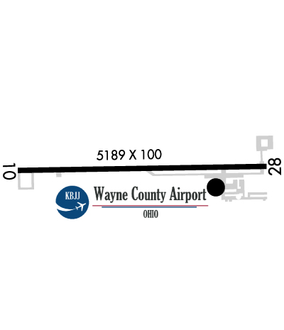
| Lat: N 4052.5 Long: W 08153.3 Elev: 1136 Var: +07 Longest Runway: 5189 | ||
| Clr Del: 121.75 AWOS: 118.07 CTAF: 122.8 | ||
| |||||||||||||||||||||||||||||||
| |||||||||||||||||||||||||||||||
| |||||||||||||||||||||||||||||||
| Rwy | Rwy | |||||||
| 5189x100 | 5189' | 5189x100 | 4971' | |||||
| Runway ID | Single Wheel | Double Wheel | Double Tandem Wheel | Dual Double Wheel |
| 10/28 | 30,000 | N/A | N/A | N/A |
| These numbers are Advisory and are not limits. The Airport Manager should have more accurate Weight Limits | ||||
 Airport Diagram might not be current. | |
| Facility Name: | WAYNE COUNTY |
| City Name: | WOOSTER |
| County: | WAYNE |
| State abbrev: | OH |
| State Name: | OHIO |
| Ownership: | PUBLICLY OWNED |
| Use: | OPEN TO THE PUBLIC |
| Owner's Name: | WAYNE COUNTY |
| Address: | 428 WEST LIBERTY |
| WOOSTER, OH 44691 | |
| Owner's Phone: | 330-287-5400 |
| Manager's Name: | AMANDA MCGEE |
| Address: | 6020 N HONEYTOWN RD |
| SMITHVILLE, OH 44677 | |
| Phone: | 330-669-9212 |
| FAA Region: | GREAT LAKES |
| FAA Field Office: | DET |
| Date | Sunrise | Sunset |
|---|---|---|
| 09/24/21 Friday | 7:17 | 19:22 |
| 09/25/21 Saturday | 7:18 | 19:20 |
| 09/26/21 Sunday | 7:19 | 19:18 |
| 09/27/21 Monday | 7:20 | 19:17 |
| 09/28/21 Tuesday | 7:21 | 19:15 |
| 09/29/21 Wednesday | 7:22 | 19:13 |
| 09/30/21 Thursday | 7:23 | 19:12 |
| 10/01/21 Friday | 7:24 | 19:10 |
| 10/02/21 Saturday | 7:25 | 19:08 |
| 10/03/21 Sunday | 7:26 | 19:07 |
| 10/04/21 Monday | 7:27 | 19:05 |
| 10/05/21 Tuesday | 7:28 | 19:03 |
| 10/06/21 Wednesday | 7:29 | 19:02 |
| 10/07/21 Thursday | 7:30 | 19:00 |
| Airport Attendance Schedule | SAT-SUN 0900-1700, MAY - OCT MON-FRI 0700-1900, NOV-APR MON-FRI 0800-1900 |
| Airport Status | OPERATIONAL (This Status can change at any time - please check NOTAMS) |
| Airport Lighting Schedule | HIRL RWY 10/28 PRESET LOW INTST DUSK TO DAWN. TO INCR INTST & ACTVT REILS RWY 10/28; PAPI RWY 10; VASI RWY 28 - CTAF. |
| Airport Storage Available | Tie Downs, Hanger |
| Extra Services Available | Air Ambulance |
| Wind Indicator | YES - (lighted) |
| Control Tower | NO |
| CTAF Frequency | 122.800 |
| Unicom Frequency | 122.800 |
| Rotating Beacon Color | CLEAR-GREEN (Light Land Airport) |
| Segmented Circle | YES |
| Landing Fee | NO; RAMP FEE FOR ALL ACFT, WAIVED W MIN FUEL PURCHASE. |
| Airport Inspected | STATE - performed by PRIVATE CONTRACT PERSONNEL |
| Inspection Date | 09/16/2019 |
| Type of Fuel Available | Grade 100LL, JET A (freeze point -40C), JET A-1 (icing inhibitor, freeze point -50C) |
| Airframe Repair Service | MAJOR |
| Power Plant Repair Service | MAJOR |
| Latitude | N4052.5 |
| Longitude | W08153.3 (ESTIMATED) |
| Arpt Elevation | 1135ft (SURVEYED) |
| Magnetic Variation | 07W |
| 6 miles NE | of WOOSTER |
| Traffic Pattern Altitude | |
| Sectional Chart | DETROIT |
| Operations (Reported) | Yearly | Avg. Daily |
|---|---|---|
| General Aviation Transient | 9000 | 25 |
| General Aviation Local | 9000 | 25 |
| Air Taxi | 200 | 1 |
| Commerical | 0 | 0 |
| Commuter | 0 | 0 |
| Military | 100 | 0 |
| Aircraft based on Field | |
|---|---|
| General Aviation Singles | 37 |
| General Aviation Multi | 3 |
| Jet Aircraft | 5 |
| General Aviation Helicopters | 6 |
| Military Aircraft | 0 |
| Gliders | 0 |
| Ultralights | 0 |
| FSS on field | NO |
| FSS tie-in | CLEVELAND |
| FSS Phone | 1-800-WX-BRIEF |
| Who issues Notams | BJJ |
| Notam D service at airport | YES |
| ARTCC Name | CLEVELAND |
| Airport Certification | |
| Aircraft Rescue & Firefighting Index | None |
| Airport of Entry | No |
| Custom Landing Rights | No |
| Joint Civil/Military | No |
| Military Landing rights | No |
| NATIONAL PLAN OF INTEGRATED AIRPORT SYSTEMS (NPIAS) |
| GRANT AGREEMENTS UNDER FAAP/ADAP/AIP |
| ASSURANCES PURSUANT TO TITLE VI, CIVIL RIGHTS ACT OF 1964 |
| DEER ON & INVOF ARPT. |
| TWY PARL TO RWY 10/28 CLSD TO ACFT OVER 6000 POUNDS. |
| FOR CD CTC CLEVELAND APCH AT 216-352-2323, WHEN APCH CLSD CTC CLEVELAND ARTCC AT 440-774-0223. |
Airport Communications & Frequencies:
| |||||||||||||||||||
| Runway: 10 | Runway: 28 | ||
| Mag heading: | 97° | Mag heading: | 277° |
| Rwy Slope: | .45% Up | Rwy Slope: | -.45% Down |
| Approach: | Approach: | ||
| Pattern: | Left Traffic | Pattern: | Left Traffic |
| Markings: | NONPRECISION INSTRUMENT | Markings: | NONPRECISION INSTRUMENT |
| Marking Condition: | GOOD | Marking Condition: | GOOD |
| Arresting Dev: | Arresting Dev: | ||
| Lat & Long: | N4052.5 W08153.9 | Lat. & Long.: | N4052.5 W08152.7 |
| Elev: | 1112.1 ft. MSL | Elev: | 1135.7 ft. MSL |
| TCH: | 33 ft. AGL | TCH: | 33 ft. AGL |
| Visual Glide Path: | 3.04 degrees | Visual Glide Path: | 3.00 degrees |
| Displaced Threshold: | No | Displaced Threshold: | 218 feet |
| Touchdown Zone: | YES | Touchdown Zone: | YES |
| Touchdown Elev.: | 1112.7 feet | Touchdown Elev.: | 1133.8 feet |
| Visual Glide Slope: | 4-Light PAPI on LEFT side of Runway | Visual Glide Slope: | 4-BOX VASI ON RIGHT SIDE OF RUNWAY; UNUSBL BYD 8 DEG LEFT OF CNTRLN. |
| RVR Equipment: | RVR Equipment: | ||
| RVV Equipment: | NO | RVV Equipment: | NO |
| Approach Lights: | Approach Lights: | ||
| REIL: | YES | REIL: | YES |
| Centerline Lights: | NO | Centerline Lights: | NO |
| Touchdown lights: | NO | Touchdown lights: | NO |
| Runway Category: | Runway with a Non-precision Approach | Runway Category: | Runway with a Non-precision Approach |
| Declared Distances: | Declared Distances: | ||
| Obstructions: | TREES | Obstructions: | ROAD |
| Marked: | NOT Marked/Lighted | Marked: | NOT Marked/Lighted |
| Clearance slope: | 30:1 | Clearance slope: | APCH RATIO 34:1 TO DSPLCD THR. |
| Obstruction height: | 78 feet AGL | Obstruction height: | 5 feet AGL |
| Dist. from runway: | 2575 feet | Dist. from runway: | 201 feet |
| Centerline offset: | Centerline offset: | ||
| Comments: | Comments: | 5 FT ROAD 180-200 FT FM RWY END. |
Thanks for using FltPlan.com
all rights reserved © 1999-2021 by Flight Plan LLC