
| AUSTIN MUNI AUSTIN MN |
| |
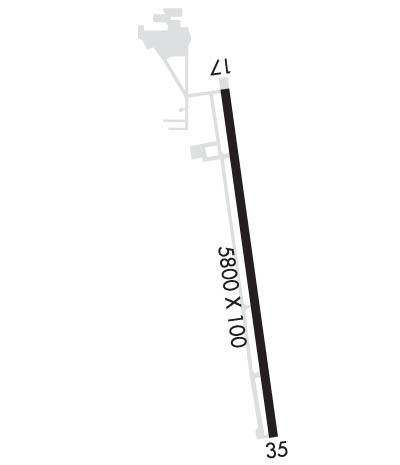
| Lat: N 4339.8 Long: W 09256.0 Elev: 1234 Var: -00 Longest Runway: 5800 | ||
| AWOS: 119.02 CTAF: 122.7 | ||
| ||||||
| ||||||
|
| Rwy | Rwy | |||||||
| 5800x100 | 5800' | 5800x100 | 5800' | 110.55 - 351° | ||||
| Runway ID | Single Wheel | Double Wheel | Double Tandem Wheel | Dual Double Wheel |
| 17/35 | 100,000 | 135,000 | N/A | N/A |
| These numbers are Advisory and are not limits. The Airport Manager should have more accurate Weight Limits | ||||
 Airport Diagram might not be current. | |
| Facility Name: | AUSTIN MUNI |
| City Name: | AUSTIN |
| County: | MOWER |
| State abbrev: | MN |
| State Name: | MINNESOTA |
| Ownership: | PUBLICLY OWNED |
| Use: | OPEN TO THE PUBLIC |
| Owner's Name: | CITY OF AUSTIN |
| Address: | 500 NE 4TH AV |
| AUSTIN, MN 55912 | |
| Owner's Phone: | 507-437-7674 |
| Manager's Name: | BRUCE W. BUDAHN |
| Address: | 710 NE 21ST ST |
| AUSTIN, MN 55912 | |
| Phone: | (507) 433-1813; (507) 433-1813. |
| FAA Region: | GREAT LAKES |
| FAA Field Office: | DMA |
| Date | Sunrise | Sunset |
|---|---|---|
| 09/24/21 Friday | 7:01 | 19:06 |
| 09/25/21 Saturday | 7:02 | 19:04 |
| 09/26/21 Sunday | 7:03 | 19:02 |
| 09/27/21 Monday | 7:04 | 19:00 |
| 09/28/21 Tuesday | 7:06 | 18:59 |
| 09/29/21 Wednesday | 7:07 | 18:57 |
| 09/30/21 Thursday | 7:08 | 18:55 |
| 10/01/21 Friday | 7:09 | 18:53 |
| 10/02/21 Saturday | 7:10 | 18:51 |
| 10/03/21 Sunday | 7:11 | 18:49 |
| 10/04/21 Monday | 7:12 | 18:48 |
| 10/05/21 Tuesday | 7:14 | 18:46 |
| 10/06/21 Wednesday | 7:15 | 18:44 |
| 10/07/21 Thursday | 7:16 | 18:42 |
| Airport Attendance Schedule | MON-FRI 0800-1700, SAT 0800-1600, SUN 0900-1500 |
| Airport Status | OPERATIONAL (This Status can change at any time - please check NOTAMS) |
| Airport Lighting Schedule | ACTVT MALSR RWY 35; REIL RWY 17; PAPI RWY 17 & 35; HIRL RWY 17/35 DALGT - CTAF. HIRL RWY 17/35 PRESET LOW INTST AT NIGHT; TO INCR INTST - CTAF. |
| Airport Storage Available | Tie Downs, Hanger |
| Extra Services Available | Flight Instruction, Aircraft Rental, Aircraft Sales |
| Wind Indicator | YES - (lighted) |
| Control Tower | NO |
| CTAF Frequency | 122.700 |
| Unicom Frequency | 122.700 |
| Rotating Beacon Color | CLEAR-GREEN (Light Land Airport) |
| Segmented Circle | NO |
| Landing Fee | NO |
| Airport Inspected | STATE - performed by STATE AERONAUTICAL PERSONNEL |
| Inspection Date | 07/23/2020 |
| Type of Fuel Available | Grade 100LL, JET A (freeze point -40C); -10AFT HRS CTC FBO 507-433-1813. |
| Airframe Repair Service | MAJOR |
| Power Plant Repair Service | MAJOR |
| Latitude | N4339.8 |
| Longitude | W09256.0 (ESTIMATED) |
| Arpt Elevation | 1233ft (SURVEYED) |
| Magnetic Variation | 00E |
| 2 miles E | of AUSTIN |
| Traffic Pattern Altitude | |
| Sectional Chart | CHICAGO |
| Operations (Reported) | Yearly | Avg. Daily |
|---|---|---|
| General Aviation Transient | 8000 | 22 |
| General Aviation Local | 17000 | 47 |
| Air Taxi | 300 | 1 |
| Commerical | 0 | 0 |
| Commuter | 0 | 0 |
| Military | 120 | 0 |
| Aircraft based on Field | |
|---|---|
| General Aviation Singles | 13 |
| General Aviation Multi | 0 |
| Jet Aircraft | 3 |
| General Aviation Helicopters | 0 |
| Military Aircraft | 0 |
| Gliders | 0 |
| Ultralights | 0 |
| FSS on field | NO |
| FSS tie-in | PRINCETON |
| FSS Phone | 1-800-WX-BRIEF |
| Who issues Notams | AUM |
| Notam D service at airport | YES |
| ARTCC Name | MINNEAPOLIS |
| Airport Certification | |
| Aircraft Rescue & Firefighting Index | None |
| Airport of Entry | No |
| Custom Landing Rights | No |
| Joint Civil/Military | No |
| Military Landing rights | YES |
| NATIONAL PLAN OF INTEGRATED AIRPORT SYSTEMS (NPIAS) |
| GRANT AGREEMENTS UNDER FAAP/ADAP/AIP |
| ASSURANCES PURSUANT TO TITLE VI, CIVIL RIGHTS ACT OF 1964 |
| MIGRATORY WATERFOWL & DEER INVOF ARPT. |
| FOR CD CTC ROCHESTER APCH AT 507-424-8111. |
Airport Communications & Frequencies:
| |||||||||||||||||
| Runway: 17 | Runway: 35 | ||
| Mag heading: | 172° | Mag heading: | 352° |
| Rwy Slope: | .00% Down | Rwy Slope: | .00% Up |
| Approach: | Approach: | LOC/GS | |
| Pattern: | Left Traffic | Pattern: | Left Traffic |
| Markings: | PRECISION INSTRUMENT | Markings: | PRECISION INSTRUMENT |
| Marking Condition: | GOOD | Marking Condition: | GOOD |
| Arresting Dev: | Arresting Dev: | ||
| Lat & Long: | N4340.2 W09256.1 | Lat. & Long.: | N4339.3 W09255.9 |
| Elev: | 1231.0 ft. MSL | Elev: | 1230.8 ft. MSL |
| TCH: | 41 ft. AGL | TCH: | 42 ft. AGL |
| Visual Glide Path: | 3.00 degrees | Visual Glide Path: | 3.00 degrees |
| Displaced Threshold: | No | Displaced Threshold: | No |
| Touchdown Zone: | YES | Touchdown Zone: | YES |
| Touchdown Elev.: | 1233.5 feet | Touchdown Elev.: | 1230.9 feet |
| Visual Glide Slope: | 4-Light PAPI on LEFT side of Runway | Visual Glide Slope: | 4-Light PAPI on LEFT side of Runway |
| RVR Equipment: | RVR Equipment: | ||
| RVV Equipment: | NO | RVV Equipment: | NO |
| Approach Lights: | Approach Lights: | MALSR - 1,400 foot medium intensity approach lighting system with runway alignment indicator lights | |
| REIL: | YES | REIL: | NO |
| Centerline Lights: | NO | Centerline Lights: | NO |
| Touchdown lights: | NO | Touchdown lights: | NO |
| Runway Category: | Runway with a Non-precision Approach having visibility minimums greater than 3/4 mile | Runway Category: | Precision Instrument Runway |
| Declared Distances: | Declared Distances: | ||
| Obstructions: | TREES | Obstructions: | TREES |
| Marked: | NOT Marked/Lighted | Marked: | NOT Marked/Lighted |
| Clearance slope: | 24:1 | Clearance slope: | 38:1 |
| Obstruction height: | 54 feet AGL | Obstruction height: | 58 feet AGL |
| Dist. from runway: | 1519 feet | Dist. from runway: | 2417 feet |
| Centerline offset: | 4 left of centerline | Centerline offset: | 221 feet right of centerline |
| Comments: | Comments: |
Thanks for using FltPlan.com
all rights reserved © 1999-2021 by Flight Plan LLC
