
| SPRINGDALE MUNI SPRINGDALE AR |
| |
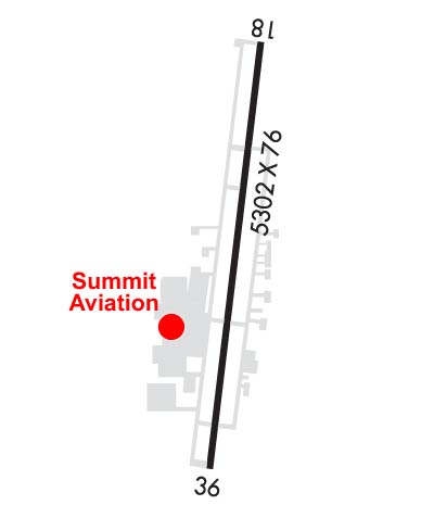
| Lat: N 3610.6 Long: W 09407.2 Elev: 1353 Var: -04 Longest Runway: 5302 | ||
| AWOS: 124.67 Ground: 121.6 Tower: 118.2 | ||
| ||||||||||||||||||||||||||||||||||||||||||||
| ||||||||||||||||||||||||||||||||||||||||||||
| ||||||||||||||||||||||||||||||||||||||||||||
| Rwy | Rwy | |||||||
| 5302x76 | 4939' | 110.90 - 183° | 5302x76 | 5302' | ||||
| Runway ID | Single Wheel | Double Wheel | Double Tandem Wheel | Dual Double Wheel |
| 18/36 | 35,000 | 50,000 | 90,000 | N/A |
| These numbers are Advisory and are not limits. The Airport Manager should have more accurate Weight Limits | ||||
 Airport Diagram might not be current. | |
| Facility Name: | SPRINGDALE MUNI |
| City Name: | SPRINGDALE |
| County: | WASHINGTON |
| State abbrev: | AR |
| State Name: | ARKANSAS |
| Ownership: | PUBLICLY OWNED |
| Use: | OPEN TO THE PUBLIC |
| Owner's Name: | CITY OF SPRINGDALE |
| Address: | CITY HALL, 201 SPRING ST |
| SPRINGDALE, AR 72764 | |
| Owner's Phone: | 479-750-8114 |
| Manager's Name: | AUSTIN BERSI |
| Address: | 802 AIRPORT AVENUE |
| SPRINGDALE, AR 72764 | |
| Phone: | 479-966-2010 |
| FAA Region: | SOUTHWEST |
| FAA Field Office: | AOK |
| Date | Sunrise | Sunset |
|---|---|---|
| 06/08/26 Monday | 5:59 | 20:32 |
| 06/09/26 Tuesday | 5:59 | 20:33 |
| 06/10/26 Wednesday | 5:59 | 20:33 |
| 06/11/26 Thursday | 5:59 | 20:34 |
| 06/12/26 Friday | 5:59 | 20:34 |
| 06/13/26 Saturday | 5:59 | 20:34 |
| 06/14/26 Sunday | 5:59 | 20:35 |
| 06/15/26 Monday | 5:59 | 20:35 |
| 06/16/26 Tuesday | 5:59 | 20:36 |
| 06/17/26 Wednesday | 5:59 | 20:36 |
| 06/18/26 Thursday | 5:59 | 20:36 |
| 06/19/26 Friday | 5:59 | 20:37 |
| 06/20/26 Saturday | 5:59 | 20:37 |
| 06/21/26 Sunday | 5:59 | 20:37 |
| Airport Attendance Schedule | 7 Days A Week 0600-2100; FOR SVC AFT HRS CALL 479-751-4462. |
| Airport Status | OPERATIONAL (This Status can change at any time - please check NOTAMS) |
| Airport Lighting Schedule | ACTVT HIRL RWY 18/36 - CTAF. WHEN ATCT CLSD ACTVT MALSF RWY 18 - CTAF. ACTVT REIL RWY 18 AND 36 - 122.8. |
| Airport Storage Available | Tie Downs, Hanger |
| Extra Services Available | Air Freight, Air Ambulance, Avionics, Charter, Flight Instruction, Aircraft Rental, Aircraft Sales |
| Wind Indicator | YES - (lighted) |
| Control Tower | YES |
| CTAF Frequency | 118.200 |
| Unicom Frequency | 122.950 |
| Rotating Beacon Color | WG |
| Segmented Circle | YES |
| Landing Fee | NO; ALL ACFT LEFT OVERNIGHT WILL BE CHARGED A RAMP FEE UNLESS FUEL HAS BEEN PURCHASED. |
| Airport Inspected | STATE - performed by STATE AERONAUTICAL PERSONNEL |
| Inspection Date | 04/30/2022 |
| Type of Fuel Available | Grade 100LL, JET A (freeze point -40C); -10100LL AVBL 24 HRS SELF SERVE WITH CREDIT CARD. |
| Airframe Repair Service | MAJOR |
| Power Plant Repair Service | MAJOR |
| Latitude | N3610.6 |
| Longitude | W09407.2 (ESTIMATED) |
| Arpt Elevation | 1352ft (SURVEYED) |
| Magnetic Variation | 04E |
| 1 miles SE | of SPRINGDALE |
| Traffic Pattern Altitude | |
| Sectional Chart | KANSAS CITY |
| Operations (Reported) | Yearly | Avg. Daily |
|---|---|---|
| General Aviation Transient | 0 | 0 |
| General Aviation Local | 0 | 0 |
| Air Taxi | 0 | 0 |
| Commerical | 0 | 0 |
| Commuter | 0 | 0 |
| Military | 0 | 0 |
| Aircraft based on Field | |
|---|---|
| General Aviation Singles | 0 |
| General Aviation Multi | 0 |
| Jet Aircraft | 0 |
| General Aviation Helicopters | 0 |
| Military Aircraft | 0 |
| Gliders | 0 |
| Ultralights | 0 |
| FSS on field | NO |
| FSS tie-in | JONESBORO |
| FSS Phone | 1-800-WX-BRIEF |
| Who issues Notams | ASG |
| Notam D service at airport | YES |
| ARTCC Name | MEMPHIS |
| Airport Certification | |
| Aircraft Rescue & Firefighting Index | None |
| Airport of Entry | No |
| Custom Landing Rights | No |
| Joint Civil/Military | No |
| Military Landing rights | YES |
| NATIONAL PLAN OF INTEGRATED AIRPORT SYSTEMS (NPIAS) |
| GRANT AGREEMENTS UNDER FAAP/ADAP/AIP |
| ASSURANCES PURSUANT TO TITLE VI, CIVIL RIGHTS ACT OF 1964 |
| FOR CD WHEN UNA VIA FREQ CTC RAZORBACK APCH 479-649-2416, WHEN APCH CLSD CTC MEMPHIS ARTCC AT 901-368-8453/8449. |
Airport Communications & Frequencies:
| |||||||||||||||||||||
| Runway: 18 | Runway: 36 | ||
| Mag heading: | 183° | Mag heading: | 3° |
| Rwy Slope: | .25% Up | Rwy Slope: | -.25% Down |
| Approach: | ILS | Approach: | |
| Pattern: | Left Traffic | Pattern: | Left Traffic |
| Markings: | PRECISION INSTRUMENT | Markings: | PRECISION INSTRUMENT |
| Marking Condition: | GOOD | Marking Condition: | GOOD |
| Arresting Dev: | Arresting Dev: | ||
| Lat & Long: | N3611.0 W09407.1 | Lat. & Long.: | N3610.2 W09407.2 |
| Elev: | 1339.2 ft. MSL | Elev: | 1352.4 ft. MSL |
| TCH: | 43 ft. AGL | TCH: | 40 ft. AGL |
| Visual Glide Path: | 3.00 degrees | Visual Glide Path: | 3.00 degrees |
| Displaced Threshold: | 363 feet | Displaced Threshold: | No |
| Touchdown Zone: | YES | Touchdown Zone: | YES |
| Touchdown Elev.: | 1351.1 feet | Touchdown Elev.: | 1352.5 feet |
| Visual Glide Slope: | 4-Light PAPI on LEFT side of Runway | Visual Glide Slope: | 4-Light PAPI on RIGHT side of Runway |
| RVR Equipment: | RVR Equipment: | ||
| RVV Equipment: | NO | RVV Equipment: | NO |
| Approach Lights: | MALSF - 1,400 foot medium intensity approach lighting system with sequenced flashers | Approach Lights: | |
| REIL: | YES | REIL: | YES |
| Centerline Lights: | NO | Centerline Lights: | NO |
| Touchdown lights: | NO | Touchdown lights: | NO |
| Runway Category: | Precision Instrument Runway | Runway Category: | Runway with a Non-precision Approach having visibility minimums greater than 3/4 mile |
| Declared Distances: | TORA:5302' TODA:5302' ASDA:5302' LDA:4939' | Declared Distances: | TORA:5302' TODA:5302' ASDA:5302' LDA:5302' |
| Obstructions: | Obstructions: | TREES | |
| Marked: | Marked: | NOT Marked/Lighted | |
| Clearance slope: | 50:1; APCH RATIO 50:1 FM DSPLCD THR. | Clearance slope: | 38:1 |
| Obstruction height: | Obstruction height: | 40 feet AGL | |
| Dist. from runway: | Dist. from runway: | 1750 feet | |
| Centerline offset: | Centerline offset: | 400 feet left of centerline | |
| Comments: | Comments: |
Thanks for using FltPlan.com
all rights reserved © 1999-2026 by Flight Plan LLC
