
| WAKEFIELD MUNI WAKEFIELD VA |
| |
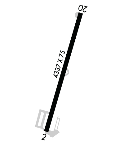
| Lat: N 3659.2 Long: W 07700.1 Elev: 111 Var: +11 Longest Runway: 4337 | ||
| AWOS: 128.32 CTAF: 122.8 | ||
| ||||||
| ||||||
|
| Rwy | Rwy | |||||||
| 4337x75 | 4039' | 4337x75 | 3866' | |||||
| Runway ID | Single Wheel | Double Wheel | Double Tandem Wheel | Dual Double Wheel |
| 02/20 | 12,500 | N/A | N/A | N/A |
| These numbers are Advisory and are not limits. The Airport Manager should have more accurate Weight Limits | ||||
 Airport Diagram might not be current. | |
| Facility Name: | WAKEFIELD MUNI |
| City Name: | WAKEFIELD |
| County: | SUSSEX |
| State abbrev: | VA |
| State Name: | VIRGINIA |
| Ownership: | PUBLICLY OWNED |
| Use: | OPEN TO THE PUBLIC |
| Owner's Name: | TOWN OF WAKEFIELD |
| Address: | P O BOX 550 |
| WAKEFIELD, VA 23888 | |
| Owner's Phone: | 757-899-2030 |
| Manager's Name: | BRIAN LAINE |
| Address: | P.O. BOX 550 |
| WAKEFIELD, VA 23888 | |
| Phone: | 757-899-0096 |
| FAA Region: | EASTERN |
| FAA Field Office: | DCA |
| Date | Sunrise | Sunset |
|---|---|---|
| 09/24/21 Friday | 6:57 | 19:02 |
| 09/25/21 Saturday | 6:58 | 19:01 |
| 09/26/21 Sunday | 6:59 | 18:59 |
| 09/27/21 Monday | 7:00 | 18:58 |
| 09/28/21 Tuesday | 7:01 | 18:56 |
| 09/29/21 Wednesday | 7:01 | 18:55 |
| 09/30/21 Thursday | 7:02 | 18:53 |
| 10/01/21 Friday | 7:03 | 18:52 |
| 10/02/21 Saturday | 7:04 | 18:50 |
| 10/03/21 Sunday | 7:05 | 18:49 |
| 10/04/21 Monday | 7:06 | 18:47 |
| 10/05/21 Tuesday | 7:07 | 18:46 |
| 10/06/21 Wednesday | 7:07 | 18:44 |
| 10/07/21 Thursday | 7:08 | 18:43 |
| Airport Attendance Schedule | IRREGULAR |
| Airport Status | OPERATIONAL (This Status can change at any time - please check NOTAMS) |
| Airport Lighting Schedule | |
| Airport Storage Available | Tie Downs, Hanger |
| Extra Services Available | Crop Dusting |
| Wind Indicator | YES - (lighted) |
| Control Tower | NO |
| CTAF Frequency | 122.800 |
| Unicom Frequency | 122.800 |
| Rotating Beacon Color | CLEAR-GREEN (Light Land Airport) |
| Segmented Circle | YES |
| Landing Fee | NO |
| Airport Inspected | STATE - performed by STATE AERONAUTICAL PERSONNEL |
| Inspection Date | 04/16/2020 |
| Type of Fuel Available | Grade 100LL; -1024 HR SELF SERVICE FUEL |
| Airframe Repair Service | NONE |
| Power Plant Repair Service | NONE |
| Latitude | N3659.2 |
| Longitude | W07700.1 (ESTIMATED) |
| Arpt Elevation | 111ft (ESTIMATED) |
| Magnetic Variation | 11W |
| 2 miles NW | of WAKEFIELD |
| Traffic Pattern Altitude | |
| Sectional Chart | WASHINGTON |
| Operations (Reported) | Yearly | Avg. Daily |
|---|---|---|
| General Aviation Transient | 6459 | 18 |
| General Aviation Local | 8289 | 23 |
| Air Taxi | 310 | 1 |
| Commerical | 0 | 0 |
| Commuter | 0 | 0 |
| Military | 1260 | 3 |
| Aircraft based on Field | |
|---|---|
| General Aviation Singles | 24 |
| General Aviation Multi | 0 |
| Jet Aircraft | 0 |
| General Aviation Helicopters | 0 |
| Military Aircraft | 0 |
| Gliders | 1 |
| Ultralights | 0 |
| FSS on field | NO |
| FSS tie-in | LEESBURG |
| FSS Phone | 1-800-WX-BRIEF |
| Who issues Notams | AKQ |
| Notam D service at airport | YES |
| ARTCC Name | WASHINGTON |
| Airport Certification | |
| Aircraft Rescue & Firefighting Index | None |
| Airport of Entry | No |
| Custom Landing Rights | No |
| Joint Civil/Military | No |
| Military Landing rights | No |
| FOR CD CTC NORFOLK APCH AT 757-464-0757. |
Airport Communications & Frequencies:
| ||||||||||||||
| Runway: 02 | Runway: 20 | ||
| Mag heading: | 28° | Mag heading: | 208° |
| Rwy Slope: | .09% Up | Rwy Slope: | -.09% Down |
| Approach: | Approach: | ||
| Pattern: | Left Traffic | Pattern: | Left Traffic |
| Markings: | NONPRECISION INSTRUMENT | Markings: | NONPRECISION INSTRUMENT |
| Marking Condition: | FAIR | Marking Condition: | FAIR |
| Arresting Dev: | Arresting Dev: | ||
| Lat & Long: | N3658.9 W07700.2 | Lat. & Long.: | N3659.6 W07659.9 |
| Elev: | 107.4 ft. MSL | Elev: | 111.4 ft. MSL |
| TCH: | TCH: | ||
| Visual Glide Path: | Visual Glide Path: | ||
| Displaced Threshold: | 298 feet | Displaced Threshold: | 471 feet |
| Touchdown Zone: | YES | Touchdown Zone: | YES |
| Touchdown Elev.: | 108.5 feet | Touchdown Elev.: | 109.9 feet |
| Visual Glide Slope: | Visual Glide Slope: | ||
| RVR Equipment: | RVR Equipment: | ||
| RVV Equipment: | NO | RVV Equipment: | NO |
| Approach Lights: | Approach Lights: | ||
| REIL: | NO | REIL: | NO |
| Centerline Lights: | NO | Centerline Lights: | NO |
| Touchdown lights: | NO | Touchdown lights: | NO |
| Runway Category: | Runway with a Visual Approach | Runway Category: | Runway with a Visual Approach |
| Declared Distances: | Declared Distances: | ||
| Obstructions: | TREES | Obstructions: | TREES |
| Marked: | NOT Marked/Lighted | Marked: | NOT Marked/Lighted |
| Clearance slope: | 4:1; CLEARANCE SLOPE TO DSPLCD THLD 11:1 | Clearance slope: | 12:1; CLEARANCE SLOPE TO DSPLCD THLD 19:1 |
| Obstruction height: | 37 feet AGL | Obstruction height: | 74 feet AGL |
| Dist. from runway: | 374 feet | Dist. from runway: | 1160 feet |
| Centerline offset: | 90 right of centerline | Centerline offset: | 54 feet right of centerline |
| Comments: | RD +15' 70' FM THR CROSSING END. | Comments: | ROAD +15 FT 70 FT FM RY END. |
Thanks for using FltPlan.com
all rights reserved © 1999-2021 by Flight Plan LLC
