
| WALLACE-PENDER WALLACE NC |
| |
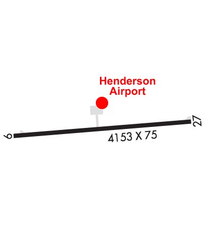
| Lat: N 3443.1 Long: W 07800.2 Elev: 38 Var: +09 Longest Runway: 4153 | ||
| CTAF: 122.8 | ||
| ||||||||||||||||||||||||||||||||||||||||||||||||||||||||||||||
| ||||||||||||||||||||||||||||||||||||||||||||||||||||||||||||||
| Rwy | Rwy | |||||||
| 4153x75 | 4004' | 4153x75 | 4002' | |||||
| Runway ID | Single Wheel | Double Wheel | Double Tandem Wheel | Dual Double Wheel |
| 09/27 | 12,500 | N/A | N/A | N/A |
| These numbers are Advisory and are not limits. The Airport Manager should have more accurate Weight Limits | ||||
 Airport Diagram might not be current. | |
| Facility Name: | WALLACE-PENDER |
| City Name: | WALLACE |
| County: | PENDER |
| State abbrev: | NC |
| State Name: | NORTH CAROLINA |
| Ownership: | PUBLICLY OWNED |
| Use: | OPEN TO THE PUBLIC |
| Owner's Name: | TOWN OF WALLACE |
| Address: | 316 E. MURRAY STREET, PO BOX 849 |
| WALLACE, NC 28466 | |
| Owner's Phone: | 910-285-4136 |
| Manager's Name: | BEN JONES |
| Address: | 250 HENDERSON FIELD ROAD |
| WALLACE, NC 28466 | |
| Phone: | 910-285-6642; FBO (DAY): 910-285-6642. AFT HRS: 910-271-8955. ALTN (POLICE DEPT): 910-285-2126. |
| FAA Region: | SOUTHERN |
| FAA Field Office: | MEM |
| Date | Sunrise | Sunset |
|---|---|---|
| 06/12/26 Friday | 5:58 | 20:26 |
| 06/13/26 Saturday | 5:58 | 20:26 |
| 06/14/26 Sunday | 5:58 | 20:26 |
| 06/15/26 Monday | 5:58 | 20:27 |
| 06/16/26 Tuesday | 5:58 | 20:27 |
| 06/17/26 Wednesday | 5:58 | 20:27 |
| 06/18/26 Thursday | 5:59 | 20:28 |
| 06/19/26 Friday | 5:59 | 20:28 |
| 06/20/26 Saturday | 5:59 | 20:28 |
| 06/21/26 Sunday | 5:59 | 20:28 |
| 06/22/26 Monday | 5:59 | 20:29 |
| 06/23/26 Tuesday | 6:00 | 20:29 |
| 06/24/26 Wednesday | 6:00 | 20:29 |
| 06/25/26 Thursday | 6:00 | 20:29 |
| Airport Attendance Schedule | SUN 1300-1800, MON-SAT 0800-1700; 24 HR ACES TO PILOTS LOUNGE. |
| Airport Status | OPERATIONAL (This Status can change at any time - please check NOTAMS) |
| Airport Lighting Schedule | ACTVT MIRLS RWY 09/27- CTAF. PAPIS OPR CONSLY. |
| Airport Storage Available | Tie Downs |
| Extra Services Available | Flight Instruction, Aircraft Rental |
| Wind Indicator | YES - (lighted) |
| Control Tower | NO |
| CTAF Frequency | 122.800 |
| Unicom Frequency | 122.800 |
| Rotating Beacon Color | WG |
| Segmented Circle | YES |
| Landing Fee | NO |
| Airport Inspected | STATE - performed by STATE AERONAUTICAL PERSONNEL |
| Inspection Date | 05/27/2024 |
| Type of Fuel Available | Grade 100LL, JET A-1 (icing inhibitor, freeze point -50C); -1024 HR SELF SVC FUEL WITH CREDIT CARD. |
| Airframe Repair Service | MAJOR |
| Power Plant Repair Service | MAJOR |
| Latitude | N3443.1 |
| Longitude | W07800.2 (ESTIMATED) |
| Arpt Elevation | 38ft (SURVEYED) |
| Magnetic Variation | 09W |
| 1 miles SW | of WALLACE |
| Traffic Pattern Altitude | |
| Sectional Chart | CHARLOTTE |
| Operations (Reported) | Yearly | Avg. Daily |
|---|---|---|
| General Aviation Transient | 0 | 0 |
| General Aviation Local | 0 | 0 |
| Air Taxi | 0 | 0 |
| Commerical | 0 | 0 |
| Commuter | 0 | 0 |
| Military | 0 | 0 |
| Aircraft based on Field | |
|---|---|
| General Aviation Singles | 0 |
| General Aviation Multi | 0 |
| Jet Aircraft | 0 |
| General Aviation Helicopters | 0 |
| Military Aircraft | 0 |
| Gliders | 0 |
| Ultralights | 0 |
| FSS on field | NO |
| FSS tie-in | RALEIGH |
| FSS Phone | 1-800-WX-BRIEF |
| Who issues Notams | RDU |
| Notam D service at airport | YES |
| ARTCC Name | WASHINGTON |
| Airport Certification | |
| Aircraft Rescue & Firefighting Index | None |
| Airport of Entry | No |
| Custom Landing Rights | No |
| Joint Civil/Military | No |
| Military Landing rights | YES |
| NATIONAL PLAN OF INTEGRATED AIRPORT SYSTEMS (NPIAS) |
| GRANT AGREEMENTS UNDER FAAP/ADAP/AIP |
| ASSURANCES PURSUANT TO TITLE VI, CIVIL RIGHTS ACT OF 1964 |
| 5 FT DITCH 135 FT RIGHT OF CNTRLN RWY 09. |
| 7 FT DITCH 140 FT LEFT OF CNTRLN RWY 27. |
| RWY 27 SAFETY AREA HAS 20 FT DEPRESSIONS/CREEK 160 FT FR THR BOTH SIDES CNTRLN. |
| MIL ACFT LIMIT DLA ON RWY TO AVOID DAMAGE TO RWY SURFACES. |
| NOISE ABATEMENT PROCS IN EFF, CALL AMGR 910-271-8955. |
| WALLACE-PENDER ARPT CLSD TO TOUCH & GO/PRACTICE APCHS 2100-0600 LCL DLY. |
| ARPT CLSD TO MIL ACFT EXCEPT 1 HR PPR. |
| FOR CD CTC WILMINGTON APCH AT 910-815-4676, OR WHEN APCH CLSD CTC WASHINGTON ARTCC AT 703-771-3587. |
Airport Communications & Frequencies:
| |||||||||||||||||
| Runway: 09 | Runway: 27 | ||
| Mag heading: | 94° | Mag heading: | 274° |
| Rwy Slope: | -.21% Down | Rwy Slope: | .21% Up |
| Approach: | Approach: | ||
| Pattern: | Left Traffic | Pattern: | Left Traffic |
| Markings: | NONPRECISION INSTRUMENT | Markings: | NONPRECISION INSTRUMENT |
| Marking Condition: | GOOD | Marking Condition: | GOOD |
| Arresting Dev: | Arresting Dev: | ||
| Lat & Long: | N3443.0 W07800.6 | Lat. & Long.: | N3443.1 W07759.8 |
| Elev: | 37.9 ft. MSL | Elev: | 29.2 ft. MSL |
| TCH: | 40 ft. AGL | TCH: | 44 ft. AGL |
| Visual Glide Path: | 3.13 degrees | Visual Glide Path: | 3.53 degrees |
| Displaced Threshold: | 149 feet | Displaced Threshold: | 151 feet |
| Touchdown Zone: | YES | Touchdown Zone: | YES |
| Touchdown Elev.: | 37.9 feet | Touchdown Elev.: | 36.2 feet |
| Visual Glide Slope: | 2-Light PAPI on LEFT side of Runway | Visual Glide Slope: | 2-Light PAPI on LEFT side of Runway |
| RVR Equipment: | RVR Equipment: | ||
| RVV Equipment: | NO | RVV Equipment: | NO |
| Approach Lights: | Approach Lights: | ||
| REIL: | NO | REIL: | NO |
| Centerline Lights: | NO | Centerline Lights: | NO |
| Touchdown lights: | NO | Touchdown lights: | NO |
| Runway Category: | Runway with a Non-precision Approach | Runway Category: | Runway with a Non-precision Approach |
| Declared Distances: | Declared Distances: |
Thanks for using FltPlan.com
all rights reserved © 1999-2026 by Flight Plan LLC


