
| PINE HILL ALBION NY |
| |
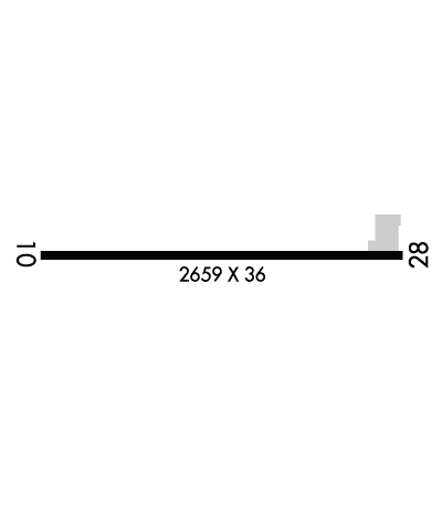
| Lat: N 4310.4 Long: W 07816.5 Elev: 669 Var: +11 Longest Runway: 2659 | ||
| CTAF: 123.0 | ||
| ||||||||||||||||||||||||||||||||
| ||||||||||||||||||||||||||||||||
| Rwy | Rwy | |||||||
| 2659x36 | 2659' | 2659x36 | 2409' | |||||
| Runway ID | Single Wheel | Double Wheel | Double Tandem Wheel | Dual Double Wheel |
| 10/28 | 12,000 | N/A | N/A | N/A |
| These numbers are Advisory and are not limits. The Airport Manager should have more accurate Weight Limits | ||||
 Airport Diagram might not be current. | |
| Facility Name: | PINE HILL |
| City Name: | ALBION |
| County: | ORLEANS |
| State abbrev: | NY |
| State Name: | NEW YORK |
| Ownership: | PRIVATELY OWNED |
| Use: | OPEN TO THE PUBLIC |
| Owner's Name: | HAINES FAMILY FARM, LLC |
| Address: | 4906 PINE HILL ROAD |
| ALBION, NY 14411-9760 | |
| Owner's Phone: | (585) 589-7758 |
| Manager's Name: | TIMOTHY ALLEN |
| Address: | 4906 PINE HILL ROAD |
| ALBION, NY 14411 | |
| Phone: | 585-589-7758 |
| FAA Region: | EASTERN |
| FAA Field Office: | NYC |
| Date | Sunrise | Sunset |
|---|---|---|
| 09/24/21 Friday | 7:02 | 19:07 |
| 09/25/21 Saturday | 7:03 | 19:05 |
| 09/26/21 Sunday | 7:04 | 19:04 |
| 09/27/21 Monday | 7:06 | 19:02 |
| 09/28/21 Tuesday | 7:07 | 19:00 |
| 09/29/21 Wednesday | 7:08 | 18:58 |
| 09/30/21 Thursday | 7:09 | 18:56 |
| 10/01/21 Friday | 7:10 | 18:55 |
| 10/02/21 Saturday | 7:11 | 18:53 |
| 10/03/21 Sunday | 7:12 | 18:51 |
| 10/04/21 Monday | 7:14 | 18:49 |
| 10/05/21 Tuesday | 7:15 | 18:48 |
| 10/06/21 Wednesday | 7:16 | 18:46 |
| 10/07/21 Thursday | 7:17 | 18:44 |
| Airport Attendance Schedule | UNATTENDED |
| Airport Status | OPERATIONAL (This Status can change at any time - please check NOTAMS) |
| Airport Lighting Schedule | ACTIVT RY LIGHTS AT 585-589-7758. |
| Airport Storage Available | Tie Downs |
| Extra Services Available | Parachute Jumping |
| Wind Indicator | YES - (unlit) |
| Control Tower | NO |
| CTAF Frequency | 123.000 |
| Unicom Frequency | 123.000 |
| Rotating Beacon Color | |
| Segmented Circle | NO |
| Landing Fee | NO |
| Airport Inspected | STATE - performed by STATE AERONAUTICAL PERSONNEL |
| Inspection Date | 08/19/2020 |
| Type of Fuel Available | None |
| Airframe Repair Service | None |
| Power Plant Repair Service | None |
| Latitude | N4310.4 |
| Longitude | W07816.5 (ESTIMATED) |
| Arpt Elevation | 669ft (SURVEYED) |
| Magnetic Variation | 11W |
| 5 miles SW | of ALBION |
| Traffic Pattern Altitude | 1500 |
| Sectional Chart | DETROIT |
| Operations (Reported) | Yearly | Avg. Daily |
|---|---|---|
| General Aviation Transient | 4000 | 11 |
| General Aviation Local | 2000 | 5 |
| Air Taxi | 0 | 0 |
| Commerical | 0 | 0 |
| Commuter | 0 | 0 |
| Military | 500 | 1 |
| Aircraft based on Field | |
|---|---|
| General Aviation Singles | 10 |
| General Aviation Multi | 0 |
| Jet Aircraft | 0 |
| General Aviation Helicopters | 0 |
| Military Aircraft | 0 |
| Gliders | 0 |
| Ultralights | 1 |
| FSS on field | NO |
| FSS tie-in | BUFFALO |
| FSS Phone | 1-800-WX-BRIEF |
| Who issues Notams | BUF |
| Notam D service at airport | YES |
| ARTCC Name | CLEVELAND |
| Airport Certification | |
| Aircraft Rescue & Firefighting Index | None |
| Airport of Entry | No |
| Custom Landing Rights | No |
| Joint Civil/Military | No |
| Military Landing rights | No |
| THIS AIRPORT HAS BEEN SURVEYED BY THE NATIONAL GEODETIC SURVEY. |
| FOR ARPT CONDS WINTER MONTHS OR LIRL OR REIL RY 10/28 CALL 585-589-7758. |
| 245 FT TWR 1500 FT SSE APCH END RY 28. |
| RWY 10/28 LMTD TO ACFT 12500 LBS. |
| 70'-80' TREES 150'LEFT AER 10 |
| PAEW 75 FT EAST RY 28. |
| FOR CD CTC CLEVELAND ARTCC AT 440-774-0490. |
| RWY 10/2 8 200 FT TURF STOPWAY ON EAST END; 1000 FT TURF RY SAFETY AREA ON WEST END. |
| RWY 10/2 8 LIRL NSTD FIRST 225 FT EAST END UNLGTD. |
Airport Communications & Frequencies:
| ||||||||||||||
| Runway: 10 | Runway: 28 | ||
| Mag heading: | 102° | Mag heading: | 282° |
| Rwy Slope: | .60% Up | Rwy Slope: | -.60% Down |
| Approach: | Approach: | ||
| Pattern: | Left Traffic | Pattern: | Left Traffic |
| Markings: | BASIC | Markings: | BASIC |
| Marking Condition: | POOR; MARKINGS FADED. | Marking Condition: | POOR; MARKINGS FADED. |
| Arresting Dev: | Arresting Dev: | ||
| Lat & Long: | N4310.4 W07816.8 | Lat. & Long.: | N4310.4 W07816.2 |
| Elev: | 653.0 ft. MSL | Elev: | 669.0 ft. MSL |
| TCH: | TCH: | ||
| Visual Glide Path: | Visual Glide Path: | ||
| Displaced Threshold: | No | Displaced Threshold: | 250 feet |
| Touchdown Zone: | YES | Touchdown Zone: | YES |
| Touchdown Elev.: | 669.0 feet | Touchdown Elev.: | 669.0 feet |
| Visual Glide Slope: | Visual Glide Slope: | ||
| RVR Equipment: | RVR Equipment: | ||
| RVV Equipment: | NO | RVV Equipment: | NO |
| Approach Lights: | Approach Lights: | ||
| REIL: | NO | REIL: | NO |
| Centerline Lights: | NO | Centerline Lights: | NO |
| Touchdown lights: | NO | Touchdown lights: | NO |
| Runway Category: | Runway with a Visual Approach | Runway Category: | Runway with a Visual Approach |
| Declared Distances: | Declared Distances: | ||
| Obstructions: | TREE | Obstructions: | ROAD |
| Marked: | NOT Marked/Lighted | Marked: | NOT Marked/Lighted |
| Clearance slope: | 17:1 | Clearance slope: | RWY 28 APCH SLP, +32 FT TREE, 502 FT FM DTHR, 77 FT LEFT OF CNTRLN, 15:1 TO DTHR. |
| Obstruction height: | 49 feet AGL | Obstruction height: | 16 feet AGL |
| Dist. from runway: | 1067 feet | Dist. from runway: | 201 feet |
| Centerline offset: | 188 right of centerline | Centerline offset: | |
| Comments: | Comments: | RWY 28 8 FT SIGN 185 FT FM THLD 64 FT RIGHT OF CNTRLN. |
Thanks for using FltPlan.com
all rights reserved © 1999-2021 by Flight Plan LLC
