
| CASSVILLE MUNI CASSVILLE MO |
| |
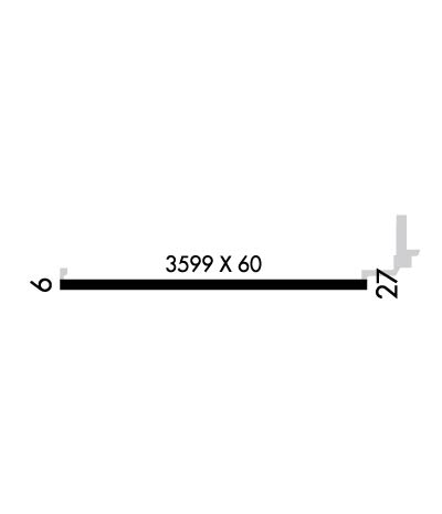
| Lat: N 3641.8 Long: W 09354.0 Elev: 1483 Var: -02 Longest Runway: 3599 | ||
| CTAF: 122.9 | ||
| ||||||||||||||||||||||||||||||||||||||||||||
| ||||||||||||||||||||||||||||||||||||||||||||
| Rwy | Rwy | |||||||
| 3599x60 | 3599' | 3599x60 | 3599' | |||||
| Runway ID | Single Wheel | Double Wheel | Double Tandem Wheel | Dual Double Wheel |
| 09/27 | 8,000 | N/A | N/A | N/A |
| These numbers are Advisory and are not limits. The Airport Manager should have more accurate Weight Limits | ||||
 Airport Diagram might not be current. | |
| Facility Name: | CASSVILLE MUNI |
| City Name: | CASSVILLE |
| County: | BARRY |
| State abbrev: | MO |
| State Name: | MISSOURI |
| Ownership: | PUBLICLY OWNED |
| Use: | OPEN TO THE PUBLIC |
| Owner's Name: | CITY OF CASSVILLE |
| Address: | 300 MAIN ST |
| CASSVILLE, MO 65625 | |
| Owner's Phone: | 417-847-4441 |
| Manager's Name: | JUSTIN HENSON |
| Address: | 300 S MAIN |
| CASSVILLE, MO 65625 | |
| Phone: | 417-847-4441; EVE PHONE # 417-342-2814 |
| FAA Region: | CENTRAL |
| FAA Field Office: | NONE |
| Date | Sunrise | Sunset |
|---|---|---|
| 06/08/26 Monday | 5:57 | 20:33 |
| 06/09/26 Tuesday | 5:56 | 20:33 |
| 06/10/26 Wednesday | 5:56 | 20:34 |
| 06/11/26 Thursday | 5:56 | 20:34 |
| 06/12/26 Friday | 5:56 | 20:35 |
| 06/13/26 Saturday | 5:56 | 20:35 |
| 06/14/26 Sunday | 5:56 | 20:36 |
| 06/15/26 Monday | 5:56 | 20:36 |
| 06/16/26 Tuesday | 5:56 | 20:36 |
| 06/17/26 Wednesday | 5:56 | 20:37 |
| 06/18/26 Thursday | 5:57 | 20:37 |
| 06/19/26 Friday | 5:57 | 20:37 |
| 06/20/26 Saturday | 5:57 | 20:37 |
| 06/21/26 Sunday | 5:57 | 20:38 |
| Airport Attendance Schedule | UNATTENDED |
| Airport Status | OPERATIONAL (This Status can change at any time - please check NOTAMS) |
| Airport Lighting Schedule | ACTVT MIRL RWY 09/27 SS-SR CTAF. PAPI RWYS 09/27 OPRS 24 HRS. |
| Airport Storage Available | Tie Downs |
| Extra Services Available | NONE |
| Wind Indicator | YES - (lighted) |
| Control Tower | NO |
| CTAF Frequency | 122.900 |
| Unicom Frequency | |
| Rotating Beacon Color | WG |
| Segmented Circle | YES |
| Landing Fee | NO |
| Airport Inspected | STATE - performed by STATE AERONAUTICAL PERSONNEL |
| Inspection Date | 06/17/2024 |
| Type of Fuel Available | Grade 100LL |
| Airframe Repair Service | NONE |
| Power Plant Repair Service | NONE |
| Latitude | N3641.8 |
| Longitude | W09354.0 (ESTIMATED) |
| Arpt Elevation | 1482ft (SURVEYED) |
| Magnetic Variation | 02E |
| 2 miles NW | of CASSVILLE |
| Traffic Pattern Altitude | |
| Sectional Chart | KANSAS CITY |
| Operations (Reported) | Yearly | Avg. Daily |
|---|---|---|
| General Aviation Transient | 0 | 0 |
| General Aviation Local | 0 | 0 |
| Air Taxi | 0 | 0 |
| Commerical | 0 | 0 |
| Commuter | 0 | 0 |
| Military | 0 | 0 |
| Aircraft based on Field | |
|---|---|
| General Aviation Singles | 0 |
| General Aviation Multi | 0 |
| Jet Aircraft | 0 |
| General Aviation Helicopters | 0 |
| Military Aircraft | 0 |
| Gliders | 0 |
| Ultralights | 0 |
| FSS on field | NO |
| FSS tie-in | COLUMBIA |
| FSS Phone | 1-800-WX-BRIEF |
| Who issues Notams | COU |
| Notam D service at airport | YES |
| ARTCC Name | KANSAS CITY |
| Airport Certification | |
| Aircraft Rescue & Firefighting Index | None |
| Airport of Entry | No |
| Custom Landing Rights | No |
| Joint Civil/Military | No |
| Military Landing rights | YES |
| NATIONAL PLAN OF INTEGRATED AIRPORT SYSTEMS (NPIAS) |
| GRANT AGREEMENTS UNDER FAAP/ADAP/AIP |
| ASSURANCES PURSUANT TO TITLE VI, CIVIL RIGHTS ACT OF 1964 |
| 100LL SELF SVC AVBL WITH CREDIT CARD ONLY. |
| FOR CD CTC SPRINGFIELD APCH AT 417-868-5620/5619. |
| RWY 09/2 7 SVR FULL-DEPTH CRACKING 1-4" WIDE ENTR LEN OF RWY. |
Airport Communications & Frequencies:
| ||||||||||||
| Runway: 09 | Runway: 27 | ||
| Mag heading: | 88° | Mag heading: | 268° |
| Rwy Slope: | -.22% Down | Rwy Slope: | .22% Up |
| Approach: | Approach: | ||
| Pattern: | Left Traffic | Pattern: | Left Traffic |
| Markings: | NONPRECISION INSTRUMENT | Markings: | NONPRECISION INSTRUMENT |
| Marking Condition: | GOOD | Marking Condition: | GOOD |
| Arresting Dev: | Arresting Dev: | ||
| Lat & Long: | N3641.8 W09354.4 | Lat. & Long.: | N3641.8 W09353.7 |
| Elev: | 1479.5 ft. MSL | Elev: | 1471.5 ft. MSL |
| TCH: | 42 ft. AGL | TCH: | 43 ft. AGL |
| Visual Glide Path: | 3.00 degrees | Visual Glide Path: | 3.00 degrees |
| Displaced Threshold: | No | Displaced Threshold: | No |
| Touchdown Zone: | YES | Touchdown Zone: | YES |
| Touchdown Elev.: | 1482.7 feet | Touchdown Elev.: | 1482.7 feet |
| Visual Glide Slope: | 2-Light PAPI on LEFT side of Runway | Visual Glide Slope: | 2-Light PAPI on LEFT side of Runway |
| RVR Equipment: | RVR Equipment: | ||
| RVV Equipment: | NO | RVV Equipment: | NO |
| Approach Lights: | Approach Lights: | ||
| REIL: | NO | REIL: | NO |
| Centerline Lights: | NO | Centerline Lights: | NO |
| Touchdown lights: | NO | Touchdown lights: | NO |
| Runway Category: | Runway with a Non-precision Approach | Runway Category: | Runway with a Non-precision Approach |
| Declared Distances: | Declared Distances: |
Thanks for using FltPlan.com
all rights reserved © 1999-2026 by Flight Plan LLC
