
| SKYDIVE CHICAGO OTTAWA IL |
| |
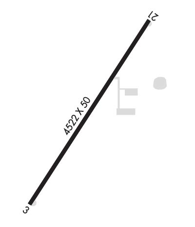
| Lat: N 4124.0 Long: W 08847.6 Elev: 616 Var: +01 Longest Runway: 4522 | ||
| CTAF: 122.72 | ||
| ||||||||||||||||||||||||||||||||
| ||||||||||||||||||||||||||||||||
| Rwy | Rwy | |||||||
| 4522x50 | 4522' | 4522x50 | 4522' | |||||
| Runway ID | Single Wheel | Double Wheel | Double Tandem Wheel | Dual Double Wheel |
| 03/21 | 12,500 | N/A | N/A | N/A |
| These numbers are Advisory and are not limits. The Airport Manager should have more accurate Weight Limits | ||||
| FltPlan does not have IFR approach charts available for K8N2. |
 Airport Diagram might not be current. | |
| Facility Name: | SKYDIVE CHICAGO |
| City Name: | OTTAWA |
| County: | LA SALLE |
| State abbrev: | IL |
| State Name: | ILLINOIS |
| Ownership: | PRIVATELY OWNED |
| Use: | OPEN TO THE PUBLIC |
| Owner's Name: | OTTAWA AIRPORT INC |
| Address: | 3215 E. 1969TH RD |
| OTTAWA, IL 61350 | |
| Owner's Phone: | 815-433-0000 |
| Manager's Name: | MATT (ROOK) NELSON |
| Address: | 3215 E. 1969TH RD; EMAIL ADDRESS: ROOK@SKYDIVECHICAGO.COM (ALL LOWER CASE) |
| OTTAWA, IL 61350 | |
| Phone: | 815-433-0000 |
| FAA Region: | GREAT LAKES |
| FAA Field Office: | CHI |
| Date | Sunrise | Sunset |
|---|---|---|
| 09/24/21 Friday | 6:44 | 18:49 |
| 09/25/21 Saturday | 6:45 | 18:48 |
| 09/26/21 Sunday | 6:46 | 18:46 |
| 09/27/21 Monday | 6:47 | 18:44 |
| 09/28/21 Tuesday | 6:49 | 18:42 |
| 09/29/21 Wednesday | 6:50 | 18:41 |
| 09/30/21 Thursday | 6:51 | 18:39 |
| 10/01/21 Friday | 6:52 | 18:37 |
| 10/02/21 Saturday | 6:53 | 18:36 |
| 10/03/21 Sunday | 6:54 | 18:34 |
| 10/04/21 Monday | 6:55 | 18:32 |
| 10/05/21 Tuesday | 6:56 | 18:31 |
| 10/06/21 Wednesday | 6:57 | 18:29 |
| 10/07/21 Thursday | 6:58 | 18:27 |
| Airport Attendance Schedule | 7 Days A Week 0800-DUSK |
| Airport Status | OPERATIONAL (This Status can change at any time - please check NOTAMS) |
| Airport Lighting Schedule | ACTVT LIRL RY 03/21 - 122.725 |
| Airport Storage Available | Tie Downs, Hanger |
| Extra Services Available | NONE |
| Wind Indicator | YES - (lighted) |
| Control Tower | NO |
| CTAF Frequency | 122.725 |
| Unicom Frequency | 122.725 |
| Rotating Beacon Color | |
| Segmented Circle | NO |
| Landing Fee | YES |
| Airport Inspected | STATE - performed by STATE AERONAUTICAL PERSONNEL |
| Inspection Date | 09/06/2019 |
| Type of Fuel Available | None |
| Airframe Repair Service | None |
| Power Plant Repair Service | None |
| Latitude | N4124.0 |
| Longitude | W08847.6 (ESTIMATED) |
| Arpt Elevation | 616ft (ESTIMATED) |
| Magnetic Variation | 01W |
| 4 miles NE | of OTTAWA |
| Traffic Pattern Altitude | |
| Sectional Chart | CHICAGO |
| Operations (Reported) | Yearly | Avg. Daily |
|---|---|---|
| General Aviation Transient | 2000 | 5 |
| General Aviation Local | 8000 | 22 |
| Air Taxi | 0 | 0 |
| Commerical | 0 | 0 |
| Commuter | 0 | 0 |
| Military | 0 | 0 |
| Aircraft based on Field | |
|---|---|
| General Aviation Singles | 2 |
| General Aviation Multi | 2 |
| Jet Aircraft | 0 |
| General Aviation Helicopters | 0 |
| Military Aircraft | 0 |
| Gliders | 0 |
| Ultralights | 0 |
| FSS on field | NO |
| FSS tie-in | KANKAKEE |
| FSS Phone | 1-800-WX-BRIEF |
| Who issues Notams | IKK |
| Notam D service at airport | YES |
| ARTCC Name | CHICAGO |
| Airport Certification | |
| Aircraft Rescue & Firefighting Index | None |
| Airport of Entry | No |
| Custom Landing Rights | No |
| Joint Civil/Military | No |
| Military Landing rights | No |
| THIS AIRPORT HAS BEEN SURVEYED BY THE NATIONAL GEODETIC SURVEY. |
| 268 FT CELLULAR TOWER 1/2 MI WSW OF RY 03. |
| FOR NOISE ABATEMENT FLY WIDE PATTERN RY 03. |
| EXTENSIVE PARACHUTE ACTVTY ON & INVOF ARPT. |
| FOR CD CTC CHICAGO ARTCC AT 630-906-8921. |
| Runway: 03 | Runway: 21 | ||
| Mag heading: | 34° | Mag heading: | 214° |
| Rwy Slope: | -.09% Down | Rwy Slope: | .09% Up |
| Approach: | Approach: | ||
| Pattern: | Left Traffic | Pattern: | Right Traffic |
| Markings: | BASIC | Markings: | BASIC |
| Marking Condition: | FAIR | Marking Condition: | FAIR |
| Arresting Dev: | Arresting Dev: | ||
| Lat & Long: | N4123.7 W08847.9 | Lat. & Long.: | N4124.3 W08847.4 |
| Elev: | 615.5 ft. MSL | Elev: | 611.3 ft. MSL |
| TCH: | TCH: | ||
| Visual Glide Path: | Visual Glide Path: | ||
| Displaced Threshold: | No | Displaced Threshold: | No |
| Touchdown Zone: | NO | Touchdown Zone: | NO |
| Touchdown Elev.: | Touchdown Elev.: | ||
| Visual Glide Slope: | Visual Glide Slope: | ||
| RVR Equipment: | RVR Equipment: | ||
| RVV Equipment: | NO | RVV Equipment: | NO |
| Approach Lights: | Approach Lights: | ||
| REIL: | NO | REIL: | NO |
| Centerline Lights: | NO | Centerline Lights: | NO |
| Touchdown lights: | NO | Touchdown lights: | NO |
| Runway Category: | Runway with a Visual Approach | Runway Category: | Runway with a Visual Approach |
| Declared Distances: | Declared Distances: | ||
| Comments: | 7 FT CROPS 68 FT FROM RY END | Comments: | 6 FT SHRUB 67 FT FM RY END. |
Thanks for using FltPlan.com
all rights reserved © 1999-2021 by Flight Plan LLC
