
| WILLARD WILLARD OH |
| |
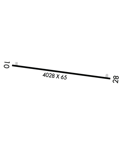
| Lat: N 4102.3 Long: W 08243.5 Elev: 967 Var: +06 Longest Runway: 4028 | ||
| CTAF: 122.9 | ||
| ||||||||||||||||||||||||||||||||||||||||||||
| ||||||||||||||||||||||||||||||||||||||||||||
| Rwy | Rwy | |||||||
| 4028x65 | 3728' | 4028x65 | 3418' | |||||
| Runway ID | Single Wheel | Double Wheel | Double Tandem Wheel | Dual Double Wheel |
| 10/28 | N/A | N/A | N/A | N/A |
| These numbers are Advisory and are not limits. The Airport Manager should have more accurate Weight Limits | ||||
 Airport Diagram might not be current. | |
| Facility Name: | WILLARD |
| City Name: | WILLARD |
| County: | HURON |
| State abbrev: | OH |
| State Name: | OHIO |
| Ownership: | PUBLICLY OWNED |
| Use: | OPEN TO THE PUBLIC |
| Owner's Name: | CITY OF WILLARD |
| Address: | 631 S MYRTLE AVE |
| WILLARD, OH 44890-1549 | |
| Owner's Phone: | 419-933-2591 |
| Manager's Name: | ROB CAVELLO; AIRPORT@WILLARDOHIO.GOV. |
| Address: | 631 S MYRTLE AVE; ARPT PHYS ADS: 3744 STATE ROUTE 103 S, WILLARD, OH 44890. |
| WILLARD, OH 44890-1549 | |
| Phone: | 419-933-7531 |
| FAA Region: | GREAT LAKES |
| FAA Field Office: | DET |
| Date | Sunrise | Sunset |
|---|---|---|
| 06/08/26 Monday | 5:59 | 21:01 |
| 06/09/26 Tuesday | 5:58 | 21:02 |
| 06/10/26 Wednesday | 5:58 | 21:02 |
| 06/11/26 Thursday | 5:58 | 21:03 |
| 06/12/26 Friday | 5:58 | 21:03 |
| 06/13/26 Saturday | 5:58 | 21:04 |
| 06/14/26 Sunday | 5:58 | 21:04 |
| 06/15/26 Monday | 5:58 | 21:05 |
| 06/16/26 Tuesday | 5:58 | 21:05 |
| 06/17/26 Wednesday | 5:58 | 21:06 |
| 06/18/26 Thursday | 5:58 | 21:06 |
| 06/19/26 Friday | 5:58 | 21:06 |
| 06/20/26 Saturday | 5:58 | 21:06 |
| 06/21/26 Sunday | 5:59 | 21:07 |
| Airport Attendance Schedule | UNATTENDED |
| Airport Status | OPERATIONAL (This Status can change at any time - please check NOTAMS) |
| Airport Lighting Schedule | ACTVT MIRL RWY 10/28 - CTAF. |
| Airport Storage Available | Tie Downs |
| Extra Services Available | NONE |
| Wind Indicator | YES - (unlit) |
| Control Tower | NO |
| CTAF Frequency | 122.900 |
| Unicom Frequency | |
| Rotating Beacon Color | |
| Segmented Circle | NO |
| Landing Fee | NO |
| Airport Inspected | STATE - performed by STATE AERONAUTICAL PERSONNEL |
| Inspection Date | 08/23/2024 |
| Type of Fuel Available | Grade 100LL; -10FOR FUEL WKDAYS 0700-1500 CALL AMGR; AFT HRS CALL 419-933-2561. |
| Airframe Repair Service | None |
| Power Plant Repair Service | None |
| Latitude | N4102.3 |
| Longitude | W08243.5 (ESTIMATED) |
| Arpt Elevation | 966ft (SURVEYED) |
| Magnetic Variation | 06W |
| 1 miles S | of WILLARD |
| Traffic Pattern Altitude | |
| Sectional Chart | DETROIT |
| Operations (Reported) | Yearly | Avg. Daily |
|---|---|---|
| General Aviation Transient | 0 | 0 |
| General Aviation Local | 0 | 0 |
| Air Taxi | 0 | 0 |
| Commerical | 0 | 0 |
| Commuter | 0 | 0 |
| Military | 0 | 0 |
| Aircraft based on Field | |
|---|---|
| General Aviation Singles | 0 |
| General Aviation Multi | 0 |
| Jet Aircraft | 0 |
| General Aviation Helicopters | 0 |
| Military Aircraft | 0 |
| Gliders | 0 |
| Ultralights | 0 |
| FSS on field | NO |
| FSS tie-in | CLEVELAND |
| FSS Phone | 1-800-WX-BRIEF |
| Who issues Notams | CLE |
| Notam D service at airport | YES |
| ARTCC Name | CLEVELAND |
| Airport Certification | |
| Aircraft Rescue & Firefighting Index | None |
| Airport of Entry | No |
| Custom Landing Rights | No |
| Joint Civil/Military | No |
| Military Landing rights | No |
| THIS AIRPORT HAS BEEN SURVEYED BY THE NATIONAL GEODETIC SURVEY. |
| FOR CD CTC CLEVELAND APCH AT 216-352-2323, WHEN APCH CLSD CTC CLEVELAND ARTCC AT 440-774-0222/0490. |
| RWY 28: AUTO DEALER PRKG LOT LGTS SHINE IN RWY APCH. |
| DEER, BIRDS, & OTR WILDLIFE ON & INVOF ARPT. |
| HOSPITAL HELI 0.4 NM EAST OF RWY END 28. |
Airport Communications & Frequencies:
| |||||||||||||||
| Runway: 10 | Runway: 28 | ||
| Mag heading: | 103° | Mag heading: | 283° |
| Rwy Slope: | -.76% Down | Rwy Slope: | .76% Up |
| Approach: | Approach: | ||
| Pattern: | Left Traffic | Pattern: | Left Traffic |
| Markings: | BASIC | Markings: | BASIC |
| Marking Condition: | GOOD | Marking Condition: | GOOD |
| Arresting Dev: | Arresting Dev: | ||
| Lat & Long: | N4102.4 W08243.9 | Lat. & Long.: | N4102.3 W08243.0 |
| Elev: | 966.6 ft. MSL | Elev: | 936.0 ft. MSL |
| TCH: | TCH: | ||
| Visual Glide Path: | Visual Glide Path: | ||
| Displaced Threshold: | 300 feet | Displaced Threshold: | 610 feet |
| Touchdown Zone: | YES | Touchdown Zone: | YES |
| Touchdown Elev.: | 965.4 feet | Touchdown Elev.: | 962.9 feet |
| Visual Glide Slope: | Visual Glide Slope: | ||
| RVR Equipment: | RVR Equipment: | ||
| RVV Equipment: | NO | RVV Equipment: | NO |
| Approach Lights: | Approach Lights: | ||
| REIL: | NO | REIL: | NO |
| Centerline Lights: | NO | Centerline Lights: | NO |
| Touchdown lights: | NO | Touchdown lights: | NO |
| Runway Category: | Runway with a Visual Approach | Runway Category: | Runway with a Visual Approach |
| Declared Distances: | Declared Distances: | ||
| Obstructions: | BLDG; ALSO 90 FT TREES, 1230 FT DSTC. | Obstructions: | TREES |
| Marked: | NOT Marked/Lighted | Marked: | NOT Marked/Lighted |
| Clearance slope: | APCH RATIO 11:1 TO DTHR OVR 22 FT BLDG, 260 FT DIST, 170 FT R. | Clearance slope: | 10:1; APCH RATIO 18:1 TO DTHR. |
| Obstruction height: | 12 feet AGL | Obstruction height: | 100 feet AGL |
| Dist. from runway: | 211 feet | Dist. from runway: | 1224 feet |
| Centerline offset: | 87 left of centerline | Centerline offset: | 136 feet left of centerline |
| Comments: | 15 FT ROAD, 75 FT DIST, 125 FT L/R; 15 FT PRKG LOT, 0-90 FT DIST, 50 FT L; 14 FT BLDG, 180 FT DIST, 100 FT L. | Comments: | 10 FT PRKG LOT, 135-200 FT DIST, 99-105 FT R. |
Thanks for using FltPlan.com
all rights reserved © 1999-2026 by Flight Plan LLC
