
| SOUTHAMPTON HELIPORT SOUTHAMPTON NY |
| |
| Lat: N 4050.8 Long: W 07228.0 Elev: 5 Var: +14 Longest Runway: 44 | ||
| CTAF: 122.9 | ||
| ||||||||||||||||||||||||||||||||
| ||||||||||||||||||||||||||||||||
| Rwy | Rwy | |||||||
| Runway ID | Single Wheel | Double Wheel | Double Tandem Wheel | Dual Double Wheel |
| H1 | N/A | N/A | N/A | N/A |
| These numbers are Advisory and are not limits. The Airport Manager should have more accurate Weight Limits | ||||
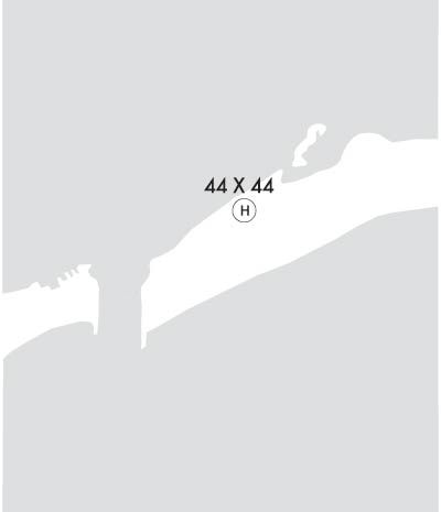 Airport Diagram might not be current. | |
| Facility Name: | SOUTHAMPTON |
| City Name: | SOUTHAMPTON |
| County: | SUFFOLK |
| State abbrev: | NY |
| State Name: | NEW YORK |
| Ownership: | PUBLICLY OWNED |
| Use: | OPEN TO THE PUBLIC |
| Owner's Name: | VILLAGE OF SOUTHAMPTON |
| Address: | 23 MAIN ST |
| SOUTHAMPTON, NY 11968 | |
| Owner's Phone: | 631-283-0247 |
| Manager's Name: | RUSSEL KRATOVILLE; OR GARY GOLESKI 631-283-4269. |
| Address: | 23 MAIN ST |
| SOUTHAMPTON, NY 11968 | |
| Phone: | 631-283-0247; EXT 224 |
| FAA Region: | EASTERN |
| FAA Field Office: | NYC |
| Date | Sunrise | Sunset |
|---|---|---|
| 06/07/26 Sunday | 5:18 | 20:19 |
| 06/08/26 Monday | 5:18 | 20:20 |
| 06/09/26 Tuesday | 5:18 | 20:20 |
| 06/10/26 Wednesday | 5:18 | 20:21 |
| 06/11/26 Thursday | 5:18 | 20:21 |
| 06/12/26 Friday | 5:18 | 20:22 |
| 06/13/26 Saturday | 5:18 | 20:22 |
| 06/14/26 Sunday | 5:18 | 20:23 |
| 06/15/26 Monday | 5:18 | 20:23 |
| 06/16/26 Tuesday | 5:18 | 20:23 |
| 06/17/26 Wednesday | 5:18 | 20:24 |
| 06/18/26 Thursday | 5:18 | 20:24 |
| 06/19/26 Friday | 5:18 | 20:24 |
| 06/20/26 Saturday | 5:18 | 20:25 |
| Airport Attendance Schedule | CONTINUOUS |
| Airport Status | OPERATIONAL (This Status can change at any time - please check NOTAMS) |
| Airport Lighting Schedule | |
| Airport Storage Available | NONE |
| Extra Services Available | NONE |
| Wind Indicator | YES - (unlit) |
| Control Tower | NO |
| CTAF Frequency | 122.900 |
| Unicom Frequency | |
| Rotating Beacon Color | |
| Segmented Circle | NO |
| Landing Fee | YES; LANDING FEE $150 FOR LESS THAN 5000 LB. MGLW & $200 FOR GREATER THAN OR EQUAL TO 5000LB. MGLW. |
| Airport Inspected | STATE - performed by STATE AERONAUTICAL PERSONNEL |
| Inspection Date | 06/25/2025 |
| Type of Fuel Available | None |
| Airframe Repair Service | None |
| Power Plant Repair Service | None |
| Latitude | N4050.8 |
| Longitude | W07228.0 (ESTIMATED) |
| Arpt Elevation | 5ft (SURVEYED) |
| Magnetic Variation | 14W |
| 5 miles SE | of SOUTHAMPTON |
| Traffic Pattern Altitude | |
| Sectional Chart | NEW YORK |
| Operations (Reported) | Yearly | Avg. Daily |
|---|---|---|
| General Aviation Transient | 0 | 0 |
| General Aviation Local | 0 | 0 |
| Air Taxi | 0 | 0 |
| Commerical | 0 | 0 |
| Commuter | 0 | 0 |
| Military | 0 | 0 |
| Aircraft based on Field | |
|---|---|
| General Aviation Singles | 0 |
| General Aviation Multi | 0 |
| Jet Aircraft | 0 |
| General Aviation Helicopters | 0 |
| Military Aircraft | 0 |
| Gliders | 0 |
| Ultralights | 0 |
| FSS on field | NO |
| FSS tie-in | NEW YORK |
| FSS Phone | 1-800-WX-BRIEF |
| Who issues Notams | ISP |
| Notam D service at airport | YES |
| ARTCC Name | NEW YORK |
| Airport Certification | |
| Aircraft Rescue & Firefighting Index | None |
| Airport of Entry | No |
| Custom Landing Rights | No |
| Joint Civil/Military | No |
| Military Landing rights | No |
| FOR CD CTC NEW YORK APCH AT 516-683-2449 |
| RWY H1 +3 FT CONCRETE BLOCK, 53 FT NE OF HELIPAD |
| RWY H1, + 5 FT DUNE, 300 FT NW OF HELIPAD |
| NOISE SENSITIVE AREA DUE TO HOUSES NEARBY. |
| NO IDLING OR WAITING ON HELIPAD PERMITTED. |
| RWY H1; +4 FT STONE WALL 22 FT S; +15 FT RD 25 FT S; +47 FT HOUSE 230 FT S. |
| RWY H1; +24 FT BRUSH 65 FT SE; +31 FT AWOS TWR 165 FT SE; +45 FT BLDG 430 FT SE. |
| RWY H1; +52 FT BLDG 550 FT SW. |
Airport Communications & Frequencies:
|
Thanks for using FltPlan.com
all rights reserved © 1999-2026 by Flight Plan LLC
