
| LENHARDT AIRPARK HUBBARD OR |
| |
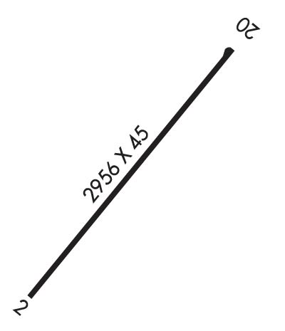
| Lat: N 4510.8 Long: W 12244.6 Elev: 165 Var: -19 Longest Runway: 2956 | ||
| CTAF: 122.9 | ||
| ||||||||||||||||||||||||||||||||||||||||||||
| ||||||||||||||||||||||||||||||||||||||||||||
| Rwy | Rwy | |||||||
| 2956x45 | 2956' | 2956x45 | 2956' | |||||
| Runway ID | Single Wheel | Double Wheel | Double Tandem Wheel | Dual Double Wheel |
| 02/20 | N/A | N/A | N/A | N/A |
| These numbers are Advisory and are not limits. The Airport Manager should have more accurate Weight Limits | ||||
| FltPlan does not have IFR approach charts available for K7S9. |
 Airport Diagram might not be current. | |
| Facility Name: | LENHARDT AIRPARK |
| City Name: | HUBBARD |
| County: | CLACKAMAS |
| State abbrev: | OR |
| State Name: | OREGON |
| Ownership: | PRIVATELY OWNED |
| Use: | OPEN TO THE PUBLIC |
| Owner's Name: | LENHARDT FAMILY; TERRI@AIRHAVEN.NET |
| Address: | 29502 S MERIDIAN RD |
| HUBBARD, OR 97032 | |
| Owner's Phone: | 503-651-2187 |
| Manager's Name: | GLENN LENHARDT; TERRI COLEMAN LEASING MANAGER |
| Address: | 29502 S MERIDIAN RD |
| HUBBARD, OR 97032 | |
| Phone: | 503-651-2187 |
| FAA Region: | NORTHWEST MOUNTAIN |
| FAA Field Office: | SEA |
| Date | Sunrise | Sunset |
|---|---|---|
| 06/08/26 Monday | 5:24 | 20:56 |
| 06/09/26 Tuesday | 5:24 | 20:57 |
| 06/10/26 Wednesday | 5:23 | 20:58 |
| 06/11/26 Thursday | 5:23 | 20:58 |
| 06/12/26 Friday | 5:23 | 20:59 |
| 06/13/26 Saturday | 5:23 | 20:59 |
| 06/14/26 Sunday | 5:23 | 21:00 |
| 06/15/26 Monday | 5:23 | 21:00 |
| 06/16/26 Tuesday | 5:23 | 21:01 |
| 06/17/26 Wednesday | 5:23 | 21:01 |
| 06/18/26 Thursday | 5:23 | 21:01 |
| 06/19/26 Friday | 5:23 | 21:02 |
| 06/20/26 Saturday | 5:23 | 21:02 |
| 06/21/26 Sunday | 5:23 | 21:02 |
| Airport Attendance Schedule | TUE-SAT 0900-1700 |
| Airport Status | OPERATIONAL (This Status can change at any time - please check NOTAMS) |
| Airport Lighting Schedule | SS-SR |
| Airport Storage Available | NONE |
| Extra Services Available | Flight Instruction |
| Wind Indicator | YES - (lighted) |
| Control Tower | NO |
| CTAF Frequency | 122.900 |
| Unicom Frequency | |
| Rotating Beacon Color | |
| Segmented Circle | NO |
| Landing Fee | NO |
| Airport Inspected | STATE - performed by STATE AERONAUTICAL PERSONNEL |
| Inspection Date | 08/08/2024 |
| Type of Fuel Available | Grade 100LL |
| Airframe Repair Service | MAJOR |
| Power Plant Repair Service | MAJOR |
| Latitude | N4510.8 |
| Longitude | W12244.6 (ESTIMATED) |
| Arpt Elevation | 165ft (ESTIMATED) |
| Magnetic Variation | 19E |
| 3 miles E | of HUBBARD |
| Traffic Pattern Altitude | |
| Sectional Chart | SEATTLE |
| Operations (Reported) | Yearly | Avg. Daily |
|---|---|---|
| General Aviation Transient | 0 | 0 |
| General Aviation Local | 0 | 0 |
| Air Taxi | 0 | 0 |
| Commerical | 0 | 0 |
| Commuter | 0 | 0 |
| Military | 0 | 0 |
| Aircraft based on Field | |
|---|---|
| General Aviation Singles | 0 |
| General Aviation Multi | 0 |
| Jet Aircraft | 0 |
| General Aviation Helicopters | 0 |
| Military Aircraft | 0 |
| Gliders | 0 |
| Ultralights | 0 |
| FSS on field | NO |
| FSS tie-in | MC MINNVILLE |
| FSS Phone | 1-800-WX-BRIEF |
| Who issues Notams | MMV |
| Notam D service at airport | YES |
| ARTCC Name | SEATTLE |
| Airport Certification | |
| Aircraft Rescue & Firefighting Index | None |
| Airport of Entry | No |
| Custom Landing Rights | No |
| Joint Civil/Military | No |
| Military Landing rights | No |
| RY 02 +6 FT FENCE 50-70' FT R OF THLD FLANKING FULL LENGTH OF RUNWAY. |
| RY 02 HAS POWERLINE AT 730 FT. |
| PARALLEL TWY WEST OF RY - GRASS. |
| RY 02 DESIGNATED CALM WIND RY. |
| RUNWAY 20 HAS NO END SAFETY AREA. |
| RUNWAY 20 HAS A 6' FENCE AT 52' LEFT OF CENTERLINE FLANKING FULL LENGTH OF RUNWAY. |
| FOR CD CTC PORTLAND APCH AT 503-493-7545. |
| Runway: 02 | Runway: 20 | ||
| Mag heading: | N/A | Mag heading: | N/A |
| Approach: | Approach: | ||
| Pattern: | Left Traffic | Pattern: | Left Traffic |
| Markings: | BASIC | Markings: | BASIC |
| Marking Condition: | GOOD | Marking Condition: | GOOD |
| Arresting Dev: | Arresting Dev: | ||
| Lat & Long: | N4510.7 W12244.8 | Lat. & Long.: | N4511.1 W12244.4 |
| Elev: | N/A | Elev: | N/A |
| TCH: | TCH: | ||
| Visual Glide Path: | 7.00 degrees | Visual Glide Path: | 4.00 degrees |
| Displaced Threshold: | No | Displaced Threshold: | No |
| Touchdown Zone: | NO | Touchdown Zone: | NO |
| Touchdown Elev.: | Touchdown Elev.: | ||
| Visual Glide Slope: | NONSTANDARD VASI SYSTEM; RY 02 NSTD VASI ONE FLASHING/STEADY LIGHT ON RIGHT SIDE OF RY. | Visual Glide Slope: | NONSTANDARD VASI SYSTEM; RY 20 NSTD VASI ONE FLASHING/STEADY LIGHT ON LEFT SIDE OF RY. |
| RVR Equipment: | RVR Equipment: | ||
| RVV Equipment: | NO | RVV Equipment: | NO |
| Approach Lights: | Approach Lights: | ||
| REIL: | NO | REIL: | NO |
| Centerline Lights: | NO | Centerline Lights: | NO |
| Touchdown lights: | NO | Touchdown lights: | NO |
| Runway Category: | Runway with a Visual Approach | Runway Category: | Runway with a Visual Approach |
| Declared Distances: | Declared Distances: | ||
| Obstructions: | ROAD; BEYOND ROAD, 171' TREES AT 1558' FROM RWY END ON CNTRLN. OBSTRUCTION CLEARANCE SLOPE IS 8:1. | Obstructions: | TREES |
| Marked: | NOT Marked/Lighted | Marked: | NOT Marked/Lighted |
| Clearance slope: | Clearance slope: | 7:1 | |
| Obstruction height: | 15 feet AGL | Obstruction height: | 74 feet AGL |
| Dist. from runway: | 201 feet | Dist. from runway: | 763 feet |
| Centerline offset: | 25 left of centerline | Centerline offset: | 161 feet right of centerline |
| Comments: | 5' FENCE AT 28-200' FROM RUNWAY END AND 28-125 LEFT OF CENTERLINE. ROAD 130 FT TO 160 FT FM END OF RY; 99 FT LEFT OF CENTER LINE. | Comments: | 8' BRIARS AT 0-15' FROM RUNWAY END AND 5-100' RIGHT OF CENTERLINE. |
Thanks for using FltPlan.com
all rights reserved © 1999-2026 by Flight Plan LLC
