
| ORLEANS ORLEANS IN |
| |
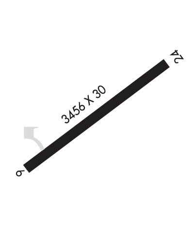
| Lat: N 3839.5 Long: W 08626.6 Elev: 655 Var: +01 Longest Runway: 3456 | ||
| CTAF: 122.8 | ||
| |||||
|
| Rwy | Rwy | |||||||
| 3456x30 | 3165' | 3456x30 | 3256' | |||||
| Runway ID | Single Wheel | Double Wheel | Double Tandem Wheel | Dual Double Wheel |
| 06/24 | N/A | N/A | N/A | N/A |
| These numbers are Advisory and are not limits. The Airport Manager should have more accurate Weight Limits | ||||
| FltPlan does not have IFR approach charts available for K7I4. |
 Airport Diagram might not be current. | |
| Facility Name: | ORLEANS |
| City Name: | ORLEANS |
| County: | ORANGE |
| State abbrev: | IN |
| State Name: | INDIANA |
| Ownership: | PUBLICLY OWNED |
| Use: | OPEN TO THE PUBLIC |
| Owner's Name: | ORLEANS BOAC |
| Address: | 675 E JACKSON ST |
| ORLEANS, IN 47452 | |
| Owner's Phone: | 812-583-1575 |
| Manager's Name: | AARON CARR |
| Address: | 550 E SOUTH ST |
| ORLEANS, IN 47452 | |
| Phone: | 812-583-1575 |
| FAA Region: | GREAT LAKES |
| FAA Field Office: | CHI |
| Date | Sunrise | Sunset |
|---|---|---|
| 06/08/26 Monday | 6:21 | 21:09 |
| 06/09/26 Tuesday | 6:21 | 21:09 |
| 06/10/26 Wednesday | 6:21 | 21:10 |
| 06/11/26 Thursday | 6:21 | 21:10 |
| 06/12/26 Friday | 6:21 | 21:11 |
| 06/13/26 Saturday | 6:21 | 21:11 |
| 06/14/26 Sunday | 6:21 | 21:12 |
| 06/15/26 Monday | 6:21 | 21:12 |
| 06/16/26 Tuesday | 6:21 | 21:12 |
| 06/17/26 Wednesday | 6:21 | 21:13 |
| 06/18/26 Thursday | 6:21 | 21:13 |
| 06/19/26 Friday | 6:21 | 21:13 |
| 06/20/26 Saturday | 6:21 | 21:13 |
| 06/21/26 Sunday | 6:21 | 21:14 |
| Airport Attendance Schedule | UNATTENDED |
| Airport Status | OPERATIONAL (This Status can change at any time - please check NOTAMS) |
| Airport Lighting Schedule | ACTVT LIRL - CTAF (3 SLOW CLICKS) |
| Airport Storage Available | Tie Downs, Hanger |
| Extra Services Available | Flight Instruction |
| Wind Indicator | YES - (lighted) |
| Control Tower | NO |
| CTAF Frequency | 122.800 |
| Unicom Frequency | 122.800 |
| Rotating Beacon Color | |
| Segmented Circle | NO |
| Landing Fee | NO |
| Airport Inspected | STATE - performed by STATE AERONAUTICAL PERSONNEL |
| Inspection Date | 05/11/2021 |
| Type of Fuel Available | None |
| Airframe Repair Service | NONE |
| Power Plant Repair Service | NONE |
| Latitude | N3839.5 |
| Longitude | W08626.6 (ESTIMATED) |
| Arpt Elevation | 655ft (ESTIMATED) |
| Magnetic Variation | 01W |
| 1 miles E | of ORLEANS |
| Traffic Pattern Altitude | |
| Sectional Chart | ST LOUIS |
| Operations (Reported) | Yearly | Avg. Daily |
|---|---|---|
| General Aviation Transient | 0 | 0 |
| General Aviation Local | 0 | 0 |
| Air Taxi | 0 | 0 |
| Commerical | 0 | 0 |
| Commuter | 0 | 0 |
| Military | 0 | 0 |
| Aircraft based on Field | |
|---|---|
| General Aviation Singles | 0 |
| General Aviation Multi | 0 |
| Jet Aircraft | 0 |
| General Aviation Helicopters | 0 |
| Military Aircraft | 0 |
| Gliders | 0 |
| Ultralights | 0 |
| FSS on field | NO |
| FSS tie-in | TERRE HAUTE |
| FSS Phone | 1-800-WX-BRIEF |
| Who issues Notams | HUF |
| Notam D service at airport | YES |
| ARTCC Name | INDIANAPOLIS |
| Airport Certification | |
| Aircraft Rescue & Firefighting Index | None |
| Airport of Entry | No |
| Custom Landing Rights | No |
| Joint Civil/Military | No |
| Military Landing rights | No |
| SEASONAL AERIAL AG ACTIVITY. LIMITED RAMP SPACE DURING PEAK PERIODS. |
| FOR CD CTC INDIANAPOLIS ARTCC AT 317-247-2411. |
| RWY 06/2 4 RWY SHOULDER SPALLING. |
| RWY 06/2 4 RY 06/24 NSTD LIRL; ONLY 2 THLD LGTS EACH SIDE OF RY. NO LGTS BTWN RY END & DSPLCD THLD BOTH ENDS. |
| Runway: 06 | Runway: 24 | ||
| Mag heading: | N/A | Mag heading: | N/A |
| Rwy Slope: | -.14% Down | Rwy Slope: | .14% Up |
| Approach: | Approach: | ||
| Pattern: | Left Traffic | Pattern: | Left Traffic |
| Markings: | NONSTANDARD | Markings: | NONSTANDARD |
| Marking Condition: | GOOD; NRS ARE SMALLER THAN STD. | Marking Condition: | GOOD |
| Arresting Dev: | Arresting Dev: | ||
| Lat & Long: | N3839.3 W08626.8 | Lat. & Long.: | N3839.6 W08626.2 |
| Elev: | 655.0 ft. MSL | Elev: | 650.0 ft. MSL |
| TCH: | TCH: | ||
| Visual Glide Path: | Visual Glide Path: | ||
| Displaced Threshold: | 291 feet | Displaced Threshold: | 200 feet |
| Touchdown Zone: | NO | Touchdown Zone: | NO |
| Touchdown Elev.: | Touchdown Elev.: | ||
| Visual Glide Slope: | Visual Glide Slope: | ||
| RVR Equipment: | RVR Equipment: | ||
| RVV Equipment: | NO | RVV Equipment: | NO |
| Approach Lights: | Approach Lights: | ||
| REIL: | NO | REIL: | NO |
| Centerline Lights: | NO | Centerline Lights: | NO |
| Touchdown lights: | NO | Touchdown lights: | NO |
| Runway Category: | Runway with a Visual Approach | Runway Category: | Runway with a Visual Approach |
| Declared Distances: | Declared Distances: | ||
| Obstructions: | CROPS | Obstructions: | ROAD |
| Marked: | NOT Marked/Lighted | Marked: | NOT Marked/Lighted |
| Clearance slope: | APCH RATIO 23:1 FM DSPLCD THLD DUE TO 50 FT TREE 900 FT FM RWY END | Clearance slope: | APCH RATIO 24:1 FM DSPLCD THLD DUE TO 15 FT ROAD 130 FT FM RWY END |
| Obstruction height: | 10 feet AGL | Obstruction height: | 15 feet AGL |
| Dist. from runway: | 201 feet | Dist. from runway: | 201 feet |
| Centerline offset: | Centerline offset: | 90 feet left of centerline | |
| Comments: | 10 FT CROPS 10 FT FM RWY END | Comments: | 15 FT ROAD 130 FT FM RWY END |
Thanks for using FltPlan.com
all rights reserved © 1999-2026 by Flight Plan LLC
