
| LEWIS COUNTY RGNL MONTICELLO MO |
| |
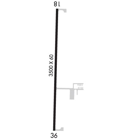
| Lat: N 4007.8 Long: W 09140.7 Elev: 675 Var: -01 Longest Runway: 3500 | ||
| CTAF: 122.7 | ||
| ||||||||||||||||||||||||||||||||||||||||||||
| ||||||||||||||||||||||||||||||||||||||||||||
| Rwy | Rwy | |||||||
| 3500x60 | 3500' | 3500x60 | 3500' | |||||
| Runway ID | Single Wheel | Double Wheel | Double Tandem Wheel | Dual Double Wheel |
| 18/36 | 30,000 | N/A | N/A | N/A |
| These numbers are Advisory and are not limits. The Airport Manager should have more accurate Weight Limits | ||||
 Airport Diagram might not be current. | |
| Facility Name: | LEWIS COUNTY RGNL |
| City Name: | MONTICELLO |
| County: | LEWIS |
| State abbrev: | MO |
| State Name: | MISSOURI |
| Ownership: | PUBLICLY OWNED |
| Use: | OPEN TO THE PUBLIC |
| Owner's Name: | LEWIS COUNTY AIRPORT AUTHORITY |
| Address: | PO BOX 85 |
| CANTON, MO 63435 | |
| Owner's Phone: | (660) 216-4801 |
| Manager's Name: | JESSE ROGERS; CONTACT PERSON - CHAIRMAN ARPT AUTH. |
| Address: | P.O. BOX 135 |
| CANTON, MO 63435 | |
| Phone: | (660) 216-4801; ALTERNATE PHONE NMBRS 660-216-4801, 660-341-0509. |
| FAA Region: | CENTRAL |
| FAA Field Office: | NONE |
| Date | Sunrise | Sunset |
|---|---|---|
| 09/24/21 Friday | 6:56 | 19:01 |
| 09/25/21 Saturday | 6:57 | 18:59 |
| 09/26/21 Sunday | 6:58 | 18:58 |
| 09/27/21 Monday | 6:59 | 18:56 |
| 09/28/21 Tuesday | 7:00 | 18:54 |
| 09/29/21 Wednesday | 7:01 | 18:53 |
| 09/30/21 Thursday | 7:02 | 18:51 |
| 10/01/21 Friday | 7:03 | 18:49 |
| 10/02/21 Saturday | 7:04 | 18:48 |
| 10/03/21 Sunday | 7:05 | 18:46 |
| 10/04/21 Monday | 7:06 | 18:44 |
| 10/05/21 Tuesday | 7:07 | 18:43 |
| 10/06/21 Wednesday | 7:08 | 18:41 |
| 10/07/21 Thursday | 7:09 | 18:40 |
| Airport Attendance Schedule | UNATTENDED |
| Airport Status | OPERATIONAL (This Status can change at any time - please check NOTAMS) |
| Airport Lighting Schedule | ACTVT MIRL RY 18/36 - CTAF. |
| Airport Storage Available | Tie Downs |
| Extra Services Available | Flight Instruction |
| Wind Indicator | YES - (lighted) |
| Control Tower | NO |
| CTAF Frequency | 122.700 |
| Unicom Frequency | 122.700; UNICOM UNMON. |
| Rotating Beacon Color | CLEAR-GREEN (Light Land Airport) |
| Segmented Circle | YES |
| Landing Fee |
| Airport Inspected | STATE - performed by STATE AERONAUTICAL PERSONNEL |
| Inspection Date | 06/12/2018 |
| Type of Fuel Available | Grade 100LL |
| Airframe Repair Service | None |
| Power Plant Repair Service | None |
| Latitude | N4007.8 |
| Longitude | W09140.7 (ESTIMATED) |
| Arpt Elevation | 675ft (SURVEYED) |
| Magnetic Variation | 01E |
| 2 miles NE | of MONTICELLO |
| Traffic Pattern Altitude | |
| Sectional Chart | KANSAS CITY |
| Operations (Reported) | Yearly | Avg. Daily |
|---|---|---|
| General Aviation Transient | 500 | 1 |
| General Aviation Local | 1250 | 3 |
| Air Taxi | 0 | 0 |
| Commerical | 0 | 0 |
| Commuter | 0 | 0 |
| Military | 5 | 0 |
| Aircraft based on Field | |
|---|---|
| General Aviation Singles | 4 |
| General Aviation Multi | 0 |
| Jet Aircraft | 0 |
| General Aviation Helicopters | 0 |
| Military Aircraft | 0 |
| Gliders | 0 |
| Ultralights | 0 |
| FSS on field | NO |
| FSS tie-in | SAINT LOUIS |
| FSS Phone | 1-800-WX-BRIEF |
| Who issues Notams | STL |
| Notam D service at airport | YES |
| ARTCC Name | KANSAS CITY |
| Airport Certification | |
| Aircraft Rescue & Firefighting Index | None |
| Airport of Entry | No |
| Custom Landing Rights | No |
| Joint Civil/Military | No |
| Military Landing rights | No |
| NATIONAL PLAN OF INTEGRATED AIRPORT SYSTEMS (NPIAS) |
| GRANT AGREEMENTS UNDER FAAP/ADAP/AIP |
| ASSURANCES PURSUANT TO TITLE VI, CIVIL RIGHTS ACT OF 1964 |
| ULTRALIGHT ACTIVITY ON & INVOF ARPT. |
| FOR CD CTC KANSAS CITY ARTCC AT 913-254-8508. |
Airport Communications & Frequencies:
| |||||||||
| Runway: 18 | Runway: 36 | ||
| Mag heading: | 180° | Mag heading: | 0° |
| Rwy Slope: | .29% Up | Rwy Slope: | -.29% Down |
| Approach: | Approach: | ||
| Pattern: | Left Traffic | Pattern: | Left Traffic |
| Markings: | NONPRECISION INSTRUMENT | Markings: | NONPRECISION INSTRUMENT |
| Marking Condition: | GOOD | Marking Condition: | GOOD |
| Arresting Dev: | Arresting Dev: | ||
| Lat & Long: | N4008.0 W09140.7 | Lat. & Long.: | N4007.5 W09140.7 |
| Elev: | 664.6 ft. MSL | Elev: | 674.9 ft. MSL |
| TCH: | 40 ft. AGL | TCH: | 40 ft. AGL |
| Visual Glide Path: | 3.00 degrees | Visual Glide Path: | 3.00 degrees |
| Displaced Threshold: | No | Displaced Threshold: | No |
| Touchdown Zone: | YES | Touchdown Zone: | YES |
| Touchdown Elev.: | 674.9 feet | Touchdown Elev.: | 675.0 feet |
| Visual Glide Slope: | 2-Light PAPI on LEFT side of Runway | Visual Glide Slope: | 2-Light PAPI on LEFT side of Runway |
| RVR Equipment: | RVR Equipment: | ||
| RVV Equipment: | NO | RVV Equipment: | NO |
| Approach Lights: | Approach Lights: | ||
| REIL: | NO | REIL: | NO |
| Centerline Lights: | NO | Centerline Lights: | NO |
| Touchdown lights: | NO | Touchdown lights: | NO |
| Runway Category: | Runway with a Non-precision Approach | Runway Category: | Runway with a Non-precision Approach |
| Declared Distances: | Declared Distances: |
Thanks for using FltPlan.com
all rights reserved © 1999-2021 by Flight Plan LLC
